List of cultural monuments in Chemnitz-Gablenz
The list of cultural monuments in Chemnitz-Gablenz contains the cultural monuments of the Chemnitz district of Gablenz , which were recorded in the list of monuments by the State Office for Monument Preservation Saxony as of June 20, 2013. In addition, the cultural monuments deleted from the list of monuments are listed.
The list is divided according to the first letters of the address.
Legend
- Name: gives the name, the description or the type of the cultural monument.
- Address: states the street name and, if available, the house number of the cultural monument. The list is basically sorted according to this address. The link "Map" leads to various map displays and gives the coordinates of the cultural monument.
- Dating: indicates the date; the year of completion or the period of construction. Sorting by year is possible.
- Description: Provides structural and historical details of the cultural monument, preferably the characteristics of the monument.
- ID: Indicates the object ID of the cultural monument assigned by the State Office for the Preservation of Monuments in Saxony .
A.
| image | designation | location | Dating | description | ID |
|---|---|---|---|---|---|
 |
Residential stable house in open development | Adelsbergstrasse 26 (map) |
around 1800 | Stately residential stable house with a distinctive pitched roof, original half-timbered construction of the upper floor at the rear and on the gable sides preserved, evidence of the former rural development of Gablenz in relative proximity to the city center |
09203887 |
 |
School with a gym at the back | Adelsbergstrasse 90 (map) |
Late 19th century (school); Early 20th century (school gym) | School building dominating the space with a clearly structured, classifying facade |
09203953 |
 |
Detached house | Adelsbergstrasse 94 (map) |
Last third of the 19th century | Simple residential construction, witness of an early suburban development in the center of Gablenz, original plaster |
09203967 |
 |
Detached house | Adelsbergstrasse 94a (map) |
High quality residential building in a prominent location, largely unchanged from the late 19th century clinker brick facade |
09203966 |
|
 More pictures |
Three-sided courtyard with two houses and a barn | Adelsbergstrasse 97 (map) |
2nd third of the 19th century | Well-preserved, closed courtyard, brick-built residential buildings with moderately steep pitched roofs, wood-paneled barn |
09203969 |
 |
Residential stable house | Adelsbergstrasse 126 (map) |
1st third of the 19th century | Detached stable house in rural shapes, evidence of the older development of the district |
09203949 |
 More pictures |
All of the wars' settlement Ostheim with "Georgenhof" | At Wiesengrund 1; 2; 3; 4; 5; 6; 7; 8th; 9; 10; 11; 12; 13 (card) |
1925/1926 | Consisting of the residential courtyard "Georgenhof" with a stone arch between the houses (individual monument - see individual monument list Georgenhof 1–4 - Obj. 09203319) and 13 multi-family row houses - in two rows along the street Am Wiesengrund (No. 1–13, odd and No. 2–12 , straight, aggregate parts)
Parts of a larger residential complex built from 1919 in several stages by the Chemnitzer Kriegersiedlung Gemeinnützigen GmbH, an important traditionalist settlement complex with high-quality space and sophisticated detail design, of urban, historical and urban value |
09203305 |
 |
Villa with garden and remains of the enclosure | Arthur-Strobel-Strasse 1 (map) |
Villa building of outstanding quality in an exceptionally good state of preservation, in the reform style of the time around 1910 |
09203968 |
|
 More pictures |
Residential stable house and side building of a former three-sided courtyard | Arthur-Strobel-Strasse 3 (map) |
2nd third of the 19th century | Residential stable house and side building with partly visible, partly hidden half-timbering on the upper floors, evidence of the rural, older development of the district |
09203950 |
 |
Apartment house in a formerly closed development in a corner | Augustusburger Strasse 102 (map) |
Around 1905 | Sophisticated rental building in a dominant urban development situation between Uferstrasse and Augustusburger Strasse, striking architectural decorations |
09203889 |
 |
Residential building | Augustusburger Strasse 228 (map) |
2nd quarter of the 19th century | Detached rural house of stately proportions, probably the remains of a three-sided courtyard |
09203946 |
 |
Villa with front garden | Augustusburger Strasse 234 (map) |
Late 19th century | Architecturally important, well-balanced Wilhelminian style building, with neo-renaissance style elements, structure elements in porphyry |
09302932 |
 |
Side building and barn of a former three-sided farm | Augustusburger Strasse 260 (map) |
1st third of the 19th century | Farm buildings of a courtyard, partly with visible framework |
09203948 |
 More pictures |
Residential stable house, side building and barn of a three-sided courtyard | Augustusburger Strasse 306 (map) |
2nd third of the 19th century | Little changed rural courtyards in typical forms |
09203942 |
 More pictures |
Brewery, with front yard and enclosure | Augustusburger Strasse 329 (map) |
End of the 19th century (factory building); around 1900 (factory building) | Complex of production buildings of a brewery including chimney, architecturally valuable plastered buildings with brick structure, high-quality details, clever use of a triangular plot of land, preserved from two different construction phases |
09203947 |
B.
| image | designation | location | Dating | description | ID |
|---|---|---|---|---|---|
 |
Apartment building in a formerly closed development | Bernhardstrasse 51 (map) |
Around 1900 | High quality Gründerzeit rental building with a tight, center-emphasized facade structure |
09203898 |
 |
Apartment building in closed development | Bernhardstrasse 53 (map) |
Around 1900 | High quality Gründerzeit rental building with a tight, center-emphasized facade structure |
09302804 |
 |
Apartment house in closed development in a corner | Bernhardstrasse 54 (map) |
Around 1905 | Sophisticated rental building with striking corner accents, rich architectural decorations, vestibule with pilasters and stucco ceiling |
09203888 |
 |
Villa (with side extension), garden and fencing | Bernhardstrasse 71 (map) |
Marked 1890/1891 | High-quality villa construction with elaborate facade structure and building decorations in neo-renaissance forms, attached tower emphasizes the distinctive hillside location, large hall extension with representative entrance front, well-preserved wrought iron fence |
09203883 |
 |
Apartment building in open development | Bernhardstrasse 92 (map) |
Marked 1894 | Simple Wilhelminian style rental building in neo-renaissance forms, richly structured roof structure, of architectural significance |
09302996 |
 |
Villa with garden | Bernhardstrasse 98 (map) |
Around 1910 | Quality villa in a delightful corner location, lively facade structure in rural shapes, striking tower motif |
09203926 |
 |
Corner apartment building with shop | Bernhardstrasse 102 (map) |
Around 1907 | Typical of the late founding period plastered building with simple facade decor |
09203815 |
 |
Apartment building in half-open development | Bernhardstrasse 103 (map) |
Around 1900 | Simple apartment building with restrained facade design in neo-renaissance forms |
09203908 |
 |
Apartment building in closed development | Bernhardstrasse 104 (map) |
Around 1900 | Typical Wilhelminian style building in clinker mixed construction |
09203816 |
 |
Apartment building in closed development | Bernhardstrasse 106 (map) |
Around 1900 | Typical Wilhelminian style building in clinker mixed construction |
09203817 |
 |
Apartment building in closed development | Bernhardstrasse 107 (map) |
Marked 1904 | Simple, late-historical clinker building with interesting sandstone decor shapes |
09302997 |
 |
Apartment building in closed development | Bernhardstrasse 108 (map) |
Around 1900 | Typical Wilhelminian style building in clinker mixed construction |
09203818 |
 |
Apartment building in closed development | Bernhardstrasse 110 (map) |
Around 1905 | Simple apartment building with restrained facade decor, worth preserving as part of a Wilhelminian style row development |
09203918 |
 |
Apartment building in a corner location in a formerly closed development | Bernhardstrasse 111 (map) |
around 1905 | simple apartment building with a high quality decor system and art nouveau touches of architectural and urban value |
09203909 |
 |
Apartment house in closed development in a corner | Bernhardstrasse 112 (map) |
Marked 1909 | High-quality rental building in an attractive urban location at the Andreas Church, economical facade decoration |
09203917 |
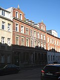 |
Apartment building in closed development | Bernhardstrasse 115 (map) |
Around 1900 | Clearly structured rental building with sophisticated facade decor in neo-renaissance forms, representative entrance door |
09203916 |
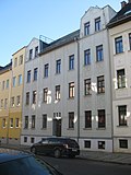 |
Apartment building in closed development | Bernhardstrasse 118 (map) |
Marked 1911 | Simple rental building with a symmetrically constructed facade with a pronounced vertical structure, restrained plaster decoration in the forms of geometric Art Nouveau |
09203897 |
 |
Residential building | Flower path 1; 3 (card) |
Around 1920 | Typical plastered building of architectural, socio-historical and urban development value, built by the general building cooperative for Chemnitz and the surrounding area, the oldest building cooperative in Chemnitz
Individual monument of the aggregate garden city Gablenz-Siedlung : residential house (two house numbers, structurally connected to Geibelstraße 74) of the estate (see also aggregate list Geibelstraße - Obj. 09301604) |
09302866 |
C.
| image | designation | location | Dating | description | ID |
|---|---|---|---|---|---|
 More pictures |
Two houses | Carl-von-Ossietzky-Strasse 44; 46; 48; 50 (card) |
1925 and later | A high-quality example of cooperative housing construction around 1930, sau Clausstrasse 89–115, Frühlichtweg 1/3, Grüner Winkel 1–6, Heimgarten 1-6
Individual features of the aggregate settlement Clausstrasse: two residential buildings (Carl-von-Ossietzky-Strasse No. 44/46 and 48/50) of a residential complex, with front garden and borders (see aggregate list Clausstrasse - Obj. 09302606) |
09205687 |
 |
Apartment building (with three entrances) | Carl-von-Ossietzky-Strasse 141; 143; 145 (card) |
1928/29 | Part of a housing estate, simple plastered building with clinker brick decorations, great Carl-von-Ossietzky-Straße 147/149 and Kreherstraße 80-86 |
09205992 |
 |
Apartment building (with two entrances) | Carl-von-Ossietzky-Strasse 147; 149 (card) |
1928/1929 | Part of a housing estate, simple plastered building of urban value, great Carl-von-Ossietzky-Straße 141–145 and Kreherstraße 80-86 |
09205994 |
 |
Apartment building in closed development | Charlottenstrasse 48 (map) |
Around 1905 | Quality rented building in clinker mixed construction, finely nuanced decor with Art Nouveau touches |
09203922 |
 |
Apartment building in closed development | Charlottenstrasse 50 (map) |
Around 1905 | Quality rental building with a balanced facade structure, art nouveau appeal |
09203808 |
 More pictures |
School with a freestanding gym at the back | Charlottenstrasse 52 (map) |
Around 1890 | Prominently situated, towering clinker brick building with strict facade structure in classifying forms |
09203921 |
 |
Apartment building in closed development | Charlottenstrasse 77 (map) |
Marked 1912 | Typical rental building with a symmetrical facade and differentiated decor, part of a uniformly designed row of houses in the reform style of the time around 1910 |
09203920 |
 |
Apartment building in closed development | Charlottenstrasse 79 (map) |
Marked 1912 | Typical rental building with a symmetrical facade and differentiated decor, part of a uniformly designed row of houses in the reform style of the time around 1910 |
09203912 |
 |
Apartment building in closed development | Charlottenstrasse 81 (map) |
Around 1910 | Simple rental building with a clearly structured facade, part of a uniformly designed row of houses in the reform style of around 1910 |
09203957 |
 |
Apartment building in closed development | Charlottenstrasse 83 (map) |
Around 1910 | Typical rental building with symmetrical facade structure and restrained decor, part of a uniformly designed row of houses in the reform style of around 1910 |
09203958 |
 |
Apartment building in closed development | Charlottenstrasse 85 (map) |
Around 1910 | Typical rental building with symmetrical facade structure and restrained, accentuated decor, part of a uniformly designed row of houses in the reform style of the period around 1910 |
09203954 |
 |
Row of houses | Charlottenstrasse 108; 110 (card) |
Around 1928 | Typical plastered building of architectural, socio-historical and urban development value, built by the general building cooperative for Chemnitz and the surrounding area, the oldest building cooperative in Chemnitz
Individual monument of the aggregate garden city Gablenz-Siedlung : row of houses (structurally connected with Geibelstraße 20-24a) of the estate (see also aggregate list Geibelstraße - Obj. 09301604) |
09203798 |
 More pictures |
Aggregate settlement Clausstraße | Clausstrasse 89; 91; 93; 95; 97; 99; 101; 103; 105; 107; 109; 111; 113; 115 (card) |
1925 and later | Quality example of cooperative housing construction around 1930
Aggregate settlement Clausstraße, with the following individual monuments: Eleven apartment blocks of a residential complex with connecting walls, front gardens and borders, Carl-von-Ossietzkystraße 44–50 (see individual monument list obj. 09205687), Clausstraße 89–115 (see individual monument list obj. 09205707), Frühlichtweg 1/3 (see individual monument list obj. 09205708) , Grüner Winkel 1–6 (see individual monument list obj. 09205735), Heimgarten 1-6 (see individual monument list obj. 09205747) as well as street green and residential green (no garden monument, only subject aggregate part) |
09302606 |
 More pictures |
Four rows of houses | Clausstrasse 89; 91; 93; 95; 97; 99; 101; 103; 105; 107; 109; 111; 113; 115 (card) |
1925 and later | A high-quality example of cooperative housing construction around 1930, sau Carl-von-Ossietzkystraße 44–50, Frühlichtweg 1/3, Grüner Winkel 1–6, Heimgarten 1–6
Individual features of the population of Clausstraße housing estate: four rows of residential buildings (No. 89–93, odd, 95/97, 99–111, odd and 113/115) of a residential complex, with connecting walls, front gardens and borders (see Clausstraße population list - Obj. 09302606) |
09205707 |
D.
| image | designation | location | Dating | description | ID |
|---|---|---|---|---|---|
 |
Apartment building with shop in a closed area in a corner, with a front garden facing Reineckerstraße | Dürerstraße 62 (map) |
Around 1905 | High-quality, late-era rental building with a clearly structured facade and a differentiated decor system |
09203884 |
 |
Apartment building in a corner location in a previously closed development | Dürerstraße 70 (map) |
Around 1910 | High-quality rental building with distinctive emphasis on corners |
09203931 |
E.
| image | designation | location | Dating | description | ID |
|---|---|---|---|---|---|
 More pictures |
Home of the allotment garden "Zum Jungborn" | Eubaer Strasse 90 (map) |
Around 1930 | The best representative of this typical building project of the time in Chemnitz, sophisticated wooden architecture in the New Objectivity style, almost unchanged, presumably some of the original furnishings still inside |
09203970 |
F.
| image | designation | location | Dating | description | ID |
|---|---|---|---|---|---|
 |
Apartment house in closed development in a corner | Fichtestrasse 35 (map) |
Simple rental building with an accentuated facade structure and rich decor, important as a striking corner building in the appearance of the adjacent Kantstrasse |
09203894 |
|
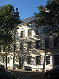 |
Apartment building in closed development | Fichtestrasse 37 (map) |
Around 1905 | Quality rental building with a sophisticated decor system in neo-renaissance forms |
09203936 |
 |
Apartment building in closed development | Fichtestrasse 39 (map) |
Around 1905 | High-quality rental building with symmetrical facade structure and sophisticated decor |
09203937 |
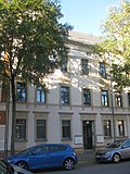 |
Apartment building in closed development | Fichtestrasse 41 (map) |
Around 1905 | Quality rental building with symmetrical facade structure and finely nuanced decor, art nouveau appeal |
09203938 |
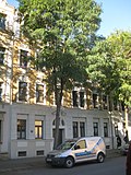 |
Apartment building in closed development | Fichtestrasse 43 (map) |
Around 1905 | Quality rental building, Art Nouveau elements, symmetrical facade structure |
09203803 |
 |
Apartment house designed in closed development | Fichtestrasse 44 (map) |
Around 1905 | Quality rental building with a restrained decor system |
09203939 |
 |
Apartment building in closed development | Fichtestrasse 45 (map) |
Around 1905 | High quality rental building, symmetrical facade composition, Art Nouveau forms |
09203802 |
 More pictures |
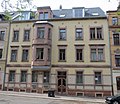
Apartment building in closed development | Froebelstrasse 2 (map) |
Around 1900 | High quality Wilhelminian style building in clinker mixed construction, of urban value, located on Andreaskirchplatz |
09203819 |
 |
Apartment building in closed development | Froebelstrasse 4 (map) |
Around 1905 | Typical of the Gründerzeit clinker brick building in good original condition, of urban development value, located on Andreaskirchplatz |
09203820 |
 |
Residential house (No. 1/3) in a residential complex, with connecting walls, front garden and edging | Frühichtweg 1; 3 (card) |
1925 and later | A high-quality example of cooperative housing construction around 1930, sow Carl-von-Ossietzkystraße 44–50, Clausstraße 89–115, Grüner Winkel 1–6, Heimgarten 1–6
Individual monument of the population of Clausstraße housing estate (see population list Clausstraße - Obj. 09302606) |
09205708 |
G
| image | designation | location | Dating | description | ID |
|---|---|---|---|---|---|
 More pictures |
Apartment building in semi-open development with a front garden | Geibelstrasse 4 (map) |
Marked 1909 | Quality rental building, largely unchanged |
09203813 |
 |
Apartment building in closed development with front garden | Geibelstrasse 5 (map) |
Around 1905 | Demanding rental building, stucco ceiling in the vestibule, largely unchanged |
09203814 |
 |
Apartment building in closed development with front garden | Geibelstrasse 7 (map) |
Marked 1908 | Richly decorated building in good original condition |
09203827 |
 |
Apartment house in closed development in a corner, with shop and front garden | Geibelstrasse 8 (map) |
Around 1910 | Typical rental building, urban situation effectively implemented through a striking corner motif |
09203963 |
 |
Apartment building in closed development with front garden | Geibelstrasse 9 (map) |
Around 1905 | Typical building in clinker mixed construction with a good original inventory |
09203826 |
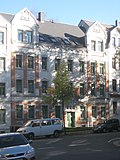 |
Apartment building in closed development with front garden | Geibelstrasse 11 (map) |
Around 1905 | Typical of the time, simply designed building in clinker mixed construction |
09203823 |
 |
Apartment building in closed development with front garden | Geibelstrasse 13 (map) |
Around 1910 | Typical plastered building in good original condition |
09203822 |
 |
Apartment building in closed development with front garden | Geibelstrasse 14 (map) |
Around 1910 | Quality rental building with symmetrical facade structure and nuanced plaster decor system |
09203914 |
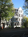 |
Apartment building in semi-open development with a front garden | Geibelstrasse 15 (map) |
1911 | Typical plastered construction with high-quality facade decor |
09203821 |
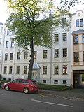 |
Apartment building in closed development with front garden | Geibelstrasse 16 (map) |
Around 1910 | High quality rental building with symmetrical facade structure and restrained plaster decor |
09203913 |
 |
Apartment house in closed development in a corner, with a front garden | Geibelstrasse 18 (map) |
Around 1910 | Typical rental building with symmetrical façade structure and restrained decor, of urban development importance as a corner building at a square-like intersection, the final part of a uniformly designed Wilhelminian era line |
09203955 |
 More pictures |
Blocks of flats | Geibelstrasse 19-103 (map) |
First construction phase from 1915 | Ensemble of architecturally sophisticated multi-family houses of socio-historical, architectural, architectural and urban development value. The fountain originally stood on the grain market and was moved to its current location when the forming plant was built
Individual features of the aggregate garden city Gablenz-Siedlung : several apartment blocks along Geibelstrasse and Brunnen in front of the Geibelstrasse 39–45 apartment block (see also aggregate list Geibelstrasse - Obj. 09301604) |
09203797 |
 More pictures |
Aggregate garden city Gablenz settlement | Geibelstrasse 19-103 (map) |
1915–1930, several construction phases | Erected in two construction phases by the general building cooperative for Chemnitz and the surrounding area, the oldest building cooperative in Chemnitz, impressive urban composition, lines accompanying the street in adaptation to gently moving terrain, accentuated by head buildings on Charlottenstraße and by the central square, traditionalist design language, architectural history, urban development history, socially and historically important
Totality of the garden city Gablenz-Siedlung : consisting of rows of houses along the street and head buildings on Charlottenstraße as well as a fountain in front of house number 39-45 (all individual monuments, see also under Blumensteig 1/3 - object 09302866, Charlottenstraße 108/110 - object 09203798, Geibelstraße 19 -103 - Obj. 09203797, Hochrain 19 - Obj. 09203800 and Postweg 5/7 - Obj. 09203799) as well as residential green with tenants' gardens (material aggregate parts), further front gardens and a square-like expansion of the street area with pergolas (garden monument) and the following housing developments as further material aggregate parts , partly with front gardens: Anger 1/3/5, Blumensteig 2/4, Hochrain 15/17, 22a and 22/24, Krummelinie 1–9 odd, 4–30 even, 11–23 odd, 27–41 odd , 32–38 straight and 40/42, Lindenhain 1/3, 2/4, 6 and 5/7/9, Postweg 1/3, 2/4, 4a, 4b and 6/8 as well as Rotdorn 4–10 straight |
09301604 |
 More pictures |
Tenement house (with three entrances, former officers' apartments in a barracks) | Geibelstrasse 214; 216; 218 (card) |
Completed in 1918 | Formerly part of a barracks, belonging to Liselotte-Herrmann-Straße 1–15, sophisticatedly designed, symmetrically structured residential building, economical architectural decorations, largely original, of local historical importance |
09203972 |
 More pictures |
Apartment buildings | Georgenhof 1; 2; 3; 4 (card) |
1925-1926 | Typical plastered buildings of architectural and urban significance
Individual features of the wares settlement Ostheim with "Georgenhof": two multi-family houses connected by stone arches (No. 1/3 and No. 2/4) of a small residential courtyard, called Georgenhof (see population list Am Wiesengrund 1–13 - Obj. 09203305) |
09203319 |
 More pictures |
Two blocks of flats | Green angle 1; 2; 3; 4; 5; 6 (card) |
1925 and later | A high-quality example of cooperative housing construction around 1930, Sau Clausstrasse 89–115, Carl-von-Ossietzky-Strasse 44–50, Frühlichtweg 1/3, Heimgarten 1–6
Individual features of the aggregate settlement Clausstraße: two apartment blocks (No. 1/3/5 and No. 2/4/6) of a residential complex, with connecting walls, front gardens and borders (see aggregate list Clausstraße - Obj. 09302606) |
09205735 |
H
| image | designation | location | Dating | description | ID |
|---|---|---|---|---|---|
 More pictures |
Two blocks of flats (No. 1/3/5 and No. 2/4/6) of a residential complex, with connecting walls, front gardens and borders |
Heimgarten 1 to 6 (map) |
1925 and later | A high-quality example of cooperative housing construction around 1930, sau Carl-von-Ossietzky-Strasse 44–50, Clausstrasse 89–115, Frühlichtweg 1/3, Grüner Winkel 1–6
Individual features of the aggregate settlement Clausstraße (see aggregate list Clausstraße - Obj. 09302606) |
09205747 |
 More pictures |
26 apartment blocks | Heimgarten 40 to 48 (even); 49 to 100; 102 to 124 (even); Zschopauer Strasse 247c-247e; Zschopauer Strasse 249c / 249d (map) |
1926-1928 | One of the most important of the traditionalist residential complexes in Chemnitz, created for the non-profit building and settlement AG "Heimat" on behalf of the union federation of employees based on a design by the Chemnitz architects Gerber and Kerner, urban planning in short, north-south oriented lines, between courtyards are formed, expressionist and baroque detail forms, remarkable open space design with pergolas, plastic ornamentation and symmetrical tree planting, the entire settlement almost unchanged and in good condition, settlement houses typical of the time, stylistically influenced by the garden city movement and the Heimat style, by architectural, social, urban development and urban significance
Individual features of the community of Heimgarten settlement:
|
09301663 |
 More pictures |
Unity of the Heimgarten settlement | Heimgarten 40; 42; 44; 47 to 97; 98 to 124 (even); Zschopauer Strasse 247c-247e; Zschopauer Strasse 249c / 249d (map) |
1926-1928 | One of the most important of the traditionalist residential complexes in Chemnitz, created for the non-profit building and settlement AG "Heimat" on behalf of the union federation of employees based on a design by the Chemnitz architects Gerber and Kerner, urban planning in short, north-south oriented lines, between courtyards are formed, expressionist and baroque detail forms, remarkable open space design with pergolas, sculptural decoration and symmetrical tree planting, the entire settlement almost unchanged and in good condition, of importance in terms of building history, social history, gardening and urban planning
Composition of the Heimgarten settlement: consisting of 26 multi-family houses and 4 single-family row houses (all individual monuments, see list of individual monuments - Obj. 09203339 and Obj. 09301663), with front gardens, residential courtyards and gardens as well as pergolas and two garden pavilions (garden monument) |
09203337 |
 |
Four blocks of flats | Heimgarten 126 to 148 (even) (map) |
1929-1931 | One of the outstanding settlements of the 1920s in Chemnitz, nowhere are the principles of "New Building" applied more clearly than here, town planning officer Fred Otto probably involved in the urban planning concept; the client was the city's own "Wohnhausbau Chemnitz GmbH"
Individual features of the aggregate settlement Pappelhof: four (formerly five) apartment blocks of a residential complex (see aggregate list Sachsenring - Obj. 09203251) |
09302682 |
 More pictures |
Residential building | Hochrain 19 (map) |
Around 1920 | Typical plastered building of architectural, socio-historical and urban development value, built by the general building cooperative for Chemnitz and the surrounding area, the oldest building cooperative in Chemnitz
Individual monument of the aggregate garden city Gablenz-Siedlung : residential house (structurally connected with Geibelstraße 90) of the estate (see also aggregate list Geibelstraße - Obj. 09301604) |
09203800 |
K
| image | designation | location | Dating | description | ID |
|---|---|---|---|---|---|
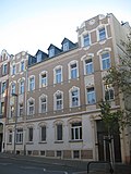 |
Apartment house designed in closed development | Kantstrasse 52 (map) |
Around 1905 | Simple rental building with high-quality building decorations, symmetrical facade structure |
09203892 |
 |
Apartment building in closed development | Kantstrasse 54 (map) |
Around 1905 | Good quality apartment building, tight facade structure, largely unchanged |
09203891 |
 |
Apartment building in a formerly closed development | Kantstrasse 56 (map) |
Around 1905 | High-quality rental building with remarkable picturesque decorations in the vestibule and stairwell |
09203890 |
 |
Apartment house designed in closed development | Kantstrasse 57 (map) |
Around 1905 | Simple, well-preserved rental building, high-quality architectural jewelry |
09203893 |
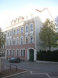 |
Apartment building in closed development | Kantstrasse 59 (map) |
Around 1905 | Simple rental building with high-quality facade decor, part of the relatively closed, preserved Wilhelminian style development on Kantstrasse |
09203906 |
 |
Apartment house designed in closed development | Kantstrasse 60 (map) |
Around 1905 | High-quality rental building, tight, vertically accentuated facade structure, largely unchanged |
09203900 |
 |
Apartment building in a previously closed development | Kantstrasse 63 (map) |
Around 1905 | High quality apartment building with a finely structured facade, part of the relatively closed, preserved Wilhelminian style development on Kantstrasse |
09203896 |
 |
Apartment building in closed development | Kantstrasse 65 (map) |
Around 1905 | High-quality apartment building with an accentuated facade in neo-baroque shapes, part of the relatively closed, preserved Wilhelminian-style development on Kantstrasse |
09203895 |
 |
Apartment building in a previously closed development; | Kantstrasse 71 (map) |
Around 1905 | Quality rental building with symmetrical facade structure and restrained but fine decor |
09203932 |
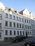 |
Apartment building in closed development | Kantstrasse 73 (map) |
Around 1905 | Simple rental building with restrained plaster decor |
09203933 |
 |
Apartment building in closed development | Kantstrasse 75 (map) |
Around 1905 | Simple rental building with symmetrical facade structure, restrained but fine decor, remarkable equipment of the vestibule |
09203934 |
 |
Apartment building in semi-open development with a front garden | Kaulbachstrasse 4 (map) |
Around 1910 | Quality rental building with symmetrical facade structure, restrained decor, part of a closed contemporary roadside development |
09203928 |
 |
Apartment building in closed development with front garden | Kaulbachstrasse 6 (map) |
1909 according to information | High-quality rental building in clinker composite construction, part of a closed contemporary roadside development, symmetrical facade structure, restrained decor system, well-preserved staircase |
09203927 |
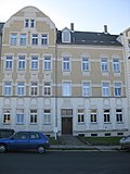 |
Apartment building in closed development with front garden | Kaulbachstrasse 8 (map) |
Around 1905 | Typical rental building, part of a closed, preserved roadside development |
09203807 |
 |
Apartment building in semi-open development with a front garden | Kaulbachstrasse 10 (map) |
Around 1905 | Typical rental building, part of a closed contemporary roadside development |
09203806 |
 |
Apartment building in closed development | Kreherstrasse 4 (map) |
Around 1905 | Typical construction in clinker mixed construction |
09203824 |
 |
Apartment building in closed development | Kreherstrasse 6 (map) |
Around 1905 | Quality construction in clinker mixed construction |
09203825 |
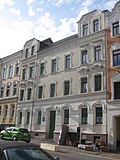 |
Apartment building in closed development | Kreherstrasse 8 (map) |
Around 1905 | Quality rental building with striking architectural decorations, remarkable picturesque furnishings in the vestibule |
09203812 |
 |
Apartment building in closed development | Kreherstrasse 9 (map) |
Around 1905 | Quality rental building with a finely nuanced decor system |
09203902 |
 |
Apartment building in closed development | Kreherstrasse 10 (map) |
Around 1905 | Quality rented building in Art Nouveau forms |
09203811 |
 |
Apartment building in closed development | Kreherstrasse 11 (map) |
Around 1905 | High quality rental building with symmetrical facade structure and a rich, finely nuanced decor system |
09203901 |
 |
Apartment building in closed development | Kreherstrasse 12 (map) |
Around 1905 | High-quality rental building, symmetrical facade structure |
09203810 |
 |
Apartment building in closed development; | Kreherstrasse 13 (map) |
Around 1905 | High-quality rental building with a symmetrically constructed facade and economical decor |
09203905 |
 |
Apartment building in a formerly closed development | Kreherstrasse 14 (map) |
Around 1905 | Sophisticated rental building with rich architectural decorations |
09203809 |
 More pictures |
Apartment building in closed development | Kreherstrasse 15 (map) |
Around 1905 | Well-preserved rental building with a symmetrical structure and economical facade decor |
09203904 |
 More pictures |
Row of houses with front garden and paving in front of No. 86 | Kreherstrasse 80; 82; 84; 86 (card) |
Around 1930 | Highly designed residential complex with striking expressionist structural motifs in brick |
09203974 |
 More pictures |
School with gymnasium, front garden and enclosure wall as well as school yard with bronze statue "Discus Thrower" | Kreherstrasse 101 (map) |
1927–1930 (school); Late 1920s (bronze statue discus thrower) | The most important school building of the 1920s in Chemnitz, an important work by the architect Friedrich Wagner-Poltrock , style language largely approximated to the New Objectivity, almost unchanged outside and inside |
09203973 |
|
More pictures |
Seven blocks of flats | Kreherstrasse 120 to 160 (even) (map) |
1929-1931 | One of the outstanding settlements of the 1920s in Chemnitz, nowhere are the principles of "New Building" applied more clearly than here, town planning officer Fred Otto probably involved in the urban planning concept; the client was the city's own "Wohnhausbau Chemnitz GmbH"
Individual features of the aggregate settlement Pappelhof: seven apartment blocks of a residential complex, of which three apartment blocks with tower-like head buildings (see aggregate list Sachsenring - Obj. 09203251) |
09302683 |
L.
| image | designation | location | Dating | description | ID |
|---|---|---|---|---|---|
 More pictures |
Residential complex (formerly for team quarters in a barracks), with front garden | Liselotte-Herrmann-Strasse 1 to 15 (odd) (map) |
Completed in 1918 | Formerly part of a barracks, impressive, castle-like overall complex on a remarkable, meandering floor plan, baroque style motifs, three-arched passage dominating the central axis, formerly part of the barracks with Geibelstraße 214-218 |
09203971 |
P
| image | designation | location | Dating | description | ID |
|---|---|---|---|---|---|
 More pictures |
Villa-like house with garden | Pfarrstrasse 1 (map) |
Late 19th century | Simple, cubic residential building from the Wilhelminian era, urban development significance as a counterpart to the school (Adelsbergstrasse 90), probably a former rectory |
09203965 |
 More pictures |
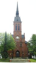
Evangelical Lutheran St. Andrew's Church with upstream stairs and church square | Pfarrstrasse 2 (map) |
1888/1889 | Neo-Gothic brick building with a steep west tower in a dominant urban development location on a small elevation |
09203919 |
 More pictures |
Consolidation of St. Andreas Friedhof Gablenz | Pfarrstrasse 29 (map) |
1867 first occupancy | Simple complex with a regular system of paths on an irregularly cut plot of land with a funeral hall from the Wilhelminian era, of importance in terms of garden history and local history
Consolidation of the St. Andreas Friedhof Gablenz, with the individual monuments: funeral hall and grave of the Thiele family (see individual monument list, same address - Obj. 09203956) and the horticultural designed cemetery (garden monument) |
09302788 |
 More pictures |
Funeral hall and tomb of the Thiele family | Pfarrstrasse 29 (map) |
Around 1870 (funeral hall); around 1910 (tomb) | Wilhelminian-era funeral hall, of local importance
Individual features of the aggregate St.-Andreas-Friedhof Gablenz: funeral hall and grave of the Thiele family (see aggregate list same address - Obj. 09302788) |
09203956 |
 |
Residential building | Postweg 5; 7 (card) |
Around 1920 | Typical plastered building of architectural, socio-historical and urban development value, built by the general building cooperative for Chemnitz and the surrounding area, the oldest building cooperative in Chemnitz
Individual monument of the aggregate garden city Gablenz-Siedlung : residential house (two house numbers, structurally connected with Geibelstraße 58) of the estate (see also aggregate list Geibelstraße - Obj. 09301604) |
09203799 |
R.
| image | designation | location | Dating | description | ID |
|---|---|---|---|---|---|
 |
Enclosure wall | Reineckerstraße 3 (near) (map) |
Late 19th century | Mighty natural stone wall along the entire length of Reineckerstrasse between Adelsbergstrasse and Bernhardstrasse |
09203882 |
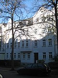 |
Apartment building in closed development with front garden | Reineckerstraße 25 (map) |
Around 1910 | Simple rental building with the original plaster structure, tile decorations and stucco decoration in the vestibule |
09203804 |
 |
Apartment house with shop in a closed area in a corner | Reineckerstraße 64 (map) |
Around 1905 | Stately rental building in a prominent corner location on a rising street, facade structure emphasizing the location, elegant decor |
09203940 |
 |
Apartment building in closed development with front garden | Reineckerstraße 66 (map) |
Around 1915 | High quality rental building with a lively facade structure and restrained decor |
09203929 |
 |
Apartment building in closed development with front garden | Reineckerstraße 68 (map) |
Around 1915 | High-quality rental building with symmetrical facade structure and differentiated decor |
09203930 |
 |
Apartment building in closed development with front garden | Reineckerstraße 70 (map) |
Around 1910 | Typical rental building with a balanced facade structure, tile decorations and ceiling stucco in the vestibule |
09203805 |
S.
| image | designation | location | Dating | description | ID |
|---|---|---|---|---|---|
 More pictures |
Aggregate settlement Pappelhof | Sachsenring 6 to 46 (straight) (map) |
1929-1931 | One of the outstanding settlements of the 1920s in Chemnitz, nowhere are the principles of New Building applied more clearly than here, town planning officer Fred Otto probably involved in the urban planning concept, the client was the city's own Wohnhausbau Chemnitz GmbH, very impressive overall effect, originally tenant gardens in the central courtyard area (lost gone), of importance in terms of building history, social history, architectural and gardening as well as urban planning
Pappelhof settlement:
|
09203251 |
 More pictures |
Seven blocks of flats | Sachsenring 6 to 46 (straight) (map) |
1929-1931 | One of the outstanding settlements of the 1920s in Chemnitz, nowhere are the principles of "New Building" applied more clearly than here, town planning officer Fred Otto probably involved in the urban planning concept; the client was the city's own "Wohnhausbau Chemnitz GmbH"
Individual features of the aggregate settlement Pappelhof: seven apartment blocks of a residential complex, six of them with tower-like head buildings (see aggregate list Sachsenring - Obj. 09203251) |
09302681 |
 More pictures |
Consolidation of residential buildings "White Wall" | Sachsenring 15 to 51 (odd) (map) |
1929-1930 | A striking example of the New Building of the 1920s and social housing in Chemnitz, presumably based on the urban planning concept of the city planning officer Fred Otto, built on behalf of the city's own "Wohnhausbau Chemnitz GmbH"
Comprehensive group of residential buildings "White Wall" with the following individual monuments:
|
09203283 |
|
More pictures |
Five apartment buildings | Sachsenring 15 to 51 (odd) (map) |
1929-1930 | A striking example of the New Building of the 1920s and social housing in Chemnitz, presumably based on the urban planning concept of the city planning officer Fred Otto, built on behalf of the city's own "Wohnhausbau Chemnitz GmbH"
Individual features of the group of houses "White Wall" (see group list, same address - Obj. 09203283): Five apartment buildings with a total of 19 entrances |
09302680 |
Z
| image | designation | location | Dating | description | ID |
|---|---|---|---|---|---|
 More pictures |
Waterworks with residential and administrative buildings, operational buildings and elevated tanks | Zschopauer Strasse 209 (map) |
Marked 1900 | Well-preserved example of a historical building complex for inner-city water extraction and supply, clinker buildings from the late 19th century |
09203959 |
 More pictures |
10 apartment blocks | Zschopauer Strasse 213 to 247 (odd); 247a; 247b; 247c; 247d; 247e; 249; 249a; 249b; 249c; 249d (card) |
1926-1928 | One of the most important of the traditionalist residential complexes in Chemnitz, created for the non-profit building and settlement AG "Heimat" on behalf of the union federation of employees based on a design by the Chemnitz architects Gerber and Kerner, urban planning in short, north-south oriented lines, between courtyards are formed, expressionistic and baroque detail forms, remarkable open space design with pergolas, plastic ornamentation and symmetrical tree planting, the entire settlement almost unchanged and in good condition, typical settlement houses, settlement parts influenced by garden city movements and Heimatstil of architectural, social, urban development and urban development significance
Individual features in the Heimgarten settlement: 10 apartment blocks with several entrances from a total of 26 apartment blocks (apartment buildings, No. 213/215/217, 219/221, 223/225/227, 229/231/233, 235/237/239, 241 / 243/245, 247 / 247a / 247b, No. 247c / 247d / 247e with Heimgarten 104-110, No. 249 / 249a / 249b, No. 249c / 249d with Heimgarten 118-124) (see also material list Heimgarten - Obj . 09203337) |
09203339 |
Deletions from the list of monuments
| image | designation | location | Dating | description | ID |
|---|---|---|---|---|---|
 |
gym | Adelsbergstrasse 36 (map) |
Receive
Deletion from the list of monuments 2010. |
|
|
 |
Residential building | Adelsbergstrasse 38 (map) |
Receive
Deletion from the list of monuments before 2010. |
|
|
| Tenement house | Augustusburger Strasse 106 (map) |
around 1900 | Demolished at the end of 2010
Apartment building in a previously closed development; simple rental building with symmetrically structured, cautiously decorated facade in neo-renaissance forms |
09203899 |
|
 More pictures |
Tenement house and shop | Fichtestrasse 33 (map) |
Demolished at the end of 2014
Deletion from the list of monuments 2010. |
|
|
 |
Tenement house | Fichtestrasse 47 (map) |
circa 1898 | Refurbished
Deletion from the list of monuments 2010. |
|
| Rural house | Gablenzer Strasse 43 (map) |
Demolished between 2001 and 2006
Deletion from the list of monuments before 2010. |
|
||
| Residential complex with front yard "Pappelhof" settlement | Heimgarten 99 to 107 (map) |
1928-1930 | Demolished in 2008, formerly owned by GGG.
Deletion from the list of monuments before 2010. |
|
swell
- State Office for the Preservation of Monuments Saxony Dynamic web application: Overview of the monuments listed in Saxony. The place “Chemnitz, Stadt; Gablenz "is selected, followed by an address-specific selection. Alternatively, the ID can also be used. As soon as a selection has been made, further information about the selected object can be displayed and other monuments can be selected via the interactive map.
- Interactive city map of the city of Chemnitz aerial photos from 2001, 2006, 2009 and 2012
Web links
Individual evidence
- ↑ Freie Presse from April 22, 2015, page 13
- ↑ a b c d e Chemnitz Official Journal of August 25, 2010, p. 10 (21st year, 34th edition) (PDF; 1.4 MB) Official announcements on changes in the list of monuments of the city of Chemnitz. Part 1
- ↑ "A Brief History of the Demolition" (Sonnenbergblog)
- ^ Sachsen-Fernsehen ( Memento from December 16, 2013 in the Internet Archive )
- ↑ Chemnitz Official Gazette of September 1, 2010, pp. 10 and 11 (21st year, 35th edition) (PDF; 940 kB) Official announcements on changes in the list of monuments of the city of Chemnitz. Part 2