List of listed objects in Feldbach (Styria)
The list of listed objects in Feldbach contains the 48 listed , immovable objects of the Austrian municipality of Feldbach in the Styrian district of Southeast Styria .
Monuments
| photo | monument | Location | description | Metadata |
|---|---|---|---|---|

|
Official building, district administration ObjektID : 28568 |
Bismarckstrasse 11-13 KG location : Feldbach |
ObjectID : 28568 Status: § 2a Status of the BDA list: 2020-02-29 Name: Official building, district main team GstNr .: .495 |
|

|
Residential building ObjectID : 28566 |
Bismarckstrasse 12 KG location : Feldbach |
ObjectID : 28566 Status: § 2a Status of the BDA list: 2020-02-29 Name: Wohnhaus GstNr .: .317 |
|

|
Figure shrine St. Johannes Nepomuk ObjectID : 28284 |
Franz-Josef-Straße location KG: Feldbach |
ObjectID : 28284 Status: § 2a Status of the BDA list: 2020-02-29 Name: Figurine picture stick hl. Johannes Nepomuk GstNr .: 533/2 |
|

|
Road bridge, Franz Josef Bridge ObjectID : 28285 |
Franz-Josef-Straße location KG: Feldbach |
ObjectID : 28285 Status: § 2a Status of the BDA list: 2020-02-29 Name: Straßebrücke , Franz-Josef-Brücke GstNr .: 516/1 |
|

|
Former Repair workshop, later waterworks ObjectID : 130713 since 2017 |
Franz-Seiner-Gasse 2 KG location : Feldbach |
ObjectID : 130713 Status : Notification Status of the BDA list: 2020-02-29 Name: Former Repair workshop, later waterworks GstNr .: .285 / 2 |
|

|
Residential barracks, goods depot, prisoner of war camp (2 buildings) ObjectID : 130714 since 2017 |
(Franz-Seiner-Gasse) Location see description KG: Feldbach |
Note: The two buildings are at Franz-Seiner-Gasse 8 and Franz-Seiner-Gasse 14 . |
ObjectID : 130714 Status : Notification Status of the BDA list: 2020-02-29 Name : Residential barracks, goods store , prisoner of war camp (2 buildings) GstNr .: .313; .282 |

|
Former Workshop building ObjectID : 130715 since 2017 |
Franz-Seiner-Gasse 15 KG location : Feldbach |
ObjectID : 130715 Status : Notification Status of the BDA list: 2020-02-29 Name: Former Workshop building GstNr .: .281 |
|

|
Bürgerhaus ObjektID : 28581 |
Grazer Straße 1 KG location : Feldbach |
ObjectID : 28581 Status : Notification Status of the BDA list: 2020-02-29 Name: Bürgerhaus GstNr .: .26 / 2 |
|

|
Community center, so-called Grazer Tor ObjektID : 28577 |
Grazer Straße 2 KG location : Feldbach |
The Grazer Tor was built in 1628 as part of the city wall, later the defensive character was defused and the gate was integrated into a two-storey baroque town house. The gate is a Styrian landmark . |
ObjectID : 28577 Status : Notification Status of the BDA list: 2020-02-29 Name: Bürgerhaus, so-called. Grazer Tor GstNr .: .25 / 1 |

|
School, former Franciscan monastery ObjectID : 28282 |
Grazer Straße 11, 13 KG location : Feldbach |
The former Franciscan monastery was built in the middle of the 17th century and rebuilt in the 4th quarter of the 19th century. Closed courtyard. After the abolition in 1786, the monastery was used as a barracks and a hospital, and since 1899 it has been a school owned by the school sisters. |
ObjectID : 28282 Status: § 2a Status of the BDA list: 2020-02-29 Name: School, former Franciscan monastery GstNr .: .11 / 2; 11/3 school, former Franciscan monastery (Feldbach) |

|
Steinerner Metzen ObjectID : 28291 |
Hauptplatz location KG: Feldbach |
The basalt tuff goblet-like measure of capacity probably dates from the 15th century and served as a sample measure for a large part of Eastern Styria before the introduction of the metric system. |
ObjectID : 28291 Status: § 2a Status of the BDA list: 2020-02-29 Name: Steinerner Metzen GstNr .: 501/4 Metzen, Feldbach (Styria) |

|
Marian column ObjectID : 28576 |
Hauptplatz location KG: Feldbach |
The Marian column was erected in 1717. It was destroyed in 1945 and re-erected in 1949. The capital and figure of the Virgin are by Hans Mauracher . |
ObjectID : 28576 Status: § 2a Status of the BDA list: 2020-02-29 Name: Mariensäule GstNr .: 501/4 Mariensäule Feldbach (Styria) |
|
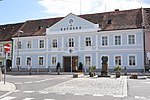
Town hall ObjectID : 28575 |
Hauptplatz 13 KG location : Feldbach |
The town hall was built in the 2nd half of the 19th century. |
ObjectID : 28575 Status: § 2a Status of the BDA list: 2020-02-29 Name: Rathaus GstNr .: .112 Rathaus Feldbach |

|
Music school, former Sparkasse, Villa Hold ObjektID : 28558 |
Kirchenplatz 4 KG location : Feldbach |
The Villa Hold was built around 1890 by the Graz architect Gunoldt in neo-Gothic style. |
ObjectID : 28558 Status: § 2a Status of the BDA list: 2020-02-29 Name: Music school, former Sparkasse, Villa Hold GstNr .: .41 Villa Hold (Feldbach) |

|
Catholic parish church hl. Leonhard ObjectID : 28270 |
Kirchenplatz 5 KG location : Feldbach |
ObjectID : 28270 Status: § 2a Status of the BDA list: 2020-02-29 Name: Catholic parish church hl. Leonhard GstNr .: .63 Leonhardskirche (Feldbach) |
|

|
Bell Tower ObjectID : 28277 |
KG location : Feldbach |
ObjectID : 28277 Status: § 2a Status of the BDA list: 2020-02-29 Name: Glockenturm GstNr .: .822 Leonhardskirche (Feldbach) - bell tower |
|

|
Railway building ObjectID : 130716 since 2017 |
Peter-Rosegger-Straße 11 KG location : Feldbach |
ObjectID : 130716 Status : Notification Status of the BDA list: 2020-02-29 Name: Railway building GstNr .: .351 |
|

|
Railway cottage Object ID: 130717 since 2017 |
at Peter-Rosegger-Straße 11 KG location : Feldbach |
ObjectID : 130717 Status : Notification Status of the BDA list: 2020-02-29 Name: Bahnhäuschen GstNr .: 535/2 Bahnhäuschen at Peter-Rosegger-Straße 11, Feldbach (Styria) |
|

|
Vicarage ObjectID : 28557 |
Pfarrgasse 3 KG location : Feldbach |
ObjectID : 28557 Status: § 2a Status of the BDA list: 2020-02-29 Name: Pfarrhof GstNr .: .319 |
|

|
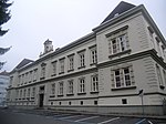
Elementary school ObjectID : 28582 |
Ringstrasse 23 KG location : Feldbach |
The two monumental buildings of the elementary school and the courthouse are part of an expansion of the city on its southern edge that was planned in the fourth quarter of the 19th century, but was not fully completed. Both were built around 1900. |
ObjectID : 28582 Status: § 2a Status of the BDA list: 2020-02-29 Name: Volksschule GstNr .: .221 / 1 |
|
District Court ObjectID : 28583 |
Ringstrasse 29 KG location : Feldbach |
The two monumental buildings of the elementary school and the courthouse are part of an expansion of the city on its southern edge that was planned in the fourth quarter of the 19th century, but was not fully completed. Both were built around 1900. |
ObjectID : 28583 Status: § 2a Status of the BDA list: 2020-02-29 Name: District Court GstNr .: .152 |

|
Fortification, Tabor ObjektID : 131438 since 2019 |
Tabor-Platz 1 KG location : Feldbach |
Note: until 2019 also listed twice under the object ID 28278 |
ObjektID : 131438 Status : Notification Status of the BDA list: 2020-02-29 Name: Fortification, Tabor GstNr .: .43; .44; .59; .45; .50; .51; .46; .47 / 1; .48; .49; .52 / 1; .52 / 2; .52 / 3; .52 / 4; .61 / 2 Tabor Feldbach |

|
Farmhouse ObjectID : 28579 |
Torplatz 3 KG location : Feldbach |
ObjectID : 28579 Status : Notification Status of the BDA list: 2020-02-29 Name: Farmhouse GstNr .: .120 |
|

|
Gasthaus Lafer ObjectID : 28578 |
Torplatz 4 KG location : Feldbach |
ObjectID : 28578 Status : Notification Status of the BDA list: 2020-02-29 Name: Gasthaus Lafer GstNr .: .26 / 1 |
|
|
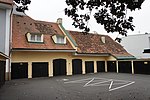
Outbuildings Object ID: 28580 |
Torplatz 5 KG location : Feldbach |
ObjectID : 28580 Status : Notification Status of the BDA list: 2020-02-29 Name: Commercial building GstNr .: .598 |
|

|
Railway embankment with bridges ObjectID : 130711 since 2017 |
at Weidenweg 14, KG location : Feldbach |
ObjectID : 130711 Status : Notification Status of the BDA list: 2020-02-29 Name: Railway embankment with bridges GstNr .: .541; 535/1 |
|

|
Sculpture Raab ObjectID : 28559 |
KG location : Feldbach |
ObjektID : 28559 Status: § 2a Status of the BDA list: 2020-02-29 Name: Skulptur Raab GstNr .: 501/19 Skulptur Raab (Feldbach) |
|

|
Defense system ObjectID : 77902 |
KG location : Feldbach |
ObjectID : 77902 Status: § 2a Status of the BDA list: 2020-02-29 Name: Wehranlage GstNr .: 516/1 |
|

|
Wayside shrine, village cross ObjectID : 28764 |
at Gniebing 71 location KG: Gniebing |
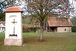
The chapel shrine with a polygonal end on three sides from the 4th quarter of the 19th century (?) Is used as a memorial for those who died in both world wars. The triangular gable front has a round arch opening into the chancel, the facade dates from the 20th century. |
ObjectID : 28764 Status: § 2a Status of the BDA list: 2020-02-29 Name: Bildstock, Dorf-Kreuz GstNr .: 1570 |

|
Shrine Object ID: 28750 |
at Gniebing 236 KG location : Gniebing |
ObjectID : 28750 Status: § 2a Status of the BDA list: 2020-02-29 Name: Bildstock GstNr .: 1449/3 |
|

|
Barrows in the Hainfeld Castle Forest ObjectID : 71248 since 2012 |
Hainfelder Schlosswald KG location : Leitersdorf |
ObjectID : 71248 Status : Notification Status of the BDA list: 2020-02-29 Name: Hill grave field in the Hainfelder Schloßwald GstNr .: 589/2 Eastern hill grave field on Steinberg, Feldbach |
|

|
Hainfeld Castle ObjectID : 36351 |
Leitersdorf im Raabtal 1 KG location : Leitersdorf |
ObjectID : 36351 Status : Notification Status of the BDA list: 2020-02-29 Name: Schloss Hainfeld GstNr .: 539/3 Schloss Hainfeld |
|
|
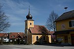
Local chapel ObjectID : 72959 |
Leitersdorf im Raabtal 117 KG location : Leitersdorf |
ObjectID : 72959 Status: § 2a Status of the BDA list: 2020-02-29 Name: Ortskapelle GstNr .: .160 |
|

|
Shrine Object ID: 72958 |
Dorfstrasse location KG: Leitersdorf |
ObjectID : 72958 Status: § 2a Status of the BDA list: 2020-02-29 Name: Bildstock GstNr .: 619/2 |
|
|
Tower castle in the Hainfeld castle forest ObjectID : 69254 |
Hainfelder Schlosswald KG location : Leitersdorf |
ObjectID : 69254 Status : Notification Status of the BDA list: 2020-02-29 Name: Turmburg im Hainfelder Schlosswald GstNr .: 589/2; 601/1; 601/5 Hainfeld Tower Castle |
|

|
Steinberg barrow field ObjectID : 69253 |
Steinberg location KG: Leitersdorf |
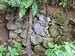
Roman burial mound field on the Steinberg: western edge in the KG Mühldorf . Through a new inventory by K. Kojalek, localization of further tumuli, small finds (pearls, ceramics) during individual examination of a tumuli in 1997, the ceramic figures point to a date in the early 2nd century. |
ObjectID : 69253 Status : Notification Status of the BDA list: 2020-02-29 Name: Hügelgräberfeld Steinberg GstNr .: 589/2 Westliches Hügelgraberfeld am Steinberg, Feldbach (KG Leitersdorf) |
|
Dorfschmiede ObjectID : 73012 |
KG location : Mühldorf |
ObjectID : 73012 Status: § 2a Status of the BDA list: 2020-02-29 Name: Dorfschmiede GstNr .: 710/5 |
|
|
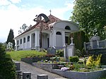
Former Cemetery, now cemetery chapel with cemetery walling ObjektID : 73038 |
KG location : Mühldorf |
ObjectID : 73038 Status : Notification Status of the BDA list: 2020-02-29 Name: Former Funeral hall, now cemetery chapel with cemetery walling GstNr .: .186; 208/6 |
|

|
Shrine Object ID: 73048 |
KG location : Mühldorf |
Note: see list of errors |
ObjectID : 73048 Status: § 2a Status of the BDA list: 2020-02-29 Name: Bildstock GstNr .: 446/2 |

|
Steinberg barrow field ObjectID : 72423 |
Steinberg location KG: Mühldorf |
Roman burial mound field on the Steinberg: mostly in the KG Leitersdorf . Through a new inventory by K. Kojalek, localization of further tumuli, small finds (pearls, ceramics) during individual examination of a tumuli in 1997, the ceramic figures point to a date in the early 2nd century. |
ObjectID : 72423 Status : Notification Status of the BDA list: 2020-02-29 Name: Hügelgräberfeld Steinberg GstNr .: 779/2 Westliches Hügelgraberfeld am Steinberg, Feldbach (KG Mühldorf) |

|
Water reservoir at Steinberg ObjectID : 78868 since 2017 |
KG location : Mühldorf |
ObjectID : 78868 Status : Notification Status of the BDA list: 2020-02-29 Name: Wasserreservoir am Steinberg GstNr .: 779/10 |
|

|
Cable car system, archaeological ground monument, material cable car ObjectID : 78869 since 2017 |
KG location : Mühldorf |
ObjektID : 78869 Status : Notification Status of the BDA list: 2020-02-29 Name: Cable car system, archaeological ground monument, material cable car GstNr .: 779/9; 785/5; 1398 |
|

|
Jewish graves at Steinberg ObjectID : 78870 since 2017 |
KG location : Mühldorf |
ObjektID : 78870 Status : Notification Status of the BDA list: 2020-02-29 Name: Jewish graves on Steinberg GstNr .: 779/39; 779/37 Jewish gravestones Steinberg |
|

|
Heeresfeldbahn Steinberg with fountain system ObjektID : 78871 since 2017 |
KG location : Mühldorf |
ObjektID : 78871 Status : Notification Status of the BDA list: 2020-02-29 Name: Heeresfeldbahn Steinberg with fountain system GstNr .: 779/45; 779/47; 793/3; 787/1; 788/1; 789/3; 779/39; 796/1; 791/5; 792/3; 779/53; 779/55; 1404; 779/43; 779/49; 786/1; 779/33; 779/37; 785/3; 785/4 Heeresfeldbahn Steinberg with fountain system |
|

|
Local chapel ObjectID : 73579 |
KG location : Raabau |
The chapel was built in 1911. On the altar is a Maria Immaculate from the 2nd half of the 18th century. |
ObjectID : 73579 Status: § 2a Status of the BDA list: 2020-02-29 Name: Ortskapelle GstNr .: .118 |

|
Farmhouse, press house ObjectID : 129722 since 2012 |
Raabau 68 Location KG: Raabau |
Note: The house is currently (Oct. 2014 [obsolete] ) being restored and is scaffolded. |
ObjectID : 129722 Status : Notification Status of the BDA list: 2020-02-29 Name: Bauernhaus, Presshaus GstNr .: 171/3 Bauernhaus Raabau 68 |

|
Local Chapel of the Holy Trinity ObjectID : 28772 |
KG location : Weißenbach |
The one-yoke local chapel of the Holy Trinity with a three-sided polygonal end dates from 1882. The three-storey, axial facade tower has a pointed helmet; Above the ogival portal niche is a round arched niche with a figure of St. Florian. The original double-leaf wooden door shows reliefs of the hll. Peter and Paul. Lateral pointed arch windows. The facade is structured by means of pilasters and a toothed frieze running around below the profiled eaves. |
ObjectID : 28772 Status: § 2a Status of the BDA list: 2020-02-29 Name: Ortskapelle Hl. Dreifaltigkeit GstNr .: 1081 |

|
Kalvarienberg / Kreuzweg ObjectID : 79451 |
KG location : Weißenbach |
ObjectID : 79451 Status: § 2a Status of the BDA list: 2020-02-29 Name: Kalvarienberg / Kreuzweg GstNr .: 102/1 Kalvarienberg Weißenbach (Feldbach) |
literature
- Kurt Woisetschläger, Peter Krenn: Dehio Handbook - The Art Monuments of Austria: Styria (excluding Graz). Topographical inventory of monuments, ed. from the Federal Monuments Office, Department for Monument Research. Publisher Anton Schroll. Vienna 1982. ISBN 3-7031-0532-1 .
Web links
Commons : Listed objects in Feldbach - collection of images, videos and audio files
Individual evidence
- ↑ a b Styria - immovable and archaeological monuments under monument protection. (PDF), ( CSV ). Federal Monuments Office , as of February 18, 2020.
- ↑ Graz Gate. (No longer available online.) Archived from the original on November 23, 2011 ; Retrieved December 30, 2011 . Info: The archive link was inserted automatically and has not yet been checked. Please check the original and archive link according to the instructions and then remove this notice.
- ↑ a b Archaeological Land of Styria - Feldbach. (No longer available online.) Archived from the original on July 26, 2013 ; Retrieved October 15, 2012 . Info: The archive link was inserted automatically and has not yet been checked. Please check the original and archive link according to the instructions and then remove this notice.
- ↑ according to GIS Styria; GstNr. .104 according to BDA does not exist.
- ↑ § 2a Monument Protection Act in the legal information system of the Republic of Austria .