List of listed objects in Fehring
The list of listed objects in Fehring contains the 38 listed , immovable objects of the Austrian municipality of Fehring in the Styrian district of Southeast Styria .
Monuments
| photo | monument | Location | description | Metadata |
|---|---|---|---|---|

|
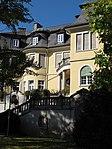
Vicarage ObjectID : 28802 |
Hatzendorf 1 location KG: Hatzendorf |
The rectory next to the church is a spacious three-storey building with a crooked roof , which is marked 1744 on the portal. |
ObjectID : 28802 Status: § 2a Status of the BDA list: 2020-02-29 Name: Pfarrhof GstNr .: 49 Pfarrhof Hatzendorf |
|
Former Sanatorium Lemperg, agricultural college Hatzendorf ObjectID : 29309 |
Hatzendorf 110 KG location : Hatzendorf |
ObjectID : 29309 Status: § 2a Status of the BDA list: 2020-02-29 Name: Former Sanatorium Lemperg, agricultural college Hatzendorf GstNr .: 956/2 Former Sanatorium Lemperg |
|

|
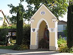
Shrine Object ID: 28803 |
Location KG: Hatzendorf |
The brick wayside shrine at the entrance to the town was built in 1741. In the course of the renovation in 1969, the frescoes were repainted by Franz Weiss . |
ObjectID : 28803 Status: § 2a Status of the BDA list: 2020-02-29 Name: Bildstock GstNr .: 2126 Bildstock Hatzendorf, Fehring |

|
Catholic parish church hll. Peter and Paul ObjectID : 29304 |
Location KG: Hatzendorf |
The parish church was built in 1545 in a north-south direction and later enlarged twice (1679 and 1755). It now consists of a cross-shaped extended hall with a flat ceiling and the choir in the south. A square tower is presented on the east side. The high altar dates from 1753. |
ObjectID : 29304 Status: § 2a Status of the BDA list: 2020-02-29 Name: Catholic parish church hll. Peter and Paul GstNr .: .20 Parish Church Hatzendorf |
|
Wegkapelle ObjektID: 29314 |
Location KG: Hatzendorf |
The chapel dates from 1870 and contains a late baroque figure of the Virgin Mary. During the renovation in 1978, saint frescoes were attached to the outside by Franz Weiss . |
ObjectID: 29314 Status: § 2a Status of the BDA list: 2020-02-29 Name: Wegkapelle GstNr .: 2107 |

|
Landmarks ObjectID : 29344 |
in front of Hohenbrugg 19 KG location : Hohenbrugg |
ObjectID : 29344 Status: § 2a Status of the BDA list: 2020-02-29 Name: Grenzsteine GstNr .: 1685/1 |
|
|
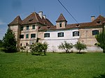
Hohenbrugg-Weinberg Castle ObjectID : 29342 |
Hohenbrugg an der Raab 1 KG location : Hohenbrugg |
Mentioned in a document in 1305. The castle got its present shape in the 16th century. |
ObjectID : 29342 Status : Notification Status of the BDA list: 2020-02-29 Name: Hohenbrugg-Weinberg Castle GstNr .: .1 Hohenbrugg Castle |

|
Shrine Object ID: 29379 |
KG location : Hohenbrugg |
ObjectID : 29379 Status: § 2a Status of the BDA list: 2020-02-29 Name: Bildstock GstNr .: 1680 |
|

|
Landmark ObjectID : 29380 |
KG location : Hohenbrugg |
Note: Location south of the Raab, about 80 m east of the observation tower |
ObjectID : 29380 Status: § 2a Status of the BDA list: 2020-02-29 Name: Grenzstein GstNr .: 1686/25 |

|
Wayside shrine, plague cross ObjectID : 29381 |
KG location : Hohenbrugg |
ObjectID : 29381 Status: § 2a Status of the BDA list: 2020-02-29 Name: wayside shrine, Pestkreuz GstNr .: 169/2 |
|

|
Town hall ObjectID : 28119 |
Grazerstraße 1 KG location : Fehring |
ObjectID : 28119 Status: § 2a Status of the BDA list: 2020-02-29 Name: Rathaus GstNr .: .88 |
|

|
Catholic parish church hl. Joseph ObjectID : 28048 |
KG location : Fehring |
ObjectID : 28048 Status: § 2a Status of the BDA list: 2020-02-29 Name: Catholic parish church hl. Joseph GstNr .: .1 / 14 Parish Church Fehring |
|

|
Vicarage ObjectID : 28062 |
Grazerstraße 10 KG location : Fehring |
The Fehringer vicarage has a remarkable crooked roof and the name 1766 on the portal. |
ObjectID : 28062 Status: § 2a Status of the BDA list: 2020-02-29 Name: Pfarrhof GstNr .: 7/1 Pfarrhof Fehring |

|
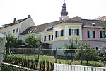
Marian column ObjectID : 28055 |
Hauptplatz location KG: Fehring |
The Marian column on the main square is marked 1697. |
ObjectID : 28055 Status: § 2a Status of the BDA list: 2020-02-29 Name: Mariensäule GstNr .: 1165/5 Mariensäule Fehring |
|
Bastion ObjectID : 77876 |
Kirchenplatz 5 KG location : Fehring |
ObjectID : 77876 Status: § 2a Status of the BDA list: 2020-02-29 Name: Bastion GstNr .: .1 / 6 Tabor Fehring |
|

|
Bastion ObjectID : 28182 |
KG location : Fehring |
ObjectID : 28182 Status: § 2a Status of the BDA list: 2020-02-29 Name: Bastion GstNr .: 1031/1 Tabor Fehring |
|
|
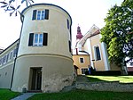
Round tower ObjectID: 28185 |
Kirchenplatz 7 KG location : Fehring |
ObjectID: 28185 Status: § 2a Status of the BDA list: 2020-02-29 Name: Rundturm GstNr .: .1 / 3 Tabor Fehring |
|

|
Epitaph, tomb of the pastor of Fehring ObjektID : 28165 |
Cemetery location KG: Fehring |
ObjectID : 28165 Status: § 2a Status of the BDA list: 2020-02-29 Name: Epitaph, tomb of the pastor of Fehring GstNr .: 883/1 |
|
|
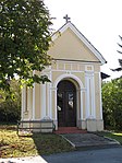
Sinzinger Chapel ObjectID : 28070 |
at Sinzingergasse 5K, KG location : Fehring |
ObjectID : 28070 Status: § 2a Status of the BDA list: 2020-02-29 Name: Sinzinger-Kapelle GstNr .: 927/2 |
|

|
Wine cellar ObjectID : 28146 |
Ungarstrasse 12 KG location : Fehring |
ObjectID : 28146 Status : Notification Status of the BDA list: 2020-02-29 Name: Weinkeller GstNr .: 944/2 |
|
|
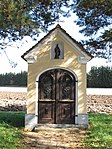
Annakapelle Object ID: 28160 |
KG location : Fehring |
ObjectID : 28160 Status: § 2a Status of the BDA list: 2020-02-29 Name: Annakapelle GstNr .: 254 |
|

|
Farmhouse Knaus vulgo Lipp ObjectID : 28190 |
Burgfeld 16 KG location : Burgfeld |
East Styrian square courtyard from the 18th century with a towed thatched roof. |
ObjectID : 28190 Status : Notification Status of the BDA list: 2020-02-29 Name: Bauernhaus Knaus vulgo Lipp GstNr .: .56 |

|
Wegkapelle ObjektID : 28227 |
opposite Höflach 5 location KG: Höflach |
ObjectID : 28227 Status: § 2a Status of the BDA list: 2020-02-29 Name: Wegkapelle GstNr .: .101 |
|
|
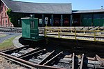
Locomotive shed with turntable ObjectID : 29757 |
Brunn 43 KG location : Johnsdorf |
ObjectID : 29757 Status : Notification Status of the BDA list: 2020-02-29 Name: Lokrundschuppen with turntable GstNr .: 1897 Fehring station |
|
|
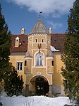
Johnsdorf-Brunn Palace ObjectID : 7289 |
Johnsdorf 1 KG location : Johnsdorf |
The late medieval fortification was converted into a castle in its present form by Katharina Elisabeth von Galler in the middle of the 17th century . A striking element is the gate tower with two-storey pillar arcades. In the second half of the 20th century it was owned by the Salesians, in 1961 a church extension was built by Robert Kramreiter . |
ObjectID : 7289 Status : Notification Status of the BDA list: 2020-02-29 Name: Schloss Johnsdorf-Brunn GstNr .: .1 / 1; .200; .1 / 2 Johnsdorf Castle |
| Barrows Fuchswald / Zachwald ObjectID : 69442 |
Fuchswald / Zachwald KG location : Pertlstein |
ObjectID : 69442 Status : Notification Status of the BDA list: 2020-02-29 Name: Hügelgräber Fuchswald / Zachwald GstNr .: 863/2 |
||

|
Bertholdstein Castle, former St. Gabriel Abbey ObjectID : 57473 |
Pertlstein 50 KG location : Pertlstein |
Fortified castle from the 12th century, with a special arcade. Note: The Benedictine Sisters of St. Gabriel moved to Sankt Johann bei Herberstein in 2008 . |
ObjektID : 57473 Status: § 2a Status of the BDA list: 2020-02-29 Name: Schloss Bertholdstein, former Abbey St. Gabriel GstNr .: .55 Schloss Bertholdstein |

|
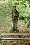
Figure St. Leonhard ObjectID : 73454 |
KG location : Pertlstein |
The figure of St. Leonhard stands at the castle entrance and dates from the middle of the 18th century. It was restored in 1952. Note: see list of errors |
ObjectID : 73454 Status: § 2a Status of the BDA list: 2020-02-29 Name: Figur hl. Leonhard GstNr .: 1491/4 |
|
Figure St. Donatus ObjectID : 73455 |
KG location : Pertlstein |
The figure of St. Donatus from the middle of the 18th century is badly weathered. |
ObjectID : 73455 Status: § 2a Status of the BDA list: 2020-02-29 Name: Figur hl. Donatus GstNr .: 482/1 |
| Roman settlement Pertlstein ObjectID : 70411 |
Pertlstein location KG: Pertlstein |
ObjektID : 70411 Status : Notification Status of the BDA list: 2020-02-29 Name: Römische Siedlung Pertlstein GstNr .: 1077/2; 1080/1 |
||

|
Local chapel St. Josef ObjectID : 28240 |
KG location : Petersdorf I |
ObjectID : 28240 Status: § 2a Status of the BDA list: 2020-02-29 Name: Ortskapelle hl. Josef GstNr .: .66 |
|
|
Kuruzzenschanze since 2020 |
KG location : Petersdorf I |
The fortification (earth wall with palisades and small forts) was built in 1703/04 and operated until the end of the 18th century. The wall was supposed to support the imperial troops of the Habsburgs in the fight against the Kuruzzen - rural rebels from Hungary in the wake of the uprising of Franz II. Rákóczi (1704–1711) - and to block the access from Hungary to Vienna. |
ObjectID: missing! Status: Notification Status of the BDA list: 2020-02-29 Name: Kuruzzenschanze GstNr .: 1123/2 Kuruzzenschanze, Austria |
|

|
Stein Castle, today an agricultural home economics school ObjectID : 28247 |
Petzelsdorf 1 location KG: Petzelsdorf |
The Stein Castle is located southwest of Fehring in the Haselbachtal. In the 16th century already the economic yard of the Fürstenfeld rule, it was expanded in 1776 by Christoph Graf Paar as the administrative seat of the local estates, and received its current name. Today's two-storey building with an octagonal south and hexagonal north tower is mainly a new building from the second half of the 19th century. The castle was used as a school for farmers' daughters and currently serves as an agricultural housekeeping school . |
ObjectID : 28247 Status: § 2a Status of the BDA list: 2020-02-29 Name: Stein Castle, today Agricultural Housekeeping School GstNr .: 204/9 Stein Castle, Fehring |

|
Local chapel ObjectID : 28243 |
Location KG: Petzelsdorf |
ObjectID : 28243 Status: § 2a Status of the BDA list: 2020-02-29 Name: Ortskapelle GstNr .: 23/3 |
|

|
Shrine Object ID: 28254 |
Location KG: slate |
ObjectID : 28254 Status: § 2a Status of the BDA list: 2020-02-29 Name: Bildstock GstNr .: 1452 |
|
|
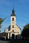
Local chapel ObjectID : 28257 |
Location KG: slate |
ObjectID : 28257 Status: § 2a Status of the BDA list: 2020-02-29 Name: Ortskapelle GstNr .: .100 Florianikapelle (Fehring) |
|

|
Wegkreuz Object ID: 81018 |
KG location : Tiefenbach |
ObjectID : 81018 Status : Notification Status of the BDA list: 2020-02-29 Name: Wegkreuz GstNr .: 578 Wegkreuz Tiefenbach |
|

|
Local chapel ObjectID : 29385 |
Location KG: Weinberg |
ObjectID : 29385 Status: § 2a Status of the BDA list: 2020-02-29 Name: Ortskapelle GstNr .: .129 Ortskapelle Weinberg (Fehring) |
literature
- Kurt Woisetschläger, Peter Krenn: Dehio Handbook - The Art Monuments of Austria: Styria (excluding Graz). Topographical inventory of monuments, ed. from the Federal Monuments Office, Department for Monument Research. Publisher Anton Schroll. Vienna 1982. ISBN 3-7031-0532-1 .
Web links
Commons : Listed objects in Fehring - collection of pictures, videos and audio files
Individual evidence
- ↑ a b Styria - immovable and archaeological monuments under monument protection. (PDF), ( CSV ). Federal Monuments Office , as of February 18, 2020.
- ^ Georg Clam Martinic : Burgen und Schlösser in Österreich, Linz, Landesverlag, 1991, p. 327/328
- ↑ § 2a Monument Protection Act in the legal information system of the Republic of Austria .