District of Southeast Styria
| location | |
|---|---|
| Basic data | |
| state | Styria |
| NUTS III region | AT-224 |
| Administrative headquarters | Feldbach |
| surface | 985 km² |
| Residents | 84,036 (January 1, 2020) |
| Population density | 85 inhabitants / km² |
| License Plate | SO |
| District Commission | |
| District Captain | Alexander Majcan |
| website |
www.bh-suedoststeiermark. steiermark.at |
| map | |
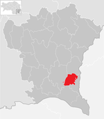
The district of Südoststeiermark is a political district of the state of Styria . It corresponds to the judicial district of Feldbach .
history
On April 20, 2012, the Styrian state government announced that on January 1, 2013, three new districts would be created by merging two districts each, the districts of Bruck-Mürzzuschlag and Hartberg-Fürstenfeld and the district of Vulkanland (named after the Styrian Vulkanland tourist region and formed from the districts of Feldbach and Radkersburg ). After the latter name was largely rejected by the affected population, it was discarded and replaced on April 23 by Südoststeiermark .
The first district captain of the new district is the previous Radkersburg district captain Alexander Majcan.
The two districts, which lie on the Burgenland border , represented a spatial planning region of Styria even before the merger.
As part of the municipal structural reform in Styria , the municipal areas of Mitterlabill , Schwarzau im Schwarzautal and Weinburg am Saßbach in the Leibnitz district as well as the Petersdorf II area in the Graz-Umgebung district have been located across district boundaries since 2015 . The boundaries of the districts have been changed in such a way that the new parishes are completely in one district.
At the end of 2019 the municipality of Murfeld was dissolved and divided between the two municipalities Sankt Veit in southern Styria and Straß in Styria (both in the Leibnitz district ):
- the cadastral community Seibersdorf bei St. Veit was incorporated into the market town of Sankt Veit,
- the cadastral communities Oberschwarza, Unterschwarza, Lichendorf and Weitersfeld were incorporated into the market community of Straß.
The area of the dissolved Murfeld community was assigned to the judicial district and neighboring district of Leibnitz , the population of the district of Southeast Styria decreased by 1671, the area by 24.22 km² less.
geography
In terms of landscape, the region encompasses the southern part of the Eastern Styrian hill country ( Riedelland ) , characteristically structured by primarily southward sweeping brooks to the Mur , which also forms the border with Slovenia . To the north, the border is unspecific, the watershed into the Raab river basin , parts of which also belong to this region. In the region lies a large part of the eastern Styrian volcanic area , with typical volcanic cones such as Riegersburg , Gleichenberger Kogel , Stradner Kogel . In the east the landscape (with the southern tip of the southern Burgenland ) continues in the Slovenian-Hungarian Prekmurje / Őrség and Porabje / Vendvidék . The border area forms the three-country nature park Raab – Örség – Goričko , to which the Raab nature park belongs.
Neighboring districts and regions
- (S) Statistical regions ; Slovenia does not have an administrative division corresponding to the districts. A reorganization is being planned, the administrative units will probably correspond to the regions
Statistically, the district falls into the NUTS region Oststeiermark AT225, which also includes the planning region Oststeiermark.
The region has 985.22 km² cadastral area , of which 734 km² (including Murfeld) are permanent settlements , and 84,036 inhabitants (as of January 1, 2020). 68.7% of the total area is permanent settlement, the highest value of all Styrian regions. The population density of 85 inhabitants per km² is well above the Styrian average (76; Austria 106), the population density in the permanent settlement area is 114 inhabitants / km² (Styria 233, Austria 259).
Regional centers are Bad Radkersburg (3,178 inhabitants) and Feldbach (13,450 inhabitants), as subregional supply centers Deutsch Goritz , Fehring , Gnas , Halbenrain , Mureck and Straden are important.
Administrative division
As part of the municipal structural reform 2014/15 , the number of municipalities in the district was significantly reduced from 2015. Since January 2015, the district consisted of the following 26 municipalities:
- Bad Gleichenberg, Bad Radkersburg, Deutsch Goritz, Edelsbach near Feldbach, Eichkögl, Fehring, Feldbach, Gnas, Halbenrain, Jagerberg, Kapfenstein, Kirchbach-Zerlach, Kirchberg an der Raab, Klöch, Mettersdorf am Saßbach, Mureck, Paldau, Pirching am Traubenberg, Riegersburg, Sankt Anna am Aigen, Sankt Peter am Ottersbach, Sankt Stefan im Rosental, Straden, Tieschen, Unterlamm.
After the dissolution of the municipality of Murfeld, which merged into the municipalities of Straß in Steiermark and Sankt Veit in southern Styria , located in the Leibnitz district , there are 25 municipalities (as of 2020).
- The population in the table is from January 1st, 2020. Regions are small regions of Styria .
| local community | location | Ew | km² | Ew / km² | Judicial district | region | Type
|
photo | Metadata |
|---|---|---|---|---|---|---|---|---|---|
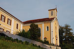
Bad Gleichenberg
|

|
5,208 | 38.77 | 134 | Feldbach | Bad Gleichenberg | local community
|
|
Acc. To code: 62375 |
Bad Radkersburg
|

|
3,178 | 30th | 106 | Feldbach | Radkersburg | urban community
|

|
Acc. To code: 62376 |
German Goritz
|

|
1,805 | 34.02 | 53 | Feldbach | - | local community
|

|
According to code: 62377 |
Edelsbach near Feldbach
|

|
1,350 | 16.13 | 84 | Feldbach | Riegersburg | local community
|

|
According to code: 62311 |
Eichkögl
|

|
1,337 | 14.91 | 90 | Feldbach | Kirchberg | local community
|

|
Acc. To code: 62314 |
Fehring
|

|
7.176 | 87.28 | 82 | Feldbach | - | urban community
|

|
Acc. To code: 62378 |
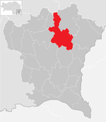
Feldbach
|
|
13,450 | 67.3 | 200 | Feldbach | 1. Feldbach 2. Bad Gleichenberg |
urban community
|

|
Acc. To code: 62379 |
Gnas
|

|
5,985 | 81.76 | 73 | Feldbach | Gnas | market community
|

|
Acc. To code: 62380 |
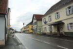
Halfway
|

|
1,731 | 38.78 | 45 | Feldbach | Radkersburg | market community
|
|
Acc. To code: 62326 |
Jagerberg
|

|
1,638 | 29.05 | 56 | Feldbach | Sassal | market community
|

|
Acc. To code: 62330 |
Kapfenstein
|

|
1,558 | 28.59 | 54 | Feldbach | Kapfenstein – St. Anna am Aigen – Frutten – Gießelsdorf | local community
|

|
Acc. To code: 62332 |
Kirchbach-Zerlach
|

|
3,248 | 39.16 | 83 | Feldbach | Kirchbach – Labilltal | market community
|

|
Acc. To code: 62381 |
Kirchberg an der Raab
|

|
4,567 | 43.9 | 104 | Feldbach | Kirchberg | local community
|

|
Acc. To code: 62382 |
Kloch
|

|
1,168 | 16.41 | 71 | Feldbach | Radkersburg | market community
|

|
Acc. To code: 62335 |
Mettersdorf am Saßbach
|

|
1,282 | 22.76 | 56 | Feldbach | Sassal | market community
|

|
Acc. To code: 62343 |
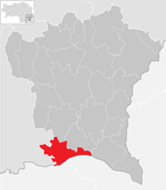
Mureck
|
|
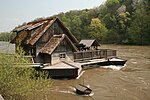
3,521 | 38.73 | 91 | Feldbach | - | urban community
|
|
Acc. To code: 62383 |
Paldau
|
|
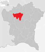
3,161 | 39.2 | 81 | Feldbach | Feldbach | market community
|

|
According to code: 62384 |
Pirching am Traubenberg
|

|
2,529 | 31.57 | 80 | Feldbach | Stiefing (Stieflingtal) | local community
|

|
Acc. To code: 62385 |
Riegersburg
|
|
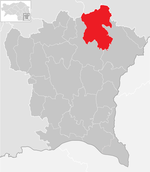
4,942 | 71.12 | 69 | Feldbach | Riegersburg | market community
|

|
According to code: 62386 |
Sankt Anna am Aigen
|
|
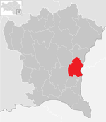
2,366 | 32.61 | 73 | Feldbach | Kapfenstein – St. Anna am Aigen – Frutten – Gießelsdorf | market community
|

|
According to code: 62387 |
Sankt Peter am Ottersbach
|

|
2,956 | 48.56 | 61 | Feldbach | Ottersbachtal | market community
|

|
According to code: 62388 |
Sankt Stefan im Rosental
|

|
3,898 | 43.2 | 90 | Feldbach | Sassal | market community
|

|
According to code: 62389 |
Straden
|

|
3,510 | 56.51 | 62 | Feldbach | Straden | market community
|

|
According to code: 62390 |
Tieschen
|
|
1,222 | 18.17 | 67 | Feldbach | Radkersburg | market community
|

|
According to code: 62368 |
Unterlamm
|

|
1,250 | 16.73 | 75 | Feldbach | - | local community
|

|
Acc. To code: 62372 |
Web links
Individual evidence
- ^ Landespressedienst Steiermark: Reform Agenda: District Reorganization in Styria ( Memento of April 25, 2012 in the Internet Archive ), accessed on April 20, 2012
- ↑ Ordinance of the Styrian Provincial Government of 10 July 2014, with which the Styrian District Authority Ordinance is changed. Provincial Law Gazette for Styria of September 10, 2014, No. 99, year 2014, ZDB -ID 705127-x .
- ^ Murfeld municipality is dissolved. ORF , March 3, 2019, accessed on March 3, 2019 .
- ↑ 46th law of April 2, 2019 on the division of the Murfeld community into the adjacent market communities of Sankt Veit in southern Styria and Straß in Styria , accessed on June 17, 2019
- ↑ Statistics Austria - Population at the beginning of 2002–2020 by municipalities (area status 01/01/2020)
Coordinates: 46 ° 57 ' N , 15 ° 53' E


