
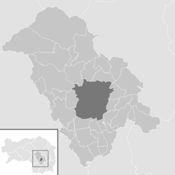
Graz area
| location | |
|---|---|
 .svg) |
|
| Basic data | |
| state | Styria |
| NUTS III region | AT-221 |
| Administrative headquarters | Graz |
| surface | 1086 km² |
| Residents | 156,070 (January 1, 2020) |
| Population density | 144 inhabitants / km² |
| License Plate | GU |
| District Commission | |
| District chief | Angelika Unger |
| website |
www.bh-graz Umgebung. steiermark.at |
| map | |
  |
|
The Graz-Umgebung district is a political district of the state of Styria .
It is located in the center of the federal state and surrounds the regional capital Graz , which is not part of the district , where the seat of the district administration is, which is why Graz-Umgebung is the only district in Styria without its own district capital. After Graz-Stadt, Graz-Umgebung is the district with the second highest number of inhabitants in the state.
geography
Geographical location
The Graz-Umgebung district is located in Central Styria . It has a share in four regions: The west and north-west of the district belong to western Styria and thus to the foothills of the Lavanttal Alps . The north and north-east of the district belong to the Grazer Bergland and thus to the peripheral mountains east of the Mur , while the east is part of the East Styrian hill country . The south of the district ultimately belongs to the Graz Basin .
The Mur , which forms the border between western and eastern Styria, flows through the district from north to south . The larger municipalities of the district are located along the Mur, so that around 70,000 inhabitants live here on around 250 km² (density: 280 inhabitants / km²). The other larger rivers in the district are the Kainach in the southwest and the Rabnitzbach in the northeast. The rest of the district is crossed by many small streams.
The highest mountains in the district are in the northwest in the area of Gleinalpe in the municipality of Übelbach . The highest peaks are formed by Speikkogel (1,988 m), Lärchkogel (1,894 m), Eiblkogel (1,831 m). In the northeast the Schöckl protrudes with a height of 1,445 m.
Expansion of the district
The Graz-Umgebung district measures around 50 km from north to south and around 40 km at its widest point from west to east, the total area is 1,086.36 km².
Neighboring districts
The district encloses the state capital and is surrounded by eight Styrian districts.
| Murtal (MT) | Leoben (LN) | Bruck-Mürzzuschlag (BM) |
| Voitsberg (VO) |
.svg)
|
Weiz (WZ) |
| Deutschlandsberg (DL) | Leibnitz (LB) | Southeast Styria (SO) |
District Courts
- The Graz-Ost judicial district comprises the eastern part of the city of Graz and the southern part of the Graz-Umgebung district.
- The Graz-West judicial district comprises the western part of the city of Graz and the northern part of the Graz-Umgebung district.
history
By a ministerial ordinance in 1854, the area of the Graz judicial district, created in 1849, was divided into three district courts: District Court I. Section (area of Graz on the right bank of the Mur), District Court II. Section (area of Graz on the left bank of the Mur), District Court III. Section (Graz area).
The area surrounding Graz continued to operate under the name of the judicial district of Gratz Umgebung from January 1, 1867 .
This formed during the separation of the political from the judicial administration from 1868 together with the jurisdictions Frohnleiten and Voitsberg the environment Graz District .
After the judicial district of Voitsberg was separated from the Graz-Umgebung district by an imperial resolution on October 1, 1891, only the Frohnleiten and Graz Umgebung district remained in the Graz-Umgebung district.
When the municipality of Petzendorf left the Leibnitz district , the area of the district increased by 2.7 km² on January 1, 1924.
From June 1, 1932 to February 28, 1937, the area of the Voitsberg district was part of the Graz-Umgebung district as a political branch .
In the course of the National Socialist administrative organization, on October 15, 1938, numerous surrounding communities were incorporated into the city of Graz, as a result of which the Graz-Umgebung district lost area.
In the 1950s, too, there were major changes to the area in the Graz-Umgebung district. The communities Affenberg and Präbach moved from the Weiz district to the Graz-Umgebung district on April 1, 1952 .
On January 1, 1957, the municipality of Pöls an der Wieserbahn was removed from the Leibnitz district and added to the Graz-Umgebung district.
The Graz-Umgebung district consisted of a total of 57 municipalities until 2014. As part of the municipal structural reform in Styria , the municipal areas of Tyrnau and Tulwitz are located in the Weiz district and the Petersdorf II district from the southeast Styria district in the Graz-Umgebung district by amalgamating communities across district boundaries . The boundaries of the districts have been changed in such a way that the new parishes are completely in one district.

District captains
- Ferdinand Kirchlehner, August 3, 1868
- Franz Stähling, December 20, 1869
- Franz Vogl, July 14, 1876
- Gustav R. von Crollolanza, 1878
- Julius Franzi R. von Vesteneck, March 27, 1881
- Franz Lautner, September 25, 1881
- Ferdinand Pirner, December 11, 1886
- Carl Russ, August 25, 1890
- Heinrich Clementschitsch, November 16, 1892
- Eugen E. von Schickh, July 9, 1899
- Alois E. von Kriehuber, September 17, 1911
- Fritz Bajardi, 1919
- Richard Schmigotz, August 1, 1919
- Paul Hohl, August 8, 1923
- Emil Krammer, March 15, 1927
- Adolf Rochelt, June 1, 1932
- August Sutter, June 26, 1945
- Hans Knieili, January 1, 1949
- Georg Stecher, January 1, 1958
- Heinz Pammer, January 1, 1962
- Alexander Mayer, August 1, 1963
- Hellmut Fallada, January 1, 1974
- Burkhard Thierrichter, January 1, 1998
- Angelika Unger, October 1, 2018
- Andreas Weitlaner, September 1, 2020
Administrative division
As part of the municipal structural reform 2014/15 , the number of municipalities in the district was significantly reduced from 2015. Since January 2015 the district has consisted of the following 36 municipalities:
- In the district of the Graz-Ost district court: Dobl-Zwaring, Eggersdorf near Graz, Feldkirchen near Graz, Fernitz-Mellach, Gössendorf, Hart near Graz, Haselsdorf-Tobelbad, Hausmannstätten, Hitzendorf, Kainbach near Graz, Kalsdorf near Graz, Kumberg, Laßnitzhöhe, Lieboch, Nestelbach near Graz, Premstätten, Raaba-Grambach, Sankt Marein near Graz, Sankt Radegund near Graz, Seiersberg-Pirka , Stattegg, Thal, Vasoldsberg, Weinitzen, Werndorf, Wundschuh.
- In the district of the Graz-West district court: Deutschfeistritz, Frohnleiten, Gratkorn, Gratwein-Straßengel, Peggau, Sankt Bartholomä, Sankt Oswald bei Plankenwarth, Semriach, Stiwoll, Übelbach.
List of municipalities in the Graz-Umgebung district
- Regions are small regions of Styria
- The population figures are from January 1st, 2020.
| local community | location | Ew | km² | Ew / km² | Judicial district | region | Type
|
photo | Metadata |
|---|---|---|---|---|---|---|---|---|---|
Deutschfeistritz
|

|
4,409 | 57.06 | 77 | Graz-West | 027 Übelbachtal dissolved August 2, 2014 |
market community
|

|
According to code: 60659 |
Dobl-Zwaring
|

|
3,544 | 37.92 | 93 | Graz-East | 064 Lower Kainach Valley | market community
|

|
Acc. To code: 60660 |
Eggersdorf near Graz
|

|
6,808 | 49.36 | 138 | Graz-East | 073 Schöcklland South | market community
|

|
According to code: 60661 |
Feldkirchen near Graz
|

|
6.703 | 11.58 | 579 | Graz-East | 057 GU 8 | market community
|

|
Acc. To code: 60608 |
Fernitz-Mellach
|

|
4,870 | 20.51 | 237 | Graz-East | 078 GU-SÜD dissolved December 30, 2017 |
local community
|

|
Acc. To code: 60662 |
Frohnleiten
|

|
6,542 | 153.84 | 43 | Graz-West | 029 GU North | urban community
|

|
According to code: 60663 |
Gössendorf
|

|
4.117 | 7.21 | 571 | Graz-East | 078 GU-SÜD dissolved December 30, 2017 |
market community
|

|
According to code: 60611 |
Burr grain
|

|
8,052 | 34.61 | 233 | Graz-West | 061 JEGG | market community
|

|
According to code: 60613 |
Gratwein street angel
|

|
12,846 | 86.69 | 148 | Graz-West | 061 JEGG | market community
|

|
Acc. To code: 60664 |
Hard near Graz
|

|
5,242 | 11.06 | 474 | Graz-East | 078 GU-SÜD dissolved December 30, 2017 |
local community
|

|
According to code: 60617 |
Haselsdorf-Tobelbad
|

|
1,526 | 6.68 | 228 | Graz-East | 064 Lower Kainach Valley | local community
|

|
Acc. To code: 60618 |
Hausmannstätten
|

|
3,475 | 6.78 | 513 | Graz-East | 078 GU-SÜD dissolved December 30, 2017 |
market community
|

|
According to code: 60619 |
Heat village
|

|
7,220 | 48.88 | 148 | Graz-East | 062 Hitzendorf | market community
|

|
Acc. To code: 60665 |
Kainbach near Graz
|

|
2,802 | 17.81 | 157 | Graz-East | 073 Schöcklland South | local community
|

|
Acc. To code: 60623 |
Kalsdorf near Graz
|

|
7,572 | 15.16 | 499 | Graz-East | 057 GU 8 | market community
|

|
Acc. To code: 60624 |
Kumberg
|

|
3,840 | 29.42 | 131 | Graz-East | 104 Kumberg | market community
|

|
Acc. To code: 60626 |
Laßnitzhöhe
|

|
2,756 | 14.88 | 185 | Graz-East | 103 Schemerl dissolved June 1, 2019 |
market community
|

|
Acc. To code: 60628 |
Dear
|

|
5,225 | 11.73 | 445 | Graz-East | 064 Lower Kainach Valley | market community
|

|
According to code: 60629 |
Nestelbach near Graz
|

|
2,640 | 27.34 | 97 | Graz-East | 103 Schemerl dissolved June 1, 2019 |
local community
|

|
According to code: 60666 |
Peggau
|

|
2,335 | 11.25 | 208 | Graz-West | 027 Übelbachtal dissolved August 2, 2014 |
market community
|

|
Acc. To code: 60632 |
Premstätten
|

|
6.339 | 29.27 | 217 | Graz-East | 057 GU 8 | market community
|

|
According to code: 60670 |
Raaba-Grambach
|

|
4,676 | 14.64 | 319 | Graz-East | 078 GU-SÜD dissolved December 30, 2017 |
market community
|

|
Acc. To code: 60667 |
Saint Bartholomew
|

|
1,442 | 11.72 | 123 | Graz-West | 062 Hitzendorf | local community
|

|
Acc. To code: 60639 |
Sankt Marein near Graz
|

|
3,747 | 41.71 | 90 | Graz-East | 103 Schemerl dissolved June 1, 2019 |
market community
|

|
Acc. To code: 60668 |
Sankt Oswald near Plankenwarth
|

|
1,268 | 11.81 | 107 | Graz-West | 062 Hitzendorf | local community
|

|
Acc. To code: 60641 |
Sankt Radegund near Graz
|

|
2.144 | 21.55 | 99 | Graz-East | 104 Kumberg | local community
|

|
According to code: 60642 |
Seiersberg-Pirka
|

|
11,408 | 17.36 | 657 | Graz-East | 057 GU 8 | local community
|

|
Acc. To code: 60669 |
Semriach
|

|
3,291 | 60.34 | 55 | Graz-West | - | market community
|

|
According to code: 60645 |
Stattegg
|

|
2,935 | 25.83 | 114 | Graz-East | - | local community
|

|
Acc. To code: 60646 |
Stiwoll
|

|
706 | 13.01 | 54 | Graz-West | 091 (name still open) | local community
|

|
According to code: 60647 |
Thal
|

|
2,288 | 18.51 | 124 | Graz-East | 062 Hitzendorf | market community
|

|
Acc. To code: 60648 |
Ubelbach
|

|
2,022 | 94.63 | 21st | Graz-West | 027 Übelbachtal dissolved August 2, 2014 |
market community
|

|
According to code: 60651 |
Vasoldsberg
|

|
4,598 | 28.08 | 164 | Graz-East | - | market community
|

|
Acc. To code: 60653 |
Weinitzen
|

|
2,670 | 18.99 | 141 | Graz-East | 104 Kumberg | local community
|

|
Acc. To code: 60654 |
Werndorf
|

|
2,383 | 6.24 | 382 | Graz-East | 057 GU 8 | local community
|

|
Acc. To code: 60655 |
Wound shoe
|

|
1,629 | 12.89 | 126 | Graz-East | 057 GU 8 | local community
|

|
Acc. To code: 60656 |
Population development

The population of the Graz-Umgebung district is growing faster than the national average. In the years 1951 to 2001 the population increased by 60%, while the whole of Styria had only about 7% growth in the same period. The reasons for this are the proximity to the state capital and the district's good infrastructure (motorways, airport, railways).
politics
The results of the municipal council elections in 2015 brought the following results across the district:
| Political party | 2015 | 2010 | 2005 | 2000 | 1995 | 1990 | ||||||||||||
|---|---|---|---|---|---|---|---|---|---|---|---|---|---|---|---|---|---|---|
| be right | % | Mandates | St. | % | M. | St. | % | M. | St. | % | M. | St. | % | M. | St. | % | M. | |
| ÖVP | 31,809 | 37.63 | 302 | 35,749 | 42.44 | 443 | 32,884 | 40.29 | 415 | 31,134 | 40.91 | 408 | 30.163 | 39.90 | 363 | 32,167 | 42.17 | 400 |
| SPÖ | 25,759 | 30.48 | 212 | 32,699 | 38.82 | 342 | 34,866 | 42.72 | 371 | 29,357 | 38.57 | 318 | 29,043 | 38.42 | 325 | 32,288 | 42.32 | 332 |
| FPÖ | 11,858 | 14.03 | 86 | 5,845 | 6.94 | 46 | 3,949 | 4.84 | 24 | 8,865 | 11.65 | 81 | 8,345 | 11.04 | 78 | 6,169 | 8.09 | 53 |
| The green | 5,894 | 6.97 | 39 | 3,560 | 4.23 | 27 | 3,686 | 4.52 | 29 | 2,383 | 3.13 | 15th | 2,034 | 2.69 | 14th | 672 | 0.88 | 6th |
| Other lists | 9,721 | 11.50 | 64 | 5,743 | 6.82 | 64 | 6.224 | 7.63 | 74 | 4,365 | 5.74 | 53 | 6.012 | 7.95 | 65 | 4,990 | 6.54 | 48 |
| Valid votes | 84,521 | 84,230 | 81,609 | 76.104 | 75,597 | 76.286 | ||||||||||||
| voter turnout | 69.71% | 73.24% | 75.27% | 77.96% | 82.38% | 91.24% | ||||||||||||
traffic
Street
The Graz-Umgebung district has excellent connections to the national road network. The Pyhrn Autobahn A 9 runs from north to south from Linz via Graz to Slovenia . It has one half * and eight full connection points in the district area: Übelbach (exit 157), Deutschfeistritz - Peggau (exit 165), Gratkorn -Nord (170) and Gratkorn-Süd (exit 173) in the north as well as Seiersberg (exit 188), Schwarzlsee * (exit 190), Schachenwald (exit 192), Kalsdorf (exit 194) and Wundschuh (exit 197) in the south of the district.
In the district area is the Graz-West junction of the A 9 with the south A 2 motorway from Vienna via Graz to Klagenfurt , which runs through the district from east to west. It can be reached via four connection points within the district: Laßnitzhöhe (exit 169), Graz Airport / Feldkirchen (exit 182), Premstätten (exit 188) and Lieboch (exit 194). In the north of the district, the Bruck expressway S 35 leads along the Mur to Bruck an der Mur .
The district is traversed by a number of former federal highways, which lead from Graz in (almost) all directions: Packer Straße B 70 runs from Graz to Klagenfurt along the Süd Autobahn, as does Gleisdorfer Straße B 65 from Graz to the state border Hungary . The Grazer Straße B 67 runs from Deutschfeistritz to Slovenia along the Pyhrn motorway. These three streets form the main axes. They also emanate from Rechberg Strasse B 64 from Frohnleiten to Weiz in the north, Weizer Strasse B 72 from Graz to Weiz in the northeast, Radlpass Strasse B 76 in the southwest and Kirchbacher Strasse B 73 in the southeast.
rail
The district is crossed from north to south along the Mur by the Southern Railway , which runs from Bruck an der Mur via Graz to Slovenia. The Koralmbahn, which is under construction, as well as some smaller railway lines such as the Graz-Köflacher Eisenbahn , which serves the south-west, the Styrian Ostbahn , which runs through the east of the district, and the Peggau – Übelbach local line in the north, branch off the southern line in the district area . Due to the mountainous and hilly landscape of the district, the west and north-east in particular cannot be connected to the rail network.
There is no railway station of national importance in the district. Only in the train stations Frohnleiten and Gratwein-Gratkorn is there a connection to all regional express connections to Spielfeld-Strass, Graz, Mürzzuschlag, Unzmarkt and Selzthal. All other stations are only served by regional trains and the Styrian S-Bahn . The InterCity network can only be reached via Graz Central Station .
Airport
Graz-Thalerhof Airport is located in the district in the area of the municipalities of Feldkirchen and Kalsdorf on the southern edge of the state capital.
Special communities
The northernmost municipality is Frohnleiten , the southernmost municipality is Dobl-Zwaring , while the westernmost municipality is Übelbach . The furthest to the east is Sankt Marein bei Graz .
The smallest municipality is Werndorf with 6.24 km², while Frohnleiten is the largest with 153.84 km² and thus exceeds Graz by 26.36 km².
Stiwoll has the fewest inhabitants with 706, Gratwein-Straßengel the most with 12,846 inhabitants (status: January 1, 2020, territorial status 2015).
The most densely populated is the municipality of Seiersberg-Pirka with almost 657 inhabitants per square kilometer, while Übelbach is the least populated with only 21 inhabitants per square kilometer.
The lowest community is Werndorf at 309 m.
Web links
- bh-graz Umgebung.steiermark.at District authority Graz-Umgebung
Individual evidence
- ↑ alex.onb.ac.at: RGBl. 1854, Item VIII, No. 27, pp. 103–118 : "Ordinance of the Ministers of the Interior, Justice and Finance of January 31, 1854, regarding the political and judicial organization of the Duchy of Styria."
- ↑ alex.onb.ac.at: RGBl. Born 1868, XVII. Piece, No. 44. P. 76 ff , "Law of May 19, 1868 on the establishment of political administrative authorities in the kingdoms ..."
- ↑ alex.onb.ac.at: RGBl. Born in 1868, XLI. Stück, No. 101, pp. 287 ff , "Ordinance of the Minister of the Interior of July 10, 1868, regarding the implementation of the law of May 19, 1868 ..."
- ↑ alex.onb.ac.at: State Law and Ordinance Gazette for the Duchy of Styria. 1891, X. Piece, No. 33: “Announcement of the k. k. Governor in Styria, regarding the division of the current political district surrounding Graz into two districts and the establishment of a district authority in Voitsberg. "
- ↑ alex.onb.ac.at: Federal Law Gazette for the Republic of Austria. 1923, 120th item, No. 621: "Ordinance of the Federal Chancellery of December 17, 1923 on the assignment of the local community Petzendorf to the district of the Graz district court and the district of the Graz district administration."
- ↑ alex.onb.ac.at: LGBl. 37, Item 4, No. 10: "Ordinance of the Styrian Provincial Government ..." The ordinance came into force on March 1, 1937.
- ↑ alex.onb.ac.at: Ordinance sheet for the official area of the governor for Styria. 1938, 6th piece. No. 10: "Ordinance of the Governor of Styria on the expansion of the area of the city of Graz and some related changes to the area of surrounding communities."
- ↑ alex.onb.ac.at: State Law Gazette for the State of Styria. 1952, Item 3, No. 18: “Ordinance of the Styrian Provincial Government on the amendment of the ordinance of the Styrian Provincial Government of December 29, 1950, LGBl. No. 63/1951, regarding the allocation of the communities Affenberg and Präbach to the political district of Graz-Umgebung "
- ↑ State Law Gazette for the State of Styria. 1956, Item 20, No. 60: “Ordinance of the Styrian regional government on the allocation of the municipality of Pöls an der Wieserbahn to the political district of Graz-Umgebung” on alex.onb.ac.at
- ↑ Ordinance of the Styrian Provincial Government of 10 July 2014, with which the Styrian District Authority Ordinance is changed. Provincial Law Gazette for Styria dated September 10, 2014. No. 99 Volume 2014. ZDB -ID 705127-x .
- ↑ District captains of the BHGU. In: bh-graz Umgebung.steiermark.at. Retrieved August 4, 2020 .
- ↑ Styria: Andreas Weitlaner will head the Graz-Umgebung district administration from September 1, 2020. In: regionews.at. August 4, 2020, accessed August 4, 2020 .
- ↑ Statistics Austria - Population at the beginning of 2002–2020 by municipalities (area status 01/01/2020)
Bruck-Mürzzuschlag |
Deutschlandsberg |
Graz |
Graz area |
Hartberg-Fürstenfeld |
Leibnitz |
Leoben |
Liezen |
Murau |
Murtal |
Southeast Styria |
Voitsberg |
Weiz
Political Expositur:
Gröbming
Former districts:
Bruck an der Mur |
Feldbach |
Fürstenfeld |
Hartberg |
Judenburg |
Knittelfeld |
Mürzzuschlag |
Radkersburg |
Stainz
Former branches:
Bad Aussee |
Iron ore |
Friedberg |
Fürstenfeld |
Knittelfeld |
Mariazell |
Mürzzuschlag |
Radkersburg |
Sankt Gallen |
Voitsberg
Coordinates: 47 ° 12 ' N , 15 ° 18' E