
West Styria

|

The West Styria includes those edge- and non-alpine areas of the Austrian federal state of Styria , the west lie the Mur.
geography
Location and landscape


West Styria is the western part of Central Styria . It comprises the southwestern part of today's Austrian state of Styria, historically known as West Central Styria . In fact, West Styria lies in the south-west of Styria; Large parts of Upper Styria , which includes the inner-alpine area of the state, are more to the west than western Styria. The name is derived from the time of the Habsburg Monarchy , when East and West Styria together formed the Central Styria of the Duchy of Styria , while Lower Styria , now Slovenian, was the mixed-language German-Slovenian area with the capital Marburg an der Drau ( Slovenian Maribor ).
In the north, western Styria is bounded by Stubalm , Packalm , Gleinalm and Hochalm to Upper Styria. In the south, the Possruck and the northernmost part of the Windischen Bühel form the border with Lower Styria, which today belongs to Slovenia. In the east the Mur is the border to Eastern Styria . In the west, the Koralm forms the border with Carinthia .
The landscape of western Styria consists of the Grazer Feld south of Graz , the Leibnitzer Feld , the western Styrian hill country , the mountain range of the Gleinz and the Sausal , the mountainous region northwest of Graz and the Styrian border mountains with the eastern and southeastern slopes of Koralm, Packalm, Stubalm and Gleinalm .
The rivers Mur, Sulm , Kainach and Laßnitz flow through it. The wide river valley of the lower Kainach is called Kainachboden and is accompanied a few kilometers by the Kaiserwald terrace. The area of the Graz-Umgebung district in the north-west of Graz with Gratwein-Straßengel , Deutschfeistritz and Übelbach and other communities is not included in western Styria in everyday life. A number of river courses are examples of river taps in which the course of a creek changes due to the fact that another, steeper flowing body of water gnaws the terrain around this creek, which ultimately leads to the fact that the original course of the creek is abandoned and its water the The direction of the steeper river follows (e.g. the course of the Laßnitz) at Deutschlandsberg and the course of other streams on the eastern slope of the Koralmzuges.
Regionally, Western Styria is divided into the Styrian planning regions Südweststeiermark and the western part of the Styrian central space , statistically in the NUTS regions West and South Styria (AT225) and the western part of Graz (AT221) - the difference between these two is the assignment of the district Voitsberg .
The southern part of West Styria is also considered to be southwest Styria. To the north, southern Styria is roughly demarcated from the rest of Central Styria by the Deutschlandsberg - Wildon (- Bad Gleichenberg ) line . The parts of southern Styria to the west and east of the Mur are referred to as Südweststeiermark and Südoststeiermark according to the division into western and eastern Styria .
- Neighboring regions
| Western Upper Styria |
|
Eastern Upper Styria |
| Lower Carinthia |
.svg)
|
Eastern Styria |
| Koroška ( Slovenia ) |
Podravska ( Slovenia ) Lower Styria (historical) |
Districts, municipalities and main towns
The districts of Deutschlandsberg and Voitsberg as well as the parts of the city of Graz west of the Mur and the districts of Graz-Umgebung and Leibnitz belong to western Styria .
- The area of western Styria lies west of the Mur in Graz and four political districts
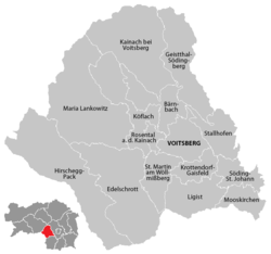
Voitsberg district

City of Graz and the Graz area (western parts)

Deutschlandsberg district
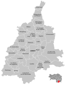
Leibnitz district


The main locations are the district towns of Voitsberg , Deutschlandsberg and Leibnitz . In addition to the densely populated southern environs of Graz with Feldkirchen , Kalsdorf , Seiersberg-Pirka , Straßgang , Lieboch , Premstätten , other larger towns such as Bad Schwanberg , Deutschfeistritz , Eibiswald , Frauental an der Laßnitz , Frohnleiten , Gleinstätten , Gratwein , Köflach , Lannach , Stainz , Wies , Wildon , western Styria includes many villages and individual farms.
traffic

Important connections to the neighboring areas are the Murtal to Upper Styria and Slovenia, the Gleinalm Tunnel and the Gaberl to Upper Styria, the Pack , Hebalm , Weinebene and Soboth to Carinthia and the Radlpass to the Slovenian Drautal. A number of bridges lead over the Mur into Eastern Styria.
West Styria is crossed east-west by the south autobahn A 2, in north-south direction by the Pyhrn autobahn A 9. The Pyhrn Autobahn runs west of Graz through one of the longest Austrian autobahn tunnels, the Plabutschtunnel , and further north through the Gleinalm tunnel. Other important road connections are the Grazer Straße B 67 from Peggau to Spielfeld , the Radlpass Straße B 76 from Lieboch via Lannach , Stainz , Frauental an der Laßnitz , Deutschlandsberg , Wies , Eibiswald to the Radlpass , the Packer Straße B 70 from Graz via Lieboch, Voitsberg and Köflach to Packsattel, Sulmtal Straße B 74 from Leibnitz to Deutschlandsberg, Südsteirische Grenzstraße B 69 from Straß in Styria to Soboth, Gaberl Straße B 77 from Köflach via Gaberl to Upper Styria and the L 601, which connects the Deutschlandsberg district connects via the Laßnitz valley with the Murtal near Wildon.
The area lies on the southern railway line leading from Bruck an der Mur via Graz and Leibnitz to Marburg . The most important train station is Graz Central Station . Western Styria is made accessible by the railway lines and, since 1935, also by the bus services of the Graz-Köflacher Bahn (GKB), which implemented its concept of a closed, uniform transport system of buses and trains in this area even before the introduction of the transport association.
West Styria is part of the Styrian Transport Association. It will be crossed by the Koralm Railway . At this track is created at Great Saint Florian as a last stop before Koralmtunnel the station Weststeiermark .
The Styrian airport, Graz-Thalerhof , is also located near Kalsdorf and Feldkirchen in western Styria.
Traffic routes and infrastructure are based on the provincial capital Graz , located in the east of western Styria .
geology
The hill country consists mainly of gravel from the Miocene period in the Neogene (earlier Tertiary ). The rocks are remnants of former sea cover and of sea beaches around 10 ± 5 million years ago as well as subsequent deposits of river gravel , they are partly known for their fossil wealth. Your area lies on the edge of the Styrian Basin . This basin was part of a sea, the Paratethys . In the course of the unfolding of the Alps, this sea receded ever further to the east ( regression ). Its area was filled in with sea and river deposits . In its west lay the Florian Bay, in which mainly sandy and clayey rocks were deposited, and the Köflach-Voitsberger Bay, in which brown coal seams formed (mostly lignite ). Further lignite deposits, albeit with a higher degree of coalification (partly shiny coal ), were built in the southwestern Eibiswalder Buch (sub-basin Eibiswald). The sea had formed together with the Mediterranean from a previous sea, the Tethys . It was later split off and took its own development. The rocks come from Baden , they also have parts from the approximately nine million year old Torton and (near Gamlitz, Leutschach, Arnfels) from the period from Ottnang to Karpat 18 to 16 million years ago . In the Kainachtal west of Wildon there is a volcanic vent from the Miocene near Weitendorf , which is part of the Transdanubian volcanic region .
The Sausal area consists of much older rocks from the Paleozoic Era , which form the Central Styrian Threshold.
Koralm, Stubalm and Gleinalm consist of crystalline rocks ( Austroalpine crystalline: eclogite , gneiss , amphibolite , mica schist ). North-west of Graz, framed by the mountain ranges just mentioned, lies the “Graz Paleozoic”. This is an area of Paleozoic rocks in which smaller, long-abandoned mines for lead, zinc and other ores were located. The "layers of Kher " and the "layers of Stiwoll " are geological terms that have been used in this area.
The Koralm is geologically an uplifted part of the mountain, a so-called Pultscholle . It only got its present form roughly in the last part of the mountain formation of the Alps about 20 million years ago, and the position of the mountain range across the course of the Alps can be traced back to it (“continental flood tectonics”). The ridge is not very pronounced compared to other mountains. At the height of the mountain range are flat areas in which economic uses such as alpine pastures, but also due to a lack of good drainage, wet areas (waterlogged, swamps, moors, moist meadows such as the lake Eben and the Filzmoos ) develop. Only at the edge of the mountains do you have to overcome short stretches of great height differences in the lowlands.
history


prehistory
During the construction work on the east portal of the Koralm tunnel , traces of settlement were found that date back to the La Tène period and further into the period from 7000–6000 BC. Go back BC. The Laßnitz valley was already densely populated in the Middle Bronze Age. Early settlement can also be proven in Kalsdorf and on the Buchkogel near Wildon through graves of the Urnfield culture and settlements from the Hallstatt period .
The publication of archaeological finds took place in some cases as early as the 19th century in works that were not always taken into account in more recent literature.
Noricum
Western Styria belonged to the Celtic Kingdom of Noricum . Individual names such as Lahn and Lann attest to this Celtic settlement.
In the districts of Leibnitz and Deutschlandsberg there are several thousand barrows that are dated to the Hallstatt, Latène and Roman imperial periods . As in southern Styria, a number of archaeological sites have been documented from this time. Most recently, such sites along the state border with Slovenia were documented in a cross-border project.
There are a number of sites from the Roman period , the 26.5 km long Roman road between Lebring and Deutschlandsberg is known as an “engineering structure with an ingenious route”.
Carantania
The area was since the end of the 6th century settlement area of the Alpine or Karantaner Slavs , who were combined in the Slavic Principality of Carantania .
After the subjugation of the Slavs by Bavaria in 772, Karantanien was annexed to the Frankish Empire in 788. West Styria was the heartland of the Mark an der Mur , also called Karantanermark, Kärntnermark, marchia Carantana, marchia transalpina, Mark Hengist, Hengistgau or similar. This is considered the home country of Styria. The name marchia Carantana appears from the year 970 and is in use until after 1055.
The Hengistburg near Hengsberg or Wildon was the military and political center (probably Palatinate ) of the area on the middle Mur (today Central Styria) and thus also western Styria in the late Carolingian period . In the year 892 King Arnulf is said to have had a meeting with the Slav prince Brazlaw von Sissek in Hengistfeldon ( Hengistfeld = Leibnitzer Feld, south of Hengsberg and the Wildoner Berg) , in which a joint action against Great Moravia was concerned. The original parish of St. Lorenzen zu Hengsberg, which stretched from the Gleinalm and Stubalm to the Mur, had its seat in the Hengistburg.
West Styria remained a Slavic settlement area until the early Middle Ages, in which a number of donations to monasteries were made. Extensive possessions in the Deutschlandsberg district, such as the Freiland area, belonged to the Archdiocese of Salzburg and the Admont Abbey .
The Slavic settlement period is reflected in many river and place names such as Laßnitz , Kainach , Feistritz .
German settlement
From the 8th or 9th, as planned from the beginning of the 11th century, German settlers moved into the country. At the beginning of the 11th century, Margrave Adalbero and his wife each received a hundred king hooves and a. in the area of Voitsberg, for which settlers from their property in Bavaria were used.
Duchy of Styria
Nobles from western Styria were involved in the resistance against King Ottokar in the 13th century , such as Hartnid von Leibnitz and Herrand von Wildon , whose family also provided the Hereditary Marshals of Styria.
The Reiner Oath from 1276 contains a pledge of loyalty from Styrian nobles to Rudolf I of Habsburg . In 1292 western Styria with Deutschlandsberg , Wildon and Leibnitz was the starting point of the fighting of the Landsberger Bund , a nobility revolt against Duke Albrecht I of Habsburg, who had ruled Styria since 1282 .
Western Styria was only on the edge of the area in which the Turkish wars took place, but Turkish troops initially came to this area after the siege of Vienna in 1529 . The greatest damage, with devastation to remote settlements on the Koralm, occurred during the Turkish invasion in 1532, when Sultan Süleyman's army moved after the unsuccessful siege of Güns ( Kőszeg ) across Eastern Styria to the Murtal and then south. The decisive factor for this path was that the western Hungarian regions were already completely devastated and plundered and that Styria was still hoping for food and booty.

Austrian Empire
The recession of Vienna in 1535 brought an agreement between the Habsburgs and the Salzburg archbishops on the status of the Salzburg possessions under state law.
The northern part of western Styria belonged to the Grazer Kreis and the south to the Marburger Kreis . Both areas were considered part of Lower Styria in the 18th century .
In the camp Thalerhof in Feldkirchen south of Graz were from 1914 to 1917 a total of about 30,000 people from Eastern Europe (mainly Ukrainians, then Ruthenian called) interned. The Russian war and political prisoners were used as auxiliary workers in the agriculture of western Styria.
Republic of Austria
At the end of the Second World War, West Styria was the area of operations for partisans from the area of the former Yugoslavia . Several assaults and clashes by members of this group with representatives of the authorities and the population at the time, as well as relevant reprisals, resulted in several dozen deaths. The murder of five partisans was the subject of the partisan murder trial in Graz .
Slovenian population
The displacement of the Slavic population by German-speaking immigrants took place earlier in the north (Voitsberg district) than in the south, where bilingualism only disappeared at the turn of the 21st century. In 1955, Article 7 of the Vienna State Treaty mentions a Slovene minority in Styria. A remaining Slovenian population is mentioned in 2002 in the literature for the southwest of the Deutschlandsberg district.
economy
Lignite deposits near Köflach and Wies led to an economic boom in the 19th century; the Eibiswald steelworks alone employed around 1,000 workers. Next to him there were a number of other steel works, some of which had only been in operation for a few years. Around Köflach and Voitsberg, lignite mining remained the most important source of income until around 1970. The general economic development of western Styria began to stagnate from around 1960 with the progressive cessation of mining and could only be continued with the establishment of industrial zones such as Voitsberg, Lannach and Deutschlandsberg ( Epcos factory). Until the 18th century, glass production and the manufacture of charcoal and potash ( ash burning ) was an important branch of business in the Koralm area , topographical names such as the place name glassworks in the community of Gressenberg or Aschenwald in the valley of the Schwarzen Sulm near Garanas prove this. The tradition of glass production is continued by the Oberglas company near Köflach.
In Lannach there is an oil storage facility that is used as a reserve storage facility and is connected to the Adria-Wien Pipeline (AWP) via a branch line from Wohlsdorf .
There are still a large number of wood-processing companies, the largest being Mayr-Melnhof Karton in Frohnleiten and the Gratkorn paper factory (which also spans the Mur, in Gratwein) belonging to the Sappi Group . Other large wood processors are located in Preding ( Holzindustrie Preding , formerly Leitinger ) and as Holztreff Liechtenstein in Deutschlandsberg (owned by the Liechtenstein family, who own large forests in the area). The production facilities of the Gaulhofer company , a large producer of windows and doors, were built on the site of the paper mill in Übelbach . Several commercial operations succeeded in attaining supra-local importance, such as the Stainz dairy (“Stainzerbutter”) and the Messner butchers in Stainz and Sorger in Frauental. One company that achieved worldwide recognition was the successor to the brass works in Frauental, which later became the Frauenthal porcelain factory , which developed into the Frauenthal Holding group, which produces ceramic catalysts and other environmental technology products. Match production in the plants in Stallhof near Stainz and (until 1982) in the SOLO plant in Deutschlandsberg is history.
Japanese companies are involved in EPCOS in Deutschlandsberg ( TDK , electronic components) and in the catalyst plant in Frauental (IBIDEN). The economic crisis from 2008 had an impact on the industrial settlements, short-time working, layoffs and company takeovers were the result, but these were largely offset in the following years.
Agriculture, which was a main industry until the middle of the 20th century, has since declined sharply.
Two of the three wine-growing regions of the Steirerland wine-growing region are located in western Styria : the southern Styria wine region and the western Styria wine region . Mainly white wines and the Schilcher from the Blauer Wildbacher vine are pressed.
The Tourism is an important income branch formed by curative resources (mineral springs in Bad Gams , mud applications in Bad Schwanberg , etc.) is encouraged. The Styrian Wine Road in the south and the Schilcher Wine Road near Deutschlandsberg document the viticulture activity. The wine-growing area of western Styria is also called Styrian Tuscany because of its location , it is an area that is often used for short holidays.
In the Federal Piber are Lipizzaner horses for the Spanish Riding School bred in Vienna. Several restaurants in western Styria have been awarded by the Gault-Millau gastronomy guide .
The energy supplier is Energie Steiermark (ESTAG), whose largest subsidiary, Steweag, is responsible for customer service. The power line network did not reach more remote areas until around 1965.
Social infrastructure
The cultural center of western Styria is the provincial capital Graz with several universities ( University of Graz , Technical and Medical University ), and technical colleges, numerous grammar schools and higher vocational schools. The only other eight-year grammar school is the Bundesgymnasium und Bundesrealgymnasium Köflach , which originally emerged as a branch in Graz. There is also the Köflach upper level secondary school with a focus on sports and the Voitsberg upper level secondary school.
The hospitals, in particular the regional hospital with the university clinic and the western location of the LKH Graz South-West in Eggenberg and the accident hospital are also located in Graz.
Regional newspapers of West Styria are the
- Weststeirische Rundschau , weekly, place of publication Deutschlandsberg, ZDB -ID 2303595-X
- Weststeirische Volkszeitung , weekly, place of publication Voitsberg, ZDB -ID 2303593-6
- Week ZDB -ID 2585510-4 , before that Südweststeirer Woche ZDB -ID 2585507-4 or Südsteirer Woche ZDB -ID 2585502-5 weekly, place of publication Leibnitz
- Aktiv Zeitung (also Grenzland Aktiv ), fortnightly, published in Eibiswald
- Leibnitz Current , monthly, place of publication Leibnitz
Large radio transmitters ( basic network transmitters ) are on the Schöckl , at Dobl ( medium wave switched off) and on the Koralm near Wolfsberg . There are also a number of filling transmitters . The telephone network is well developed, but there are gaps in broadband coverage and mobile phone reception cannot always be assumed in mountainous areas.
environment

The intensive agricultural and forestry use and the earlier industrial use of the area through coal mining and iron production have left traces in the settlement structure, in the road network and in the straightening of the rivers, but did not cause any lasting large-scale damage. The overburden dumps of the mines have grown together, the lignite opencast mines (Oberdorf near Voitsberg etc.) have been renatured, the Voitsberg lignite power station was shut down in 2006. However, the original natural vegetation , which would consist of mixed forests with red beeches and other deciduous trees, can only be covered to a limited extent due to the intensive use of the forest through the production of charcoal and glass.
In western Styria there are a number of protected areas, such as the protected areas Koralpe, Soboth-Radlpass, Amering-Stubalpe, the landscape protection area Pack-Reinischkogel-Rosenkogel and the European protected areas ( Natura 2000 ) in the Laßnitztal. The protected areas are documented in the information system of the State of Styria.
The use of the water reserves for dams was considered in the past for different rivers and partially realized ( Packer reservoir , reservoir in the Soboth). The construction of a power station for the upper reaches of the Sulm is under discussion, and the upper reaches of the Laßnitz was also examined for water management use. Small power plants are located on the upper reaches of almost all major rivers.
Culture

Cultural assets
From early epochs there are grave monuments (burial mounds) near Rassach and in Sulmtal ( Großklein ) in western Styria , from Roman times the excavations of the city of Flavia Solva and the Roman villa in Grünau near Groß Sankt Florian from the 1st to 3rd centuries, the was explored in 13 excavation campaigns between 1988 and 2002. The Grünau silver mug is a valuable find .
Other cultural sites in western Styria are closely linked to the Catholic Church: Rein Abbey is the world's oldest existing Cistercian monastery, pilgrimage churches such as Maria Lankowitz and “Maria Himmelfahrt” in Osterwitz are frequently visited. The Castle Stainz , in the ethnographic collections and the Hunt Museum are located, is also a former monastery. The Seggau Castle near Leibnitz, built by the Bishops of Seckau , is now a seminar center and houses the largest historical bell in Styria. A number of palaces and castles as Schloss Eggenberg , Schloss St. Martin in Straßgang , Hollenegg Castle , Castle Lannach , Castle torrent and the Castle Germany Mountain occupy the Styrian history in design and origin.
The old town of Graz - strictly speaking in Eastern Styria - is a UNESCO World Heritage Site and was expanded to the western part of the city in 2010 as the City of Graz - Historic Center and Eggenberg Castle with Eggenberg Castle.
The cultural property protection map and the inventory of monuments of the Federal Monuments Office contain many references to monuments of art and economic history.
Museums
Graz offers the Styrian State Archives and the Landeszeughaus and Joanneum museums .
The Austrian Open Air Museum in Stübing near Deutschfeistritz also documents the design of the settlements and farms in western Styria.
The Technical Railway Museum Lieboch contains exhibits from Styrian railway history, especially the longest-serving steam locomotive in the world, the GKB 671 .
The Austrian Aviation Museum is located at Thalerhof Airport .
Cultural life
In Graz there is an opera house , numerous theaters and small theaters, and the Kunsthaus Graz .
The Deutschlandsberg youth music festival is part of the Styrian Autumn avant-garde festival . Internationally known pianists such as Paul Badura-Skoda , Elisabeth Leonskaja , Oleg Maisenberg, Leonid Brumberg and Svjatoslav Richter performed as part of the Deutschlandsberg Piano Spring . Regular performances by other artists such as the Altenberg Trio complement the concert calendar.
The brass bands in western Styria are active in social life beyond Styria. A meeting of the chapels from those places that are named after St. Oswald (Oswalder meeting) takes place regularly . In addition to wind instruments, the Styrian harmonica (Knöpferlharmonika) and the dulcimer are also common musical instruments .
The burning of Easter fires is a widespread custom in western Styria. Furthermore, Easter crosses are set up, whereby not only cross symbols , but also other appearances with Easter symbols such as chalices , hearts , monstrances etc. are designed. Hikes to these symbols are described as "gemma cross hoaz'n schaun".
Regional dialects
Different dialects can be found in western Styria. The language of the first German settlers belonged to South Bavarian . The Koralm formed a language border, the "Koralpenschranke", which "intercepts the last Central Bavarian forays into Upper and West Styria."
With the settlement of the area around Söding by the monks of Rein Abbey , which was founded in 1129 from Ebrach in Upper Franconia, Franconian settlers came to western Styria. The colloquial language in western Styria “does not allow a strong Franconian addition to be misunderstood even in the present”. In the Hirschegg area there are also Swabian - Alemannic language components. The colloquial language of West Styria is the subject of the "West Styrian Dictionary", this language contains a number of words that can be traced back to Slavic origin, such as the word Opok for the marl soil of West Styria.
Personalities
The life and work of the following people have brought important results for West Styria:
- Archduke Johann , owner of the Stainz estate, first mayor of Stainz
- Viktor Geramb , specialist in folklore from Deutschlandsberg
- Anton Hafner (also Toni Hafner ), painter of a series of paintings in West Styrian parish churches and composer
- Carl Hermann , sculptor
- Walter Kainz, musician and folklorist, together with Eduard Walcher, a key contributor to the recording of West Styrian vocabulary
- Hans Kloepfer , doctor and writer, who gained popularity through his West Styrian dialect poetry
- Hanns Koren , folklorist and founder of the Styrian Autumn
- Ernst Reinhold Lasnik , author and historian for the Voitsberg district
- Matthias Macher , district and court doctor in Stainz and medical writer with a focus on healing springs and baths in Styria
- Eduard Walcher, dialect poet
- Martin Bartenstein (as well as other members of the noble Bartenstein family ), ÖVP politician
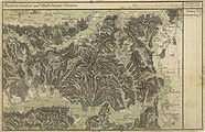
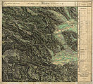
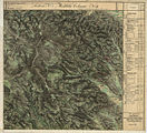
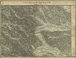
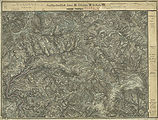
West Styria on historical maps
West Styria was in the Graz and Marburg districts of Austria-Hungary . Your area is documented in the land surveys.

Graz and Grazer Feld (“Murboden”) in the recording sheet of the 3rd regional survey, 1879

Voitsberg, middle Kainachtal, 1877/78

Wies, Eibiswald, Soboth, 1877/78

Leibnitz, Sausal, Unterlauf von Laßnitz and von Sulm, 1879

The border between the Marburger (yellow) and the Graz district (red-brown) was moved several times to the south between 1748 and 1850, around 1855

West Styrian hill country, 1678, alpine areas as "albums"

Franzisco-Josephinische (3rd) land survey , special map 1: 75,000 sheets 5254 Deutschlandsberg, 1894/1913

Special map sheet 5255 Leibnitz and Wildon, 1894/1914

General map of Central Europe sheet 33 ° 47 ° Graz, 1893

Josephinische (1.) Landesaufnahme , Pack and Hebalm, around 1790

Kainachtal near Mooskirchen and Lannach, Grazer Feld southwest of Graz, around 1790

Schwarzkogelzug northwest of Deutschlandsberg, upper Stainztal , around 1790

Lower Stainztal, Kainachtal to the confluence with the Mur near Wildon, around 1790

Schwanberg and the surrounding area, around 1790
Sausal , lower reaches of Laßnitz and Sulm, Leibnitz, around 1790
Franziszeische (2nd) land survey , Deutschlandsberg and Schwanberg, 1834/35
The west of Stainz with parts from Bad Gams and Ligist to the Schwarzkogel, 1834/35
Deutschlandsberg and Schwanberg, recording sheet, 1877/78
Pack and Hebalm, course of Packer Strasse, 1877/78

Stainz, Rosenkogel, Reinischkogel, 1877/78


literature
- Office of the Styrian Provincial Government, Department 16 - State and Communal Development : Central Styria and Region Profile Southwest Styria . Both Vienna, current version: October 2011 ( 1st (PDF; 2.5 MB) and 2nd , both pdf, raumplanung.steiermark.at)
- Claus Jürgen Hutterer, Walter Kainz, Eduard Walcher: “West Styrian Dictionary. Grammar and vocabulary according to subject groups. ”In the series:“ Writings on the German language in Austria ”Volume 13/14. Published by Peter Wiesinger, Böhlau, Vienna / Cologne / Graz 1987, ISBN 3-205-07321-5 .
- Paul W. Roth (Ed.): “Glass and coal. Catalog for the state exhibition in 1988 in Bärnbach / West Styria. “Leykam, Graz 1988, ISBN 3-7011-7196-3
- Herbert Blatnik: “Contemporary witnesses remember the years 1938–1945 in Southwest Styria.” 2nd edition, Lerchhaus, Eibiswald, December 2000, ISBN 3-901463-08-9 , pp. 242–243.
- Magdalena M. Eibl: “Investigations into the Noric-Pannonian barrows. Focus on Styria. ”AV Akademiker Verlag Saarbrücken 2014. ISBN 978-3-639-67891-8 .
- Max Rosenzopf: "Weststeirisches Musikantentum." In the series: "Corpus Musicae Popularis Austriacae - Complete Edition of Folk Music in Austria." Volume 21: "Folk Music in Styria." Ed .: Österreichisches Volksliedwerk , Böhlau-Verlag, Vienna-Cologne-Weimar 2016. ISBN 978-3-205-79649-7 .
Web links
Individual evidence
-
↑ the term Alpe used on maps is not common in Styria and is increasingly not used in official terms such as Koralm tunnel .
Alm from albums , but the Alps as a “learned refreshment”, the word Alpe would be the singular, invented much later, “a pure paper form”: Wilhelm Brandenstein : Review of Paul Zinsli, Grund and Grat. In: Österreichische Alpenzeitung No. 69 ( 1951), pp. 28-29. Furthermore: “The place names of the Rauriser valley.” In: “Der Naturfreund.” Issue 3/4 (1932), p. 64. Both publications cited from: Fritz Freiherr Lochner von Hüttenbach: “Wilhelm Brandenstein. Small name-based work. ” Academic printing and publishing company . Graz 1978. ISBN 3-201-01038-3 . P. 23–24 and P. 84. A similar form in which –b– becomes –m– is represented there for Hilbe – Hilm (“sheltered, sunny location”). The cited book review concerns: Paul Zinsli: Grund und Grat. The mountains in the mirror of the Swiss-German dialects. 352 S. Verlag A. Francke, Bern 1944. The older standard dictionary "Unger-Khull, Styrian vocabulary as a supplement to Schmeller's Bavarian dictionary", Graz 1903, p. 16, gives many references for "Alm", but not for "Alpe" : literature.at , the more recent "Dictionary for Weststeirisch" mentions the word Alpe related to mountain not and pointing for Alpe in Alm : S. 304 and 562, respectively. - ↑ Margarete Sekera, Heinrich Hacker (editor), Max Eisenhut (mapping): “Austrian soil mapping. Explanations for the soil map 1: 25,000. Mapping area Deutschlandsberg ”(KB 24). Published by the Federal Ministry of Agriculture and Forestry (Federal Agricultural and Chemical Research Institute, Soil Mapping and Soil Management). Vienna 1975. pp. 57-58.
- ↑ Sieghart Otto Morawetz: "Tapping in the Steirischen Randgebirge and its surroundings." In: "Mitteilungen des Naturwissenschaftlichen Verein für Steiermark." Graz 1976, Volume 106, ISSN 0369-1136 ZDB -ID 206167-3 , pp. 83-87.
- ↑ Year of the granting of the license according to the Motor Vehicle Lines Act: Anton Reinbacher: “70 years of GKB bus operation.” In: “The turntable. The staff magazine of Graz-Köflacher Bahn- und Busbetrieb GmbH. "Issue 20, April 2005, p. 2. Abridged and expanded version of an article by this author in" Omnibusspiegel "1992.
-
↑ Sepp Tezak : "Graz-Köflacher Bahn." Volume 1 "Vehicle Park", Volume 2 "History and Route." In the series: "Bahn im Bild" Volumes 4 and 15. Pospischil Publishing House, Vienna 1980
Rainer Krafft-Ebing (editor ): “50 years of motor vehicle operation. 1935-1985. Commemorative publication on the occasion of the 50th anniversary of the vehicle operation of the Graz-Köflacher Railway and Mining Company. "Published by the management of the transport company of the Graz-Köflacher Railway and Mining Company. Graz 1985. - ↑ Rainer Krafft-Ebing: “Festschrift Busbetriebe.” P. 2.
- ↑ Enlargement of the geological overview map of the Republic of Austria 1: 1,500,000. In: Hans Georg Krenmayr, Albert Daurer (editor): “Rocky Austria. A colorful geological history of Austria. ”Federal Geological Institute, Vienna 1999, appendix. ISBN 3-85316-006-9 .
- ↑ Hartmut Hiden: "Geology of the settlement area." P. 17. In: Helmut-Theobald Müller (Ed.), Gernot Peter Obersteiner: "District topography Deutschlandsberg." First volume, general part.
- ↑ Karl Stingl: "The Lignite-Bearing Sediments of the Middle Miocene Köflach-Voitsberg Embayment (Styrian Basin, Austria)" ( The lignite-bearing sediments of the Middle Miocene Köflach-Voitsberger Bay, Styrian Basin, Austria ). Archive for deposit research of the Federal Geological Institute. Volume 24, Vienna 2003, pp. 219-229, ISSN 0253-097X .
- ↑ Peter Beck-Mannagetta: "Report 1990 on geological recordings of the Quaternary on sheet 206 Eibiswald" (the geological map 1: 50,000 of Austria.) Yearbook of the Federal Geological Institute, Volume 134, 1991, Volume 3, pp. 553-554.
- ↑ a b Andrea Brunnsteiner: "Revising the 'Florian layers' in the area between Kainach and Laßnitz ." P. 7. Diploma thesis on obtaining the Magistrate degree at the Faculty of Natural Sciences of the Karl-Franzens University Graz, Institute for Geology and Paleontology. September 1997, university publication, no publisher, no ISBN.
- ↑ Helmut W (alter) wing, F (ranz) Neubauer: “Geology of the Austrian federal states in brief individual representations. Styria. Geological map of Styria 1: 200,000 with explanations. "Geologische Bundesanstalt," Bundesländerserie ", Vienna 1984, ISBN 3-900312-12-5 , pp. 21-23.
- ↑ a b c Helmut W (old) wing: “Geological map of the pretertiary underground.” In: “Geological thematic maps of the Republic of Austria 1: 200,000. South Styrian Basin - South Burgenland Threshold. ”Published by the Federal Geological Institute, Vienna 1988; Arthur Kröll, Albert Daurer (editor): "Explanations of the maps of the pretertiary subsoil of the Styrian basin and the southern Burgenland threshold." Relief map with basin and threshold designation on pages 4–5 of the explanations, ISBN 3-900312-65-6 . Geological map and explanations together with relief map, aeromagnetic map and gravity map in a plastic cover.
-
↑ Leopold Weber: "Investigation of the ore deposits in the area of Stiwoll-Kher (Grazer Paläozoikum)." Archive for deposit research of the Federal Geological Institute, Vienna, Volume 1, Vienna, March 1982, pp. 97–111.
Leopold Weber: "The lead-zinc ore deposits of the Graz Paleozoic and their geological framework". Archive for deposit research, Volume 12, Vienna 1990, ISBN 978-3-900312-72-5 . - ↑ Helmut W (alter) Flügel, H (ans) P (eter) Schönlaub: “Evidence of deeper Lower Devonian and higher Silurian in the Rannach facies of the Graz Palaeozoic.” In: “Mitteilungen der Geologische Gesellschaft in Wien”, 63rd volume 1970, pp. 142-148.
- ↑ Arthur Winkler-Hermaden a. a .: "Scientific study results of the working group for geological-pedological investigations in the catchment area of the Laßnitz river in south-western Styria." Austrian Academy of Sciences, mathematical and natural science class, Dept. I, 149. Issue 7-10, pp. 225-226. Vienna. Peter Beck-Managetta: "About the geological structure of the Koralpe." In: G. Weissensteiner: "Minerals of the Koralpe". 1. Special volume of the club magazine "Die Eisenblüte". Association of Styrian Mineral Collectors, Graz 1979, p. 6.
- ↑ a b Hartmut Hiden: "Geology of the settlement area." P. 11.
- ↑ in the source referred to as "Bronze Age": Weststeirische Rundschau, March 14, 2009. Volume 82, No. 11, p. 6.
- ↑ a b Weststeirische Rundschau, May 9, 2009, 82nd volume no.19 p. 5.
- ↑ Georg Tiefengraber: “Prehistoric and early historical finds from Kalsdorf near Graz. Settlement topographical studies in the central Graz Basin. ”Dissertation at the University of Vienna, Faculty of Historical and Cultural Studies, Institute for Pre- and Protohistory, Vienna 2005, university publication, no ISBN, p. 7.
- ↑ Christoph Gutjahr: “Fundchronik / Hallstattzeit; Tumulus 4 tumulus field Buchkogel, KG Unterhaus, MG Wildon, VB Leibnitz ": In:" Fund reports from Austria ", published by the Federal Monuments Office BDA, Volume 45, year 2006, Vienna 2007, p. 662 f.
- ↑ Bernhard Hebert: Finds in archives - What could have long been known in (Styrian) archeology. (PDF; 75 kB) In: “Forum Archaeologiae - Journal for Classical Archeology” 39th edition / VI / 2006.
- ↑ from Celtic Lahn (e) 'sluggish water'. Wilhelm Brandenstein : "Steirisch Lahn - a Celtic word." In: " Indo-European research." Volume 60 (1952), pp. 21–28. Quoted from: Fritz Freiherr Lochner von Hüttenbach: “Wilhelm Brandenstein. Small name-based work. ”Academic printing and publishing company. Graz 1978, ISBN 3-201-01038-3 , pages 125-132. The word is treated there with the old Irish lan 'full' and the Latin planus 'even'.
- ↑ Magdalena M. Eibl: “Investigations into the Noric-Pannonian barrows. Focus on Styria. ”AV Akademiker Verlag Saarbrücken 2014. ISBN 978-3-639-67891-8 . P. 58.
-
↑ Matija Črešnar, Marko Mele, Karl Peitler, Manca Vinazza (ed.): “Archaeological biography of a landscape on the Styrian-Slovenian border. Results of the cross-border project BorderArch-Steiermark / Arheološka biografija krajine ob meji med avstrijsko Štajersko in Slovenijo. Rezultati čezmejnega projekta BorderArch-Steiermark ”(Universalmuseum Joanneum, Archeology & Coin Cabinet:“ Schild von Steier ”, supplement 6/2015), Graz / Ljubljana 2015, ISBN 978-3-902095-69-5 .
Compare “Hidden treasures on the border. Weir systems, settlements, tumuli and pungen - an EU project examined the many archaeological treasures in the Styrian-Slovenian border area. " Walter Schmidbauer in Kleine Zeitung online, accessed on September 2, 2017. - ^ Carl Schmutz: "Historisch-topographisches Lexicon von Steyermark". Fourth volume. P. 365.
- ↑ Günther Burkert: “Styria as a Turkish marching area. The years 1529 and 1532 as a heavy burden on the Styrian population. ”In: Gerhard Pferschy, Peter Krenn:“ Die Steiermark. Bridge and Bulwark. ”Pp. 192–200.
- ↑ Christian Fleck : "Koralmpartisanen - About different careers of politically motivated resistance fighters." Ludwig Boltzmann Institute for Historical Social Science, Materials for Historical Social Science, Volume 4, Verlag Böhlau, Vienna-Cologne 1986, ISBN 3-205-07078-X .
- ↑ Christian Stenner (Ed.): “Slovenian Styria. Displaced minority in Austria's southeast. ”Series of publications on the customer of Southeast Europe II / 23. Published by the Institute for History of the University of Graz, Department of Southeast European History, Univ.-Prof. Dr. Karl Kaser. Böhlau Verlag, Vienna-Cologne-Weimar 1997, ISBN 3-205-98690-3 .
- ↑ Klaus-Jürgen Hermanik: "Hidden Minority." 2007.
- ↑ a b c Hutterer: "West Styrian Dictionary", p. 10, with references to older literature.
- ^ "State Treaty on the Restoration of an Independent and Democratic Austria", signed on May 15, 1955 in Vienna, Austrian Federal Law Gazette No. 152/1955, 39th issue, issued on July 30, 1955, p. 727
- ↑ Peter Čede, Dieter Fleck: "The Styrian-Slovenian border area as reflected in the administrative division and linguistic minorities: The development of the linguistic minorities on both sides of the Styrian-Slovenian border reflects the eventful history of the border region, which is less than a hundred years old." In: Gerhard Karl Lieb (editor): “Continuity and change in the cultural and natural landscape. Festschrift for Herwig Wakonigg. “Grazer Schriften der Geographie und Raumforschung, Volume 38, published by the Institute for Geography and Spatial Research at the University of Graz, October 2002, without ISBN.
- ↑ Hans Jörg Köstler: “Steel production in West Styria with special consideration of the second half of the 19th century.” In: Journal of the Historisches Verein für Steiermark. Festschrift “150 Years of the Historical Association.” Volume 91/92, 2001/02, pp. 467-510.
- ^ Association of Austrian Newspapers: Press Handbook . Media and journalists for PR and advertising in Austria. Manz Verlag, Vienna, ISBN 978-3-214-08134-8 .
- ↑ For 1 kg of glass 2400 kg of wood were necessary, 97% of it in the form of potash, 3% for heat generation: Paul W. Roth: "Waldglashütten." In: Paul W. Roth (Ed.): "Glass and coal." Catalog for the state exhibition in 1988 in Bärnbach / West Styria. Leykam Verlag, Graz 1988, ISBN 3-7011-7196-3 , p. 123.
- ↑ Andreas Exner: “Potential natural distribution of the common beech ( Fagus sylvatica L.) in forest communities and on locations in the Hebalm area (northeastern Koralpe). With a plant-sociological overview of the most important types of vegetation on logs, forest-free wet and humid locations as well as rock corridors in the area.
- ↑ Protected areas
- ↑ Parliamentary question from Christiane Brunner to the Minister of Agriculture, 1202 / J (XXIV. GP) , regarding the Schwarze Sulm.
- ↑ On the occasion of the geological survey for the "general water management planning of Styria": Peter Beck-Mannagetta: "The geology of the catchment area of Laßnitz (West Styria)". Dissertation at the Philosophical Faculty of the University of Vienna, published in: "Mitteilungen des Alpenländischen Geologische Verein" (Messages from the Geological Society in Vienna), Volume 34, Vienna 1941, p. 1.
- ↑ Cultural property protection map 1: 50,000. Sheet 198 Deutschlandsberg. According to the Hague Convention of May 14, 1954, Federal Law Gazette No. 58/1964, edited by the Documentation Center and Convention Office of the Federal Monuments Office, Vienna 1977.
- ↑ Kurt Woisetschläger, Peter Krenn: "Dehio Handbuch - Die Kunstdenkmäler Österreichs: Styria (excluding Graz)." Topographical monument inventory, ed. from the Federal Monuments Office, Department for Monument Research, Anton Schroll, Vienna 1982, ISBN 3-7031-0532-1
- ↑ Rosenzopf, Musikantentum, pp. 23–47.
- ↑ (analogously: “let's go see the burning cross”) Weststeirische Rundschau, March 22, 2013, 86th year, no. 12, p. 14.
- ↑ "Atlas on the history of the Styrian peasantry." Peter Wiesinger: "The dialects of Styria." Map No. 12, Part II: "The Styrian dialects in the context of the Bavarian-Austrian dialect area - word geography." The remarks on the "Koralpenschranke" are available in the explanations of this map sheet.
- ↑ Hutterer: "West Styrian Dictionary", foreword, p. III.