
Laßnitz (Sulm)
|
Laßnitz upper course: Niedere Laßnitz / Pöschlbach |
||
 Upper course of the Laßnitz with bridge piers of the former forest railway |
||
| Data | ||
| Water code | AT : HZB: 2-220-234-343-030; STM: 2272.2724 | |
| location | West Styria , Austria | |
| Drain over | Sulm → Mur → Drau → Danube → Black Sea | |
| River basin district | Mur | |
| source | between Handalm and Weberkogel ; Middle Koralpe 46 ° 51 ′ 11 ″ N , 15 ° 1 ′ 20 ″ E |
|
| Source height | 1650 m above sea level A. approx. | |
| muzzle | In Leibnitz coordinates: 46 ° 47 '9.89 " N , 15 ° 31' 50.03" E 46 ° 47 '9.89 " N , 15 ° 31' 50.03" E |
|
| Mouth height | 265 m above sea level A. | |
| Height difference | 1385 m | |
| Bottom slope | 22 ‰ | |
| length | 63.9 km | |
| Catchment area | 496.39 km² | |
| Left tributaries | Hofbauerbach (Fkm 3.5), Rettenbach (Fkm 6), Mittereggbach (Fkm 29), Wildbach (Fkm 30), Gamsbach / Werkswasser Porzellanfabrik (Fkm 30), Vocherabach (Fkm 31), Rassachbach (Fkm 33), Saubach (Fkm 36), Stainzbach (Fkm 43), Oisnitzbach (Fkm 44), Predingbach (Fkm 45) |
|
| Right tributaries | Brendlbach (river kilometer 4), Osterwitzbach / Betleitenbach (Fkm 13), Gleinzbach (Fkm 44) |
|
| Small towns | Deutschlandsberg , Leibnitz | |
| Communities | Deutschlandsberg, Frauental an der Laßnitz , Groß Sankt Florian , Wettmannstätten , Preding , Sankt Nikolai im Sausal , Hengsberg , Lang , Tillmitsch , Leibnitz | |
| Residents in the catchment area | 30,000 | |
| ⊙ Niedere Laßnitz [ieS]; Origin Laßnitz, variants: confluence ⊙ Niedere Laßnitz / Pöschlbach and Rettenbach; ⊙ Niedere Laßnitz and Osterwitzbach | ||
The Laßnitz is a tributary of the Sulm in western Styria in Austria .
geography
Description of the run

The Laßnitz rises at about 1650 m as Niedere Laßnitz in the middle Koralpe between Handalm ( 1853 m above sea level ) and Wildbachalm ( 1805 m ) in the Osterwitz area . It flows to the confluence of the Rettenbach (for which the name Niedere Laßnitz is also found) on the border with the former municipality of Kloster shortly to the north, then in a deeply cut valley to Deutschlandsberg to the east. In this part of its course it is a torrent with a steep gradient.
Shortly before Deutschlandsberg, the Laßnitz in the Deutschlandsberger Klause circles the castle hill of the Deutschlandsberg castle .
From Deutschlandsberg the river runs in a wide, flat valley, the actual Laßnitz valley, circles the Sausal and flows into the Sulm at Leibnitz at 267 m . After another 6.5 km the Sulm flows into the Mur . The location of the river mouths can give the impression that the Sulm is a right tributary of the Laßnitz and that the Laßnitz flows into the Mur.
Like many larger rivers in the Eastern Alps, the Laßnitz flows from northwest to southeast. The reason for this is the unfolding of the Alps, which is still not quite complete today.
Strong gradient in the upper reaches due to the geological situation
This gradient has its reason in the formation of the Koralpe: Geologically, the Koralpe is an uplifted part of the mountain, a pult . From their mountain ridge (where the source areas are located) the rivers and streams have to overcome large differences in altitude over short stretches into the lowlands (in the Laßnitz: into the Graz basin ).

The steep slopes of the river valleys lead to landslides (which also open up mineral discovery sites).
history
Word origin and naming of the river
The name Laßnitz (890 Luonzniza ) is derived from the Slavic Lieznica and translated as 'Waldbach'. In linguistics, l ǫčica , * loNč'nica 'Wiesenbach' is also discussed, to lonka ( locative lonce ) or * lǫka 'moist, swampy meadow'. As another option (such as 1345 Lesniz, Laßnitz Murau or 1080 Laznich in Paltental) * laz'nica to laz , laz ъ , Gereut , clearing, bright patch in the forest '( "Gereutbach"), as well as in the source stream Rettenbach stuck could. The root could also be in the place name of the city of Deutschlandsberg . Regardless of the details of its origin, the -itz name ('-bach') indicates the ancient Slavic population.

Information that deals with a river Laßnitz in the middle part of the Koralpe is not clear: It can mean several bodies of water that belong to the same river system, but can be a few kilometers (and several hundred meters in altitude) apart: Upper reaches of the Laßnitz, Wildbach or Rettenbach : The upper reaches of the Laßnitz is called the Niedere Laßnitz . Depending on how the map is displayed, this name denotes the 6½ kilometer run to the confluence of the Rettenbach, 15 kilometers from the headwaters to the confluence of the Betleitenbach / Osterwitzbach in the Freiland area or the 25 km to Deutschlandsberg. The spring course, now known as the Niedere Laßnitz , can then be referred to as Laßnitz or Pöschlbach (after the large farm at the mouth of the Rettenbach).

To the north of the Laßnitz flows the tributary, formerly known as Hohe Laßnitz , and from around 1990 called Wildbach , which flows into it at Frauental an der Laßnitz . Furthermore, the designation Niedere Laßnitz is used for the torrent and another tributary of the Laßnitz, the Rettenbach. In older publications even today's (Niedere) Laßnitz can be referred to as Hohe Laßnitz and the torrent as Niedere Laßnitz .
The name variants can be traced back to the fact that in the 19th century the origin of the Laßnitz was not assumed to be in the area of the Handalm, as it is today, but on the Hebalm and the Rettenbach was seen as the upper reaches of the Laßnitz. In the Josephinische Landesaufnahme 1787 the Laßnitz is shown as Groß Lasnitz Bach , the wild brook as Klein Lasnitz Bach . At that time it was also unclear whether the Laßnitz flowed into the Sulm or vice versa the Sulm into the Laßnitz, i.e. the name of the last kilometers from Leibnitz to Mur.
The catchment area is the old settlement area
Barrows in the catchment area of the Laßnitz, z. B. near Rassach , prove that this area was settled in the Avar period in the 6th – 8th centuries. Century, within the framework of which a Slavic population can be assumed, and that the area belongs to Carantania .
The Roman villa of Grünau from the 1st to 4th / 5th is located in the community of Groß St. Florian . Century The large Roman settlement Flavia Solva is located in Leibnitz .
Teufelsgraben near Leibnitz
This ditch originally extended several kilometers between Laßnitz and Mur . It is interpreted as a Roman irrigation canal, but also as an early fortification that is associated with the Hengistburg in the Mark on the Mur . The ditch is mentioned in a document from AD 982. This ground monument is still well preserved near the Gralla motorway service station on the Pyhrn motorway . There the trench has a depth of one and a half and a clear width of about six meters. In parts it is bordered by a wall of excavated material up to 80 cm high and up to four meters wide at its base from the bottom of the pit.
Buildings and changes in the course of the Laßnitz
The slope of the river has been the subject of power plant planning several times. Around 1922 it was planned to build a hydropower plant in the Klause near Deutschlandsberg in the area of the former paper mill in the Burgegg district. A 30 meter high dam wall would have dammed the Laßnitz to around two kilometers and generated electricity with two Francis turbines . The upper reaches of the Laßnitz was examined on the occasion of the geological survey for the general water management planning of Styria .
In the years 1962 to 1966 the Laßnitz from Groß St. Florian was straightened through large-scale improvement measures . Lateral waters were combined into receiving waters , the old course, dead arms, hollows and channels were largely filled in.
In the Ice Age , around 1.8 million years ago, the Laßnitz had a different course after leaving the mountains near the Deutschlandsberger Klause. She followed the path of today's Leibenbach towards Sulm . It was diverted to the east by a tap in the Old Quaternary . As a result, she quickly deepened, so that she could not get back to her original bed, even after she had to move her run after heavy floods. The old course in the Leibenfeld was no longer in a valley floor, the Leibenfeld became a dry river terrace.
Without this change, the Laßnitz would today (if it had kept the course of the Leibenbach) flow into the Sulm at Prarath or meet the Schwarze Sulm at St. Martin . The main river in today's Laßnitztal from Deutschlandsberg would be the small Mittereggbach, from Frauental the torrent. The fact that the Leibenbach in the valley of the Schwarzen Sulm flows parallel to the Sulm for several kilometers without flowing into it can be attributed to this change in course, as well as the fact that the Laßnitz follows a course below Deutschlandsberg to Groß St. Florian that runs differently than that geographical conditions made this expected (north and not south of the valley floor).
environment
No serious burdens
The Laßnitz has no serious environmental impact. Industrial companies (e.g. match factories such as the SOLO factory in Deutschlandsberg) that influenced water quality a few decades ago have been closed.
Agricultural fertilization in the middle and lower reaches of the river has so far only resulted in low levels of pollution from fertilizer residues .
Protected areas
The former communities of Kloster, Freiland and (partially) Trahütten and individual pieces of land at the western end of Osterwitz (parts of the former Stoff farm ) on the upper reaches of the Laßnitz are located in a nature reserve.
The Deutschlandsberger Klause is a nature reserve: The reserve extends over a length of approx. 1200 meters with an area of approx. 27 hectares and an average altitude of 400 to 500 meters on both sides of the Laßnitz.
The Deutschlandsberger Klause is also a NATURA 2000 protected area (European protected area ). Protected goods are the habitats of the plants growing there. The more detailed description is:
“The gorge stretch, located in the Styrian foothills, is criss-crossed by landslide heaps made of coarse, blocky material. The stretch of the river Lassnitzbach offers a varied picture with pools, island formations and large boulders. Small forest streams, trickle meadows and seepage points occur on the steep slopes. "
Part of the Laßnitzau am Unterlauf (in the course of the circumnavigation of the Sausal) is a landscape protection area.
Some Laßnitz sections in the lower reaches belong to the NATURA 2000 protected area (European protected area ) Demmerkogel-Süd slopes, Wellinggraben with Sulm, Saggau and Laßnitz sections and Pößnitzbach. From the description:
“The base or lime-rich soils are influenced by groundwater and surface water (waterlogging, characterized by seepage and precipitation). The oxbow lakes of the Laßnitz have numerous wood relics from the Au am (dry) oxbow lake. Pools and silting areas show a high faunistic and floristic potential. As in the Sulm, the soils are rich in lime or bases and lie in the groundwater area (subhydric, semiterrestrial). At the mouth of the Laßnitz the hardwood alluvial forest (oak-elm-meadow) dominates, including forest areas on the low terrace and transition to the hillside forest. The softwood alluvial forest (Weiden-Au) is often in a complex with water bodies. "
The meadow landscape at the confluence of the Laßnitz in the Sulm is a nature reserve.
Flow regulations
The mean flow rate is 6.2 m³ / s at Obertillmitsch (276 m), shortly before the confluence with the Sulm .
The water balance of the central Laßnitz valley is heavily influenced by the river regulation from 1962 to 1966: Before the regulation, the Laßnitz flowed as a strongly meandering body of water on a flat river dam. Accordingly, the river in the broad valley floor often changed its bed, which was evidenced by silted up river arms and oxbow lakes. As a result of the regulation, the course of the river was shortened, the gradient increased and the groundwater level sank, which means that many agriculturally used soils were withdrawn from the influence of the groundwater, but also meadows that were previously wet became more usable for agriculture.
The construction of the Koralmbahn was the reason for a further relocation of the course of the river: In the years 2008/09 the course of the Laßnitz near Gussendorf was redesigned over two kilometers and flood retention basins were created. As part of this work, the Laßnitz bridge between Gussendorf and Lassenberg near Wettmannstätten was rebuilt as a 142 m long and 14.5 m high reinforced concrete bridge.
fauna
Both brown trout and rainbow trout live in the water itself . Dragonflies and caddis flies live on the water of the upper reaches . Their larvae are a reliable indicator of water quality; they only occur in bodies of water with good to very good water quality.
flora
Rare plants grow in the upper reaches of the Laßnitz: the Sturzbach Gemswurz and the mica saxifrage , which was only found in the area of the western Styrian peripheral mountains and its foothills (Koralpe, Bachergebirge ). It thrives in dry places under overhanging rocks, if possible without direct contact with precipitation water (rain, etc.) and does not tolerate strong light: The deeply cut valleys of the Laßnitz upper reaches, e.g. B. the Deutschlandsberger Klause, are one of its distribution areas.
_1.jpg)
Sweet chestnuts thrive in the mild climate of the middle and lower reaches of the Laßnitz .
Water quality
The water quality is from the community of Freiland, approx. River kilometer 10, in quality class I-II (almost unpolluted, until then almost drinking water quality), from the confluence of the Stainzbach in quality class II, due to the pollution from settlements and fertilization of agricultural areas.
The water hardness is low (range 1-2 - soft water, depending on the groundwater input from irrigation systems, etc.).
Floors
The agriculturally usable soils are brown earth soils with almost all types of water supply up to pseudogley or gley . In the upper reaches, there are rocky brown soils made of crystalline slate as medium-quality arable and grassland, whereby arable use only makes sense up to an altitude of 800 to 1000 m, or nutrient-poor tendrils . From Deutschlandsberg on there are (former) auboils and silicate loose sediment brown soils, some of which are formed from tertiary sediment (Florianer Tegel ).
economy
Operating modes
In the Laßnitz catchment area, agriculture, forestry and commercial operations are the most common forms. Large industry is missing. A number of offers are available for tourism, with a focus on short and recreational vacations (the area can be easily reached from the city of Graz ).
Agriculture
Agricultural and forestry production mainly comprises cattle breeding, agriculture and hunting. Farm milk production and delivery to the local dairies, formerly a main source of income for agriculture, has declined in favor of beef production over the past few decades, but is still the basis of a larger dairy in Stainz.
In the area of the upper reaches, grassland farming dominates , grain is sometimes grown (mainly barley and wheat, previously also rye).
Fruit growing (especially for apples) is carried out in special crops.
The lower reaches are dominated by the agricultural corn and pumpkin production. Pumpkin production is part of the production of seed oil .

Fallow deer (fallow deer) is kept in gates for meat production. Important livestock breeds are the Holstein and Simmental cattle . In addition , beef cattle breeds are bred with Charolais , white-blue Belgians and other breeds. Pig breeding mainly includes the Pietrain , Landrace and Edelschwein breeds . The Sulmtaler are common on chickens .
Red deer (stag), chamois, wild boar (wild boar) on the upper reaches and generally deer and hares are the most common larger wild animals in the Laßnitz catchment area. Badgers have become rare. Bears rarely switch to the headwaters from the south. The fox is a common predatory game. The large contiguous forest in the upper reaches of the Laßnitz home to many species of birds, including grouse (capercaillie). A common bird of prey that also beats free-range chickens and cats is the buzzard.
Trout, carp and other edible fish are drawn in a number of fish ponds.
forestry
The extensive forests on the upper reaches of the river (mainly spruce, fir, red pines and larches, on hardwood linden and ash) are used by forestry operations. Forestry was the reason for the construction of the Liechtenstein Forest Railway .
Viticulture
The Laßnitz flows through the western Styria wine-growing region . The Deutschlandsberg area lies in the core zone of the Schilcher cultivation area. The vine from which this wine is made is called " Blauer Wildbacher " after the Wildbach district of the Deutschlandsberg community .
Commercial and industrial
In Deutschlandsberg there is a large factory for electronic components, in Frauental an der Laßnitz there is a large ceramic factory (mainly industrial porcelain).
On the course of the Laßnitz there are a number of small power plants to supply neighboring farms and businesses with electrical energy. Up until the beginning of the 20th century, the river's hydropower was also used by a number of mills and sawmills .
Importance as a traffic route
Up until the beginning of the 20th century, the Laßnitz was important for timber transport through Holztrift . Since then, the river has had no significance as a traffic route. Since around 1980 the upper course has been used temporarily as a training course for white water sports.
From Freiland to Deutschlandsberg, the Laßnitz is accompanied by the route of the former Liechtenstein Forest Railway . Today this route is a hiking trail.
Historical maps
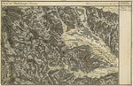
- The course of the Laßnitz in the three regional recordings from around 1789 to 1910
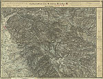
Sources in the Lassnitz Graben between Wildbach Alm and Hand Alm in the recording sheet 1: 25,000 of the Francisco-Josephine (3rd) land survey , as of 1877/78

Upper reaches west of Deutschlandsberg in the Josephinische (1.) Landesaufnahme , around 1790
The Laßnitz valley east of the Ulrichberg (top right)

The Stainzbach is an important tributary

Mouth of the torrent in the Frauental area (then: Laßnitz and Zeierling)
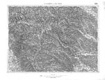
Special map as of 1937, with the route of the forest railway

The lower reaches of the Laßnitz around 1914


Web links
Individual evidence
- ↑ a b c d e Digital Atlas Styria, topic of waters and water information ; especially Lassnitz. and Niedere Laßnitz. Extract from the digital Styrian body of water index.
- ↑ BMLFUW (ed.) : List of areas of the Austrian river basins: Mur area. In: Contributions to Austria's Hydrography Issue No. 60, Vienna 2011, p. 105. PDF download , accessed on July 6, 2018.
- ↑ Peter Beck-Mannagetta (1917–1998): The geology of the catchment area of the Laßnitz (West Styria) . In: Mitteilungen der Alpinen Geologische Vereinigung, Volume 34, year 1941. Vienna 1942. Pages 1-37. Furthermore the multi-page bibliography of this author in his obituary: Mitteilungen der Österreichischen Geologische Gesellschaft No. 90 (1997). Vienna 1999, pages 207-212. ISSN 0251-7493 .
- ↑ On the influence on the formation of the Alps, division into crust wedges or parts at the beginning of the Carpathian Mountains and the Dinaric Mountains : Hans Georg Krenmayr, Albert Daurer (editor): Rocky Austria. A colorful geological history of Austria. Geologische Bundesanstalt, Vienna 1999, page 46. ISBN 3-85316-006-9 .
- ↑ Gerda Woletz: The bed load conditions of the Laßnitz , in: Artur Winkler-Hermaden, Peter Beck-Mannagetta, Karl Bistritschan, Gerda Woletz, Karl Schoklitsch, Herbert Pichler: Scientific study results of the working group for geological-pedological investigations in the catchment area of the Laßnitz river in southwest Styria. Session reports of the Academy of Sciences in Vienna, mathematical and natural science class, Department 1, Volume 149, Issue 7 to 10 (presented at the session on June 27, 1940). Verlag Hölder-Pichler-Tempsky Vienna 1940. Pages 245-257.
- ↑ Arthur Winkler-Hermaden a. a .: Scientific study results of the working group for geological-pedological investigations in the catchment area of the Laßnitz river in south-western Styria. Austrian Academy of Sciences, mathematical and natural science class, Dept. I, 149. Issue 7-10, pp. 225-226. Vienna. Peter Beck-Managetta: About the geological structure of the Koralpe. In: G. Weissensteiner: Mineralien der Koralpe . 1. Special volume of the club magazine Die Eisenblüte . Association of Styrian Mineral Collectors, Graz 1979. Page 6.
- ↑ G (ernot) Weissensteiner: Minerals of the Koralpe . 1. Special volume of the club magazine Die Eisenblüte . Association of Styrian Mineral Collectors, Graz 1979.
- ↑ a b Fritz Lochner von Hüttenbach: The clearing names of Styria. In: Michaela Ofitsch, Christian Zinko: 125 years of Indo-European Studies in Graz. Festival tape on the occasion of the 125th anniversary of the research facility "Indo-European Studies" at the Karl-Franzens University Graz. Verlag Leykam, Graz 2000. ISBN 3-7011-0026-8 . P. 252.
- ^ Wilhelm Brandenstein : The mountain and field names in Granatspitzgruppe (Hohe Tauern). In: Journal for Place Name Research. No. 4 (1928), pp 155-165. Quoted from: Fritz Freiherr Lochner von Hüttenbach: Wilhelm Brandenstein. Small name-based work. Academic printing and publishing company. Graz 1978, ISBN 3-201-01038-3 . Pp. 41–52, here: p. 51.
- ↑ Heinz Dieter Pohl: Settlement history and tradition of place names of Slovene origin in East Tyrol and Carinthia (with views of the rest of Austria). In: Peter Ernst, Isolde Hausner, Elisabeth Schuster, Peter Wiesinger (eds.): Place names and settlement history. Files of the symposium of the Working Group for Name Research - Institute for German Studies at the University of Vienna and Institute for Austrian Dialect and Name Lexicons of the Austrian Academy of Sciences from 28.-30. September 2000. C. Winter University Press. Heidelberg 2002. pp. 177-189, here: p. 178. ISBN 3-8253-1138-4 .
- ↑ Manfred Trummer: Slawische Steiermark = Slightly extended version of the lecture of the same name at the symposium “To be foreign - stay together. The Slovene Ethnic Group in Austria ”as part of the“ Slovene Days ”at the Karl-Franzens University in Graz, 25. – 28. March 1996. From: Christian Stenner (Ed.): Slovenian Styria. Displaced minority in Austria's southeast. Böhlau Verlag, Vienna-Cologne-Weimar 1997, pages 15-34. ISBN 3-205-98690-3 .
- ↑ a b Austrian map 1: 50,000 - ÖK 50, sheet 188 Wolfsberg. Published by the Federal Office for Metrology and Surveying (Land Survey) in Vienna. New additions 1959/1960, map continuation 1991, individual supplements 1993.
- ^ Rettenbach (3). Extract from the digital Styrian body of water index: Information on the kilometer of confluence of the receiving water: 8.488 km
- ^ Austrian map 1: 50,000 189 Deutschlandsberg, map revision 1965, supplements 1968 and soil map 1: 25,000 mapping area Deutschlandsberg, sheet 189-3N. Photo and print: Federal Agricultural and Chemical Research Institute / Soil Mapping, Vienna. Published by the Federal Ministry of Agriculture and Forestry. Austrian soil mapping of the Federal Research and Training Center for Forests, Natural Hazards and Landscape - BFW, Federal Office for Forests.
- ↑ a b Freytag-Berndt hiking map with short guide. Sheet 41, Graz-Koralpe-Eibiswald. 1: 100,000 edition 1983 - 1183841137, Verlag Freytag-Berndt and Artaria, Vienna. ISBN 3-85084-641-5 .
- ^ On the title page of the Austrian map 1: 25,000 - ÖK 25 V, sheet 189 Deutschlandsberg. Recorded in 1983.
- ^ Austrian map 1: 50,000 - ÖK 50, sheet 189 Deutschlandsberg. New in 1983, map continuation in 1991.
- ^ Josephinische Landesaufnahme 1787, in: Historische Karten, Digitaler Atlas Steiermark, Geografisches Informationssystem GIS des Landes Steiermark.
- ↑ Maximilian Riederer, Gunther Riedlsperger, Johann Tomaschek: Freiländer Ortschronik . Self-published by the community of Freiland near Deutschlandsberg, 1988. Page 195, with a reference to Josef Andreas Janisch: Topographical-statistical lexicon of Styria with historical notes and comments. Graz, Leykam-Josefsthal publishing house 1878-85. Volume 1: AK. 1878-. VIII, 821 pages. Volume 2: LR. 1885. 793 pages (32 plates). Reprint: Verlag für Collectors , Graz 1978-79.
- ↑ Contribution to the Teufelsgraben ( Memento of the original from September 28, 2007 in the Internet Archive ) Info: The archive link was inserted automatically and has not yet been checked. Please check the original and archive link according to the instructions and then remove this notice. in the Austrian Castle Forum.
- ↑ Weekly newspaper “Weststeirische Rundschau” from October 10, 2009. Volume 82, No. 41. Page 3.
- ↑ West Styrian Rundschau . No. 3, year 2013 (January 18, 2013), 86th year, ZDB -ID 2303595-X . Simadruck Aigner u. Weisi, Deutschlandsberg 2013, p. 3.
- ↑ Peter Beck-Mannagetta: The geology of the catchment area of the Laßnitz (West Styria) . P. 1.
- ^ A b Margarete Sekera, Heinrich Hacker (editor), Max Eisenhut (mapping): Austrian soil mapping. Explanations for the soil map 1: 25,000. Mapping area Deutschlandsberg (KB 24) . Published by the Federal Ministry of Agriculture and Forestry (Federal Agricultural and Chemical Research Institute, Soil Mapping and Soil Management). Vienna 1975. Pages 53-56. As of 2007 under: Austrian soil mapping of the Federal Research and Training Center for Forests, Natural Hazards and Landscape - BFW, Federal Office for Forests.
- ^ Geological map of the Republic of Austria , sheet 189 Deutschlandsberg: Gravel terraces with silt loam cover, Old Pleistocene. Published by the Federal Geological Institute Vienna.
- ↑ Explanations for the soil map 1: 25,000. Pages 57-58.
- ^ Sieghart Otto Morawetz: Tapping in the Styrian Edge Mountains and its surroundings. In: Communications from the Natural Science Association for Styria. Graz 1976. Volume 106. ISSN 0369-1136 ZDB -ID 206167-3 . Pp. 90-91.
- ↑ Landscape protection area 02: Pack - Reinischkogel - Rosenkogel . Ordinance of the Styrian Provincial Government of May 25, 1981, Styria. State Law Gazette No. 37/1981 in the version of the correction (new map display) No. 64/1981. Map of the protected area ( Memento of the original dated December 21, 2007 in the Internet Archive ) Info: The archive link was inserted automatically and has not yet been checked. Please check the original and archive link according to the instructions and then remove this notice. in the Digital Atlas Styria.
- ^ Ordinance of the District Authority of Deutschlandsberg of February 22, 1982 on the declaration of the Deutschlandsberger Klause as a nature reserve (plant protection area), announced in the Grazer Zeitung of March 5, 1982, 9th item, page 117. Before: Ordinance of November 12, 1968, Grazer Newspaper 1969, issue 33, page 339.
- ↑ Ordinance of the Styrian state government of April 19, 2006 on the declaration of the area "Deutschlandsberger Klause" (AT2214000) as European protected area No. 33. Styria. LGBl. No. 76/2006. CELEX No. 31992L0043, 32003R1882. This ordinance is based on the Fauna-Flora-Habitat Directive (FFH RL) 92/43 / EEC of the Council of May 21, 1992 for the conservation of natural habitats and wild animals and plants, OJ. EU No. L 206 page 7, last amended by Regulation (EC) No. 1882/2003 of the European Parliament and of the Council of 29 September 2003, ABl. EU No. L 284, page 1 ff.
- ↑ Landscape protection area 33: Laßnitzau. Ordinance of the Styrian Provincial Government of June 29, 1981, stmk. LGBl. No. 85/1981.
- ↑ European Protected Area No. 16. Ordinance of the Styrian Provincial Government of March 12, 2007, styrian. LGBl. No. 19/2007. CELEX No. 31979L409, 32003R0807, 31992L0043, 32003R1882. www.ris.bka.gv.at/lr-steiermark/ Index 5500/02/231. This regulation is based on the Bird Protection Directive (VS-RL) 79/409 / EEC of the Council of April 2, 1979 on the conservation of wild birds, ABl. EU No. L 103, pages 1, last amended by Council Regulation (EC) No. 807/2003 of April 14, 2003, ABl. EU No. L 122, pages 36 ff., And on the Fauna-Flora-Habitat Directive (FFH RL).
- ↑ Ordinance of the Leibnitz district administration of March 10, 1992. Grazer Zeitung 1992, page 208. See www.ris.bka.gv.at, Steirisches Landesrecht. Index 5500/02/99.
- ↑ Weekly newspaper “Weststeirische Rundschau” from September 6, 2008. 81st year No. 36. Page 5.
- ↑ Pictures under Flora-Austria ( Memento of the original from October 8, 2007 in the Internet Archive ) Info: The archive link has been inserted automatically and has not yet been checked. Please check the original and archive link according to the instructions and then remove this notice. and under Saxifraga .
- ^ Office of the Styrian Provincial Government: Styrian Water Quality Atlas .
- ↑ Explanations for the soil map 1: 25,000. Pages 150-158.
- ↑ The municipality Wildbach was united with the municipality Deutschlandsberg on January 1st, 1970: Announcement of the Styrian state government of December 15th, 1969, styrian. State Law Gazette No. 226/1969.