
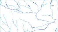
Stainzbach
|
Stainzbach Stainz |
||
 The Stainztal near Herbersdorf |
||
| Data | ||
| location | In West Styria , Austria | |
| River system | Danube | |
| Drain over | Laßnitz → Sulm → Mur → Drau → Danube → Black Sea | |
| source | On the eastern slope of the Reinischkogel 46 ° 55 ′ 44 ″ N , 15 ° 7 ′ 13 ″ E |
|
| Source height | 1390 m above sea level A. | |
| muzzle | Near Zehndorf, Wettmannstätten in the Laßnitz coordinates: 46 ° 50 ′ 31 ″ N , 15 ° 24 ′ 25 ″ E 46 ° 50 ′ 31 ″ N , 15 ° 24 ′ 25 ″ E |
|
| Mouth height | 284 m above sea level A. | |
| Height difference | 1106 m | |
| Bottom slope | 38 ‰ | |
| length | 29.3 km | |
| Catchment area | 175.36 km² | |
| Discharge at the Wieselsdorf A Eo gauge : 144.8 km² Location: 3.58 km above the mouth |
NNQ (08/19/2001) MNQ 1990–2010 MQ 1990–2010 Mq 1990–2010 MHQ 1990–2010 HHQ (06/04/1992) |
130 l / s 350 l / s 1.56 m³ / s 10.8 l / (s km²) 50 m³ / s 117 m³ / s |
| Left tributaries | Leskybach, Mauseggbach, Trogbach (also Falleggbach, from the Mausegger Graben), Schwarzenbach, Greisbach, Lemsitz, Zirknitz, Zettelbach, Teiplbach, Oisnitzbach | |
| Right tributaries | Theussenbach, Rainbach, Sierlingbach, Neurathbach, Langwiesenbach , Lannbach | |
| Communities | Stainz , Wettmannstätten , Preding | |
| Residents in the catchment area | 5000 | |
The Stainzbach , also called the Stainz , is a river in western Styria in Austria . It flows in a north-west-south-east direction from the Reinischkogel to the Laßnitz .
In its first 7.6 km (from the source to the mouth of the Theussenbach) the creek is classified as a torrent .
The Stainzbach has the number 3936 in the Styrian water system. Its mean water flow is 1–2 m³ / s.
Run
Riverbed
The Stainzbach rises on the eastern slope of the Reinischkogel. Its upper course lies in the Sauerbrunngraben, also called Höllgraben, a narrow V-valley in the Koralpe . After about 8 km after Sauerbrunn, west of Marhof, it reaches the plain of the Stainztal. In this first part, the creek bed falls about 880 meters. In the remaining 21 km of its course there is only a difference in altitude of about 120 meters. After Marhof, the Stainzbach flows through the village of Stainz and on to the Laßnitz without touching any other localities. In this wide valley, the river ran in natural meanders until 1961 . When floods occurred regularly floods . The greatest damage was caused by floods in 1954 and 1966.
The middle and lower course of the Stainzbach are heavily changed by river straightening . The regulation work began in 1961 with the relocation of the estuary into the Laßnitz as part of the Laßnitz regulation, in 1963 the regulation took place up to the Sauruggmühle near Wieselsdorf, from 1969 to 1971 further up to the mouth of the Teiplbach. In this area, the Stainzbach was already in the process of becoming a dam river , and in the event of high water, the lack of a drainage facility created flood lakes. 1974 to 1978 work at Stainz was brought forward because of the flood damage, from 1977 to 1980 work was carried out at Mettersdorf, 1980 to 1982 on the Ettendorf – Herbersdorf I construction lot, from 1983 to 1986 from there to Stallhof.
The lower course of the stream was moved several hundred meters to the south. After the regulation work, the mouth of the Stainzbach in the Laßnitz was about 500 meters further west. The old bridge of the Graz-Köflacher-Bahn over the Stainzbach was used to run the Oisnitzbach in the opposite direction to the previous direction of flow of the Stainzbach under the railway and then to let it flow into the Stainz. This old Stainzbachbrücke (later Oisnitzbrücke) remained in place for the time being and was replaced by a culvert in 1999 . A new bridge was built southeast of it for the Stainzerbahn and the road between Preding and Wohlsdorf, as was a new bridge for the Graz-Köflacher-Bahn. This work was one of the large-scale river regulations in central western Styria, which also affected Laßnitz and Saubach (the latter even by dividing it into two parts, which means that there have been two bodies of water with this name in the area since then). The regulations were expected to yield a total of 2000 hectares of arable land. They were discussed for a long time in the previous years, but could not be implemented quickly and quickly in view of the high costs.
The profit from the regulatory work is controversial. A statement has been published, according to which the faster flow rate of the water caused damage due to more extensive washing away of the soil and other disadvantages.
The river regulations have not been updated in the public documents (land register, cadastre, municipality boundaries), so that the earlier course of the river bed can be traced from municipality and property boundaries. Since then, the Stainzbach has been lined with a number of small areas that are no longer connected to the original properties on the other side of the river bed due to the regulation.
- The lower course of the Stainzbach before and after the regulation

18th century, former (northern) river bed with an old mouth at the Pöllmühle
21st century, southern river bed, new estuary, old course is oxbow lake


The Stainzbach is accompanied by several small channels (remnants of earlier mill streams or drainage ditches), some of which are laid in concrete pipes.
There is a mineral spring near Sauerbrunn , the Erzherzog-Johann-Quelle . Another named source in the Stainz valley is the Johannes-Brunnen on the Sierlingbach south of the village of Wald in western Styria .
The Stainzbach flows north of Zehndorf at Wettmannstätten into the Laßnitz .
The upper reaches of the Stainzbaches is in the crystalline basement of the Koralpe cut. The subsoil of the middle and lower rivers consists of a thick layer of deposited gravel , which lies on the bedrock (continuation of the Koralpe crystalline). The lower course of the Stainzbach is lined with remains of the high and low terrace of the Leibnitzer Feld . Higher parts of the terrain consist of remnants of the former sea bed from the time of the Torton about ten million years ago. Boreholes in the valley of the Stainzbach did not reach the bedrock (several hundred meters below the gravel): They are near Neudorf (82 m), Lasselsdorf (160 m), Mettersdorf (50 m), Wieselsdorf (141 m) and at the original mouth documented at the Pöllmühle with a depth of 63 meters.
On Stainzbach and its tributaries are a number of sewage treatment plants . The largest of these systems is that of the Stainz wastewater association, which was built in 1981 and is designed for over 20,000 people.
Old arms
Old arm in front of the former estuary
The lowest part of the barrel of Stainzbaches its initial opening in Pöllmühle north of Zehnsdorf since the regulation an approximately 1.8 km long oxbow lake .
Wieselsdorf old arm
Several dried up oxbow lakes of the Stainzbach at the mouth of the Teiplbach were connected to the Teiplbach in 2008 as part of a nature conservation project of the Austrian Nature Conservation Union and a wood processing company. This 400 m long new water course is to serve as a spawning area and shelter for fish. It is located at 46 ° 51 '9 " N , 15 ° 21' 48" O .
Old arms of Grafendorf
The area of some oxbow lakes near Grafendorf is also preserved as a biotope by the Naturschutzbund. It should contribute to securing the oxbow lakes with their wooded borders as still waters . The old branches are at 46 ° 52 '46 " N , 15 ° 18' 59" O .
Surname
The brook is mentioned in 1160 as riuus Stauwencz , 1249 as aqua stainz , 1456 as stencz , 1494 as steincz , around 1500 as staencz. There are several interpretations for this : One explanation derives the name from a sour tasting spring water and traces it back to the Slovenian word ščava "sour mineral water". As evidence for this it is mentioned that the Stainzbach flows past a place whose name refers to such a body of water: Sauerbrunn near Marhof (with the Sauerbrunngraben named after it). The water of this "Sauerbrunn" (the "Erzherzog-Johann-Quelle") is known as mineral water.
The names Stainz and Sauerbrunn are regarded as a Slavic-German double name in this context. The name is also derived from * Stav / ьnica , to stav ' ъ ' Stau, Damm '.
There are several streams with this name in Styria: The river Ščavnica in Lower Styria was also known as "Stainz" (or Stanz) until 1918, it flows east of Ljutomer (Eng. Luttenberg ) into the Mur. The (water and place) name “Stanz” (1492: Stainz ) in the Mürz Valley in Upper Styria is derived from * Stav / ьnica .
Protected areas
The source and the upper reaches of the Stainzbach (Sauerbrunngraben) lie in the northeast of the Pack-Reinischkogel-Rosenkogel conservation area .
A small wood is under nature protection as the "Auwaldrest near Stallhof (Herbersdorf)" in the Herbersdorf cadastral community (protected area NSG-c21). It is located south of the Langwiesenbach near its confluence with the Stainzbach and is about 0.7 hectares in size. There are several ponds in this alluvial forest . The ponds are covered with plants ( floating leaf zone , submerged spawning herb zone ) , their banks have large sedge ( silting zones ). A drainage ditch in the nature reserve is a habitat for frog spoons , swamp yarrow and other plants that specialize in this habitat . The protected area is endangered because its area is too small to shield it from adverse effects.
The biotopes at the Grafendorf arm and at the Wieselsdorf arm are not designated as nature reserves of the State of Styria, but are based on a private initiative of the Nature Conservation Union. The owner of the land in question is the Austrian Nature Conservation Union, Landesgruppe Steiermark, which does not permit any other use of this land.
Other properties on which oxbow lakes are located are also owned by nature conservation associations, for example west of Grafendorf at 46 ° 52 ′ 44 ″ N , 15 ° 18 ′ 45 ″ E (Styrian Mountain and Nature Guard) and south of Ettendorf ( Naturschutzbund) at 46 ° 52 '57 " N , 15 ° 17' 39" O .
Development
The catchment area of the Stainzbach is accessible in the valley by public transport and roads, the headwaters on the Reinischkogel can be reached via several hiking trails. The Radlpass Straße B 76 crosses the Stainztal in the village of Stainz, it follows the bus route Graz – Stainz – Deutschlandsberg of the Graz-Köflacher-Bahn . Mettersdorfer Straße L 617 between Stainz and Preding is parallel to the Stainzbach . The L 642 Sauerbrunnstraße is located in the western part of the Stainztal. The lower reaches of the Stainz are crossed by Schröttenstrasse L 601, the connection between Wildon and Deutschlandsberg, and by L 639 (Preding - Wettmannstätten). On some of these streets there are bus routes for school transport. The Preding-Wieselsdorf station on the Graz - Lieboch - Deutschlandsberg - Wies-Eibiswald railway line is on the lower reaches of the Stainz. The narrow-gauge Stainzerbahn , which also runs parallel to the Stainzbach, has not used public transport since 1980 (its passenger traffic was stopped in 1951), only steam trains of the " Flascherlzug " run.

history
In the Sauerbrunngraben an unspecified lance tip was found, at the source of Bad Sauerbrunn a "considerable number of bronze coins " from the time of the emperors Constantine to Arcadius , from about 292 to 408 AD.
The: Journey Through the Stainzbaches several no longer preserved fortifications were Burg Whose stone which Stainz Castle (now a former monastery received) and the castle Herbersdorf . A moat to the west of this castle is interpreted as the end of the former castle grounds.
At its mouth, the Stainzbach and the Laßnitz form a triangle of land on which the listed sites of a settlement from the Middle Bronze Age and the medieval Forstjogl fortification are located. A number of barrows have also been found in this area .
From 1783 to 1805, the Stainzbach formed the border between the Graz and Marburg districts of the then Duchy of Styria from the confluence of the Langwiesenbach east of Stainz to the confluence with the Laßnitz .
literature
- Stefanie Greiter: The importance of oxbow lakes and other humid biotopes for a possible biotope network in the Lower Stainzbachtal . Diploma thesis at the University of Graz 1997.
- Verena Fabiani: History of dealing with the waters and wood on the banks in the Stainzbachtal. Diploma thesis at the University of Natural Resources and Life Sciences, Vienna 1996.
Web links
Stainzbach. In: Digital waters of the Steiermark. wis.stmk.gv.at, accessed on July 10, 2013 (German).
Individual evidence
- ↑ Federal Ministry of Agriculture, Forestry, Environment and Water Management (Ed.) : List of areas of the Austrian river basins: Mur area. Contributions to Austria's Hydrography, Issue No. 60, Vienna 2011, p. 104 ( PDF; 4.5 MB ( page no longer available , search in web archives ) Info: The link was automatically marked as defective. Please check the link according to the instructions and then remove this notice. )
- ↑ Federal Ministry of Agriculture, Forestry, Environment and Water Management (ed.): Hydrographisches Jahrbuch von Österreich 2010. 118th volume. Vienna 2012, p. OG 317, PDF (12.6 MB) on bmlrt.gv.at (yearbook 2010)
- ↑ WIS - Styrian Water Register. Ordinance of the Governor of Styria dated July 11, 1995, with which the catchment areas of torrents and avalanches in Styria are determined. Announced September 5, 1995. Styrian State Law Gazette No. 63/1995. Born in 1995, 16th piece. ZDB -ID 705127-x Municipality of Marhof No. 050.
- ↑ Greiter: Old arms. P. 11.
- ↑ Fabiani: History. Pp. 25-27.
- ↑ Floods of the Styrian streams are banned. In: Südost Tagespost . February 14, 1957. p. 3.
- ↑ Fabiani: History. P. 27.
- ↑ a b Helmut W. Flügel: Geological map of the pretertiary underground. In: Geological thematic maps of the Republic of Austria 1: 200,000. South Styrian Basin - South Burgenland threshold. Published by the Federal Geological Institute. Vienna 1988. Arthur Kröll, Albert Daurer (editor): Explanations of the maps of the pretertiary subsoil of the Styrian basin and the southern Burgenland threshold. ISBN 3-900312-65-6 . Together with relief map, aeromagnetic map and gravity map in a plastic envelope.
- ↑ Artur Winkler-Hermaden: The geological conditions in the middle and lower Laßnitz valley in southwest Styria as the basis for water management planning. In: Session reports of the Academy of Sciences, mathematical-scientific class . Department I, Volume 149. Presented at the meeting on June 27, 1940. Vienna 1940. ISSN 0371-4810 ZDB -ID 211443-4 . Pp. 232–239 (with map sketch) (PDF; 1.6 MB).
- ↑ List of sewage treatment plants Municipal sewage treatment plants in Styria (> 50 PE), Political District Deutschlandsberg.
- ↑ Water number 51 in the Steiermark water register.
- ↑ Biotop Stainzaltarm Wieselsdorf ( Memento of the original from December 3, 2013 in the Internet Archive ) Info: The archive link was inserted automatically and has not yet been checked. Please check the original and archive link according to the instructions and then remove this notice. (queried July 12, 2013).
- ↑ Stainzaltarm Grafendorf ( Memento of the original from March 4, 2016 in the Internet Archive ) Info: The archive link was inserted automatically and has not yet been checked. Please check the original and archive link according to the instructions and then remove this notice. (queried July 12, 2013).
- ↑ a b Brigitta Mader: The Alpine Slavs in Styria. A toponomastic-archaeological investigation. Writings of the Balkan Commission, Linguistic Department, Volume 31. Austrian Academy of Sciences, OeAW, Philosophical-Historical Class. Verlag der ÖAW, Vienna 1986. ISBN 3-7001-0769-2 . ZDB ID 519043-5 . P. 92.
- ↑ Bad Sauerbrunn
- ^ Josef Georg Planinc: Bad Sauerbrunn: Project of a spa facility in the municipality of Marhof near Stainz (district of Deutschlandsberg). Diploma thesis at the Institute for Architectural Technology of the Graz University of Technology in 1990.
- ↑ Fritz Lochner v. Hüttenbach: Styrian place names. On the origin and interpretation of names of settlements, mountains, waters and fields . In the series: Graz comparative works. Volume 21. Verlag Leykam Graz 2008. ISBN 978-3-7011-0116-0 . ZDB -ID 2083885-2 . Pp. 42, 49, 78.
- ↑ Mader: Alpine Slavs . P. 93.
- ↑ Lochner v. Hüttenbach: place names . P. 79.
- ↑ Landscape protection area 2: Ordinance of the Styrian state government of May 25, 1981, stmk. State Law Gazette No. 37/1981 in the version of the correction (new map display) No. 64/1981. Map of the protected area ( Memento of the original dated December 21, 2007 in the Internet Archive ) Info: The archive link was inserted automatically and has not yet been checked. Please check the original and archive link according to the instructions and then remove this notice. in the Digital Atlas Styria. Before that, protection existed under the ordinance of June 12, 1956, LGBl. No. 35, for the protection of parts of the landscape and the landscape (Landscape Protection Ordinance 1956) in the version of the ordinances LGBl. No. 57/1958, 125/1961, 185/1969, 96/1970, 14/1974, 147/1974 and 30/1975, with regard to Annex 1 Z 2.
- ↑ Ordinance of the district authority of Deutschlandsberg ( page no longer available , search in web archives ) Info: The link was automatically marked as defective. Please check the link according to the instructions and then remove this notice. dated December 19, 1986 on the declaration of an alluvial forest residue in the KG. Herbersdorf to the nature reserve (plant protection area). Grazer Zeitung, Official Gazette for Styria. Born in 1987. ZDB -ID 1291268-2 p. 51.
- ↑ Information page of the office of the Styrian state government.
- ↑ District court Stainz, cadastral community (KG) 61210 Grafendorf, deposit number (EZ) 223, plots no. 446/2, 446/3, 1014/2, 1014/5, 1014/6 and 1014/7, a total of 4255 m² and KG 61079 Wieselsdorf, EZ 233 Lot No. 777, 1099 m² (accessed July 16, 2013).
- ↑ Bezirksgericht Stainz, KG 61217 Herbersdorf, EZ 174, property no. 602/12 with 691 m² (accessed July 17, 2013).
- ↑ District Court Stainz, KG 61217 Herbersdorf, EZ 176, property no. 93/3 with 534 m² and next to it KG 61204 Ettendorf, EZ 241 property no. 628/4, 2441 m² (accessed July 17, 2013).
- ↑ Greiter: Old arms. Pp. 4-15.
- ↑ Ulla Steinklauber: Finds from the "Sporiroaofen" in West Styria . Find reports from Austria. Published by the Federal Monuments Office. Volume 42, year 2003. Vienna 2004. ISSN 0429-8926 ZDB -ID 213982-0 . Pages 417.
-
^ Fritz Pichler: A new excavation area. In: Communications from the Anthropological Society in Vienna (MAG). Volume XVII (Volume VII of the New Series). Vienna 1887. ISSN 0373-5656 ZDB -ID 206023-1 . Page
[76](the square brackets belong to the page number, the volume has two page numbers, one with and one without these brackets). The passage also refers to Josef Andreas Janisch, topographical-statistical lexicon of Styria with historical notes and comments. Graz 1878–1885, p. 791. -
^ Fritz Pichler: A new excavation area. Page
[76]with reference to: Karl Weinhold: Grave antiquities from Klein-Glein in Lower Styria. In: Communications from the Historical Association for Styria . X. Issue 1861. ZDB -ID 345732-1 . Pp. 265-296.