
Wildon
|
market community Wildon
|
||
|---|---|---|
| coat of arms | Austria map | |
 |
|
|
| Basic data | ||
| Country: | Austria | |
| State : | Styria | |
| Political District : | Leibnitz | |
| License plate : | LB | |
| Surface: | 32.67 km² | |
| Coordinates : | 46 ° 53 ' N , 15 ° 31' E | |
| Height : | 314 m above sea level A. | |
| Residents : | 5,493 (January 1, 2020) | |
| Postal code : | 8410 | |
| Area code : | 03182 | |
| Community code : | 6 10 59 | |
| NUTS region | AT225 | |
| UN / LOCODE | AT WDO | |
| Address of the municipal administration: |
Hauptplatz 55 8410 Wildon |
|
| Website: | ||
| politics | ||
| Mayor : | Helmut Walch ( SPÖ ) | |
|
Municipal Council : (2015) (25 members) |
||
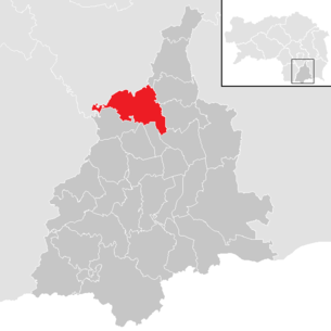
| Location of Wildon in the Leibnitz district | ||
  |
||
 Wildon Town Hall |
||
| Source: Municipal data from Statistics Austria | ||


Wildon (emphasized on the second, long-spoken syllable) is a market town in southern Styria with 5493 inhabitants (as of January 1, 2020) and belongs to the Leibnitz district . The market town is located on the Wildoner Berg , which borders the Leibnitzer Feld , directly at the confluence of the Kainach and the Mur .
As part of the municipal structural reform in Styria , it has been merged with the Weitendorf municipality since 2015 and continues to use the Wildon name. The basis for this is the Styrian Municipal Structural Reform Act - StGsrG. In addition, the market community was expanded to include the cadastral community of Sukdull and other properties from the previously existing community of Stocking .
geography
Wildon lies on both sides of the Mur at the transition between Grazer Feld in the north and Leibnitzer Feld in the south. The west of the community is traversed by the Kainach, which flows into the Mur north of the town center at the foot of the Wildoner Berg . In the northeast the community has a small share of the eastern Styrian hill country , in the northwest lies the southern end of the Kaiserwald .
Community structure
The municipal area comprises nine localities (population in brackets as of January 1, 2020):
- Afram (166)
- Aug (125)
- Kainach near Wildon (272)
- Lichendorf (115)
- Neudorf ob Wildon (290)
- Stocking (423)
- Sukdull (415)
- Weitendorf (1100)
- Wildon (2587)
The community consists of six cadastral communities (area: as of December 31, 2018):
- Kainach (364.77 ha)
- Stocking (566.83 ha)
- Sukdull (592.37 ha)
- Lower House (374.50 ha)
- Weitendorf (1,023.78 ha)
- Wildon (350.04 ha)
Neighboring communities
Wildon has eleven neighboring communities, four of which are in the Graz-Umgebung district (GU).
| Wound shoe (GU) |
Werndorf (GU)
Fernitz-Mellach (GU)
|
|
| Dobl-Zwaring (GU) |
.svg)
|
Sankt Georgen an der Stiefing |
| Hengsberg | Ragnitz |
history
The first villages were already in the Neolithic (around 4000 BC) at the strategically favorable location in the confluence of the Kainach and Mur. Archaeological finds on the neighboring Buchkogel confirm this. A burial ground , which was discovered near the secondary school, dates from the late urn field period . Archaeological excavations on the Bocksberg uncovered a grave from the Lasinja culture (early Copper Age ), in which the remains of a cremation ( corpse fire ) were buried in a bowl. The age of this burial has been confirmed to be around 6000 years, making it the oldest grave in Styria.
The meaning of the place name has not been conclusively deciphered. The possibilities range from the Celtic "fialdunum" (hospitable place) to the Slavic "bilo donje" (place halfway up) to the "Wilde" (the Middle High German meaning for mare), which is the horse family with the largest mountain "stallion" and the smallest "ful" (foal) would complete.
In the early Middle Ages (around 1000 AD), the Hengistburg , the center of what was then the Mark on the middle Mur, was probably on the Wildoner Schloßberg. It was supposed to secure the border to the east. Since the 12th century, the Hengistburg was followed by several castles that existed side by side: the prince's fief Altwildon (first mentioned in 1173), seat of the respected and powerful family of the Lords of Wildon, the archbishopric Salzburg castle Neuwildon on the plateau as well as the Ful house and the tower Hengst halfway up blocked the way from Graz to Leibnitzer Feld.
The place was first mentioned in 1219. The place is best known for its connection with the minne poet Herrand von Wildonie (Herrand II. Von Wildon), who was also politically active around the middle of the 13th century. The colors of the Wildonian coat of arms , white and green, also replaced the Styrian national colors of that time, black and white, and the Styrian panther was also the wildonian heraldic animal. The place received market rights and the right to fortify itself at the beginning of the 13th century. In 1292, Wildon was the starting point for the Landsberger Bund's fighting , an uprising by Styrian nobles against the Habsburg Albrecht I.
The Riegersburg was once owned by Wildon. Imperial troops besieged Wildon in the Baumkirch feud around 1470 for over a year before it could be conquered. The sovereign rule Oberwildon came into being. From 1624 the Eggenbergs were the landlords, whose rule was connected to an extensive regional court.
In 1680 Wildon was spared the plague, as a thank you the Mariensäule (plague column) was erected on the main square. Between 1796 and 1809 French occupation troops passed through several times. After the Second World War , Wildon first belonged to the Soviet and then to the British zone of occupation. In 1955 the community of Unterhaus was incorporated.

Population development

Culture and sights

- Wildon has been forming together with the communities of Hengsberg , Lang and Lebring-St. Margarethen the small region "Kulturpark Hengist".
Economy and Infrastructure
traffic
Because of the bridges over Kainach and Mur, the market directly on the main road to Trieste had an important function in the transport network. Rafting and shipping on the Mur brought both economic benefits and financial sacrifices, as bank protection structures had to be built on the rivers. The originally important through traffic developed into negative pollution after 1945, as the so-called “guest worker route” led through the narrow market at that time.
In 1974 the Wildoners blocked the Grazer Straße B 67 and thus accelerated the expansion of a temporary bypass until the Pyhrn motorway A 9 was later completed.
Today, the accessibility of the economic centers via the motorway, southern railway and Graz Airport, which is 15 km away, can be rated positively.
Wildon can be reached from Graz with the S5 S-Bahn in the direction of Spielfeld - Straß in 24 minutes, the trains run every hour, at rush hour more frequently. Wildon is located on the Mur Cycle Path , and a small swimming lake invites you to stop off in midsummer.
Establishments
In Wildon there are several catering establishments and small and medium-sized businesses , e.g. B .:
- AKG Plastics (plastic hollow body, since 1962)
- Hereschwerke (automation, plant construction, approx. 200 employees)
schools
Schools have existed in Wildon since the 16th century. There are currently four public schools and one kindergarten with two groups:
- Elementary school
- secondary schools
- Polytechnic school
- Herrand-von-Wildon Music School
Others
The equestrian facility is no longer in operation, the district court was closed in 2002.
politics
mayor
Helmut Walch (SPÖ) was elected mayor of the newly composed municipality at the constituent meeting of the municipal council on April 23, 2015. The election of Helmut Walch was possible because the SPÖ, FPÖ and the “Projekt Wildon” list had reached a coalition agreement for the 2015-2020 municipal council period at the meeting on April 17, 2015. This is the first time in 70 years that the ÖVP has not provided the mayor. From January 1, 2015 until the constituent meeting, the former mayor of Wildon, Gerhard Sommer (ÖVP), was government commissioner in charge of the merged municipality.
The community board also includes the first vice mayor Franz Plasser (ÖVP), the second vice mayor Andreas Url (FPÖ), the community treasurer Johann Eder (FPÖ) and board member Gert Egger (ÖVP).
Municipal council
The municipal council consists of 25 members. According to the result of the 2015 municipal council election , it is composed as follows:
- 10 mandates ÖVP
- 7 mandates SPÖ
- 5 FPÖ mandates
- 2 mandates for the Wildon project
- 1 mandate The Greens Wildon
| Political party | 2015 | 2010 | 2005 | 2000 | |||||||||||||||||
|---|---|---|---|---|---|---|---|---|---|---|---|---|---|---|---|---|---|---|---|---|---|
| Large community | Wildon | Weitendorf | Wildon | Weitendorf | Wildon | Weitendorf | |||||||||||||||
| be right | % | Mand. | St. | % | M. | St. | % | M. | St. | % | M. | St. | % | M. | St. | % | M. | St. | % | M. | |
| ÖVP | 1069 | 37 | 10 | 757 | 59 | 11 | 487 | 48 | 8th | 612 | 49 | 8th | 507 | 54 | 8th | 692 | 54 | 9 | 455 | 50 | 8th |
| SPÖ | 727 | 25th | 7th | 190 | 15th | 2 | 420 | 41 | 6th | 330 | 27 | 4th | 435 | 46 | 7th | 265 | 21st | 3 | 198 | 22nd | 3 |
| FPÖ | 618 | 22nd | 5 | 44 | 3 | 0 | 40 | 4th | 0 | not running | not running | 192 | 15th | 2 | 107 | 12 | 2 | ||||
| The green | 180 | 6th | 1 | 49 | 4th | 0 | 66 | 7th | 1 | 85 | 7th | 1 | not running | 138 | 11 | 1 | not running | ||||
| Wildon project | 275 | 10 | 2 | 199 | 16 | 2 | not running | 215 | 17th | 2 | not running | not running | not running | ||||||||
| BZÖ | not running | 34 | 3 | 0 | not running | not running | not running | not running | not running | ||||||||||||
| K. Reiter-Haas | not running | not running | not running | not running | not running | not running | 157 | 17th | 2 | ||||||||||||
| Eligible voters | 4,343 | 2,052 | 1,256 | 1,855 | 1,201 | 1,770 | 1,116 | ||||||||||||||
| voter turnout | 67% | 63% | 82% | 68% | 81% | 73% | 84% | ||||||||||||||
coat of arms
Both previous communities (Weitendorf and Wildon) had community coats of arms.
- Coats of arms of the previous municipalities

Weitendorf

Wildon


The Wildon coat of arms was awarded to the citizenship by King Ferdinand I on November 17, 1544 , presumably at the intervention of the Wildon-based landlord and hereditary field master Maximilian Leysser. The blazon read:
- “The coat of arms shows a tower in a red shield on a green meadow. The tower is made of white blocks and has a golden portcullis. The figure of a bearded wild man rises out of the three peaks and carries a mace over his right shoulder with both hands to strike. "
The legend of the wild man is linked to this coat of arms, which probably only wants to connect the place name with the attribute “wild” . According to the legend, he lived in the so-called “Wilde Mann Cave” on the Schlossberg and harassed and threatened the local residents. A virgin captured by him is said to have blinded him with a knitting needle and thus made him defenseless. The figure of the wild, club-armored man refers to Celtic heroes (e.g. Dagda ) and others. U. on a pre-Christian use of the cave as a natural sanctuary .
Due to the amalgamation of the municipalities, the coat of arms became invalid from January 1, 2015 and was re-awarded by the Styrian state government with effect from October 30, 2019 . The new blazon reads:
- “In a red shield, a silver brick, black jointed tower with three battlements, each pierced with black by a key notch, and black pierced round arched gate, each with a black pierced key, including a raised golden portcullis. Growing out of the tower is a golden, long-bearded wild man with a green plaited wreath in his curly hair, holding a silver, pointed mace over him with both hands to strike. "
Personalities
- Andreas Hardter (1780–1816), painter and art teacher
- Raimund Schittenhelm (* 1947), commander of the National Defense Academy
- Herrand II of Wildon (around 1230 – around 1278), minstrel
Historical maps of the Wildon area

Josephine land survey , approx. 1790

Wildon around 1879

Franzisco-Josephinische Landaufnahme , ca.1910


Web links
- 61059 - Wildon. Community data, Statistics Austria .
- Website of the market town of Wildon
- Der Wilde Mann von Wildon , haben.at, Styria
- Internet presence of the culture park Hengist
Individual evidence
- ^ Styrian municipal structural reform .
- ↑ Section 3, Paragraph 5, Item 3 of the Act of December 17, 2013 on the reorganization of the municipalities of the State of Styria ( Styrian Municipal Reform Act - StGsrG). State Law Gazette for Styria dated April 2, 2014. No. 31, year 2014, ZDB -ID 705127-x , p. 3.
- ↑ Section 5, Paragraph 3, Item 2 of the Styrian Municipal Structural Reform Act - StGsrG, p. 5.
- ↑ Statistics Austria: Population on January 1st, 2020 by locality (area status on January 1st, 2020) , ( CSV )
- ↑ CSV file from REGIONALINFORMATION.zip (1,221 KB) ; accessed on January 12, 2019
- ↑ Discovered the oldest grave in Styria. In: Weststeirische Rundschau . No. 24, year 2013 (June 14, 2013), 86th year, ZDB -ID 2303595-X , Simadruck Aigner u. Weisi, Deutschlandsberg 2013, p. 3.
- ↑ a b c Marktgemeinde Wildon: 04/23/2015: Wildon City Council ( Memento from June 17, 2015 in the Internet Archive ), accessed on June 16, 2015.
- ↑ Wildon gets a red mayor . Kleine Zeitung , April 18, 2015, archived from the original on May 31, 2016 . .
- ↑ The coat of arms of the market town of Wildon ( Memento from December 4, 2010 in the Internet Archive )
- ↑ 81. Announcement by the Styrian state government of October 17, 2019 on the granting of the right to use a municipal coat of arms to the market town of Wildon (political district of Leibnitz) , ris.bka.gv.at, accessed on October 22, 2019.

All Saints' Day at Wildon |
Arnfels |
Ehrenhausen an der Weinstrasse |
Empersdorf |
Gabersdorf |
Gamlitz |
Gleinstätten |
Gralla |
Large small |
Heiligenkreuz am Waasen |
Heimschuh |
Hengsberg |
Kitzeck im Sausal |
Long |
Lebring-Sankt Margarethen |
Leibnitz |
Leutschach an der Weinstrasse |
Oberhaag |
Ragnitz |
Sankt Andrä-Höch |
Sankt Georgen an der Stiefing |
Sankt Johann im Saggautal |
Sankt Nikolai im Sausal |
Sankt Veit in southern Styria |
Schwarzautal |
Straß in Steiermark |
Tillmitsch |
Wagna |
Wildon
50 former communities (dissolved 1945–1969): Aflenz an der Sulm |
Altenberg near Leibnitz |
Badendorf |
Brünngraben |
Feiting |
Felgitsch |
Flamberg |
Liquid |
Gersdorf an der Mur |
Grötsch |
Hart at Wildon |
Hasendorf an der Mur |
Haslach an der Stiefing |
High |
Hut |
Kainach near Wildon |
Labuttendorf |
Landscha on the Mur |
Lappach |
Lebring |
Guide ring |
Lichendorf ** |
Lind near Sankt Veit am Vogau |
Lipsch |
Maggau * |
Marchtring |
Mitteregg |
Nestelberg |
Neudorf an der Mur |
Neudorf im Sausal |
Neutersdorf |
Oberjahring |
Oberschwarza ** |
Ottenberg |
Perbersdorf near Sankt Veit ** |
Pichla at Mureck ** |
Prarath |
Sankt Margarethen bei Lebring |
Shirka |
Schönberg an der Laßnitz |
Schrötten an der Laßnitz |
Seibersdorf near Sankt Veit ** |
Siebing ** |
Sukdull |
House of Commons |
Unterlabill * |
Unterschwarza ** |
Forest chess |
Weitersfeld an der Mur ** |
Wutschdorf 24 former municipalities (dissolved since 2014): Berghausen |
Breitenfeld am Tannenriegel |
Ehrenhausen |
Eichberg-Trautenburg |
Shine on the Wine Route |
Hainsdorf in the Schwarzautal |
Kaindorf an der Sulm |
Leutschach |
Mitterlabill *** |
Murfeld *** |
Pistorf |
Ratsch on the Wine Route |
Retznei |
Sankt Nikolai ob Draßling |
Sankt Ulrich am Waasen |
Sankt Veit am Vogau |
Schlossberg |
Schwarzau in the Schwarzautal *** |
Seggauberg |
Stocking |
Sulztal on the Wine Route |
Weinburg am Saßbach *** |
Weitendorf |
Wolfsberg in the Schwarzautal municipality was at the time of dissolution in: * Feldbach district ; ** Radkersburg district ; *** District of Southeast Styria