
Ščavnica
|
Ščavnica Stainz |
||
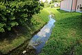
 Straightened river course at Slaptinci (Gem. Sveti Jurij) |
||
| Data | ||
| location | Štajerska , Slovenia | |
| River system | Danube | |
| Drain over | Mur → Drava → Danube → Black Sea | |
| source | Zgornja Velka, Windische Bühel 46 ° 41 ′ 0 ″ N , 15 ° 45 ′ 47 ″ E |
|
| Source height | 360 m | |
| muzzle | at Razkrižje in the Mur Coordinates: 46 ° 31 ′ 25 ″ N , 16 ° 18 ′ 12 ″ E 46 ° 31 ′ 25 ″ N , 16 ° 18 ′ 12 ″ E |
|
| Mouth height | 161 m | |
| Height difference | 199 m | |
| Bottom slope | 3.6 ‰ | |
| length | 56 km | |
| Catchment area | 288 km² | |
| Discharge at the Pristava gauge Location: approx. 6 km above the mouth |
NNQ (09/30/1992) MNQ 1971–2000 MQ 1971–2000 MHQ 1971–2000 HHQ (11/05/1998) |
18 l / s 118 l / s 2.11 m³ / s 45.6 m³ / s 64.4 m³ / s |
| Left tributaries | Lipnica, Murica | |
| Right tributaries | Turja, Kostanjevico | |
| Reservoirs flowed through | Gajševsko jezero | |
| Small towns | Ljutomer | |
| Communities | Šentilj , Sveta Ana , Gornja Radgona , Sveti Jurij , Križevci , Razkrižje | |
 Historical map with Stainztal and surroundings (around 1880) |
||
The Ščavnica ( German Stainz , not to be confused with the Stainzbach in western Styria ) is a right bank tributary of the Mur in the Štajerska region in northeastern Slovenia . The river has its source in the Windischen Bühel and after 56 kilometers flows into the Mur at Razkrižje .
course
The Ščavnica rises at 360 m. i. J. in the village of Zgornja Velka (municipality Šentilj ) in the Windischen Bühel a few kilometers south of the Austrian border. The stream initially runs in a south-easterly direction through a sparsely populated ditch and then for a few kilometers along state road 433 before the valley floor widens in the municipality of Sveta Ana . While the river flows a few kilometers in a west-east direction, a narrow ridge , only about 20 meters high , separates the valley of the Ščavnica from the Apaško polje in the north. In this section the course shows largely natural meanders with narrow forests accompanying the stream.
As a result, the course of the river is straightened and passes the municipalities of Gornja Radgona and Sveti Jurij in a south-easterly direction before it enters the Mursko polje in Križevci . Here the Ščavnica flows through the artificially created Gajševsko jezero , touches the small town of Ljutomer to the north and flows into the Mur in the municipality of Razkrižje .

Hydrology

As a typical Pannonian lowland channel, the Ščavnica has a snow-rain regime with a clear maximum runoff in March. A secondary maximum can be found in late autumn. In the summer months the river suffers from the drought and carries comparatively little water. The lowest known discharge at the Pristava gauge is only 18 l / s and dates from September 30, 1992.
The valley floor of the Ščavnica was often flooded in the past, for example in November 1925. Despite extensive regulations , floods still occur on the middle and lower reaches of the river as a result of heavy rainfall, most recently in February 2009 when the river reached a water level of within a few hours 287 cm and a discharge of 49.6 m 3 / s swelled. The highest known discharge of 64 m 3 / s was measured on November 5, 1998.
Cultural landscape

While only the first 15 to 16 kilometers of the Ščavnica are more or less natural, the middle and lower reaches were straightened in the 1970s . In addition to flood protection , the main goal was to gain agricultural arable land. In contrast to the Pleistocene gravel terraces on the middle reaches, the sandy-loamy soils in the Mursko polje are quite fertile. Mainly corn and wheat are cultivated in the valleys , while the hills are characterized by viticulture and fruit growing . Along the Ščavnica, fields and meadows between industrial agriculture dominate the landscape. Many agricultural businesses rely on livestock farming, with horse breeding in the Mur basin in particular looking back on a long tradition.
After the expansion of the Radkersburg Railway in 1890, Ljutomer in particular gradually began to industrialize and is now a center of building materials, textiles, food, and wood and metal industries. Nevertheless, the agricultural character of the Ščavnica valley was preserved for a long time. Around 1991, 30% of the population living in the Bühel and 17% of the population living in the Mur basin were still active in the primary sector - above average values for Slovenian standards.
Water quality
For a long time the Ščavnica had to struggle with poor water quality due to the discharge of agricultural and industrial wastewater . In the years from 2002 to 2005 the water was in "poor chemical condition", residues of detergents, phenols , metolachlor and pesticides were found. In 2006, the Ščavnica was certified as “good condition” for the first time. Limnological studies by the Slovenian Ministry of the Environment from 2009 and 2010 also confirmed that Ščavnica was in a moderate to good condition (e.g. with regard to nitrate levels ). The benthic population was even classified as very good. The construction of a sewage treatment plant for Ljutomer in 2005 made a significant contribution to improving the situation .
photos

Natural upper course

Renatured section of the river

First road sign on the upper reaches

Straightened Ščavnica near Biserjane

Confluence of the Lipnica (right)
Ščavnica in Ljutomer


Web links
- Ščavnica dolina - development and condition (Slovenian)
literature
- Mojca Gorjak: Okoljska ocena in makrofiiti Ščavnice. Diploma thesis at the Institute of Biology at the University of Ljubljana 2009, 86 p. PDF (Slovenian).
- Martina Mirt: Ribe v reki Ščavnici. Diploma thesis at the Institute of Biology at the University of Ljubljana 2009, 85 p. PDF (Slovenian).
- Vesna Roškar: Krajinska ureditev reguliranega vodotoka na primeru reke Ščavnice. Diploma thesis at the Institute for Landscape Architecture at the University of Ljubljana 2007, 106 pp. PDF (Slovenian).
- Kristina Šijanec: Ščavnica dolina. Njen razvoj in stanje v prostoru. In: Geografski obzornik , pp. 47–56. PDF (Slovenian).
Individual evidence
- ↑ a b c Reke, then 25 km, in njihova padavinska območja. Statistični urad Republike Slovenije , accessed on February 24, 2017 (Slovenian, English).
- ↑ a b Vodna bilanca Slovenije 1971-2000. Agencija Republike Slovenije za okolje, accessed on February 24, 2017 (Slovenian).
- ↑ Marko Kolbezen: Velike poplave in povodnji na Slovenskem - II (Great floods and floods in Slovenia) . Ujma, Ljubljana 1992, Uprava Republike Slovenije za zaščito in reševanje 6, pp. 214–215 (Slovenian).
- ↑ Poplave med 7th February 11th 2009 (flood between 7th and 11th February 2009). Uprava Republike Slovenije za zaščito in reševanje, February 2009, accessed on February 24, 2017 (Slovenian).
- ↑ a b Kristina Šijanec: Ščavnica dolina. Njen razvoj in stanje v prostoru. Geografski obzornik, accessed on March 17, 2017 (Slovenian).
- ↑ kakovost voda v Sloveniji (water quality in Slovenia). Agencija Republike Slovenije za okolje, 2008, accessed on March 17, 2017 (Slovenian).
- ↑ Ocena stanja rek v Sloveniji v LETIH 2009 2010 (state of the Slovenian rivers in 2009 and 2010). Agencija Republike Slovenije za okolje, January 2012, accessed on March 17, 2017 (Slovenian).
- ↑ Mojca Gorjak: okoljska ocena in makrofiiti Ščavnice (environmental assessment and macrophytes in the Ščavnica) . Diploma thesis at the Biological Institute of the University of Ljubljana 2009, p. 17 (Slovenian).