
Franziszeische Landesaufnahme

The Franziszeische Landesaufnahme ( Second Land Recording ) is a large-scale cartographic project in the Habsburg rulership , recording the area of the new Austrian Empire in the 1810s to 1850s . It is after the first Austrian Emperor I Franz named. It was the second major mapping project of the Habsburg Monarchy after the Josephine land survey of the 1760s to 1780s (Joseph II).
The Franziszeische Landesaufnahme is something different from the Franziszeische cadastral survey, which was carried out at about the same time : The cadastre had the aim of creating a uniform basis for the assessment of property tax , the Landesaufnahme primarily served military purposes ( military geography ).
The 2628 map sheets of the recording and derived maps are accessible in the Austrian State Archives / War Archives .
History and methodology

The Franziszeische Landesaufnahme was to replace the Josephinische Landesaufnahme from 1806 . The Franziszeische Landesaufnahme was able to process the recording of the properties in the Franziszeische Cadastre and used triangulation for the first time .
A first triangulation took place from 1807 to 1829, another with improved methods from 1848. At the beginning of the work there were still different triangulation systems in the individual Austrian crown lands , which meant that an overall representation across the borders of these lands was not possible. The maps ended at the borders of the former crown lands, the maps on both sides of a border do not fit exactly together (see below the maps of Preitenegg and the Hebalm).
The scale of the Franziszeische Landesaufnahme was 1: 28.800 equal to that of the Josephinian. As the first country was Salzburg added that in the years 1805-1810 and since 1816 to Austria belonged. Countries such as Tyrol and Vorarlberg , which were not included in the Josephinische Landesaufnahme, were preferred.
The state survey was carried out by its own institution: The Topographische Anstalt (topographic-lithographic institution of the k. U. K. Quartermaster General). The Military Geography Institute later emerged from this establishment and was succeeded by the Austrian Federal Office for Metrology and Surveying .
The results of the land survey were no longer kept secret (as in the previous Josephin land survey). They were published in maps in the scale 1: 144,000 ( special map ) and 1: 288,000 ( general map ) . These maps are also referred to as “Franziszeische Landesaufnahme”.
Galicia and the Hungarian countries ( Transleithanien ) are not included in the special map, because these areas were still not fully processed in the land survey when it was set up after more than 60 years. General cards were available for the entire Austro-Hungarian monarchy.
Presentation and scope
Characteristic of the maps that were created from the Franziszeische Landesaufnahme is the optically dark representation of mountainous areas: This resulted from the fact that closely spaced hatches were used to represent height differences . In contrast to the Josephinische Landesaufnahme, these black hatches make differences in level clearer, but make additional information, which is also written in black, difficult to read.
Elevation lines and elevation information are not available on the maps. The lack of elevation lines, together with the non-metric scale information, forms an easily recognizable feature to distinguish sheets from the Franziszeische land survey from similar looking maps of the later (third, Franzisco-Josephinischen) land survey.
In some copies of the Franziszeische Landesaufnahme there are records ("designations") on the right edge of the map about the individual villages, their buildings and stables: on this basis it is noted how many military personnel and horses could be quartered there "comfortably". The designations also contain information on the administrative structure and parish district.
The state record includes over 3,300 sheets, some of which were later changed (for example railway lines). The years of admission are 1806–1869.
The long processing time, but also the utilization of (partly not updated) sheets of the cadastre led to quality differences in the individual map sheets.
Work on the Franziszeische Landesaufnahme stopped in 1869. When the work was stopped, parts of Hungary , Transylvania , Galicia and Bukovina were still untreated. The Franziszeische Landesaufnahme was replaced by the Franzisco-Josephinische Landesaufnahme (Third Land Recording).

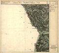
The west of Stainz with parts of Gams and Ligist to the Schwarzkogel

Preitenegg west of the Hebalm
Hebalm and western Rettenbach

Weineben , glassworks and the Styrian part of the Koralm summit


See also
- List of map series
- Josephine land survey
- Franziszeischer Cadastre
- Franzisco-Josephinische Landaufnahme
- Fourth land recording
- Austro-Hungarian country recordings
- Carte des environs de Schönbrun et ceux de Laxemburg
literature
- Ernst Hillbrand: The map collection of the Vienna War Archives. In: Communications from the Austrian State Archives. Vol. 28, 1975, ISSN 0259-4153 , pp. 183-196.
- Ernst Hofstätter: Contributions to the history of the Austrian regional recordings. An overview of the topographical recording procedures, their origins, their developments and organizational forms of the four Austrian regional surveys. 2 volumes. Federal Office for Metrology and Surveying, Vienna 1989.
- Christian Sam: Official cartography in Austria. Seminar paper at the University of Vienna, summer semester 2006. p. 5 ( pdf ( Memento from August 12, 2007 in the Internet Archive )).
Regional:
- Wilfried Beimrohr, Tyrolean State Archives : Special Map Tyrol, Vorarlberg and Liechtenstein 1823 . 2006 - Information sheet on the Josephinian and Franziszeische land recordings and on the special map of the princes of Tyrol, together with Vorarlberg and the neighboring Sovereign Principality of Liechtenstein, measured trigonometrically, topographically recorded, reduced and drawn in 1823 ( pdf , tirol.gv.at)
- Franz Dickinger: The tree in the middle of the world on Gusterberg near Kremsmünster, starting point for land photographs. In: Heimatblätter 1983/12, pp. 34–53. online (PDF) in the forum OoeGeschichte.at
Web links
Tickets online:
- mapire.eu : The country recordings in easy-to-use digital form
- https://mapire.eu/de/browse/country/secondsurvey : Online edition of the second military recording
- various Austrian provincial GIS: Historical maps of Tyrol (TIRIS)
Individual evidence
- ↑ Wilfried In the tube: The First and Second land survey of Tyrol. Tyrolean Provincial Archives, 2007 (pdf, tirol.gv.at) - the first land survey had only been started in 1803 and had to be handed over to Bavaria unfinished in the Napoleonic Wars in 1806.
- ↑ Austrian State Archives. Archive plan context. Card collection. Signature AT-OeStA / KA KPS KS archiving history .