
Ligist
|
market community Ligist
|
||
|---|---|---|
| coat of arms | Austria map | |
 |
|
|
| Basic data | ||
| Country: | Austria | |
| State : | Styria | |
| Political District : | Voitsberg | |
| License plate : | VO | |
| Main town : | Ligist market | |
| Surface: | 34.62 km² | |
| Coordinates : | 47 ° 0 ' N , 15 ° 13' E | |
| Height : | 392 m above sea level A. | |
| Residents : | 3,222 (January 1, 2020) | |
| Postal code : | 8563 | |
| Area code : | 03143 | |
| Community code : | 6 16 12 | |
| NUTS region | AT225 | |
| Address of the municipal administration: |
Ligist 22 8563 Ligist |
|
| Website: | ||
| politics | ||
| Mayor : | Johann Nestler ( ÖVP ) | |
|
Municipal Council : (2015) (21 members) |
||
| Location of Ligist in the Voitsberg district | ||
  |
||
 View from the north of the Ligist castle ruins over the main town |
||
| Source: Municipal data from Statistics Austria | ||

Ligist is a market town with 3222 inhabitants (as of January 1, 2020) in western Styria , about ten kilometers southeast of the district capital Voitsberg .
geography
The Schilcher market Ligist is located in the western Styrian hill country at the beginning of the Schilcher Wine Route. The place itself is surrounded by hills all around, where wine and fruit are grown.
Community structure
The municipality is divided into seven localities (number of inhabitants in brackets as of January 1, 2020):
- Dietenberg (679)
- Grabenwarth (189)
- Ligist Market (713)
- Ligistberg (173)
- Oberwald (263) with Dörfl, Hörglitzberg, Mitterspiel and Waldkeuschler
- Steinberg (819) with Kohlgruben, Laßnitz, Mitteregg and Nestlerkogel
- Unterwald (386) with Althofen
The community comprises five cadastral communities (area as of December 31, 2019):
- Grabenwarth (334.28 ha)
- Ligist (145.40 ha)
- Oberwald (1,152.92 ha)
- Steinberg (838.37 ha)
- Unterwald (991.52 ha)
Grabenwarth


Grabenwarth is a cadastral community and a settlement area in the east of Ligist on the border with Mooskirchen and St. Johann-Köppling .
The border to Mooskirchen is formed by the Lassnitz brook , which flows into the Kainach, not to be confused with the Laßnitz (Sulm) river near Deutschlandsberg .
The name of the place is evidence of part of the old fortification, a lookout point ( observation point ). Grabenwarth is about 70 m above the Kainach valley and offers (without forest) a wide view to the east into the valley of the Kainach . At the junction of the paths from Grabenwarth to Ligist and to Hallersdorf in the Kainachtal, a place name "Warthe" is given in the maps of the official land survey from around 1950 to 1985.
Steinberg
The areas of Steinberg are located on the northeast slopes of the mountain of the same name. The Steinberg motorway junction of the A2 motorway is located on the southern border of the area .
The Laßnitz settlement is located in the cadastral community of Steinberg (spelling according to the official map with "ß"). In everyday life, this settlement is often counted as part of Grabenwarth because of its location. This "Laßnitz" must not be confused with the village of Laßnitz in Frauental an der Laßnitz .
The settlement was shown as "Laßwitz" on the maps based on the new records in the mid-20th century.
This name variant must be kept in mind when evaluating documents from the second half of the 20th century.
The cadastral community of Steinberg is the headwaters of the Lassnitz stream.
history
The Celts settled in Ligist and Roman coins were also found in Ligist. The Ligister Castle was built by the Lubgasters. From this the place name Lubgast and later Ligist developed. After the Lubgastern, the Lords of Saurau lived in the castle.
Settlement
In today's Ligister municipal area, settlement remains can be detected that are five to six thousand years old. The Celts provided the densest settlement before the birth of Christ. Archaeological artefacts of a settlement have been found time and again since 1930 during field cultivation in the local area of Dietenberg . Part of it comes from the Latène period , another part is more recent. Since robbery excavations threatened to destroy the site, the State Museum Joanneum carried out rescue excavations from 1976 . A late Latène Age building around 12 m long was uncovered. The property stands on a terrace made of river debris and has foundation walls made of local stone and river pebbles, the outer walls were clad with stone slabs. Two other buildings in the vicinity were cut during the excavation. A bronze brooch in the spring La Tène style was also found. Due to the construction of a medieval castle, the "Dietenburg" (see below), the older objects have been partially destroyed on this site and can no longer be completely classified in terms of time.
Owner of the lordship
The early days of the facility are linked to the Lubgaster family. Around 1300, the rule passed into the possession of the Knights of Saurau . On December 9, 1464, Friedrich von Saurau reached Emperor Friedrich III. the market survey. In 1846 the Goëss- Saurau family acquired the property. The Sovereign Order of Malta has been the owner since 1928 .
Hammer mills
For several centuries the Ligist area was of great importance because of the hammer mills that knocked hard along the Ligistbach . From the great time of the Ligister hammers, a hammer mill (roob) can still be seen today, which was in operation until after the Second World War.
The steelworks in Ligist was only in operation from 1851 to 1857.
Historical maps
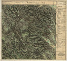
- The Ligist area and its surroundings in the three regional surveys in the period from around 1789 to 1910

West and south of Ligist (far right) in the Josephinische Landesaufnahme around 1790

Grabenwarth in the east of Ligist (far left)
Comfortable accommodation for men and horses is mentioned in the Franziszeische Landesaufnahme , around 1835

The Kainach valley in the north, recording sheet of the state survey around 1877/78

Gundersdorf, St. Stefan ob Stainz in the south

In the francisco-josephine land survey , approx. 1910


Culture and sights
Museums
On October 26, 1969, the local history museum in the Hammerherrenhaus (formerly Gasthaus Trummer) was officially opened. In 1973 the local history museum moved to the palace of the Sovereign Order of Malta, where it is still located today.
music
On June 18, 1954, under the chairmanship of Mayor MR Dr. Anton Saurugg and in the presence of the mayors of Krottendorf, Unterwald, Oberwald, Steinberg, Gaisfeld, Grabenwarth and St. Johann founded the music school. In the 1975/76 school year she got new premises in the Ligist elementary school. Since 1981 there has also been a school at the Ligist music school in Söding. The organizational statute for music schools in Styria issued in 1998/99 gave it public rights. In the anniversary year 2004, the old fire station of the Ligist volunteer fire brigade was converted into a modern music school building, which was officially opened in October 2004.
Buildings


- Ligist castle ruins : The victory of Emperor Otto the Great over the Hungarians in 955 resulted in the construction of a fortification belt and thus the creation of the above-mentioned "Dietenburg". This defense system was officially confirmed around the year 1060.
- The current Ligist castle complex reached its final expansion towards the end of the 17th century. From the castle Ligist the remains of walls and dating back to the 1625 altar today only (now in the chapel Grabenwarth ) available.
- Parish Church of Ligist : There is no documentary evidence of when Ligist has had a church . But there was a modest church 700 years ago, which was then expanded and consecrated to Peter and Paul on Sunday in 1473. The feast Sunday around July 1st still commemorates this event. The church received its present size in the 19th century.
- The burial chapel of the Saurau family is attached to the church. 13 larger and 13 smaller coffins are buried in the crypt.
- At the entrances to the church you can see four stone figures on gate-like pedestals. In front of the main entrance they represent Saint Catherine (with the wheel) and Saint Barbara (with the tower); Coming from the side of the market square, one sees Saint Peter (with the key) and Saint Paul (with the sword).
- Ligist Castle
- Ligist outdoor swimming pool
Culinary specialties
Ligist is famous far beyond Styria for its Schilcher and pumpkin seed oil .
Site design
In 1997 Ligist was awarded a silver medal in the village category as part of the European “ Entente Florale Europe ” competition.
Economy and Infrastructure
Ligist is a tourist destination that focuses primarily on gentle tourism. There are a large number of inns, taverns and shelters throughout the municipality. The leisure sports facility in Ligist was built in 2019.
education
- Elementary school Ligist
- Elementary school Unterwald (closed since 2013)
politics
Municipal council
The municipal council consists of 21 members and, due to the 2020 municipal council election, consists of mandates from the following parties:
- 10 ÖVP
- 8 SPÖ
- 2 FPÖ
- 1 The Green League
mayor
Mayor is Johann Nestler (ÖVP)
coat of arms
The blazon (description of the coat of arms) of the municipal coat of arms reads:
- “The coat of arms is a shield divided by gold and green; in the upper field a black, gold-crowned upper half owl with spread flight, in the lower field two diagonally crossed silver hammers. "
The owl comes from the coat of arms of the Counts of Saurau. The hammers point to the importance of the former hammer mills, which were an important economic factor in the Ligister area until the 19th century.
Personalities
Honorary citizen
- Heinrich Gsellmann, pastor of Ligist
- 1958: Anton Saurugg, doctor
Sons and daughters of the place
- Hans Fedl , honorary president of SK Sturm Graz
- Simon Klug (1871–1945), politician of the CS , member of the Constituent National Assembly 1919–1920, member of the National Council 1920–1930, 1931–1934
- Marianna Raters-Salchinger , ex-skier in the World Cup team of the ÖSV
- Christof Spörk (* 1972), musician and cabaret artist
- Leopold Städtler (* 1925), Provost of the Diocese of Graz-Seckau
- Annemarie Zdarsky (* 1928), SPÖ politician , member of the Federal Council 1973–1976, member of the Styrian state parliament 1976–1989
Web links
- 61612 - Ligist. Community data, Statistics Austria .
- ligist.gv.at Website of the municipality
Individual evidence
- ↑ Statistics Austria: Population on January 1st, 2020 by locality (area status on January 1st, 2020) , ( CSV )
- ↑ Regionalinformation , bev.gv.at (1,094 kB); accessed on January 10, 2020.
- ↑ a b Austrian map 1: 50,000. Sheet 189 Deutschlandsberg. Recorded 1944–1949, map revision 1965. Individual supplements 1968, 1975, 1982. Published by the Federal Office for Metrology and Surveying (Landesaufnahme) Vienna.
- ^ Austrian map 1: 50,000 - ÖK 50. Sheet 4104 Deutschlandsberg. Update 2006, version (lower right of the map) 2009. Published by the Federal Office for Metrology and Surveying Vienna.
- ^ Susanne Sievers / Otto Helmut Urban / Peter C. Ramsl: Lexicon for Celtic Archeology. A-K and L-Z ; Announcements of the prehistoric commission in the publishing house of the Austrian Academy of Sciences , Vienna 2012, ISBN 978-3-7001-6765-5 , p. 413 f.
- ↑ Hans Jörg Köstler: "Steel production in West Styria with special consideration of the second half of the 19th century." In: "Journal of the Historisches Verein für Steiermark." Festschrift "150 Years of the Historischer Verein." Volume 91/92, volumes 2001 / 02. Pp. 492-493.
- ↑ Flower Office Austria
- ^ Elections, Voitsberg district. Retrieved August 17, 2020 .
- ↑ Mayor. Retrieved January 28, 2020 .
- ↑ Data & facts. Retrieved January 28, 2020 .
- ↑ Sunday Post on July 15, 1951, p. 13.
- ↑ Weststeirische Volkszeitung on January 18, 1958, p. 4.
Cadastral communities: Grabenwarth | Ligist | Oberwald | Steinberg | Unterwald
Localities Dietenberg | Grabenwarth | Ligist Market | Ligistberg | Oberwald | Steinberg | Unterwald • Market place: Ligist market • Village: Grabenwarth
Rotte Dietenberg • Scattered houses: Althofen | Dörfl | Hörglitzberg | Cabbage pits | Lassnitz | Ligistberg | Mitteregg | Mid-game | Nestlerkogel | Oberwald | Steinberg | Unterwald | Waldkeuschler
Other locations: Baderbauer | Dorner | Ebenwascher | Hotel Enzianhof | Dark Shoemaker | Fritz | Guggi | Gugibauer | Hemmerchristi | Hemmerjörgl | Gasthaus Herlwirt | Hubenbauer | Hubenpeter | Jankibauer | Chaste bucket | Cook | Kraindl | Krakl | Kramerbauer | Shrink Trimmer | Ligist Castle | Gasthaus Moserweber | Paulijosl | Plant | Pölzl | Schopper | Sulhart | Starchlhans | Rauchbauer | Forest weaver | Waldwiedner | Washerjakl | Windisch | Zach
Counting area: Ligistmarkt | Steinberg | Oberwald | Unterwald
