
Schwarzkogel (Lavanttal Alps)
| Schwarzkogel | ||
|---|---|---|
 Summit of the Schwarzkogel from the Stoffkogel |
||
| height | 1550 m above sea level A. | |
| location | Middle Koralpe , Styria , Austria | |
| Mountains | Styrian fringe mountains, Koralpe | |
| Dominance | 3.7 km → Stoffkogel | |
| Notch height | 181 m ↓ Rehbockhütte | |
| Coordinates | 46 ° 54 '28 " N , 15 ° 4' 0" E | |
|
||
| rock | Koralmcrystalline: eclogite on the summit, mica slate and slab of gneiss as a base | |
| First ascent | unknown, former alpine pasture area: since time immemorial with cattle care and hunting | |
| Development | Forest roads | |
| Normal way | Hiking trail from the Freiländer Alm, approx. One hour | |
| particularities | highest of the three eclogite summit areas in the Koralm crystalline | |

The Schwarzkogel is 1550 m above sea level. A. high mountain in the middle Koralpe in Styria , Austria .
location
The Schwarzkogel is the highest point of a north-west-south-east running ridge. This ridge begins with a foothill, which is called "Blochriegel" in everyday parlance in the area, but is shown on maps as "Hochriegel" ( 1440 m above sea level ) and the Filzmoos area on the Freiländer Alm in the Hebalm area . It forms the watershed between Rettenbach or Laßnitz on the one hand and Wildbach on the other. The Gratzenbach flow into these rivers to the south and the Klosterbach to the north .

East of the Schwarzkogel, the ridge runs under the name "Wolfsriegel" first to the town of St. Oswald ( 1050 m above sea level ). On the southern slope of the Wolfsriegel is an area that was called "Rometzen" (Rametz, Ramsn) in the 19th century. This name comes from Latin and means a small wood or an area with bushes. East of St. Oswald the ridge continues to Gerhardshof (860 m) and over a narrow saddle (792 m) at the vlg farm . Large between the deep valleys of Laßnitz and Wildbach. To the east follows the elevation on which Freiland (847 m) lies. After this locality, the ridge is also referred to in literature as the “free country ridge”.
From Laufenegg (Gh.Moserjosl, 772 m) the ridge divides and falls in a southern branch over the Deutschlandsberg castle hill (511 m) steeply to Deutschlandsberg (368 m) and north into the heights between Deutschlandsberg and Wildbach (Poschenberg, 430 m) ). The Mittereggbach flows between these two branches and flows into the Laßnitz near Frauental an der Laßnitz .

The Schwarzkogel is located in the former municipality of Kloster . The ridge lies further to the east in the communities of Freiland and Deutschlandsberg .
- The Rometzen on the Schwarzkogel (original map of the cadastre)

The Rometzen at Wolfsriegel in Rettenbach (above)

The wolf bar at the farm vlg. Christoflenz


The ridge lies up to the border of the town of Deutschlandsberg near Laufenegg in the Pack - Reinischkogel - Rosenkogel conservation area .
history
From 1203 to 1849, the Schwarzkogel and the upstream elevations largely belonged to the free land of the Benedictine monastery of Admont (with the exception of the town of Deutschlandsberg and some smaller properties in the eastern part of the ridge).

In 1207, the area was counted as a “predium” (economic property) in a tenth confirmation, which extended from Blumau an der Laßnitz (“Bluminow”) between the two Laßnitz streams up to the Alps (= the alpine pastures of the Freiländer Alm).
Surname
There are several reasons for the name "Schwarz" -Kogel:
- Forest cover:
The mountain is overgrown with coniferous wood ( spruce , fir , pine ) in its higher parts . That makes it appear darker than the adjoining alpine area. The word “black” can denote the forest cover of an area.
- However, the forest was not always like this: In the 18th century ( Josephinische Landesaufnahme ), large areas of the summit were identified as unwooded, as meadow or pasture, only the (steep) northeastern slope into the Wildbach valley bears the forest signature. The difference in brightness would not have existed in its present form and intensity. The argument can come from a time before, when the alpine pastures but not the summit area were cleared.
- Difference in brightness:
- The rock from which the summit of the Schwarzkogel is made (eclogite) is darker than that of the elevations in the area: Hochriegel, Laurakogel, Münzerkogel, Kampelekogel etc. These heights consist of (gneiss or garnet) mica schist, which is due to the sunshine its sometimes high mica content can create a very bright, shiny impression.

- Need for distinction:
The name is said to have arisen from the desire to distinguish the mountain (an alpine pasture on it, etc.) from another area. The pair of terms black and white is used in such contexts (see also Schwarze and Weisse Sulm a few kilometers south of the Schwarzkogel).
- A difference in brightness may have contributed to the naming, but it does not have to be the cause. In fact, an old path leads south from the Hebalm over the lake Eben and the Hof Halt to the saddle between Bärofen and Stoffkogel past a "Weiß-Alm". This explanation is supported by the fact that the area of the Hebalm was called "Stocker Alm" in the 18th century in larger areas than later. The Weiß-Alm is on the southern border, the Schwarz-Kogel on the northern border.
The naming based on a pair of opposites is traced back to (not undisputed ) ideas about Slavic gods, which are said to have been represented in opposites of light and darkness (dualism). - However, in addition to the Schwarzkogel discussed here, there was another survey of this name: A summit that is now called “Glashüttenkogel” is also identified as “Schwarz Kogel” in the Josephinian survey. It is located approx. 7.5 km south-southwest of the Schwarzkogel, which is treated here, between Moserkogel and Kumpfkogel (then Moser Alpe and Gumpf Kogel), west of the village of Osterwitz . The pair of opposites “Weiß-Alm Schwarz-Kogel” can also be related to this mountain, so that this name interpretation would have to be examined in more detail before it can be based on a dualism.

- Ownership:
- The manorial rule of the area in which the mountain lies was from 1203 to 1849 with the Benedictine monastery of Admont . In the Middle Ages, the monks of this order were "black monks" because of their clothing , and their monasteries were called "black monasteries".
- This designation is associated with the fact that the neighboring elevation "Reinischkogel" refers to the property of the Cistercian monastery Rein bei Graz (founded 1129), whose monks wore white clothing in their habit and the name should make the difference between the manors clear.
- Scary:
- According to a legend, a farmer from Rettenbach was pursued by a black figure and there are other haunted stories from the area.
- After them, the Schab-Bock is said to have appeared in the area. The word "black" can designate eerie, ominous areas in which harmful or unrest-causing spirits are said to live.
- "Weiß Alm" and twice "Schwarzkogel" around 1789 ( Josephinische Landesaufnahme )

The "Wise Alps" at Bärofen (bottom right)

"Schwarz Kogel" west of Osterwitz between "Gumpf Kogel" and "Moser Alm"
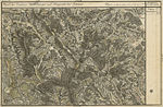
"Schwarz Kogel" east of Rettenbach , Schröfel See and Hebalm


The word " Kogel " is due to the rounded summit . A round summit structure is referred to in geomorphology as a dome , the name can be combined with Kuppe / Koppe (probably from Latin cuppa “mug”), or Kogel / Kofel (cf. “Kugel”), Kopf / Köpfel , Nock , Gupf or Kulm ( Latin culmen , "high point").
Routes to the summit
The Schwarzkogel can be climbed from all sides over the (sometimes steep) slopes of the summit area, the routes have no alpine difficulty levels. However, there are no well-marked paths that would lead directly to the summit. Faded markings of an earlier hiking trail are difficult to see. Hiking equipment and the ability to move in easy but unpaved terrain are therefore a prerequisite, even in good weather.
Due to the forest cover, the summit is only suitable as a vantage point to a limited extent (view to the south possible, but no all-round view, depending on the forest cover). A marked path leads from the village of St. Oswald over the Wolfsriegel on a forest road about 500 meters and 70 meters north of the summit to the Freiländer Almhütte.
geology
The Schwarzkogel consists of rocks that have been redesigned several times in the course of the mountain formation (metamorphic rocks). The rock group is called Koralpen or Koralm crystalline.
The summit of the Schwarzkogel consists of the hardest and densest rock exposed on the earth's surface , eclogite .
This rock is over half a billion years old. It was first discovered and named by the French geologist and mineralogist René-Just Haüy in the 18th century on one of his scientific trips to southern western Styria. Because of its special origin and other properties, it is not an everyday rock. This is the reason for geological excursions to the Schwarzkogel area.

It is one of the three peaks made from this rock in the Koralpe ridge (next to Rosenkogel and Pöschelkogel, which are in the vicinity of the Schwarzkogel).
The boundary between the summit area made of eclogite and the other rocks can be recognized in several places in nature by a clear change in the slope (downward slope): eclogite is much harder than the other rocks. Hard rock slopes are steeper than softer rock slopes.
Hochriegel and Wolfsriegel or the continuation of the ridge to the east consist of gneiss mica schist , which contains a number of small marble deposits, and slab gneiss.
This gneiss is criss-crossed with pegmatites ("pegmatoid impregnated"), which may A. in quartz deposits ( quartz veins ) shows. Rocks that occur more rarely are elongated but narrow stretches of Hirschegger gneiss and gneiss quartzite. This elongated expansion is based on the fact that the area consists of layers of rock (ceilings) pushed one on top of the other, which in turn were arched, compressed and shifted. The ceiling structure is partially exposed again through weathering.
Like the entire Koralpe, the ridge has been thoroughly geologically investigated because these mountains influenced the current appearance of the Alps at their eastern end.

The steep slopes lead to landslides through which mineral discovery sites are opened up. Road constructions (especially for forest roads) and quarries also make discovery sites, e.g. B. for grenade , accessible. The dark and light rocks are clearly visible in the rubble of the stream beds in the area.
The marble and quartz deposits are not extensive. They are used in a number of smaller quarries for local needs.
Terrain step in front of Deutschlandsberg

The ridge falls on the western border of the city of Deutschlandsberg into the Graz Basin. The partly steep gradient has its reason in the formation of the Koralpe:
The Koralpe is geologically an uplifted part of the mountain, a so-called Pultscholle . It only got its present form roughly in the last part of the mountain formation of the Alps about 20 million years ago, and the position of the mountain range across the course of the Alps can be traced back to it (“continental flood tectonics”). The ridge is not very pronounced compared to other mountains. At the height of the mountain range are flat areas in which economic uses such as alpine pastures, but also due to a lack of good drainage, wet areas (waterlogged, swamps, moors, moist meadows such as the lake Eben and the Filzmoos ) develop. Only at the edge of the mountains do you have to overcome large differences in altitude in the lowlands over short stretches, with the eastern slope being significantly flatter than the transition to the Lavant valley in the west of the Koralpe.
Course of the rock formation below the earth's surface
From Deutschlandsberg the ridge runs below the surface of the level of the Graz basin . This level began to emerge around 23 million years ago. It is formed by rocks and deposits of a former sea from the Neogene (formerly the Young Tertiary): the "Florian layers" made of sandstone and marl. In addition, in the Gleinz ridge, there are block gravel and sandy clay with pieces of rock that also occur in the Koralpe ( eclogite , gabbro ).
The places where the Schwarzkogel mountain range disappears under the gravel of the Graz Basin can be clearly recognized in nature by the fact that the long and up to 15% steep slopes of the streets from the Koralpe merge into flat stretches of road.
Below the surface of the earth, the rock pull sinks deeper as quickly as above. Its upper edge already reaches today's sea level before Frauental an der Laßnitz . South of Groß St. Florian , the currently explored deepest point of the ridge is located in a basin deeper than 600 m below sea level (= 900 to 1000 m below today's surface in the Gleinz). This basin is called "St. Florian basin" or "Florian Bay". It belongs to the West Styrian Basin (West Styrian Neogen Basin), which is separated from the East Styrian Basin by the Central Styrian Threshold (from the Sausal to the princes west of Graz). All parts belong to the west of the Pannonian Basin.
To the east of the basin of St. Florian rises the Sausal , which consists of other rocks.


Web links
Individual evidence
- ↑ J (oseph) Thaler: Tyrol's antiquities in its geographical proper name (continued). In: New magazine of the Ferdinandeum for Tyrol and Vorarlberg. Published by the curators of the same. Twelfth ribbon. Innsbruck 1846. Pages 1–130, here: Page 101. Keyword: Rometz, Rametz. Derivation from Middle Latin rameta = Sylvula (little wood). See also the Latin Ramus branch: Duden Volume 5. Foreign dictionary . 9th edition, page 877 and French rameau Zweig, ramée Buschwerk. The second interpretation in the Ferdinandeum newspaper in Italian: romano-mezzo = medium romanum = wälsches possession cannot be justified from the history of the area, there are no proof of owners from southern Europe.
- ^ Gerhard Fischer: Osterwitz. a miraculous place in the high pürg. Life, joy and suffering of an area and its inhabitants. Osterwitz 2002. Editor and publisher: Osterwitz community. Page 14.
- ↑ Landscape protection area 02: Ordinance of the Styrian state government of May 25, 1981, stmk. State Law Gazette No. 37/1981 in the version of the correction (new map display) No. 64/1981. Map of the protected area ( Memento of the original dated December 21, 2007 in the Internet Archive ) Info: The archive link was inserted automatically and has not yet been checked. Please check the original and archive link according to the instructions and then remove this notice. in the Digital Atlas Styria.
- ↑ Maximilian Riederer, Gunther Riedlsperger, Johann Tomaschek: Freiländer Ortschronik . Self-published by the community of Freiland near Deutschlandsberg, 1988. Pages 28–33.
- ↑ black I. 1) d) In: Jakob and Wilhelm Grimm : German dictionary . Volume 15 Schiefeln – Seele. Leipzig 1899. Column 2301, line 49. Reprint from Deutscher Taschenbuch Verlag. Munich 1991, ISBN 3-423-05945-1 . dtv 5945. Structure quoted from: The digital Grimm - Electronic edition of the first processing . Version 12/04. Two thousand and one, Frankfurt am Main, ISBN 3-86150-628-9 . Competence center for electronic cataloging and publication processes in the humanities at the University of Trier in conjunction with the Berlin-Brandenburg Academy of Sciences.
- ↑ For the meaning of “black” for “dark” and “white” for “shiny” see: black I. 2) a). In: Jakob and Wilhelm Grimm : German dictionary . Volume 15 Schiefeln – Seele, column 2302, line 21.
- ↑ black I. 2) b). In: Jakob and Wilhelm Grimm : German dictionary . Volume 15 Schiefeln – Seele, column 2302, line 55.
- ^ Wilhelm Brandenstein: main and tributary rivers. In: Mélanges Ramovs. Slavistična Revija 3 (1950) pages 301-303. Quoted from: Fritz Freiherr Lochner von Hüttenbach: Wilhelm Brandenstein. Small name-based work. Academic printing and publishing company. Graz 1978, ISBN 3-201-01038-3 , pages 1–3.
- ^ Gerhard Fischer: Osterwitz . Page 23.
- ↑ black I. 2) d) β) In: Jakob and Wilhelm Grimm : German dictionary . Volume 15 Schiefeln – Seele. Column 2304, lines 7 and 28.
- ↑ Story of the Spuk in the Gratzmühle , Sunday Messenger November 22, 1981.
- ↑ Franz Brauner: What the home tells. Styrian Heimathefte, Issue 12: West Styria. The Kainach, Sulm and Laßnitz valleys. Verlag Leykam (Pedagogical Department) Graz 1953. Beginning with page 89 with legends from Osterwitz.
- ↑ black II. 1). In: Jakob and Wilhelm Grimm : German dictionary . Volume 15 Schiefeln – Seele, column 2314, line 71.
- ↑ Map sheets without frame Josephinische Landesaufnahme, Geographical Information System GIS of the State of Styria as part of the Digital Atlas Styria. Select the map under Historical Maps “Joseph. Landesaufn. 1787 ".
- ↑ Definition from: “Summit shapes and mountain names” in the Lemma Summit .
- ↑ freytag & berndt hiking, cycling and leisure map WK 237: Saualpe, Lavanttal, Koralpe, region Schilcherheimat 1: 50,000. With leisure guide, GPS points and location register. ISBN 3-85084-322-X or Austrian map 1: 50,000. Sheet 188 Wolfsberg. Federal Office for Metrology and Surveying, Vienna. New in 1959, 1960, map continuation 1998.
- ↑ a b District topography. Helmut-Theobald Müller (ed.), Gernot Peter Obersteiner (overall scientific management): History and topography of the Deutschlandsberg district. Graz / Deutschlandsberg 2005, ISBN 3-901938-15-X . Styrian Provincial Archives and District Authority Deutschlandsberg 2005. In the series: Great historical regional studies of Styria. Founded by Fritz Posch †. Volume 3. First part, general part. Hartmut Hiden: Geology of the settlement area. Page 12.
- ^ Notices from the residents of several farms, most recently from the farm owner vlg. Zach in Klosterwinkel on June 14, 2007. Contacts with the landowners are necessary in this context: Searching for and taking geological rock samples no longer belongs to the legally recognized private uses according to the Forest Act (such as hiking, mushroom picking and berry picking) because it is this can also involve searching for areas with potential for mining ( prospecting and / or exploration ) in accordance with the mining law.
- ^ Geological map of the Republic of Austria 188 Wolfsberg. Published by the Federal Geological Institute, Vienna 1980.
-
↑ Peter Beck-Mannagetta (1917–1998): The geology of the catchment area of the Laßnitz (West Styria) . In: Mitteilungen der Alpinen Geologische Vereinigung, Volume 34. Vienna 1942. Pages 1–37. Furthermore the multi-page bibliography of this author in his obituary: Mitteilungen der Österreichischen Geologische Gesellschaft No. 90 (1997). Vienna 1999, pages 207-212. ISSN 0251-7493 .
Geological map of the Republic of Austria 1: 50,000. Published by the Federal Geological Institute Vienna (GBA). Sheets 188 Wolfsberg, 189 Deutschlandsberg.
On the influence on the formation of the Alps, division into crust wedges or parts at the beginning of the Carpathian Mountains and the Dinaric Mountains : Hans Georg Krenmayr, Albert Daurer (editor): Rocky Austria. A colorful geological history of Austria. Federal Geological Institute, Vienna 1999, ISBN 3-85316-006-9 , page 46. - ↑ G. Weissensteiner: Minerals of the Koralpe . 1. Special volume of the club magazine Die Eisenblüte . Association of Styrian Mineral Collectors, Graz 1979 and: District Topography. First volume, general part. Hartmut Hiden: Geology of the settlement area. Page 9–14.
- ↑ Arthur Winkler-Hermaden a. a .: Scientific study results of the working group for geological-pedological investigations in the catchment area of the Laßnitz river in south-western Styria. Austrian Academy of Sciences, mathematical and natural science class, Dept. I, 149. Issue 7-10, pages 225-226. Vienna. Peter Beck-Mannagetta: About the geological structure of the Koralpe. In: G. Weissensteiner: Mineralien der Koralpe . 1. Special volume of the club magazine Die Eisenblüte . Association of Styrian Mineral Collectors, Graz 1979. Page 6.
- ↑ a b District topography. First volume, general part. Hartmut Hiden: Geology of the settlement area. Page 11.
- ^ Geological map of the Republic of Austria 189 Deutschlandsberg. Published by the Federal Geological Institute, Vienna 1991.
- ↑ a b District topography . First volume, general part. Hartmut Hiden: Geology of the settlement area. Pages 9-18.
- ↑ Helmut W. Flügel: Geological map of the pretertiary underground. In: Geological thematic maps of the Republic of Austria 1: 200,000. South Styrian Basin - South Burgenland threshold. Published by the Federal Geological Institute. Vienna 1988. Arthur Kröll, Albert Daurer (editor): Explanations of the maps of the pretertiary subsoil of the Styrian basin and the southern Burgenland threshold. ISBN 3-900312-65-6 . Together with relief map, aeromagnetic map and gravity map in a plastic envelope.