Klosterbach (torrent)
| Klosterbach | ||
|
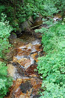
The Klosterbach has exposed a small quartz vein in the middle course |
||
| Data | ||
| location | In western Styria , Austria , from the middle Koralpe to the east to the course of the torrent | |
| River system | Danube | |
| Drain over | Wildbach → Laßnitz → Sulm → Mur → Drau → Danube → Black Sea | |
| source | In Filzmoos in the middle of the Koralpe on the Hebalm (Freiländer Alm) 46 ° 54 ′ 51 ″ N , 15 ° 4 ′ 12 ″ E |
|
| Source height | 1440 m above sea level A. | |
| muzzle | In Klosterwinkel in den Wildbach Coordinates: 46 ° 53 ′ 27 " N , 15 ° 6 ′ 47" E 46 ° 53 ′ 27 " N , 15 ° 6 ′ 47" E |
|
| Mouth height | 790 m above sea level A. | |
| Height difference | 650 m | |
| Bottom slope | 13% | |
| length | 4.9 km | |
| Catchment area | 5 km² | |
| Drain |
MQ |
100 l / s |
| Communities | monastery | |
| Residents in the catchment area | approx. 10, in summer (weekend houses) approx. 20 | |
The Klosterbach is a tributary of the torrent in the middle Koralpe in western Styria in Austria .
It rises in Filzmoos in the middle Koralpe on the Hebalm (Freiländer Alm) and flows first to the east, then south-east to the mouth of the torrent , which lies at its river kilometer 4. It is a torrent with a steep gradient.
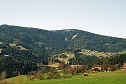
The cloister stream lies entirely in the cadastral municipality of Klosterwinkel of the municipality of Kloster .
After the Josephinische Landesaufnahme in 1787, one of the old routes from Deutschlandsberg and Stainz to the Hebalm and on to Carinthia followed its upper course .

The Sterzriegel is located north of the stream .
Local meaning and history
With a similarly strong unnamed tributary to the south, the Klosterbach forms the boundaries of the small ridge on which the farm vlg. Gratzen is located.
In the past, the Klosterbach was sometimes viewed as the actual main river of the upper Wildbach Valley, the upper reaches of the Wildbach. One reason could have been the location of the cloister stream in a locally significant place (see Gratzen ) compared to the upper course of the stream in a sparsely inhabited area.
The monastery stream can therefore be called a torrent in parlance and in older documents . The western source river of the torrent was also referred to as the Klosterbach.
An investigation into the bed load conditions of the Laßnitz also deals with the composition of the pebbles in the Klosterbach.

Flora and fauna
The cloister stream is almost entirely in the forest area (mainly spruce , more rarely maples , ash and birch ). Individual green areas in its catchment area are used for grassland farming and as pastures.
Water quality
The water quality is quality class I (unpolluted, practically drinking water quality).
The water hardness is low (range 1–2 - soft water).
credentials
- ^ Josephinische Landesaufnahme , Geographical Information System GIS of the State of Styria in the context of the Digital Atlas Styria. Select the map under Historical Maps “Joseph. Landesaufn. 1787 ".
- ^ Austrian map 1: 25,000. Sheet 189/1 Ligist. Published by the Federal Office for Metrology and Surveying (Land Survey) in Vienna. New additions in 1947, individual additions in 1953.
- ↑ Gerda Woletz: The bed load conditions of the Laßnitz , in: Artur Winkler-Hermaden, Peter Beck-Mannagetta , Karl Bistritschan, Gerda Woletz, Karl Schoklitsch, Herbert Pichler: Scientific study results of the working group for geological-pedological investigations in the catchment area of the Laßnitz river in southwest Styria. Session reports of the Academy of Sciences in Vienna, mathematical and natural science class, Department 1, Volume 149, Issue 7 to 10 (presented at the session on June 27, 1940). Verlag Hölder-Pichler-Tempsky Vienna 1940. Pages 247-257.

