Deutschlandsberg district
| location | |
|---|---|
| Basic data | |
| state | Styria |
| NUTS III region | AT-225 |
| Administrative headquarters | Deutschlandsberg |
| surface | 864 km² |
| Residents | 60,867 (January 1, 2020) |
| Population density | 70 inhabitants / km² |
| License Plate | DL |
| District Commission | |
| District Captain | Helmut-Theobald Müller |
| website |
bh-deutschlandsberg. steiermark.at |
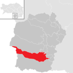
| map | |
The Deutschlandsberg district is a political district in the state of Styria .
geography
Geographical location
The Deutschlandsberg district is located in the south-west of Styria in the Lavanttal Alps . It is bounded in the west and southwest by the Koralpe and in the southeast - east of the Radlpass - by the Poßruck . In the north it is limited by the eastern foothills of the Packalpe . Only in the east is there no natural border. The district measures around 35 km at its widest point in both north-south and east-west directions.
The district is largely drained to the east towards the Mur . The extreme northeast on the border with the Graz-Umgebung district belongs to the catchment area of the Kainach . The north is drained by the Laßnitz and its most important tributary, the Stainzbach . The south belongs to the catchment area of the Black and White Sulm, the two source rivers of the Sulm . The southeast is drained by the Saggaubach . Only the Feistritz in the southwest is one of the tributaries of the Drau .
The highest elevations in the district are the Handalm ( 1853 m above sea level ) in the north-west and the Große Speikkogel ( 2140 m above sea level ) in the west. The lowest point is at 286 m above sea level. A. in the municipality of Preding .
Adjacent local authorities
The Deutschlandsberg district borders:
- in Styria
- in the north to the Voitsberg district
- in the northeast to the Graz-Umgebung district
- in the east to the Leibnitz district
- in the west to the Carinthian district of Wolfsberg
- in the south to Slovenia
Territorial changes
After the First World War, the municipality of Soboth ( Sobota or v Soboti ) and parts of the municipalities of Oberfesing ( Zgornja Vižinga ), Pernitzen ( Pernice ) and St. Primon ob Hohenmauthen ( Sveti Primož nad Muto ) became part of the Deutschlandsberg district. On January 1, 1924, the market town of Preding and the town of Tobis from the Leibnitz district (or Wildon judicial district ) were assigned to the Deutschlandsberg district and its district court.
Small changes were made between the following (then) municipalities from 1952:
- 1952 between Gasselsdorf and St. Johann im Saggautal (Ried Weichselberg-Blaselberg)
- 1964 between Dietmannsdorf im Sulmtal and Prarath
- 1965 between Breitenbach in western Styria and Gießenberg
- 1980 between Wettmannstätten and St. Nikolai im Sausal
- 1981 between Lannach, Lieboch and Mooskirchen
- 1986 between Großradl and Oberhaag
- 1988 between Lannach and Dobl
- 1989 between Preding, Hengsberg and St. Nikolai im Sausal
- 1990 between Sulmeck-Greith and Gleinstätten
- 1991 between Preding and Zwaring-Pöls
- 1994 between Sulmeck-Greith and Oberhaag
From 1868, the offices of the Deutschlandsberg district administration were provisionally located in the building opposite today's district court in Kirchengasse (formerly Gasthaus Stelzer), then until 1901 in the Feilhofer Schlössl . The history of the Deutschlandsberg district administration was graphically presented in seven display boards. These boards were handed over on August 27, 2018 on the occasion of the 150th anniversary celebrations; they are accessible on the second floor of the official building (Kirchengasse 12) during opening hours.
history
The Deutschlandsberg district shares the development of the history of Styria . A number of barrows have been documented in his area, some of which are under monument protection. Due to its location on the southern border of Styria, it belonged in the last months of the Second World War to the area of operations of partisans from the area of what was then Lower Styria ( CdZ area Lower Styria ).
The First and Second World Wars claimed 4,313 lives in the district. In the 2nd World War 2269 fallen and 518 missing soldiers were recorded in the district.
Administrative division
The district of Deutschlandsberg originally consisted of 95 communities or 170 cadastral communities. It was the only one that was newly created in the then Duchy of Styria in 1868. It comprised three judicial districts:
- Deutschlandsberg with 37 communities and 64 cadastral communities
- Eibiswald (20 Gem. Or 52 KG)
- Stainz (38 mixed or 54 KG)
In 2014, before the structural reform, the district consisted of 40 municipalities; as part of the municipal structural reform 2014/15 , the number of municipalities in the district was significantly reduced - since 2015, the Deutschlandsberg district has consisted of 15 municipalities , including one town and ten market communities, the total area is 864.02 km².
These 15 municipalities are:
- Bad Schwanberg, Deutschlandsberg, Eibiswald, Frauental an der Laßnitz, Groß Sankt Florian, Lannach, Pölfing-Brunn, Preding, Sankt Josef (West Styria), Sankt Martin im Sulmtal, Sankt Peter im Sulmtal, Sankt Stefan ob Stainz, Stainz, Wettmannstätten, Wies .
The population in the table is from January 1st, 2020. Regions are small regions of Styria .
| local community | location | Ew | km² | Ew / km² | Judicial district | region | Type
|
photo | Metadata |
|---|---|---|---|---|---|---|---|---|---|
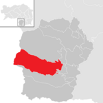
Bad Schwanberg
|
|
4,559 | 124.19 | 37 | Deutschlandsberg | 022 Sulmtal – Koralm | market community
|

|
According to code: 60349 |
Deutschlandsberg
|

|
11,663 | 179.08 | 65 | Deutschlandsberg | 092 (core area) Bad Gams – Deutschlandsberg – Frauental | urban community
|

|
Acc. To code: 60344 |
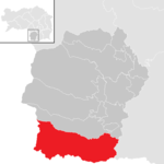
Eibiswald
|
|
6,391 | 152.04 | 42 | Deutschlandsberg | - | market community
|

|
According to code: 60345 |
Frauental on the Laßnitz
|

|
2,930 | 15.58 | 188 | Deutschlandsberg | 092 (core area) Bad Gams – Deutschlandsberg – Frauental | market community
|

|
According to code: 60305 |
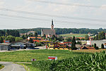
Great Saint Florian
|

|
4.130 | 48.78 | 85 | Deutschlandsberg | 102 Innovative Laßnitztal | market community
|
|
Acc. To code: 60346 |
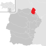
Lannach
|
|
3,537 | 19.87 | 178 | Deutschlandsberg | - | market community
|

|
According to code: 60318 |
Pölfing-Brunn
|

|
1,627 | 6.16 | 264 | Deutschlandsberg | - | market community
|

|
Acc. To code: 60323 |
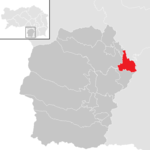
Preding
|
|
1,782 | 18.23 | 98 | Deutschlandsberg | 102 Innovative Laßnitztal | market community
|

|
Acc. To code: 60324 |
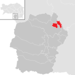
Sankt Josef (West Styria)
|
|
1,619 | 13.3 | 122 | Deutschlandsberg | 064 Lower Kainach Valley | local community
|

|
Acc. To code: 60326 |
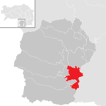
Sankt Martin im Sulmtal
|
|
3,105 | 39.18 | 79 | Deutschlandsberg | 022 Sulmtal – Koralm | local community
|

|
Acc. To code: 60347 |
Sankt Peter im Sulmtal
|

|
1,256 | 10.98 | 114 | Deutschlandsberg | 022 Sulmtal – Koralm | local community
|

|
Acc. To code: 60329 |
Sankt Stefan ob Stainz
|

|
3,579 | 49.23 | 73 | Deutschlandsberg | 084 Reinischkogel | local community
|

|
Acc. To code: 60348 |
Stainz
|

|
8,749 | 92.84 | 94 | Deutschlandsberg | 055 Stainz (Schilcherland) | market community
|

|
Acc. To code: 60350 |
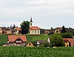
Wettmannstätten
|

|
1,621 | 17.97 | 90 | Deutschlandsberg | 102 Innovative Laßnitztal | market community
|
|
Acc. To code: 60341 |
Wies
|
|
4,319 | 76.57 | 56 | Deutschlandsberg | - | market community
|

|
Acc. To code: 60351 |
Population development

District captains since 1868
1939 to 1945 district administrators . From dates without further details indicate the beginning of the year.
| Ferdinand Praunegger | August 3, 1868 |
| Gustav Gutmann | July 8, 1871 |
| Franz Lautner | February 27, 1873 |
| Julius Franzi Ritter von Vesteneck | September 25, 1881 |
| Alexander Freiherr von Neupauer | January 28, 1888 |
| Rudolf Count Pace | August 25, 1890 |
| Johann Hussak | January 24, 1897 |
| Otto Demeter Tirka | May 23, 1901 (leader until July 20, 1904) |
| Josef de Villavicencio | January 19, 1906 |
| Ferdinand Zoffal | August 28, 1913 (until 1915 Head of Office) |
| Viktor Kastner-Pöhr | March 1924 |
| Johann (es) Knieli | 1933 - March 11, 1938 (relieved of the position as "politically unreliable", moved to Graz and retired in November, reinstated from June 25, 1945) |
| Anton Stiegler | March 12-14, 1938 |
| Josef Pelpik | March 15, 1938 - August 30, 1938 |
| Alois Dieber | September 15, 1938 - August 31, 1939 |
| Rudolf Schwarz | August 31 - September 2, 1939 |
| Wolfgang Buder | September 2, 1939 |
| Wolfgang Kunz | July 26, 1940 |
| Herbert Leonhardt | April 1943 |
| Josef Huber | November 1944 |
| Franz Rader | May 15, 1945 (provisional, as official veterinarian, later state veterinary director) |
| Johann (es) Knieli | June 25, 1945 (from 1949 district captain of Graz-Umgebung) |
| Anton Kronabether | 1949 (previously imprisoned in 1938 as deputy of BH Knieli, released, banned from working) |
| Friedrich Mayer | 1960 |
| Artur Prommer | 1965 (managing director from December 1964 after a serious accident of his predecessor, from July 1, 1965 definitely) |
| Herbert Schell | 1974 |
| Ingrid Klug-Funovits | 1989 |
| Helmuth-Theobald Müller | August 1996 |
literature
- Weekly newspaper "Weststeirische Rundschau". Independent weekly newspaper from Simadruck for the Deutschlandsberg district. Deutschlandsberg, from 1927.
- Konrad Maritschnik: "Abandoned elementary schools in the Deutschlandsberg district." Self-published 2014.
- Helmut-Theobald Müller (ed.), Gernot Peter Obersteiner (overall scientific management): “History and topography of the Deutschlandsberg district .” (“District topography .”) Graz-Deutschlandsberg 2005, ISBN 3-901938-15-X , Styrian regional archive and district administration Deutschlandsberg 2005. In the series: "Great historical regional studies of Styria." Founded by Fritz Posch †, Volume 3.
- Gerald Wolf: "The NSDAP in the Deutschlandsberg district from 1933 to the" Anschluss "in 1938." In: Herbert Blatnik, Hans Schafranek (Ed.): "From the NS ban to the" Anschluss ". Styrian National Socialists 1933–1938. ”Czernin Verlag, Vienna 2015, ISBN 978-3-7076-0554-9 , pp. 268–300.
- Gerald M. Wolf: "Now we are the masters ..." The NSDAP in the Deutschlandsberg district and the July putsch in 1934 (Grazer Zeitgeschichtliche Studien, Volume 3). StudienVerlag, Innsbruck-Vienna-Bozen 2008, ISBN 978-3-7065-4006-3 .
- Cathrin Weisi: "... definitely not world history ...": A region writes its newspaper - 65 years of "Weststeirische Rundschau" for the political district of Deutschlandsberg. University of Graz, diploma thesis, Graz 1992.
- Gunther Riedlsperger: “Castles and mansions in the paradise of Styria. Deutschlandsberg district. ”Simadruck-Verlag Deutschlandsberg.
- Waltraud Weisi (Ed.): “At that time. Old photographs from the Deutschlandsberg district. ”Three volumes, Volume 1 1992, Volume 2 1995, Volume 3 2004, Simadruck, Deutschlandsberg.
- Heinz Otto: The temperature reversal in Southwest Styria . In: “Messages from the natural science association for Styria.” Volume 101, Graz 1971, pp. 97–118.
Web links
- bh-deutschlandsberg.steiermark.at District authority Deutschlandsberg
- Municipal directory of the district authority Deutsch-Landsberg 1868. From: “Political division of the Duchy of Styria, proclamation of the k. k. Governor in Styria dated October 31, 1868, with which the detailed classification overviews for the political and judicial organization of the Duchy of Styria are brought to the knowledge. “State Law and Ordinance Gazette of the Duchy of Styria from April 21, 1869, XX. Piece, No. 36, p. 59 and appendix.
Individual evidence
- ^ "Ordinance of the Federal Chancellery of November 29, 1923 on the allocation of the local communities of Preding and Tobis to the district of the district court and to the district of the district authority of Deutschlandsberg." Federal Law Gazette, 117th issue , No. 600, p. 1908.
- ↑ a b c d e f "The birthday of the Deutschlandsberg district." Weststeirische Rundschau, No. 35, August 31, 2018, year 2018, 91st year, p. 1.
- ^ Maria Lichtenegger: The burial mound group "Bründlteiche". With an overview of the state of research in barrow research in Styria since 1980. Diploma thesis at the KFU Graz, Graz 2007. pp. 19–35.
- ↑ 75 years ago ... In: Weststeirische Rundschau . No. 19, Volume 2020 (May 8, 2020), 93rd Volume. ZDB -ID 2303595-X . Simadruck Aigner u. Weisi, Deutschlandsberg 2020, p. 2.
- ↑ until 2019 "Schwanberg"
- ↑ Statistics Austria - Population at the beginning of 2002–2020 by municipalities (area status 01/01/2020)
- ↑ District captains since 1868 (PDF; 691 kB), accessed on September 9, 2012.
- ↑ (on the résumés of Franz Rader, Johann Knieli, Anton Kronabether and Arthur Prommer) Helmut-Theobald Müller: Four district captains who have taken on great responsibility for our region. In: Weststeirische Rundschau . No. 18, volume 2020 (May 1, 2020), 93rd volume. ZDB -ID 2303595-X . Simadruck Aigner u. Weisi, Deutschlandsberg 2020, pp. 2–3.
Coordinates: 46 ° 49 ' N , 15 ° 13' E


