
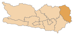
Wolfsberg district
| location | |
|---|---|
  |
|
| Basic data | |
| state | Carinthia |
| NUTS III region | AT-213 |
| Administrative headquarters | Wolfsberg |
| surface | 974 km² |
| Residents | 52,607 (January 1, 2020) |
| Population density | 54 inhabitants / km² |
| License Plate | WHERE |
| website | https://www.ktn.gv.at/Verwaltung/Bezirke/BH-Wolfsberg |
| map | |
  |
|
The Wolfsberg district is a political district in the Austrian state of Carinthia .
geography
The district is located in the Lavant Valley in eastern Carinthia in the Lower Carinthia region ; Koralpe and Packalpe form the border with Styria . The Wolfsberg district is crossed by the Lavant River , which flows into the Drau at Lavamünd . The lower part of the district is embedded between the cliff zone and Saualpe . The upper part of the district lies between the Packalpe and the Seetal Alps and borders the Obdacher Sattel to the north .
Adjacent local authorities
| Murau | Murtal | Voitsberg |
| St. Vitus |
.svg)
|
Deutschlandsberg |
| Völkermarkt | Slovenia |
Administrative division
The Wolfsberg district is divided into nine communities , including three towns and four market communities . The number of inhabitants as of January 1, 2020 are in brackets.
Community reforms
There were once 32 parishes in the Wolfsberg district. Before the most recent community reform in January 1973, there were 23:
| # | Church today | Parish in 1972 | Wolfsberg district |
|---|---|---|---|
| 1 | Bad St. Leonhard in Lavanttal |
|
|
| 2 | Frantschach-St. Gertraud | ||
| 3 | Lavamünd | ||
| 4th | Preitenegg | ||
| 5 | Reichenfels | ||
| 6th | St. Andrä in the Lavant Valley |
|
|
| 7th | St. Georgen in the Lavant Valley |
|
|
| 8th | St. Paul in the Lavant Valley |
|
|
| 9 | Wolfsberg |
|

|
Legend for the breakdown table
|
| local community | Slovenian | location | Ew | km² | Ew / km² | Judicial district | region | Type | Metadata |
|---|---|---|---|---|---|---|---|---|---|
Bad St. Leonhard in Lavanttal
|

|
4,328 | 111.83 | 39 | Wolfsberg | urban community |
According to code: 20901 |
||
Frantschach-Sankt Gertraud
|

|
2,556 | 100.94 | 25th | Wolfsberg | market community |
According to code: 20905 |
||
Lavamünd
|
Labot |

|
2,870 | 93.7 | 31 | Wolfsberg | market community |
Acc. To code: 20909 |
|
Preitenegg
|

|
930 | 68.36 | 14th | Wolfsberg | local community |
According to code: 20911 |
||
Reichenfels
|

|
1,792 | 87.23 | 21st | Wolfsberg | market community |
According to code: 20912 |
||
Saint Andrew.svg)
|

|
9,873 | 113.59 | 87 | Wolfsberg | urban community |
According to code: 20913 |
||
Sankt Georgen im Lavanttal
|

|
1,960 | 72.34 | 27 | Wolfsberg | local community |
According to code: 20914 |
||
Sankt Paul im Lavanttal
|

|
3,273 | 47.46 | 69 | Wolfsberg | market community |
According to code: 20918 |
||
Wolfsberg_COA.svg)
|
Volšperk |

|
25,025 | 278.63 | 90 | Wolfsberg | urban community |
According to code: 20923 |
Population development

The population is expected to continue to decline, with a decline of over 6% by 2030. The causes are both the birth deficit and the high rate of emigration . The very high rate of emigration among the 20 to 34 age group is particularly noticeable.
This is astonishing, since both unemployment are low and incomes are high: The unemployment rate in the Wolfsberg district in 2017 was 7.7%, well below the average for the federal state of Carinthia and also below the average for Austria . The gross median income of EUR 2,563 is significantly higher than that of Carinthia and Austria:
 |
 |
economy
2.3% of the population work in agriculture and forestry ( primary sector according to the NACE definition). That is well above the average for Carinthia (0.9%) and Austria (0.7%). The production sector is even more pronounced: 42.6% compared to 26.4% in Carinthia and 25.2% in Austria. The share in the service sector is correspondingly lower:
 |
 |
 |

Agriculture and Forestry
The number of agricultural and forestry operations in the Wolfsberg district is falling continuously, the number fell from 1,955 in 2006 to 1,671 in 2017.
In the valley areas, grain maize is predominantly grown with pigs and chickens. Fruit is grown in the Lower Lavant Valley, especially apples for must and schnapps products. In 2018, 2 million kilograms of fruit were processed. At higher altitudes and also in the Upper Lavant Valley, grassland management predominates. With 36,528 animals, the district had the highest herd of cattle in Carinthia in 2017. The timber industry with the large spruce stands on Koralpe and Saualpe is also of great importance . In 2017, 227,000 cubic meters of wood were sold in the district , of which 212,000 cubic meters were softwood .
production
The top 5 industrial companies in the Wolfsberg district are (as of 2017):
There are also a large number of wood processing companies (sawmills, pellet manufacturers, carpenters) and Austria's largest harmonica manufacturer in Bad St. Leonhard. |
 |
tourism

The number of overnight stays is low compared to most other Carinthian districts. The Wolfsberg district recorded a total of 320,000 overnight stays in 2017. 5 Carinthian districts had between 1 and 2 million overnight stays, the Spittal district had over 3 million overnight stays in the same year.

Overnight stays in the tourism year 2017 (in thousands)

Mining
Iron mica ( hematite ) near Waldenstein is currently being mined in the Wolfsberg district . Hematite is mainly used for anti-corrosion coatings. For on the Koralpe lying lithium -Occurrence drill testing have been conducted since the 2016th Commercial dismantling is planned for 2021.

Infrastructure / traffic
- Railway: From 2010, the line from Zeltweg to Bad St. Leonhard has only been used by freight trains from the railway line, which was once continuously passable from Zeltweg to Klagenfurt . Passenger traffic between Bad St. Leonhard and Wolfsberg has also been suspended since the end of 2018. The tunnel breakthrough was celebrated on August 14, 2018 when the new Koralm Railway was built. The connection line to Wolfsberg will also be electrified by the time it is completed.
- Road: The main traffic artery is the south A2 motorway , which leads from Vienna to Klagenfurt and on to the national border with Italy . It crosses the district from Packsattel to Griffner Berg .
Individual evidence
- ↑ Statistics Austria - Population at the beginning of 2002–2020 by municipalities (area status 01/01/2020)
- ↑ RML Regional Management Lavanttal GmbH. Retrieved January 4, 2019 .
- ↑ a b c WIBIS, Carinthian Economic Development Fund - District Profile 2017. Accessed on January 4, 2019 .
- ↑ Lavantaler Obst, Harvest 2018. Accessed January 4, 2019 .
- ↑ Land Kärngten, Agriculture Report 2017. Accessed on January 4, 2019 .
- ^ Province of Carinthia, Tourism. Retrieved January 4, 2019 .
- ↑ Kleine Zeitung, iron mica from the valley shimmers worldwide. October 13, 2017, accessed January 4, 2019 .
- ^ ORF Carinthia, plans for lithium mining are becoming more concrete. June 18, 2018, accessed January 4, 2019 .
- ↑ Kleine Zeitung, The train has also left here. August 11, 2017, accessed January 4, 2019 .
- ↑ ÖBB, Construction Information Koralmbahn. February 2018, accessed January 4, 2019 .
Web links
Coordinates: 46 ° 50 ' N , 14 ° 50' E