
Sulmeck-Greith
Sulmeck-Greith (Former municipality) |
|||
|---|---|---|---|
|
|||
| Basic data | |||
| Pole. District , state | Deutschlandsberg (DL), Styria | ||
| Judicial district | Deutschlandsberg | ||
| Coordinates | 46 ° 44 ′ 0 ″ N , 15 ° 19 ′ 0 ″ E | ||
| height | 320 m above sea level A. | ||
| Residents of the stat. An H. | 1318 (January 1, 2014) | ||
| Building status | 551 (2011 ) | ||
| surface | 18.62 km² | ||
| Postcodes | 8443, 8543, 8544, 8551 | ||
| Primaries | + 43/3465, 3457 | ||
| Statistical identification | |||
| Community code | 60347 | ||
| Counting district / district | Ortisei in Greith, Gasselsdorf, Dietmannsdorf im Sulmtal (60347 003, 004, 005) | ||
 Location of the former municipality of Sulmeck-Greith in the Deutschlandsberg district with the municipality boundaries until the end of 2014 |
|||
| Independent municipality until 2014; KG: 61116 Gasselsdorf, 61123 Kopreinigg, 61133 Pitschgauegg, 61144 Tombach, 61152 Dietmannsdorf, 61153 Graschach |
|||

Sulmeck-Greith was an independent municipality in the Deutschlandsberg district in Styria until the end of 2013 . Today it is part of the municipality of St. Martin im Sulmtal in western Styria . At the time of incorporation it had 1318 inhabitants. As part of the structural reform of the Styrian community , Sulmeck-Greith was merged with the community of St. Martin im Sulmtal in 2015; the new community continues the name of St. Martin im Sulmtal. The basis for this is the Styrian Municipal Structural Reform Act - StGsrG. A complaint brought by the municipality against the amalgamation to the Constitutional Court was unsuccessful.
geography
location
Sulmeck-Greith is located in southern western Styria at the confluence of the Black and White Sulm . The largest part of the area with the cadastral communities Gasselsdorf, Dietmannsdorf and Graschach lies in the area where the two Sulm springs meet. In the south, there is a hilly part called St. Ulrich im Greith. The cadastral communities of Tombach, Kopreinigg and Pitschgauegg and the parish church of Sankt Ulrich lie between the Sulmtal and the Saggautal .
Community structure
Sulmeck-Greith consists of a total of six cadastral communities. Three of them are on the plain, in the Sulmtal (Graschach, Dietmannsdorf iS, Gasselsdorf) and the other three on the height, in Greith (Kopreinigg, Pitschgauegg, Tombach). In the north of Sulmeck-Greith lies the cadastral community of Graschach , in the west Dietmannsdorf in Sulmtal and in the south-east Gasselsdorf . In the south, the Kopreinigg cadastral community joins, in which the village of Sankt Ulrich in Greith is located. The southernmost part of the area is formed by the cadastral communities Pitschgauegg in the west and Tombach in the east.
A small change in the boundary between the communities of Wies and Sulmeck-Greith took effect on January 1, 2014 for KG Pitschgauegg.
Neighboring places
| St. Martin in the Sulmtal | Pistorf | |
| Pölfing-Brunn |
.svg)
|
Gleinstätten / Sankt Johann im Saggautal |
| Wies | Pitschgau | Oberhaag |
history
The place was part of the Mark Steiermark, created in 1122, which was separated from Bavaria as the Duchy of Styria in 1180 . From 1192 the area was ruled by the Babenbergs in personal union between Austria and Styria.

In the west of the village of St. Ulrich in Greith, Kopreinigg Castle was located on a flat site measuring about 50 by 70 meters. It began with a fortified tower ( tower castle , motte ), which is believed to have been built in the 13th century by a Wildon servant : Ulrich in der Koprounik is mentioned in 1301, and in 1308 he was awarded the tithe for the Bischofegg castle by the Bishop of Seckau . Before 1400 his line died out, the construction of the defense came to the related Grasl family ( Graezer, Gräsl ). The Grasl sold the castle to Paul von Eibiswald in 1475 . 1576 has been claimed that the castle Kopreinigg a castle tower exists, but this was unprovable lack of documents. In 1658 the castle was only inhabited by a caretaker, it was dilapidated and its land brought little income. In 1681 the castle, then as a multi-storey square , was depicted by Georg Matthäus Vischer , in 1740 it was already deserted. At that time only the north wing should have existed, in 1826 the building no longer appears. The building was probably in ruins between 1785 and 1826 and was demolished. In 1848 the manor was dissolved and a glassworks in Soboth belonged to it. There are no more walls recognizable, only remnants of bricks and mortar and rock debris in the property of its location. The word “Schlosskogel” is used as the name of the site for the 20th century. There is a mention of a residential building in the vicinity that it was said to have been built from the stones of the castle.
From 1282 to 1918 the area was under the rule of the Habsburgs .
On November 6, 1918, the place came as part of Styria to the Republic of German-Austria. After the annexation of Austria in 1938, he came to the Reichsgau Steiermark, 1945 to 1955 he was part of the British zone of occupation in Austria.
The former community Sulmeck-Greith was created on January 1, 1969 by amalgamating the communities Dietmannsdorf in Sulmtal, Gasselsdorf and Sankt Ulrich in Greith. The name of the municipality of Sankt Ulrich was changed to Sankt Ulrich in Greith on June 1, 1951 .
population
The population in the Sulmeck-Greith area has not changed significantly since the 19th century.

Population structure
In 2001, Sulmeck-Greith had 1,507 inhabitants according to the census. 99.5% of the population had Austrian citizenship. 96.8% of the population committed to the Roman Catholic Church, while 2.3% were without religious beliefs.

Sights of Sulmeck-Greith are particularly in the so-called foliage village of St. Ulrich. The parish church, which is consecrated to Saint Ulrich, has ceiling paintings by Peter Pongratz , a contemporary altar by Werner Schimpl and a popular Pietà .
- Greith-Haus , a cultural center in St. Ulrich in Greith
Economy and Infrastructure
According to the 2001 census of workplaces , there were 29 workplaces with 277 employees in Sulmeck-Greith as well as 507 out-commuters and 222 in-commuters. The most important industry is manufacturing. There are 130 agricultural and forestry holdings (93 of them in the main occupation), which in 1999 farmed 2,078 hectares.
The main occupation consists of commuters, small farmers, some commercial enterprises and an industrial enterprise. A typical wine is the West Styrian Schilcher , which is mainly grown here in Sulmeck-Greith. The most important company is the brickworks (Tondach) Gleinstätten.
The area is opened to traffic via Sulmtal Straße B 74 and Pölfing Brunnerstraße L 605. The South Styrian border road B 69 is located south of Sulmeck-Greith.
politics
The ÖVP was the strongest parliamentary group in the Sulmeck-Greith municipal council. In the municipal council elections, the ÖVP was able to grow strongly and won an additional mandate, the mandate distribution according to the last municipal council election in 2010 was:
- 10 ÖVP
- 5 SPÖ
coat of arms
The right to use the coat of arms was granted by the Styrian state government, which also presented the coat of arms on July 1, 1986. The coat of arms shows the black and the white Sulm in a white and black, curved broad line. The two lines run diagonally from the upper corners to the base of the shield. A leafy bunch of grapes hangs above the lines, symbolizing the fertility of the landscape. The basic color of the shield is divided into two parts, with the left part of the coat of arms in red and the right part in white. The grapes, on the other hand, are half of the other color.
Personalities
Honorary citizen
- 2008 Gerhard Roth (* 1942), writer
Web links
- The Greith House
- Statistical data on the former municipality (click on the individual lines on the linked page)
Historical maps
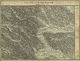
- Sulmeck-Greith and its surroundings in the record sheets of the state survey around 1879

Sulmeck-Greith is in the east of Pölfing-Brunn
The north of Dietmannsdorf near St. Martin

Gleinstätten is in the northeast

Oberhaag is the neighboring municipality to the east


Individual evidence
- ^ Styrian municipal structural reform .
- ↑ Section 3, Paragraph 2, Item 3 of the Act of December 17, 2013 on the reorganization of the municipalities of the State of Styria ( Styrian Municipal Reform Act - StGsrG). Provincial Law Gazette for Styria of April 2, 2014. No. 31, year 2014. ZDB -ID 705127-x . P. 2.
- ↑ recognition of the Constitutional Court of 24 November 2014 G 79/2014.
- ↑ Announcement of the Styrian state government of November 21, 2013 about the change of the border between the market town of Wies and the town of Sulmeck-Greith, both political district of Deutschlandsberg. Styrian Provincial Law Gazette of December 6, 2013. No. 155, 35th issue. ZDB ID 705127-x . Pp. 683-684.
- ↑ Werner Murgg, Bernhard Hebert: Medieval and early modern fortifications in the district of Deutschlandsberg: recording of the soil monuments. With drawings by Stefan Karl. Contributions to medieval archeology in Austria BMÖ. Volume 10, born in 1994. Ed .: Austrian Society for Medieval Archeology ÖGM, Vienna. ISSN 1011-0062 . Pp. 66-67. Coordinates of Kopreinigg Castle: 46 ° 42 ′ 56 ″ N , 15 ° 19 ′ 26 ″ E
- ^ Robert Baravalle: Castles and palaces of Styria. An encyclopaedic collection of the Styrian fortifications and properties, which were endowed with various privileges. Graz 1961, Stiasny publishing house. P. 73.
- ↑ Law of December 3, 1968 on territorial changes of municipalities , Provincial Law Gazette for Styria of December 27, 1968, Part 22, No. 164. P. 187.
- ↑ Announcement of May 16, 1951 , State Law Gazette for Styria of December 28, 1959, Issue 13, No. 37, p. 114.

Bad Schwanberg | Deutschlandsberg | Eibiswald | Frauental an der Laßnitz | Great Saint Florian | Lannach | Pölfing-Brunn | Preding | Sankt Josef (West Styria) | Sankt Martin im Sulmtal | Sankt Peter im Sulmtal | Sankt Stefan ob Stainz | Stainz | Wettmannstätten | Wies
93 Former communities (dissolved since 1945):
Aibl |
Aigen |
Bad Gams |
Blumegg |
Breitenbach in West Styria |
Dietmannsdorf im Sulmtal |
Ettendorf near Stainz |
Feisternitz |
Field tree |
Freidorf an der Laßnitz |
Open field near Deutschlandsberg |
Gamsgebirge |
Garanas |
Gasselsdorf |
Georgsberg |
Gersdorf |
Grafendorf near Stainz |
Graggerer |
Grass shoe |
Greisdorf |
Greith |
Gressenberg |
Großradl |
Grub near Groß Sankt Florian |
Grünau an der Laßnitz |
Gundersdorf |
Gussendorf |
Hasreith |
Herbersdorf |
Hollenegg |
Kleinradl |
Monastery |
Kornriegl |
Kothvogel |
Kraubath (West Styria) |
Krottendorf an der Laßnitz |
Kruckenberg |
Laaken |
Lasselsdorf |
Lebing |
Limberg near Wies |
Mainsdorf |
Marhof |
Mettersdorf |
Michlgleinz |
Nassau |
Neudorf near Stainz |
Neurath |
Niedergams |
Oberhart |
Upper Latin |
Oisnitz |
Osterwitz |
Otternitz |
Petzelsdorf in West Styria |
Pichling at Stainz |
Pirkhof |
Pitschgau |
Rassach |
Rossegg |
Rostock |
Red wine |
Sankt Oswald ob Eibiswald |
Sankt Ulrich in Greith |
Schönaich |
Sierling |
Soboth |
Stainztal |
Stable yard |
Stammeregg |
Sterglegg |
Sulmeck-Greith |
Sulz |
Sulz-Laufenegg |
Tanzelsdorf |
Teipl |
Tobis |
Tobisegg |
Trahütten |
Trough |
Unterbergla |
Vochera am Weinberg |
Vochera an der Laßnitz |
Front village |
Forest in West Styria |
Wernersdorf |
Wetzelsdorf in West Styria |
Wielfresen |
Wieselsdorf |
Torrent |
Wohlsdorf |
Zeierling |
Zirknitz