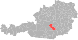
Judenburg district
| Former Judenburg district | |
|---|---|
 |
|
| Basic data | |
| Country | Austria |
| state | Styria |
| Capital | Judenburg |
| surface | 1,097.7 km² |
| Residents | 44,983 (December 31, 2011) |
| density | 41 inhabitants per km² |
| ISO 3166-2 | AT-6 |
Cars: JU
|
|
Coordinates: 47 ° 14 ' N , 14 ° 32' E
The former political district of Judenburg was in the northwest of Styria . On January 1st, 2011 the district had 44,983 inhabitants on 1097.67 km². The administrative seat was Judenburg . The license plate was JU.
history
From 1748 there had been a district of Judenburg , which included the entire Upper Murtal and Upper Ennstal with the Salzkammergut . In 1848 it was added to the Bruck district for the whole of Upper Styria .
The Judenburg district was separated from the Bruck district in the course of the separation of the political and judicial administration in 1868. It comprised the judicial districts of Knittelfeld , Obdach (dissolved June 1, 1923), Oberzeiring (dissolved October 1, 1976) and Judenburg .
The district of Knittelfeld was separated from the Judenburg district by ordinance of the Styrian state government of February 20, 1946. When the judicial district of Oberzeiring was dissolved in 1976, the political district of Judenburg corresponded to the judicial district of Judenburg.
As part of the Styrian municipal structural reform , the districts of Judenburg and Knittelfeld were merged again on January 1, 2012, only as the Murtal district , which is congruent with the Judenburg judicial district when the Knittelfeld judicial district is dissolved on July 1, 2013.
Administrative division
The Judenburg district was divided into 24 communities , including two towns and five market communities. The population as of January 1, 2011 is in brackets.
| local community | location | Pop. | surface | Ew / km² | Judicial district | region | Type |
|---|---|---|---|---|---|---|---|
Amering
|
 47 ° 3 ′ 0 ″ N , 14 ° 44 ′ 0 ″ E |
1056 | 48.73 km² | 22 inhabitants per km² | Judenburg | local community | |
Bretstein
|
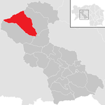 47 ° 20 ′ 0 ″ N , 14 ° 25 ′ 0 ″ E |
308 | 91.44 km² | 3.4 inhabitants per km² | Judenburg | local community | |
Eppenstein
|
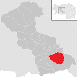 47 ° 7 ′ 51 ″ N , 14 ° 44 ′ 22 ″ E |
1248 | 57.59 km² | 22 inhabitants per km² | Judenburg | local community | |
Fohnsdorf
|
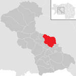 47 ° 12 ′ 30 " N , 14 ° 40 ′ 46" E |
8025 | 54.7 km² | 147 inhabitants per km² | Judenburg | local community | |
| Hohentauern |
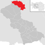 47 ° 26 ′ 3 ″ N , 14 ° 29 ′ 1 ″ E |
453 | 92.64 km² | 4.9 inhabitants per km² | Judenburg | local community | |
Judenburg
|
 47 ° 10 ′ 21 ″ N , 14 ° 39 ′ 37 ″ E |
9314 | 13.22 km² | 705 inhabitants per km² | Judenburg | Borough | |
Maria Buch-Feistritz
|
 47 ° 9 '15 " N , 14 ° 42' 26" E |
2302 | 28.5 km² | 81 inhabitants per km² | Judenburg | local community | |
shelter
|
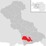 47 ° 4 ′ 0 ″ N , 14 ° 42 ′ 0 ″ E |
2138 | 42.8 km² | 50 inhabitants per km² | Judenburg | market community | |
Oberkurzheim
|
 47 ° 14 ′ 0 ″ N , 14 ° 35 ′ 0 ″ E |
700 | 29.16 km² | 24 inhabitants per km² | Judenburg | local community | |
Oberweg
|
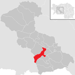 47 ° 9 ′ 0 ″ N , 14 ° 39 ′ 0 ″ E |
594 | 34.33 km² | 17 inhabitants per km² | Judenburg | local community | |
Oberzeiring
|
 47 ° 15 ′ 0 ″ N , 14 ° 29 ′ 0 ″ E |
852 | 38.22 km² | 22 inhabitants per km² | Judenburg | market community | |
Pöls
|
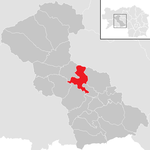 47 ° 13 ′ 10 " N , 14 ° 35 ′ 2" E |
2475 | 33.37 km² | 74 inhabitants per km² | Judenburg | market community | |
Pusterwald
|
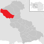 47 ° 18 ′ 31 ″ N , 14 ° 22 ′ 30 ″ E |
488 | 105.29 km² | 4.6 inhabitants per km² | Judenburg | local community | |
| Reifling |
 47 ° 9 ′ 0 ″ N , 14 ° 41 ′ 0 ″ E |
385 | 16.22 km² | 24 inhabitants per km² | Judenburg | local community | |
| Rice road |
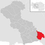 47 ° 8 ′ 5 " N , 14 ° 49 ′ 47" E |
177 | 62.27 km² | 2.8 inhabitants per km² | Judenburg | local community | |
Sankt Anna am Lavantegg
|
 47 ° 2 ′ 19 ″ N , 14 ° 41 ′ 19 ″ E |
432 | 47.14 km² | 9.2 inhabitants per km² | Judenburg | local community | |
Sankt Georgen ob Judenburg
|
 47 ° 12 ′ 23 " N , 14 ° 29 ′ 53" E |
885 | 44.33 km² | 20 inhabitants per km² | Judenburg | local community | |
Sankt Johann am Tauern
|
 47 ° 21 ′ 0 ″ N , 14 ° 28 ′ 0 ″ E |
492 | 84.51 km² | 5.8 inhabitants per km² | Judenburg | local community | |
Sankt Oswald-Möderbrugg
|
 47 ° 17 ′ 0 ″ N , 14 ° 29 ′ 0 ″ E |
1183 | 56.04 km² | 21 inhabitants per km² | Judenburg | local community | |
| Sankt Peter ob Judenburg |
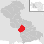 47 ° 11 ′ 0 ″ N , 14 ° 35 ′ 0 ″ E |
1115 | 50.28 km² | 22 inhabitants per km² | Judenburg | local community | |
Sankt Wolfgang-Kienberg
|
 47 ° 6 ′ 1 " N , 14 ° 38 ′ 53" E |
375 | 20.44 km² | 18 inhabitants per km² | Judenburg | local community | |
Unzmarkt-Frauenburg
|
 47 ° 12 ′ 1 ″ N , 14 ° 26 ′ 44 ″ E |
1381 | 36.45 km² | 38 inhabitants per km² | Judenburg | market community | |
Weißkirchen in Styria
|
 47 ° 9 ′ 14 " N , 14 ° 44 ′ 19" E |
1294 | 1.27 km² | 1,019 inhabitants per km² | Judenburg | market community | |
Zeltweg
|
 47 ° 11 ′ 26 " N , 14 ° 45 ′ 4" E |
7311 | 8.7 km² | 840 inhabitants per km² | Judenburg | Borough |
literature
- Walter Brunner (ed.): History and topography of the Judenburg district . 2 volumes, = Great Historical Regional Studies of Styria 4, Graz 2008
Individual evidence
- ↑ Law of May 19, 1868 on the establishment of political administrative authorities in the kingdoms ... Reichs-Gesetz-Blatt für das Kaiserthum Oesterreich. Born in 1868, XVII. Piece, No. 44.
- ^ Ordinance of July 10, 1868. Reichs-Gesetz-Blatt für das Kaiserthum Oesterreich. Born in 1868, XLI. Piece, No. 101.
- ↑ Ordinance of the Federal Government of March 29, 1923, regarding the abandoning of district courts. Federal Law Gazette for the Republic of Austria, 1923, Issue 42, No. 187.
- ↑ Federal Law Gazette No. 353/1976 .
- ^ Ordinance of the Styrian provincial government of February 20 regarding the establishment of a district administration in Knittelfeld. Provincial Law Gazette for the State of Styria: Item 1, No. 3.
- ↑ Ordinance of the Styrian Provincial Government of October 20, 2011 on Sprengel, designation and seat of the district authorities in Styria. LGBl. No. 103/2011 item 36 (pdf).
- ↑ Statistics Austria - Population at the beginning of the year and quarter


