
Sankt Peter ob Judenburg
|
Sankt Peter ob Judenburg
|
||
|---|---|---|
| coat of arms | Austria map | |
 |
|
|
| Basic data | ||
| Country: | Austria | |
| State : | Styria | |
| Political District : | Murtal | |
| License plate : | MT (from July 1, 2012; old: JU) | |
| Surface: | 50.28 km² | |
| Coordinates : | 47 ° 11 ' N , 14 ° 35' E | |
| Height : | 750 m above sea level A. | |
| Residents : | 1,078 (January 1, 2020) | |
| Population density : | 21 inhabitants per km² | |
| Postal code : | 8755 | |
| Area code : | 03579, 03572 | |
| Community code : | 6 20 32 | |
| NUTS region | AT226 | |
| Address of the municipal administration: |
Hauptstrasse 17 8755 Sankt Peter ob Judenburg |
|
| Website: | ||
| politics | ||
| Mayor : | Wolfgang Rosenkranz ( ÖVP ) | |
|
Municipal Council : ( 2020 ) (15 members) |
||
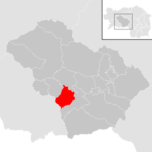
| Location of Sankt Peter ob Judenburg in the Murtal district | ||
  |
||
 View from Falkenberg to St. Peter ob Judenburg |
||
| Source: Municipal data from Statistics Austria | ||

Sankt Peter ob Judenburg is a municipality with 1078 inhabitants (as of January 1, 2020) in the Austrian state of Styria .
geography


Sankt Peter is located approx. 5 km west of the district capital Judenburg im Murtal on the northernmost foothills of the Seetal Alps , at the foot of the Zirbitz massif or on the right (southern) bank of the Mur, the highest point in the community is the Erslstand at 2124 m .
Community structure
The community consists of the four cadastral communities : St. Peter, Rothenthurm, Feistritzgraben, Möschitzgraben.
There are the following localities (population in brackets as of January 1, 2020):
- Feistritzgraben (81)
- Furth (77)
- Mitterdorf (32)
- Möschitzgraben (67)
- Pichl (30)
- Rach (13)
- Rothenthurm (402)
- Sankt Peter ob Judenburg (376)
Neighboring communities
| Pöls-Oberkurzheim | ||
| Sankt Georgen ob Judenburg |
.svg)
|
Judenburg |
| Scheifling | Judenburg |
history
The political community Sankt Peter ob Judenburg was established in 1849/50 and originally only comprised the area of the cadastral community Sankt Peter. After the eastern part (the western part - Schütt - came to what was then Wöll) to St. Peter in 1951 after the dissolution of the municipality of Pichl, the union of the municipalities of Feistritzgraben, Möschitzgraben, Rothenthurm and Sankt Peter ob Judenburg was created on January 1st, 1970 today's municipality of Sankt Peter ob Judenburg.
A community association (3G) was founded with the two neighboring communities of St. Georgen ob Judenburg and Unzmarkt-Frauenburg.
In 2018, the three municipalities also founded a tourism association called Urtal .
Culture and sights
- In the parish church of St. Peter ob Judenburg there is a fisherman's pulpit built by the Judenburg sculptor Johann Nischlwitzer in 1774. During the renovation of the interior of the church in the early 1990s, ceiling frescoes of the twelve apostles were exposed.
- Museum Furth-Schmiede: The former blacksmith's and equipment shop in the Furth district was renovated on the initiative of an association and is open to the public as a museum.
- AuErlebnisWeg Schau die Au: In 2004 the “Schau die Au” educational trail was opened in St. Peterer Au near Furth. At 5 stations, the visitor is brought closer to the fluvial world. Length (there and back): 4 km.
Economy and Infrastructure
Established businesses

Many employed people commute to the neighboring communities, the 145 jobs available in St. Peter are structured (according to the 2001 census) as the graphic shows.
In addition to the growing craft businesses in the districts of St. Peter, Rothenthurm and Furth, an industrial area was opened up around 2000 in the east of Rothenthurm on Triesterstraße. In 2011, the 3G communities of St. Peter ob Judenburg, St. Georgen ob Judenburg and Unzmarkt-Frauenburg built the 3G industrial park east of the Furth district.
traffic
- Street: Sankt Peter is located on the busy B317 Friesacher Strasse, which is part of the shortest route from Vienna to Italy. The volume of traffic is correspondingly high. In addition, the B114 Triebener Straße branches off from the B317 in the municipality, the easternmost crossing over the Niedere Tauern .
politics
The municipal council has 15 members.
- With the municipal council elections in Styria in 2000, the municipal council had the following distribution: 10 ÖVP and 5 SPÖ.
- With the municipal elections in Styria in 2005 , the municipal council had the following distribution: 10 ÖVP, 4 SPÖ and 1 FPÖ.
- With the municipal elections in Styria in 2010 , the municipal council had the following distribution: 9 ÖVP, 5 SPÖ and 1 FPÖ.
- With the municipal elections in Styria in 2015 , the municipal council had the following distribution: 8 ÖVP, 4 SPÖ and 3 FPÖ.
- With the municipal council elections in Styria 2020 , the municipal council has the following distribution: 9 ÖVP, 4 SPÖ and 2 FPÖ.
mayor
- since 1998 Wolfgang Rosenkranz (ÖVP)
Personalities
- Honorary citizen of the community
- 1985 Franz Sattler (councilor)
- 1988 Josef Riegler (* 1938) (Federal Minister for Agriculture and Forestry)
- 1989 Josef Gascha (Mayor of St. Peter ob Judenburg 1970–1975)
- 1999 Walter Frewein (Mayor of St. Peter ob Judenburg 1985–1998)
- People related to the community
- Alf Poier (* 1967) cabaret artist
- Gerfried Stocker, Head of Ars Electronica
- Willibald Cernko (* 1956) bank manager
- Martin Gutl (1942 - 1994) Pastor of St. Peter ob Judenburg 1981-1984
literature
- Johann Andritsch: St. Peter ob Judenburg with Rothenthurm, Feistritzgraben, Möschitzgraben, Pichl. History of a community. St. Peter ob Judenburg 1993
Web links
- 62032 - Sankt Peter ob Judenburg. Community data, Statistics Austria .
Individual evidence
- ↑ Statistics Austria: Population on January 1st, 2020 by locality (area status on January 1st, 2020) , ( CSV )
- ↑ General State Law and Government Gazette for the Crown Land of Styria, Issue 21, October 7, 1850, No. 378.
- ↑ Statistics Austria: dissolutions or associations of municipalities from 1945
- ^ Result of the 2005 municipal council elections in Sankt Peter ob Judenburg, Judenburg district. State of Styria, March 13, 2005, accessed on July 20, 2020 .
- ^ Election result of the municipal council election 2010 in Sankt Peter ob Judenburg, Judenburg district. State of Styria, March 21, 2010, accessed on July 20, 2020 .
- ^ Election result of the 2015 municipal council elections in Sankt Peter ob Judenburg. State of Styria, March 22, 2015, accessed on July 20, 2020 .
- ↑ Results of the municipal council election 2020 in Sankt Peter ob Judenburg. State of Styria, June 28, 2020, accessed on July 20, 2020 .
.svg)
Fohnsdorf | Gaal | Hohentauern | Judenburg | Knittelfeld | Kobenz | Lobmingtal | Shelter | Pöls-Oberkurzheim | Pölstal | Pusterwald | Sankt Georgen ob Judenburg | Sankt Marein-Feistritz | Sankt Margarethen bei Knittelfeld | Sankt Peter ob Judenburg | Seckau | Spielberg | Unzmarkt-Frauenburg | Weißkirchen in Styria | Zeltweg
Former parishes (dissolved since 1945):
Former Judenburg district :
Allersdorf near Judenburg |
Amering |
Bretstein |
Eppenstein |
Feistritz near Weißkirchen |
Feistritzgraben |
Fisching |
Flat chess |
Frauenburg |
Granitzen |
Grand lobbying |
Buddy |
Kienberg |
Kleinlobming |
Maria book |
Maria Buch-Feistritz |
Möschitzgraben |
Murdorf |
Obdachegg |
Oberkurzheim |
Oberweg |
Oberzeiring |
Pichl |
Pichlhofen |
Pöls |
Prethal |
Reifling |
Rice road |
Rothenthurm |
Sankt Anna am Lavantegg |
Sankt Johann am Tauern |
Sankt Oswald-Möderbrugg |
Sankt Wolfgang-Kienberg |
Discs |
Schoberegg |
Schwarzenbach am Großering |
Unzmarkt |
Waltersdorf near Judenburg |
Wöll
husband Knittelfeld district :
Apfelberg |
Dürnberg |
Feistritz near Knittelfeld |
Mitterlobming |
Rachau |
Sankt Lorenzen bei Knittelfeld |
Sankt Marein near Knittelfeld