
Zirbitzkogel
| Zirbitzkogel | ||
|---|---|---|
 Zirbitzkogel with Zirbitzkogelhaus |
||
| height | 2396 m above sea level A. | |
| location | Styria , Austria | |
| Mountains | Seetal Alps | |
| Dominance | 33.2 km → Seckauer Zinken ( Seckauer Tauern ) | |
| Notch height | 1502 m ↓ Neumarkter Sattel | |
| Coordinates | 47 ° 3 '0 " N , 14 ° 34' 0" E | |
|
||
| rock | Gneiss , mica slate | |
| Normal way | Hike | |

The Zirbitzkogel is 2396 m above sea level. A. the highest point in the Seetal Alps . It is located south of the upper Mur Valley in Styria near the border with Carinthia . The Lavant , a left tributary of the Drava, rises on its southern slope .
Its name is not derived, as is often assumed, from the stone pine trees that are part of the area , but from the Croatian čьrvenica, which can be translated as "red area" and refers to the common rust-leaved alpine rose ( Rhododendron ferrugineum ). This rhododendron plant is known locally as alpine rose , possibly an indication of the plant's toxicity.
The Zirbitzkogel is built from crystalline rock; Slate , gneiss and granite predominate. Despite its comparatively low altitude, it has a distinctive high mountain character. Its relief was formed by ice age glaciers and later slope movements. In the very spring-rich area there are some cirque lakes , such as the two Winterleitensee lakes.
Closed spruce forests, which are replaced by loosened spruce, larch and stone pine stands ( Swiss stone pine -larch forest) extend into the subalpine zone . In the summit area, a wide-area, interspersed by almost flat plateaus predominates Krumm harrows lawn . The summit area was known to ornithologists as the breeding habitat of the Mornell's ringed plover , which until 1995 brooded in a few pairs almost every year. After that no more broods were found, but individual migrants and resting individuals were observed. Gemsheide and various lichens predominate in places more exposed to the wind .
The area is known to butterflies for some very rare species, including the endemic Elophos zirbitzensis .
The Zirbitzkogel, which is well developed for tourism, is a very popular hiking and tour-going area. The Zirbitzkogelhaus is located on its summit, and there are other huts along the ascent routes. Starting points for an ascent of the Zirbitzkogel are St. Anna or St. Wolfgang bei Obdach on the north route and Neumarkt on the south route.
The Zirbitzkogel area was included in the list of Natura 2000 regions and has been a European protected area since May 2006 .
Huts
- Winterleitenhütte (1,782 m) northeast of the Zirbitzkogel, in the middle of the Seetaleralpe military training area.
- Alpengasthof Sabathy (1,620 m), at the eastern foot of the Zirbitzkogel
- Zirbitzkogelhaus (2,376 m), directly below the summit of the Zirbitzkogel
- Waldheimhütte (1,614 m), halfway between Obdach and the Zirbitzkogel
- Tonnerhütte (1,600 m), halfway between Mühlen (Ort) and Zirbitzkogel
photos


upper Lindersee

Zirbitzkogel from the west

Wildsee

Summit cross in winter
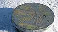
Panorama board at the Zirbitzkogel summit


Web links
Individual evidence
- ↑ Mountain names. Retrieved August 24, 2017 .