Rabnitzbach
| Rabnitzbach | ||
|
Rabnitzbach near Kumberg |
||
| Data | ||
| location | Styria , Austria | |
| River system | Danube | |
| Drain over | Raab → Moson-Danube → Danube → Black Sea | |
| source | Rabnitzberg northeast of the Schöckl | |
| Source height | approx. 1000 m above sea level A. | |
| muzzle | near Gleisdorf in the Raab coordinates: 47 ° 5 '48 " N , 15 ° 42' 3" E 47 ° 5 '48 " N , 15 ° 42' 3" E |
|
| Mouth height | 344 m above sea level A. | |
| Height difference | approx. 656 m | |
| Bottom slope | approx. 26 ‰ | |
| length | 25.6 km | |
| Catchment area | 130.8 km² | |
| Small towns | Gleisdorf | |
| Communities | Kumberg , Eggersdorf near Graz , Ludersdorf-Wilfersdorf | |
|
Rabnitz near Wilfersdorf |
||
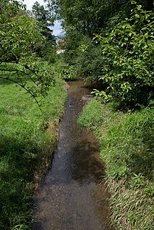
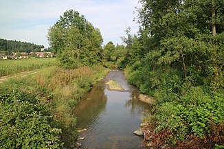
The Rabnitzbach (the Rabnitz ) is a source river of the Raab . It rises near the Schöckl and flows from the north in a south-easterly direction and flows into the Raab near Gleisdorf . It reaches a length of approx. 25.6 km.
Water quality
The brook is almost natural and therefore has the water quality class I. It is rich in fish and one of the cleanest waters in Styria .
hazards
The seemingly harmless brook can very quickly become a flood hazard and has been a threat several times. This could be reduced through torrent control in endangered places without damaging the nature significantly.
The last time that floods occurred was in August 2008 in the municipal area of Ludersdorf-Wilfersdorf, where residential areas and a commercial area were flooded.
|
Tributaries and hydraulic structures
|
|||||||||||||||||||||||||||||||||||||||||||||||||||||||||||||||||||||||||||||||||||||||||||||||||||||||||||||||||||||||||||||||||||||||||||||||||||||||||||||||
Individual evidence
- ↑ Extract from the digital Styrian body of water index. State of Styria , accessed February 1, 2017 .
- ↑ BMLFUW (ed.) : List of areas of the river areas: Leitha, Rabnitz and Raab areas. In: Contributions to Austria's hydrography, No. 63, Vienna 2014, p. 7/69. PDF download , accessed July 6, 2018.

