Listsee
| Listsee | ||
|---|---|---|

|
||
| Geographical location | Bavaria , Germany | |
| Tributaries | underground | |
| Drain | Hammerbach → Hoswaschbach → Saalach → Salzach → Inn → Danube | |
| Location close to the shore | Bad Reichenhall | |
| Data | ||
| Coordinates | 47 ° 44 '9.3 " N , 12 ° 50' 4" E | |
|
|
||
| Altitude above sea level | 640 m | |
| surface | 0.4 ha | |
| length | 116 m | |
| width | 47 m | |
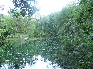
The Listsee (formerly the “Untitled Lake”) is a small lake above Bad Reichenhall in the Berchtesgadener Land district . It belongs to the Karlstein district of the city of Bad Reichenhall.
description
The lake lies at about 640 m and is about 0.4 hectare in size and is only fed underground. Its course is the Hammerbach which flows into the Hoswaschbach (also Hosewaschbach) in the district of Nonn . It usually has a deep green color.
legend
According to a legend, giants are said to have danced a round dance all night long on the previous forest meadow, which caused them to stamp the forest floor so that a large hole in the ground formed. This filled with water and thus formed the Listsee.
Water supply
In the area of the Listsee there are many springs that supply the city of Bad Reichenhall with water. There was also a high reservoir built in 1899 right by the lake.
Individual evidence
- ^ Wilhelm Zils: Historical visit in Nonn. in: Erna Pranz: Heimatblätter Bad Reichenhall . 1980, Mitterfelden Verlag, p. 140.
- ↑ http://www.untersberg.org/html/listsee.html
- ^ Anton Körner: Reichenhall's century 1800-1900 . in: Erna Pranz: Heimatblätter Bad Reichenhall . 1980, Mitterfelden Verlag, p. 100.
