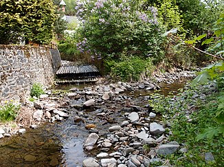
Lonau (Sieber)
| Lonau | ||
|
Confluence of the Kleiner Lonau (left) and Großer Lonau (right) |
||
| Data | ||
| Water code | DE : 4882684 | |
| location | north of Herzberg am Harz in the district of Göttingen in Lower Saxony | |
| River system | Weser | |
| Drain over | Sieber → Oder → Rhume → Leine → Aller → Weser | |
| source | from Großer and Kleiner Lonau in Lonau 51 ° 41 ′ 24 ″ N , 10 ° 21 ′ 33 ″ E |
|
| Source height | 339 m | |
| muzzle | in the north of Herzberg am Harz in the Sieber coordinates: 51 ° 39 '43 " N , 10 ° 20' 50" E 51 ° 39 '43 " N , 10 ° 20' 50" E |
|
| Mouth height | 243 m | |
| Height difference | 96 m | |
| Bottom slope | 27 ‰ | |
| length | 3.5 km (from Lonau ) (with Großer Lonau 9.5 km)
|
|
| Catchment area | approx. 14 km² | |
| Small towns | Herzberg am Harz | |
The Lonau is a 3.5 km long tributary of the Sieber in Lower Saxony .
course
It is created in Lonau by the confluence of the Great Lonau and the Little Lonau . Then it flows in a southerly (meanwhile in a south-southwestern) direction through the Lonau valley to Herzberg am Harz , where it flows into the Sieber after the Lonau waterfall .
On some maps, the Lonau (between the town of Lonau and Herzberg) is referred to as the Great Lonau . However, this contradicts the general usage of the local population, according to which the Kleine Lonau and the Große Lonau are the two source rivers of the Lonau .
swell
- Topographic map 1: 25000, No. 4228 Riefensbeek
- Topographic map 1: 25000, No. 4328 Bad Lauterberg in the Harz Mountains


