Loosduinen
 flag |
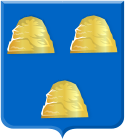
 coat of arms |
| province |
|
| local community |
|
| Residents | 47,123 (Jan. 1, 2017) |
| Coordinates | 52 ° 3 ' N , 4 ° 13' E |
| Important traffic route |
|
| prefix | 070 |
| Postcodes | 2544-2545, 2547, 2551-2553 |
| Location of the Loosduinen district in The Hague | |
Loosduinen is a district of The Hague with around 47,000 inhabitants.
history
The first mention of the place comes from the year 1186, when the later count Dietrich VII. (Dirk VII.) Of Holland married Aleida von Kleve in a "Villa Losdun". In the first half of the 13th century , the Counts of Holland had a monastery built here, which was closed in 1574. The former monastery church became the Evangelical Abdijkerk . After 1276, Loosduinen became a place of pilgrimage, as Countess Margarete von Henneberg is said to have given birth to 364 or 365 children that year during the “Miracle of Loosduinen” .
Loosduinen was an independent municipality from 1811 to 1923, after which it belongs to The Hague.
The name of the place comes from the fact that the original village was located in a dune area that was silted up inland - the dunes no longer played a role in protecting against the North Sea and were therefore "loze duine" (German false dunes ).
Personalities
- Mathilde von Brabant, († December 21, 1267 ), daughter of Duke Henry I of Brabant and wife of Count Florens IV of Holland , was buried in Loosduinen
- Vincent van Gogh painted the picture "Farmhouses in Loosduinen" in 1883
- Piet Moeskops (1893–1964), racing cyclist
- Mien van Bree (1915–1983), racing cyclist
literature
- Willem Eicke den Hertog: De Abdij van Loosduinen . The Hague 1997.
Web links
- Loosduinen on the official website of the municipality of The Hague (Dutch)
- Website Loosduins Museum De Korenschuur (Dutch)
Individual evidence
