
Mühlhausen near Schwenningen
|
Mühlhausen near Schwenningen
City of Villingen-Schwenningen
|
|
|---|---|
 |
|
| Height : | 660–770 m above sea level NN |
| Area : | 4.75 km² |
| Residents : | 765 (December 31, 2011) |
| Population density : | 161 inhabitants / km² |
| Incorporation : | January 1, 1970 |
| Incorporated into: | Schwenningen am Neckar |
| Postal code : | 78056 |
| Area code : | 07720 |
-6309-Pano.jpg) View from the Mühlhauser Halde
|
|
After neighboring Weigheim, Mühlhausen is the second easternmost district of Villingen-Schwenningen . The place has 765 inhabitants (as of 2011) on an area of 4.75 km² . Mühlhausen is about two kilometers from Schwenningen, five kilometers from Tuningen and two kilometers from Weigheim.
District and geographical location
Mühlhausen is located on the western part of the Baar plateau. The area is 475 hectares, of which 311 hectares are used as a landscape and 112 hectares are woodland. The “Halde” and “Teufelsloch” of the district have been under nature protection since 1995 and are a popular hiking destination.
history
Mühlhausen was founded around the 7th century. The village was first mentioned in 1179, specifically the church located there. Goods were held by different monasteries. In 1803 Mühlhausen and the city of Rottweil became part of Württemberg . After the Kingdom of Württemberg was founded , Mühlhausen went to the Tuttlingen District Office in 1810 . During the administrative reform during the Nazi era in Württemberg , the municipality was u. a. with Weigheim assigned to the Rottweil district . In 1945 Mühlhausen became part of the French zone of occupation and thus came to the newly founded state of Württemberg-Hohenzollern , which was incorporated into the state of Baden-Württemberg in 1952. The village of Mühlhausen is characterized by handicrafts and trades. On January 1, 1970, it was incorporated as a district after Schwenningen. On January 1, 1972, it then became a district in the merged district town of Villingen-Schwenningen. Land consolidation was started in 1978 and completed in 1998.
Infrastructure
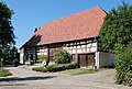
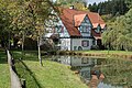
The infrastructure has essentially not changed since the 1970s. Mühlhausen has the church of St. Georg. In the village there are also some renovated traditional buildings around the village square: the gin house with herb garden, musts , mill and bakery . Mühlhausen also has a kindergarten. There is also a farming museum. Every Friday there is also a farmers' market nearby. There are bus connections to Weigheim or Trossingen, Tuningen and the district towns of Villingen and Schwenningen.
useful information
Mühlhausen took part in the state competition "Our village should be more beautiful" since 1980. After a bronze and silver award, the place received a gold medal on 1989 in this context.
societies
In Mühlhausen there is a sports club, a tennis club (in partnership with Weigheim), the Freundeskreis Dorf Mühlhausen eV and the heap guild.
Population development
- 1950: 435 inhabitants
- 1970: 670 inhabitants
- 1981: 653 inhabitants
- 1984: 676 inhabitants
- 1993: 740 inhabitants
- 1996: 755 inhabitants
- 1999: 807 inhabitants
- 2000: 812 inhabitants
- 2003: 845 inhabitants
- 2004: 831 inhabitants
- 2005: 754 inhabitants
- 2011: 765 inhabitants
gallery

Halde nature reserve

Halde nature reserve, little orchid

Devil's hole
Land consolidation 1998 - Kohlbrunnen
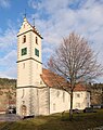
St. George Church
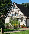
Göpelhaus

Göpelhausplatz

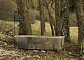
Fountain at Göpelhausplatz
Farm Museum

Old rectory
Mill
-9886.jpg)


Web links

Herzogenweiler | Marbach | Mulhouse | Obereschach | Pfaffenweiler | Rietheim | Schwenningen | Tannheim | Villingen | Weigheim | Weilersbach