Mej
| Mej | ||
|
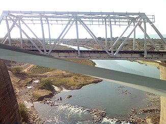
Railway bridge over the Mej |
||
| Data | ||
| location | Rajasthan ( India ) | |
| River system | Ganges | |
| Drain over | Chambal → Yamuna → Ganges → Indian Ocean | |
| Headwaters | in Tehsil Mandalgarh 25 ° 7 ′ 31 ″ N , 75 ° 23 ′ 9 ″ E |
|
| Source height | approx. 500 m | |
| muzzle |
Chambal coordinates: 25 ° 40 ′ 31 " N , 76 ° 17 ′ 33" E 25 ° 40 ′ 31 " N , 76 ° 17 ′ 33" E |
|
| Mouth height | approx. 200 m | |
| Height difference | approx. 300 m | |
| Bottom slope | approx. 1.8 ‰ | |
| length | approx. 170 km | |
| Catchment area | 5860 km² | |
The Mej (also Mez ) is a left tributary of the Chambal in the north of the Indian state of Rajasthan .
The Mej rises in the eastern part of Tehsils Mandalgarh in the Bhilwara district - 45 km west of the city of Kota - at an altitude of 500 m . It flows in a north-easterly direction through the Bundi district , where it has numerous meanders . After about 170 km it finally flows into the Chambal on the left. The Mej drains an area of 5860 km², which extends over parts of the districts of Bhilwara, Bundi and Tonk .
Web links
Commons : Mej - collection of images, videos and audio files
