Macun Lakes
| Macun Lakes National Park exclave | ||
|---|---|---|
| The Macun Lakes viewed from above in September, looking towards Lavin. | ||
|
|
||
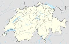
| Location: | Graubünden , Switzerland | |
| Next city: | Lavin | |
| Surface: | 3.6 km² | |
| Founding: | August 2000 | |
The Macun Lakes ( Rhaeto-Romanic in the idiom Vallader ) form a nature reserve in the municipality of Zernez in the Lower Engadine and have been part of the Swiss National Park since August 2000 . The lake plateau is 2600 m above sea level. M. and consists of 23 cirque lakes , of which the Lai Grond ( , dt. Big Lake ) with approximately 1.5 hectares is the largest lake. With a depth of 8.5 m, the Lai Grond is also the deepest lake.
location
The lake plateau is 2600 m above sea level. M. and belonged to the political community Lavin , which was incorporated into Zernez in 2015. The plateau is surrounded by Piz d'Arpiglias ( 3027 m above sea level ), Piz Sursassa ( 2968 m above sea level ) and a dozen other nameless peaks with heights of 3000 m above sea level. M. The eponymous Piz Macun ( 2889 m above sea level. M. , dt. Capricorn top ) is about 500 m from the parking area removed.
The lake plateau drains, partly underground, into the Aua da Zeznina ( Zezina brook ), which flows into the Inn between Lavin and Guarda .
As part of the Swiss National Park, the Macun Lake District is an exclave : it is separated from the rest of the park area by the Val Laschadura .
Hiking routes
The Macun Lake District is accessible from Zernez via the Munt Baselgia (German church hill ) (transition to 2945 m above sea level ). The terrain is steep. The route from Lavin follows the Val Zeznina (Alp Val Zeznina Dadaint ). Both routes are generally classified with a difficulty level of T3 .
Most hikers ascend from Zernez and then descend to Lavin, only rarely the other way around. According to the monitoring of the Swiss National Park, there are around 10 to 15 people a day in summer.
Apart from the marked hiking trails, the area of the Macun Lakes is not open to tourists. There are no places to eat or stay overnight. As everywhere in the national park, the route command applies. The only rest area is at the Lai d'Immez .
fauna
Ibex , chamois and alpine marmots can often be seen. Ptarmigan breed in the area.
Fish live in seven, mainly larger, lakes, but only a few species: American char , minnow , brown trout . The fishing operations were carried out by men in part within the Alpsee management as of the end of the 19th century, but strengthened until around 1970. In addition, live in the lakes midge larvae and worms, as well, but only in Lai Grond , pisidium . Snails and dragonflies are not seen at the Macun Lakes.
flora
In contrast to the surrounding Lower Engadine Dolomites , the subsoil of the Macun Lake District consists of crystalline rock ( silicate , gneiss ). Accordingly, a different flora appears than in the surrounding areas. The pygmy buttercup has its only location here in Switzerland.
As everywhere in the Swiss National Park, plants are fully protected.
Say
A legend from the 16th century tells of a dragon who lived in Lai Grond and dragged grazing cattle into the lake. Another legend tells of dwarfs who lived in a cave near Lai Grond and forged stars from golden leaves in winter.
These and other legends were written down in 1953 by Maria Ritz under the title L'istorgia da Janaiverin in Vallader .
Surname
The ibex, which can be easily observed in the area, gave the lake plateau and Piz Macun its name: macun is an old Rhaeto-Romanic word for ibex . Today, however, the word capricorn or, depending on the Rhaeto-Romanic idiom , the Germanism stambuc ( Sutsilvan ) or stambuoch (Vallader and Putèr ) is used for the animal .
Web links
- Macun lakes on schweizersee.ch
Individual evidence
- ↑ http://www.nationalpark.ch/tasks/sites/de/assets/File/Macun_2010.pdf
- ↑ Long-term water monitoring by the HYDRA Institute, since 2002.
- ↑ Janine Rüegg (2003). Macun Monitoring Manual.
- ↑ http://janaiverin.ch
- ↑ Kornelia Stinn: The legendary lake district of Macun. In: nzz.ch. May 6, 2010, accessed October 14, 2018 .
- ↑ [1] , accessed on July 21, 2012.
- ↑ [2] , accessed on July 21, 2012.

