Magalang
| Municipality of Magalang | ||
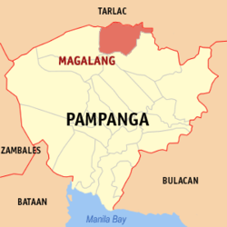
| Location of Magalang in the Pampanga Province | ||
|---|---|---|

|
||
| Basic data | ||
| Region : | Central Luzon | |
| Province : | Pampanga | |
| Barangays : | 27 | |
| District: | 1. District of Pampanga | |
| PSGC : | 035411000 | |
| Income class : | 2nd income bracket | |
| Households : | 15,257 May 1, 2000 census
|
|
| Population : | 113.147 August 1, 2015 census
|
|
| Coordinates : | 15 ° 13 ′ N , 120 ° 40 ′ E | |
| Postal code : | 2011 | |
| Mayor : | Lyndon A. Cunanan | |
| Geographical location in the Philippines | ||
|
|
||
Magalang is a municipality in the Pampanga Province of the Philippines . It has 113,147 inhabitants (August 1, 2015 census).
Barangays
Magalang is politically divided into 27 barangays .
|
|
traffic
Magalang can be reached from Manila and Angeles City via Mabalacat on the North Luzon Expressway and - also via Mabalacat - connected to the provinces further north via the Philippine trunk road network. There is also the Woodland Airpark, an airfield for ultralight and model aircraft. Sightseeing flights to the nearby Mt. Arayat offered. Pilot training including exam for microlight aircraft as well. With the Diosdado Macapagal International Airport - formerly "Clark Airbase" or "Clark" for short, ( IATA code CRK, ICAO code RPLC) in Mabalacat there is an international airport in the immediate vicinity to the west of the city.


