Mandakini
| Mandakini | ||
|
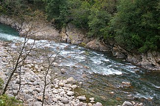
Mandakini near Guptakashi |
||
| Data | ||
| location | Uttarakhand ( India ) | |
| River system | Ganges | |
| Drain over | Alaknanda → Ganges → Indian Ocean | |
| origin |
Chorabarigletscher 30 ° 44 '45 " N , 79 ° 3' 50" O |
|
| Source height | 3865 m | |
| muzzle |
Alaknanda near Rudraprayag Coordinates: 30 ° 17 ′ 15 ″ N , 78 ° 58 ′ 40 ″ E 30 ° 17 ′ 15 ″ N , 78 ° 58 ′ 40 ″ E |
|
| Mouth height | approx. 600 m | |
| Height difference | approx. 3265 m | |
| Bottom slope | approx. 47 ‰ | |
| length | approx. 70 km | |
| Left tributaries | Kaliganga, Madhyamaneshwar | |
| Small towns | Rudraprayag | |
| Communities | Kedarnath , Gaurikund | |
|
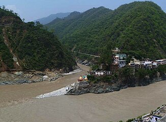
Mouth of the Mandakini into the Alaknanda |
||
The Mandakini ( Hindi : मंदाकिनी ) is a right tributary of the Alaknanda , the left source river of the Ganges , in the Himalayas in the Indian state of Uttarakhand .
The headwaters of the Mandakini are located on the southern flank of Mount Kedarnath in the south of the Gangotri group in the Garhwal Himalayas at an altitude of 3865 m . The river is fed by the Khorabari Glacier. The Hindu pilgrimage site of Kedarnath is located near the source . The Mandakini flows mainly in a southerly direction through the district of Rudraprayag and finally flows into the Alaknanda at the district capital of Rudraprayag . The Mandakini has a length of approx. 70 km.
Web links
Commons : Mandakini - collection of images, videos and audio files

