Mataviejas (river)
|
Río Mataviejas Río Ura |
||
|
Río Mataviejas in the Ura Gorge |
||
| Data | ||
| location | Burgos Province , (Spain) | |
| River system | Duero | |
| Drain over | Arlanza → Duero → Atlantic | |
| source | north of the municipality of Carazo 41 ° 58 ′ 48 ″ N , 3 ° 21 ′ 6 ″ W |
|
| Source height | approx. 1150 msnm | |
| muzzle | south of Puentedura in the Río Arlanza Coordinates: 42 ° 2 ′ 6 " N , 3 ° 35 ′ 7" W 42 ° 2 ′ 6 " N , 3 ° 35 ′ 7" W |
|
| Mouth height | approx. 855 msnm | |
| Height difference | approx. 295 m | |
| Bottom slope | approx. 9.8 ‰ | |
| length | approx. 30 km | |

The Río Mataviejas (also Río Ura ) is an approximately 30 km long tributary of the Río Arlanza in the northern Spanish province of Burgos in the autonomous region of Castile-León .
geography
The Río Mataviejas rises in the south of the Sierra de la Demanda about 2 km north of the municipality (municipio) Carazo . It flows first a short distance in a southerly direction, then - apart from a few loops - in a northwesterly direction and flows into the Río Arlanza about 1 km south of the municipality of Puentedura , which in turn is a tributary of the Duero via the Río Arlanzón .
Tributaries
The Río Mateviejas has no major tributaries apart from a few streams (arroyos) .
places
Attractions
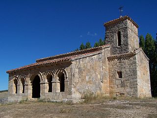
There are few places of interest on the banks of the Río Mataviejas - the most important is the Romanesque cloister of the Santo Domingo de Silos monastery from the 11th / 12th. Century. The hermit church (ermita) Santa Cecilia, possibly from the Mozarabic period (10th century), is located about 1200 m south of the town of Santibáñez del Val , but only about 100 m from the river; it received a south porch (portico) in the 12th century . Scenic attractions are the Yecla and Ura gorges; both are suitable for hiking.
