Medemand
| Medemand | ||
|---|---|---|
| Location of the sandbank in the mouth of the Elbe | ||
| Waters | Elbe (mouth of the Elbe) | |
| Water depth | 0.5 m | |
| Geographical location | 53 ° 54 '0 " N , 8 ° 48' 0" E | |
|
|
||
| length | 200 m | |
| width | 50 m | |
| surface | 10 ha | |
| The Medemsand seen from Cuxhaven | ||
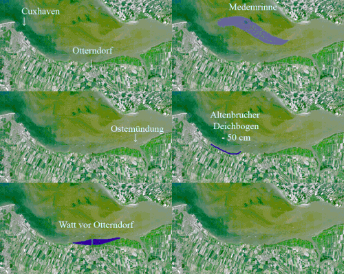
The Medemsand Island was a small island in the Elbe estuary on the Schleswig-Holstein coast across from Otterndorf ( Lower Saxony ), where the Medem River flows into the Elbe. The locals in the area around Cuxhaven also called it "Flak Island". The island belonged to the district of Dithmarschen and was administered by the Brunsbüttel water management office . It was removed by flushing the Medem channel and no longer exists today.
history
As early as 900 the island was annexed by Hamburg under the name Me-Sand , but later, when a large part of the coast came under Danish rule, Schleswig-Holstein was incorporated.
Anti-aircraft battery
The Medemsand Island was artificially created shortly before the Second World War as an anti-aircraft outpost through sand flushing. The island was to be expanded into a forward flak station in the event of possible air raids on Hamburg. As a result, anti-aircraft guns and bunkers were installed. The Wehrmacht operated a radio direction finding station between 1940 and 1944 and also had a Würzburg giant stationed on the island. The head of this facility at the time was Dr. Wächtler from Hamburg. Some of the foundations of the positions as well as a dilapidated log cabin and bunker remains were still visible in the eastern part of the island until the end of the 1950s. In the middle of the island was a 7 m high steel tower on which a beacon used to burn.
geography
Medemsand Island once had an area of around 10 hectares. The highest point on the island was around 9 m above mean high water . It had the shape of a narrow oval in west-east orientation and a length of approx. 200 m. The shores of the island were bordered with a vertical steel sheet pile wall , which reached up to the level of the mean high water. The steel wall was joined by slopes paved with basalt blocks at an angle of about 30 ° . The subsoil of the island itself consisted of sand, earth and probably gravel. On the south side of the Medemsand Island there was an approx. 100 m long pier on wooden piles facing south-south-east . Light railroad tracks were laid on it. It served to supply the flak soldiers stationed there.
post war period
After the war , some explosions were carried out on the island , probably on the orders of the British occupation forces . The result was several trenches that now divided the island. At the instigation of the Otterndorf road construction master, parts of the basalt blocks were removed and used in road construction in the post-war period.
The island was eroded and destroyed
In the following decades the fairway of the "Medemrinne" and the adjacent mudflats of the "Medemsands" and "Medemgrunds" migrated further north. As a result, the island moved ever closer to the fairway of the "Medemrinne" and was completely destroyed in the last 40 years by the constant undercutting. The increased flow velocity is held responsible for the north migration of the Medem channel. This in turn stems from the numerous deepenings in the Elbe over the past few decades.
According to the experience report of a sea kayaker from 1987, the surface of the Medemsand Island was already flooded by approx. 50 cm at medium high tide . Only numerous basalt blocks, pile and bunker remains protruded from the water.
According to information from the Cuxhaven Waterways and Shipping Office from December 2007, the island practically no longer exists today. Even at low tide , nothing of the island or its remains is visible. Two tons still mark the area as a shoal . For the past 30 years, the Cuxhaven Waterways Authority has only viewed the Medemsand Island as a "shipping obstacle".
Elbe estuary region
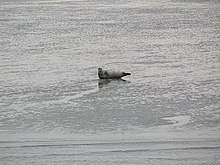
The region is a quiet zone for animals such as seals in the very busy Elbe estuary in the German Bight . Although the island was located within the Schleswig-Holstein Wadden Sea National Park , it was never raised to Zone I status, so that it was previously possible to enter the island or its remains at any time. There are occasional tourist trips to the mudflats of the Medemsand. The next planned deepening of the Elbe is to fill the Medemrinne, a large tidal creek between Medemsand and Medemgrund, with the silt of the Elbe fairway. This creates a large dump area in the Medemrinne and in front of the Neufelder mudflat area of approx. 175 hectares with a volume of approx. 20 million cubic meters.


