Mewegen
|
Mewegen
community Rothenklempenow
Coordinates: 53 ° 31 '8 " N , 14 ° 14' 53" E
|
|
|---|---|
| Height : | 16 m above sea level NHN |
| Area : | 7.3 km² |
| Residents : | 304 (December 31, 2004) |
| Population density : | 42 inhabitants / km² |
| Incorporation : | January 1, 2005 |
| Postal code : | 17321 |
| Area code : | 039744 |
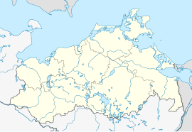
Location of Mewegen in Mecklenburg-Western Pomerania |
Mewegen is a district of the community Rothenklempenow in the district of Vorpommern-Greifswald in the east of Mecklenburg-Western Pomerania .
The village is about 30 m above sea level. NHN in a wooded region (southern Ueckermünder Heide ). Here you can still find the cobblestone streets and well-tended front gardens typical of the area. In the village there is a stone church over 500 years old and an inhabited stork's nest, in the immediate vicinity there is the Black Lake , surrounded by protected cotton grass bog .
The place was one of the Eickstedtschen goods in Rothenklempenow, which in 1497 by the Pomeranian Duke Bogislaw X has been confirmed. The place name has changed over time from Mitweide, Medewege and Middewege to Mewegen (from the 18th century). After the Thirty Years' War , the Mewegen manor was destroyed.
On January 1, 2005, the previously independent municipality of Mewegen was incorporated into Rothenklempenow. Mewegen last had 304 inhabitants (December 31, 2004) on an area of 7.30 km². The small elementary school in the Mewegen countryside is located in the village .
In Löcknitz , about ten kilometers south of Mewegen, there are rail and trunk roads to Pasewalk and Stettin . In neighboring Blankensee there is a border crossing for pedestrians to Buk in the Gmina Dobra (Republic of Poland ).
Population development
|
Individual evidence
- ^ Office Löcknitz-Penkun - SB Liegenschaften (ed.): Areas of the office area . Figures in hectares - as of June 2, 2017. Löcknitz August 2, 2017.
- ↑ StBA: Changes in the municipalities in Germany, see 2005
- ↑ Municipal directory Germany 1900. Randow district.
- ^ Pomeranian Information System (ISP). Randow district
- ^ A b Michael Rademacher: German administrative history from the unification of the empire in 1871 to the reunification in 1990. Landkreis Randow. (Online material for the dissertation, Osnabrück 2006).
- ↑ a b c d e Population on December 31. according to communities and districts. (No longer available online.) In: SIS-Online - Statistisches Informationssystem. Statistical Office MV, archived from the original on December 26, 2017 ; Retrieved December 25, 2017 . Info: The archive link was inserted automatically and has not yet been checked. Please check the original and archive link according to the instructions and then remove this notice.
