
Nadrensee
| coat of arms | Germany map | |
|---|---|---|

|
Coordinates: 53 ° 20 ' N , 14 ° 21' E |
|
| Basic data | ||
| State : | Mecklenburg-Western Pomerania | |
| County : | Vorpommern-Greifswald | |
| Office : | Löcknitz-Penkun | |
| Height : | 28 m above sea level NHN | |
| Area : | 20.71 km 2 | |
| Residents: | 335 (Dec 31, 2019) | |
| Population density : | 16 inhabitants per km 2 | |
| Postal code : | 17329 | |
| Area code : | 039746 | |
| License plate : | VG, ANK, GW, PW, SBG, UEM, WLG | |
| Community key : | 13 0 75 095 | |
| Office administration address: | Chausseestraße 30 17321 Löcknitz |
|
| Website : | ||
| Mayor : | Dorina Voss | |
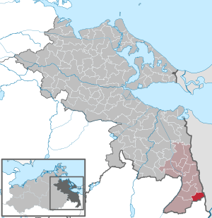
| Location of the municipality of Nadrensee in the Vorpommern-Greifswald district | ||
  |
||

Nadrensee is a municipality in the district of Vorpommern-Greifswald in the state of Mecklenburg-Western Pomerania in northeast Germany. It is administered by the Löcknitz-Penkun Office .
location
The community between three lakes on a plateau between Oder and Randow is located in the extreme south-east of Mecklenburg-Western Pomerania. It borders on Poland in the east and the state of Brandenburg in the south . The easternmost point of Mecklenburg-Western Pomerania is on the eastern edge of the municipality at 14 ° 24 'E. L.
Nadrensee is surrounded by the neighboring communities of Grambow in the north, Barnisław in the northeast, Kołbaskowo in the east, Mescherin and Tantow in the south, Penkun in the southwest and Krackow in the west and northwest.
Districts
- Nadrensee
- Pomelles
Living spaces
- Neuenfeld
- Hohenhof
- Forester's house
history
Nadrensee was first mentioned in a document in 1257. The name is derived from the Low German na dreen Seen . Some Hufen belonged to the Cistercian monastery Walkenriede in Damitzow . The monks later sold this property to a virgin monastery in Szczecin , where the land remained until the Reformation .
Incorporations
Pomellen was incorporated as a district after Nadrensee on October 15, 1950.
Population development
|
According to the 2011 census , the community has a share of 28 percent foreigners, all of whom have Polish citizenship .
politics
mayor
- 1990–2014 Dirk Zimmermann
- since 2014 Dorina Voss
Coat of arms, flag, official seal
The municipality has no officially approved national emblem, neither a coat of arms nor a flag . The official seal is the small state seal with the coat of arms of the region of Western Pomerania . It shows an upright griffin with a raised tail and the inscription "GEMEINDE NADRENSEE * LANDKREIS VORPOMMERN-GREIFSWALD".
Attractions


- Good with Park Nadrensee
- Kiebitzberg Nadrensee settlement
- Pomellen castle wall
- Good pomels
- Nadrensee day care center
Infrastructure
The area around Nadrensee is determined by agriculture. Customs and the federal police are based in Pomellen.
The A 11 motorway border crossing to Poland is in Pomellen . The nearest train station, Tantow train station , is 7 km away in Tantow, Brandenburg . The Rosow Station , about 3 km from Nadrensee, was from 1896 to 1980 in operation. Last but not least, the Nadrensee landowner campaigned for its construction. A connecting line ran from the station to a gravel pit near Nadrensee.
See also
literature
- Erwin Schulz: The place name detective - medieval settlement names in the Uecker-Randow district (1121–1591) - origin, details, explanations - with an overview of place names from 1600 . Ed .: Norbert Raulin. Schibri-Verlag, Milow 2007, ISBN 978-3-937895-44-4 , pp. 84 f .
Web links
Individual evidence
- ↑ Statistisches Amt MV - population status of the districts, offices and municipalities 2019 (XLS file) (official population figures in the update of the 2011 census) ( help ).
- ↑ Federal Statistical Office (Ed.): Municipalities 1994 and their changes since 01.01.1948 in the new federal states . Wiesbaden 1995, ISBN 3-8246-0321-7 .
- ↑ Municipal directory Germany 1900. Randow district.
- ^ A b c Michael Rademacher: German administrative history from the unification of the empire in 1871 to the reunification in 1990. Landkreis Greifenhagen. (Online material for the dissertation, Osnabrück 2006).
- ↑ a b c d e Population on December 31. according to communities and districts. (No longer available online.) In: SIS-Online - Statistisches Informationssystem. Statistical Office MV, archived from the original on December 26, 2017 ; Retrieved December 25, 2017 . Info: The archive link was inserted automatically and has not yet been checked. Please check the original and archive link according to the instructions and then remove this notice.
- ↑ Census 2011 ( Memento of the original from April 13, 2014 in the Internet Archive ) Info: The archive link was inserted automatically and has not yet been checked. Please check the original and archive link according to the instructions and then remove this notice.
- ↑ Main Statute, Section 1, Paragraph 1 (PDF).
- ↑ Horst Regling, Dieter Grusenick, Erich Morlok, Die Berlin-Stettiner Eisenbahn , transpress, Stuttgart 1996, p. 73.
Ahlbeck | Old Tellin | Altwarp | Altwigshagen | Anklam | Bandelin | Bargischow | Behrenhoff | Bentzin | Benz | Mountain wood | Blankensee | Blesewitz | Boldekow | Boock | Brietzig | Brünzow | Bugewitz | Buggenhagen | Butzow | Daberkow | Dargelin | Dargen | Dersekow | Ducherow | Eggesin | Fahrwalde | Ferdinandshof | Garz | Glazov | Görmin | Grambin | Grambov | Greifswald | Gribow | Gross Kiesow | Groß Luckow | Great Polzin | Gützkow | Hammer ad Uecker | Hanshagen | Heinrichswalde | Heringsdorf | Hinrichshagen | Hintersee | Iven | Jarmen | Jatznick | Comb teeth | Karlsburg | Karlshagen | Katzow | Kemnitz | Klein Bünzow | Koblentz | Korswandt | Koserow | Krackow | Krien | Kröslin | Kruckow | Krugsdorf | Krummin | Krusenfelde | Lassan | Leopoldshagen | Levenhagen | Liepgarten | Löcknitz | Loddin | Loissin | Loitz | Lubmin | Luebs | Luckow | Luetow | Medow | Meiersberg | Mellenthin | Mesekenhagen | Mölschow | Mönkebude | Murchin | Nadrensee | Neetzow-Liepen | New Boltenhagen | New Kosenow | Neuenkirchen | Neuenkirchen | Low | Papendorf | Pasewalk | Peenemünde | Penkun | Plow | Polzow | Postlow | Pudagla | Ramin | Rankwitz | Rollwitz | Rossin | Rossow | Rothemühl | Rothenklempenow | Rubenov | Rubkov | Sarnow | Sassen-Trantow | Sauzin | Schmatzin | Schönwalde | Spantekow | Stumble on the Peene | Stolpe on Usedom | Strasburg (Uckermark) | Torgelow | Trassenheide | Tutow | Ückeritz | Ueckermünde | Usedom | Square | Vogelsang-Warsin | Völschow | Wackerow | Weitenhagen | Wilhelmsburg | Wolgast | Wrangelsburg | Wusterhusen | Zemitz | Zempin | Zerrenthin | Ziethen | Zinnowitz | Zirchow | Züssow