
Zempin
| coat of arms | Germany map | |
|---|---|---|

|
Coordinates: 54 ° 4 ′ N , 13 ° 57 ′ E |
|
| Basic data | ||
| State : | Mecklenburg-Western Pomerania | |
| County : | Vorpommern-Greifswald | |
| Office : | Usedom-South | |
| Height : | 2 m above sea level NHN | |
| Area : | 3.3 km 2 | |
| Residents: | 948 (Dec. 31, 2019) | |
| Population density : | 287 inhabitants per km 2 | |
| Postal code : | 17459 | |
| Area code : | 038377 | |
| License plate : | VG, ANK, GW, PW, SBG, UEM, WLG | |
| Community key : | 13 0 75 148 | |
| Office administration address: | Markt 1 17406 Usedom |
|
| Website : | ||
| Mayor : | Werner Schön | |
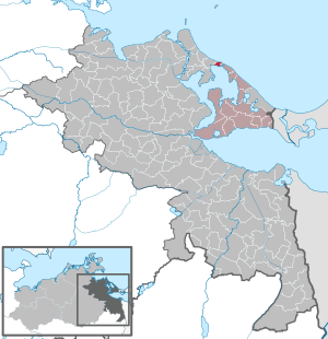
| Location of the municipality of Zempin in the Vorpommern-Greifswald district | ||
  |
||

Seebad Zempin is a municipality on the island of Usedom, located directly on the shores of the Baltic Sea and the backwater . The municipality is administered by the Usedom-Süd office based in the city of Usedom . Until 2005 the community was part of the Usedom-Mitte office. Zempin also has beautiful sights such as an old school that is now a museum, or the promenade.
Geography and traffic
Zempin is the smallest seaside resort on Usedom. It lies between Zinnowitz and Koserow at the narrowest point between the Baltic Sea and the Achterwasser . It is located on federal road 111 and can be reached via the Züssow – Swinoujscie railway line . About 16 kilometers east of the community are the three imperial baths Bansin , Heringsdorf and Ahlbeck and two kilometers west of the town of Zinnowitz.
history


Zempin was first mentioned in the "Water Ordinance because of the Lassanian Water" of July 4, 1571 as "Zempihn". Later, in 1589 as "Zempynn". The Slavic name is interpreted as "cloudy" or "dark".
In the PUM 1835, Zempin can be recognized as a farming and fishing village on the backwater. Only the "Zempiner Packerei" (herring packing) can be seen on the beach of the Baltic Sea.
With the Peace of Westphalia of 1648, Vorpommern and thus also the place Zempin came under Swedish rule, after the place previously belonged to the Duchy of Pomerania . After the Treaty of Stockholm on February 1, 1720, the island of Usedom and thus also the town of Zempin became Prussian property. After the administrative reform in 1815, Zempin came to the Prussian province of Pomerania and belonged to the district of Usedom-Wollin from 1818 to 1945 .
After the storm surges of 1872 and 1874, which tore the island between Zempin and Koserow and flooded the town of Damerow , a dike was built from Zempin am Griepow to Koserow, which was built up in stages at a height of 3.5 m until the GDR era.

In 1880 the place expanded further and is now also on the road (today's B 111), the Zempiner boat station is on the coast and the first bathing huts are mentioned.
In 1911 Zempin received a railway connection, it joined the German Baths Association in 1908 and a pier was built in 1933 , which, however, disintegrated again in World War II.
In 1920 the focus of the place was already on the B 111 and the Zempiner Strandhotel was built on the Baltic Sea beach.
Between 1943 and 1945, three launching devices were built in the forest area between Zinnowitz and Zempin for further testing of the Fieseler Fi 103 flying bomb , also known as "V 1", and on August 13, 1943, they were subordinated to Flak Regiment 155 (W). Regular shooting in Zempin began under Colonel Max Wachtel on October 14, 1943. The "Flakzielgerät FZG 76", which had been tried and tested in secrecy, had the code name Maikäfer in 1944 in Belgium and France . From the field positions I.-III. With the unloading ramp, the straightening house, the ski position and the Walter sling, there are still some remains. After the end of the Second World War, the buildings of the Kriegsmarine Flakschule were removed as a military facility, other technical buildings were looted and the concrete roads in the forest were partially blown up. In the decades after 1945 no stone remained in the forest .
In 1956 the constantly growing campsite was established and the place between Altdorf and Straßendorf grew together.
Zempin has had state recognition as a seaside resort since 1996, and a new holiday complex with holiday apartments, hotels and other infrastructure has been built on Griepow (dune hill in the east).
From 1945 to 1952, the municipality, with the part of the district of Usedom-Wollin that remained in Germany after the Second World War , formed the district of Usedom in the state of Mecklenburg . This was in 1952 in the district of Wolgast in District Rostock on.
The community has belonged to the state of Mecklenburg-Western Pomerania since 1990. Since 1994, Zempin has belonged to the district of Ostvorpommern , which was added to the district of Vorpommern-Greifswald in 2011 .
politics
coat of arms
|
|
Blazon : “Divided by a wave cut; above, in blue, two opposing golden sprats one above the other; a blue twin bar in silver below. "
The coat of arms was designed by Michael Zapfe from Weimar . It was approved on March 10, 1998 by the Ministry of the Interior and registered under No. 156 of the coat of arms of the state of Mecklenburg-Western Pomerania. |
| Reasons for the coat of arms: In the coat of arms, the wave cut refers to the location of the municipality on the Baltic Sea and the Achterwasser. The coats of arms symbolize the most important occupations of the inhabitants. The sprats stand for fishing, the twin bars in the silver field, according to the design principle of pars pro toto, for the awning fabric of the beach chairs and thus for beach tourism on the Baltic Sea. The colors blue and white also indicate that the municipality belongs to the Western Pomerania region. |
flag
The flag was designed by the Anklam design office Schönherr and approved on December 17, 1998 by the Ministry of the Interior.
The flag is made of white cloth. It is covered in the middle with the municipal coat of arms, which takes up two thirds of the height of the flag cloth. The length of the flag is related to the height as 5: 3.
Official seal
The official seal shows the municipal coat of arms with the inscription "GEMEINDE SEEBAD ZEMPIN * LANDKREIS VORPOMMERN-GREIFSWALD".
Attractions


→ See: List of architectural monuments in Zempin
- Zempiner salt huts at the access to the beach in the dunes, one dated 1882 (were demolished in the course of the new construction of the Kurplatz and Promenade in spring 2012)
- A total of around 50 thatched roof houses in several village streets
- Large oak at the fishing port of the backwater; Trunk circumference around 4.5 meters, around 350 years old
- Heimat-Vereinshaus Alte Schule ( "Uns olle Schaul" ) : School until 2000, now an exhibition room for over 30 self-built boat models by the Zempiner fisherman Konrad Teuert (* 1919); Tiefert's life and work was the subject of the ZDF documentary Winterreise in February 2005 - from Usedom to the glacier ice . In addition, the historic grocery store of Karl Schichlein was reconstructed in this club house (furniture from 1928).
- Halfway to Koserow: Lüttenort , former home (now a small museum with a sculpture garden) of the painter Otto Niemeyer-Holstein
Personalities
- The ceramic and watercolor painter Rosa Kühn (* 1928) lived in Zempin until 2005 and now lives in Bansin.
- The painter, graphic artist and writer Hugo Scheele lived in the Villa Baltica on Waldstrasse from 1921 until his death.
- Kurt Heinz Sieger (1917–2002), landscape and nude painter, lived and died in Zempin.
literature
- Zempiner Heimathefte No. 1, No. 2, No. 3 and No. 4
- Harald Tresp / Sven Grempler: Remnants of a bygone era in Zempin , an almost neglected place where German secret weapons were tested. Zempin 2000.
Web links
- Pictures of the former starting points of the Fieseler Fi 103 near Zempin
- Heimatverein Zempin e. V.
- Zempin seaside resort
Individual evidence
- ↑ Statistisches Amt MV - population status of the districts, offices and municipalities 2019 (XLS file) (official population figures in the update of the 2011 census) ( help ).
- ↑ Johann Carl Dähnert : Collection of common and special Pomeranian and Rügischer provincial documents, laws, privileges, contracts, constitutions and regulations. Volume 3. pp. 624-626. Stralsund 1769. ( digitized by the Digital Library of Mecklenburg-Vorpommern)
- ↑ Manfred Niemeyer: Ostvorpommern I . Collection of sources and literature on place names. Vol. 1: Usedom. (= Greifswald contributions to toponymy. Vol. 1), Ernst-Moritz-Arndt University of Greifswald, Institute for Slavic Studies, Greifswald 2001, ISBN 3-86006-149-6 . P. 70
- ↑ Harald Tresp: Rubble from a bygone era in Zempin . Pp. 5-15.
- ↑ Hans-Heinz Schütt: On shield and flag production office TINUS, Schwerin 2011, ISBN 978-3-9814380-0-0 , p. 378/379.
- ↑ a b main statute § 1 (PDF).
- ↑ The house "Uns olle Schaul" - exhibitions Heimatverein Zempin e. V., accessed April 17, 2017.
Ahlbeck | Old Tellin | Altwarp | Altwigshagen | Anklam | Bandelin | Bargischow | Behrenhoff | Bentzin | Benz | Mountain wood | Blankensee | Blesewitz | Boldekow | Boock | Brietzig | Brünzow | Bugewitz | Buggenhagen | Butzow | Daberkow | Dargelin | Dargen | Dersekow | Ducherow | Eggesin | Fahrwalde | Ferdinandshof | Garz | Glazov | Görmin | Grambin | Grambov | Greifswald | Gribow | Gross Kiesow | Groß Luckow | Great Polzin | Gützkow | Hammer ad Uecker | Hanshagen | Heinrichswalde | Heringsdorf | Hinrichshagen | Hintersee | Iven | Jarmen | Jatznick | Comb teeth | Karlsburg | Karlshagen | Katzow | Kemnitz | Klein Bünzow | Koblentz | Korswandt | Koserow | Krackow | Krien | Kröslin | Kruckow | Krugsdorf | Krummin | Krusenfelde | Lassan | Leopoldshagen | Levenhagen | Liepgarten | Löcknitz | Loddin | Loissin | Loitz | Lubmin | Luebs | Luckow | Luetow | Medow | Meiersberg | Mellenthin | Mesekenhagen | Mölschow | Mönkebude | Murchin | Nadrensee | Neetzow-Liepen | New Boltenhagen | New Kosenow | Neuenkirchen | Neuenkirchen | Low | Papendorf | Pasewalk | Peenemünde | Penkun | Plow | Polzow | Postlow | Pudagla | Ramin | Rankwitz | Rollwitz | Rossin | Rossow | Rothemühl | Rothenklempenow | Rubenov | Rubkov | Sarnow | Sassen-Trantow | Sauzin | Schmatzin | Schönwalde | Spantekow | Stumble on the Peene | Stolpe on Usedom | Strasburg (Uckermark) | Torgelow | Trassenheide | Tutow | Ückeritz | Ueckermünde | Usedom | Square | Vogelsang-Warsin | Völschow | Wackerow | Weitenhagen | Wilhelmsburg | Wolgast | Wrangelsburg | Wusterhusen | Zemitz | Zempin | Zerrenthin | Ziethen | Zinnowitz | Zirchow | Züssow