
Blesewitz
| coat of arms | Germany map | |
|---|---|---|

|
Coordinates: 53 ° 50 ' N , 13 ° 37' E |
|
| Basic data | ||
| State : | Mecklenburg-Western Pomerania | |
| County : | Vorpommern-Greifswald | |
| Office : | Anklam Land | |
| Height : | 11 m above sea level NHN | |
| Area : | 12.65 km 2 | |
| Residents: | 238 (Dec. 31, 2019) | |
| Population density : | 19 inhabitants per km 2 | |
| Postal code : | 17392 | |
| Area code : | 03971 | |
| License plate : | VG, ANK, GW, PW, SBG, UEM, WLG | |
| Community key : | 13 0 75 013 | |
| LOCODE : | DE 7BU | |
| Community structure: | 3 districts | |
| Office administration address: | Rebelower Damm 2 17392 Spantekow | |
| Website : | ||
| Mayor : | Frank Zibell | |
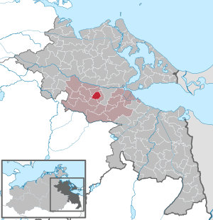
| Location of the municipality of Blesewitz in the Vorpommern-Greifswald district | ||
  |
||

Blesewitz is a municipality near the town of Anklam in the Vorpommern-Greifswald district in Mecklenburg-Western Pomerania (Germany). It is administered by the Anklam-Land office based in the municipality of Spantekow .
Geography and traffic
Blesewitz is north of federal highway 197 and south of federal highway 199 . Anklam is about seven kilometers northeast of the municipality. The federal motorway 20 can be reached via the junction Anklam (approx. 20 km).
Districts
- New Sanitz
- Alt Sanitz
- Blesewitz
history
New Sanitz
Neu Sanitz was first mentioned in 1345 as "Nyenzagenicz". It was not until 1851 that the place was called Neu Sanitz. The place was laid out as Vorwerk / Meierhof in the desert Feldmark von Sanitz, but was to nerdin as pertinence, d. H. Part of an estate , proper. For an interpretation of the name, see Alt Sanitz.
In addition to the Vorwerk, Neu Sanitz had a few small, scattered settlement courtyards.
Since 1895 Neu Sanitz has been touched by the Anklam-Gellendin-Dennin small railway line, which, unlike other small railway lines, was not dismantled in 1945, but only in 1969. The place had its own stopping point.
Alt Sanitz
Alt Sanitz was first mentioned in a document in 1258 as "de Zaiens", 1631 with "Sanitz" and then from 1851 with Alt Sanitz. As a Slavic foundation, this means “Heubach”. The place probably fell into desolation during the Thirty Years' War , because it was only rebuilt in 1764 by immigrant families.
Alt Sanitz was also affected by the small railway line Anklam-Gellendin-Dennin in 1895 and also had a stopping point.
The place consisted of a contiguous row of flats and had a post mill. Striking to the south of the village are a large number of stone walls made of stones collected from the arable land and used to demarcate the cattle pastures.
The rural community of Alt Sanitz was merged with Neu Sanitz and Blesewitz to form the community of Sanitz in the 1920s . Sanitz, in turn, became part of the Pelsin community in 1935. On the occasion of the dissolution of the large Pomeranian communities after the Second World War , the community of Sanitz emerged from Alt Sanitz, Neu Sanitz and Blesewitz . Blesewitz was spun off from the municipality of Sanitz on January 1, 1951. On December 31, 1952, Sanitz was incorporated into Blesewitz. So both places came together again, but this time under the name Blesewitz .
Blesewitz

Blesewitz was first mentioned in a document as Blaseviz in 1326. The current name is not mentioned until 1658. The Slavic founding name means something like "bare surface". Blesewitz is a manor village, which later developed into an anger village, with a church and churchyard.
The former knighthood of Blesewitz belonged to the Kolbe family, who were based in Mecklenburg and Pomerania. The non-noble family had grown rich as mill owners and bought several estates in the middle of the 18th century, including Charlottenhof, Rossin and Pritzlow. Blesewitz came to the family at the beginning of the 19th century. The last owner was Paul Kolbe, he had 865 hectares here , 100 hectares of which were forest.
After the land reform and during the LPG times, the manor house built around was used as a residence for resettlers and later as a rural cultural center. Almost all of the buildings and their surroundings, including the park, have been preserved from the compact estate, only partially changed in the GDR era (roofs, etc.).
politics
In the state elections in Mecklenburg-Western Pomerania in 2011 , 97 valid votes were cast. Of these, 28.9 percent were for the NPD (2006: 32.2), 22.7 percent for the CDU (29.8), 16.5 percent for the SPD (14.9) and 15.5 percent for Die Linke (9.9).
In the state elections in Mecklenburg-Western Pomerania in 2016, 48.2 percent of the votes were cast for the AfD and 17.3 percent for the NPD. With this, the village achieved a certain fame as a stronghold of right-wing populist and right-wing extremist parties.
Coat of arms, flag, official seal
The municipality has no officially approved national emblem, neither a coat of arms nor a flag . The official seal is the small state seal with the coat of arms of the region of Western Pomerania . It shows an upright griffin with a raised tail and the inscription "GEMEINDE BLESEWITZ * LANDKREIS VORPOMMERN-GREIFSWALD".
Attractions

- The Blesewitz church consists of the retracted choir from the 14th century and the barrel-vaulted nave from the 15th century, both separated by the triumphal arch ; West tower made of timber frame.
- Two-storey manor house Blesewitz from the 18th century with two later side wings.
literature
- Manfred Niemeyer: East Western Pomerania. Collection of sources and literature on place names. Volume 2: Mainland. (= Greifswald contributions to place name studies. Volume 2). Ernst Moritz Arndt University of Greifswald, Institute for Slavic Studies, Greifswald 2001, ISBN 3-86006-149-6 .
Web links
Individual evidence
- ↑ Statistisches Amt MV - population status of the districts, offices and municipalities 2019 (XLS file) (official population figures in the update of the 2011 census) ( help ).
- ↑ a b c Manfred Niemeyer: Ostvorpommern . Collection of sources and literature on place names. Vol. 2: Mainland. (= Greifswald contributions to toponymy. Vol. 2), Ernst-Moritz-Arndt University of Greifswald, Institute for Slavic Studies, Greifswald 2001, ISBN 3-86006-149-6 . P. 10 ff
- ↑ Anklam district register as of 1910
- ↑ Anklam district register as of 1935
- ^ Michael Rademacher: German administrative history from the unification of the empire in 1871 to the reunification in 1990. Anklam district. (Online material for the dissertation, Osnabrück 2006).
- ↑ GenWiki: Landkreis Anklam
- ^ Hubertus Neuschäffer: Western Pomerania's castles and mansions. Husum Druck- und Verlagsgesellschaft, 1993, ISBN 3-88042-636-8 , p. 32.
- ↑ Results of the state election 2011
- ↑ http://www.laiv-mv.de/static/LAIV/Abt4.Statistisches%20Amt/Dateien/Publikationen/B%20VII%20Wahlen/Landtagswahlen/B%20721E/B721E%202016%2001.pdf
- ↑ Main Statute, Section 1, Paragraph 2 (PDF).
Ahlbeck | Old Tellin | Altwarp | Altwigshagen | Anklam | Bandelin | Bargischow | Behrenhoff | Bentzin | Benz | Mountain wood | Blankensee | Blesewitz | Boldekow | Boock | Brietzig | Brünzow | Bugewitz | Buggenhagen | Butzow | Daberkow | Dargelin | Dargen | Dersekow | Ducherow | Eggesin | Fahrwalde | Ferdinandshof | Garz | Glazov | Görmin | Grambin | Grambov | Greifswald | Gribow | Gross Kiesow | Groß Luckow | Great Polzin | Gützkow | Hammer ad Uecker | Hanshagen | Heinrichswalde | Heringsdorf | Hinrichshagen | Hintersee | Iven | Jarmen | Jatznick | Comb teeth | Karlsburg | Karlshagen | Katzow | Kemnitz | Klein Bünzow | Koblentz | Korswandt | Koserow | Krackow | Krien | Kröslin | Kruckow | Krugsdorf | Krummin | Krusenfelde | Lassan | Leopoldshagen | Levenhagen | Liepgarten | Löcknitz | Loddin | Loissin | Loitz | Lubmin | Luebs | Luckow | Luetow | Medow | Meiersberg | Mellenthin | Mesekenhagen | Mölschow | Mönkebude | Murchin | Nadrensee | Neetzow-Liepen | New Boltenhagen | New Kosenow | Neuenkirchen | Neuenkirchen | Low | Papendorf | Pasewalk | Peenemünde | Penkun | Plow | Polzow | Postlow | Pudagla | Ramin | Rankwitz | Rollwitz | Rossin | Rossow | Rothemühl | Rothenklempenow | Rubenov | Rubkov | Sarnow | Sassen-Trantow | Sauzin | Schmatzin | Schönwalde | Spantekow | Stumble on the Peene | Stolpe on Usedom | Strasburg (Uckermark) | Torgelow | Trassenheide | Tutow | Ückeritz | Ueckermünde | Usedom | Square | Vogelsang-Warsin | Völschow | Wackerow | Weitenhagen | Wilhelmsburg | Wolgast | Wrangelsburg | Wusterhusen | Zemitz | Zempin | Zerrenthin | Ziethen | Zinnowitz | Zirchow | Züssow