
Office of Anklam-Land
| coat of arms | Germany map | |
|---|---|---|

|
Coordinates: 53 ° 47 ' N , 13 ° 35' E |
|
| Basic data | ||
| State : | Mecklenburg-Western Pomerania | |
| County : | Vorpommern-Greifswald | |
| Area : | 531.11 km 2 | |
| Residents: | 9514 (Dec 31, 2019) | |
| Population density : | 18 inhabitants per km 2 | |
| License plate : | VG, ANK, GW, PW, SBG, UEM, WLG | |
| Office key : | 13 0 75 5553 | |
| Office structure: | 18 parishes | |
| Office administration address : |
Rebelower Damm 2 17392 Spantekow |
|
| Website : | ||
| Head of Office : | Holger Vogel | |
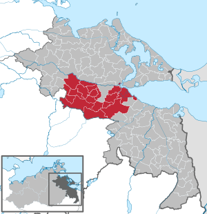
| Location of the Anklam-Land office in the Vorpommern-Greifswald district | ||
  |
||

The Office Anklam-Land is located in the Vorpommern-Greifswald in Mecklenburg-Vorpommern (Germany). 18 municipalities are united in the Anklam-Land office to carry out their administrative business. The administrative seat is in the municipality of Spantekow .
On January 1, 2005, the Anklam-Land office was formed from the dissolved offices of Ducherow , Krien and Spantekow . On June 7th, 2009 Drewelow and Japenzin were incorporated into Spantekow and Löwitz and Rathebur after Ducherow. On January 1, 2010, Pelsin became a district of Anklam . On January 1st, 2012 Neuendorf A became a district of Ducherow, Neuendorf B a district of Spantekow and Putzar a district of Boldekow.
The formerly independent municipality of Wietstock was incorporated into Altwigshagen from the neighboring district of Uecker-Randow on January 1, 2011 and thus changed to the Torgelow-Ferdinandshof office .
On January 1, 2014, the previous municipalities of Liepen and Neetzow were merged to form the new municipality of Neetzow-Liepen .
The official area extends from the Peene in the north to the Großer Landgraben in the south. A small part of the office borders the Szczecin Lagoon in the northeast . The office is bounded in the south by the Mecklenburg Lake District and the offices of Torgelow-Ferdinandshof and Am Stettiner Haff and in the north by the Züssow office . Some elevations in the office reach a height of over 50 meters. The largest lake in the office is the Putzarer See . Larger rivers are the Peene, the Große Landgraben and the Peene-Südkanal .
Economically only agriculture is worth mentioning, tourism also plays a certain, albeit small, role. There are larger industrial settlements only in the vicinity of Anklam.
The federal highway 199 leads through the north of the Anklam-Land office from the federal highway 20 to the west to Anklam . The federal highway 197 (from Anklam to Neubrandenburg ) crosses the office in a north-south direction.
The municipalities with their districts
- Bargischow with Anklamer ferry, Gnevezin and Woserow
- Blesewitz with Alt Sanitz and New Sanitz
- Boldekow with Borntin, Glien, Glien Siedlung, Kavelpaß, Putzar , Rubenow and Zinzow
- Bugewitz with limestone, Kamp , Lucienhof and Rosenhagen
- Butzow with Alt Teterin, Lüskow and Neu Teterin
- Ducherow with Busow , Heidberg, Kurtshagen, Löwitz , Marienthal, Neuendorf A , Rathebur , Schmuggerow, Schwerinsburg and Sophienhof
- Iven
- Krien with Albinshof, Krien-Horst, Neu Krien, Stammersfelde and Wegezin
- Krusenfelde with Gramzow and Krusenkrien
- Medow with Brenkenhof, Nerdin, Thurow and Wussentin
- Neetzow-Liepen with Kagenow , Klein Below , Liepen , Neetzow , Padderow , Preetzen , Priemen , Steinmocker and Steinmocker expansion
- New Kosenow with Alt Kosenow, Auerose, Dargibell and Kagendorf
- New churches with Müggenburg and Strippow
- Postlow with Görke and Tramstow
- Rossin with Charlottenhof
- Sarnow with Idasruh, Panschow and Wusseken
- Spantekow with Dennin, Drewelow , Fasanenhof, Janow , Japenzin , Neuendorf B , Rebelow, Rehberg and Schwerinshorst
- Stolpe on the Peene with Dersewitz, Grüttow and Neuhof
politics
Coat of arms, flag, official seal
The office does not have an officially approved national emblem, neither a coat of arms nor a flag . The official seal is the small state seal with the coat of arms of the region of Western Pomerania . It shows an upright griffin with a raised tail and the inscription "AMT ANKLAM-LAND * LANDKREIS VORPOMMERN-GREIFSWALD".
Individual evidence
- ↑ Statistisches Amt MV - population status of the districts, offices and municipalities 2019 (XLS file) (official population figures in the update of the 2011 census) ( help ).
- ↑ Main Statute § 1 (PDF).