
Ducherow
| coat of arms | Germany map | |
|---|---|---|

|
Coordinates: 53 ° 46 ' N , 13 ° 47' E |
|
| Basic data | ||
| State : | Mecklenburg-Western Pomerania | |
| County : | Vorpommern-Greifswald | |
| Office : | Anklam Land | |
| Height : | 4 m above sea level NHN | |
| Area : | 77.28 km 2 | |
| Residents: | 2461 (Dec. 31, 2019) | |
| Population density : | 32 inhabitants per km 2 | |
| Postal code : | 17398 | |
| Primaries : | 039726, 039777 | |
| License plate : | VG, ANK, GW, PW, SBG, UEM, WLG | |
| Community key : | 13 0 75 029 | |
| Office administration address: | Rebelower Damm 2 17392 Spantekow |
|
| Website : | ||
| Mayor : | Bernd Schubert ( CDU ) | |
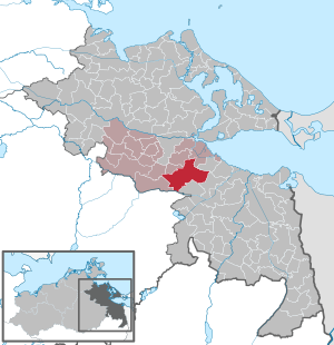
| Location of the municipality of Ducherow in the Vorpommern-Greifswald district | ||
  |
||

Ducherow is a municipality in the district of Vorpommern-Greifswald in Mecklenburg-Western Pomerania, Germany. It has been administered since January 1, 2005 by the Anklam-Land office based in the municipality of Spantekow . It is the most populous municipality in the office and was the seat of the office Ducherow until December 31, 2004 . Ducherow forms a basic center for its surroundings .
Geography and transport links
The community is located on the western edge of the Ueckermünder Heide . Anklam is about 13 kilometers northwest and Ueckermünde about 20 kilometers east of the municipality.
Ducherow is on federal highway 109 . The Angermünde – Stralsund railway runs through the municipality. In the past, the Ducherow – Heringsdorf – Wolgast ferry line leading to the island of Usedom branched off at Ducherow station , which is now only passable on the part of the island between Swinoujscie and Wolgast . The desired restart from Ducherow requires the reconstruction of the Karnin lift bridge or the construction of a new railway bridge between the Pomeranian mainland and Usedom. This connection would reduce the travel time between Berlin and Usedom to around two hours, that is, roughly halved.
Districts
|
Desolations and residential areas in the municipal area
|
|
At the same time as the local elections on June 7, 2009, the previously independent communities of Löwitz and Rathebur were incorporated into Ducherow. On January 1, 2012, Neuendorf A.
history

Busow
Busow was first mentioned in a document as Bussow in 1278 . The name proves a Slavic foundation, it should mean something like God's wrath or God's glory .
Ducherow
Ducherow was first mentioned in 1229 as Dogodowe and then in 1328 as Ducherow in today's spelling. The name is interpreted from the Slavic with in front of the hill .
Heidberg
Originally, the large Ducherow brickworks was located here. This ceased operations after reunification and fell into ruin. The remaining brickworks residential buildings and the houses that were added later together with the old residential areas Heidemühl and Brandshof then formed the district with the name Heidberg .
Kurtshagen
Kurt Hagen was in 1779 as Curtshagen first mentioned in documents. The name is a German foundation. "Hagen" means forest, the "Curt" could be derived from the name of the founder. It was created as a manor on the Feldmark of Neuendorfer A.
Loewitz
Löwitz was first mentioned in a document in 1533 as Lowitz . The Slavic founding name was interpreted as "Rindenbach".
Marienthal
Marienthal was first mentioned in a document with its current name in 1776. It was laid out as a new Vorwerk to Rathebur.
The manor house with the stables was rebuilt around 1900. Due to the high land values, the economic situation was relatively good. The last landowner, Weiblinger, was expropriated in 1945 and the manor house was divided between two new farmers. The manor house is an elongated simple plastered building. It has been partially renovated in the last few years, but it looks bad because of the division of property. The former manor buildings were also changed during the LPG era. The former manor park was partially built over and is only available in remnants. The park wall was probably cleared after 1945 in favor of building materials.
Neuendorf A
The town of Neuendorf was first mentioned in 1317. Neuendorf A was named as Niendorp 1618 on the Lubin map. It was first written with the addition A in 1779, then again for a long time without or alternating with a or b and only officially from 1957 with A.
Rathebur
Rathebur was first mentioned in 1271 as "Ratebur". The Slavic name probably means "The battle-merry".
Schmuggerow
On the southern edge of the park there is a tower hill which, from an archaeological point of view, dates from the early German period after 1230.
Schmuggerow was first mentioned in 1407 as "Smuggerow". The name is of Slavic origin and means "peat camp".
Schmuggerow is an anger village, although it was dominated by the estate. The manor is only partially preserved, the manor house has been reconstructed. The large park in the middle of which the manor house, called the castle, stands, is only partially preserved because it was partially built on after 1945.
The palace / manor house, built in the classical style with baroque accents, is located in the middle of the manor park. It was built by the Schwerin family, who had lived in Löwitz and Schmuggerow since 1560. It was built in 1870/71 and belonged to the von Schwerin family. It was built by the well-known architect Otto Brückwald for the daughter of Count Maximillian von Schwerin. It is two-story and has a basement. The entrance forms the center of the symmetrical building and leads inside via a wide staircase. The central projection with triangular gable is also striking.
Gut Schmuggerow was acquired in 1815 by a merchant who had a new manor house built west of the castle.
Since 1895 Schmuggerow was affected by the small railway line Anklam-Gellendin-Uhlenhorst, which like all small railways dismantled in 1945 and went to the USSR as reparation.
After 1945 the building served as accommodation for resettlers and new farmers.
In 1997 the castle was renovated according to old drawings and is now a family castle with 17 bedrooms and a ballroom on the first floor. It houses the castle hotel, 13 holiday apartments and a restaurant in the castle cellar. The park can be walked on. In it lies the grave of Erna Raabe, a painter and friend of the von Schwerin family.
Sophienhof

Sophienhof was first mentioned as such in 1631. It was originally a Vorwerk zu Löwitz, this corridor was previously called "Hagedorn". The Vorwerk Sophienhof was economically part of the Löwitz manor. In 1494 a Zabel von Schwerin proved that Sophienhof was in the pawn district of the Schwerin family. The place was named after Sophie Juliane von Schwerin, the sister of Field Marshal Curt Christoph von Schwerin. The place was previously called Hagedorn. Gut Sophienhof made a name for itself in horse and cattle breeding, for which Schwerin received high awards in 1910. After 1945 the manor house served as accommodation for resettlers.
Schwerinsburg
Today's district of Schwerinsburg was formerly called Cummerow. During a visit by King Friedrich Wilhelm I of Prussia in 1733 , he was renamed Schwerinsburg after Kurt Christoph Graf von Schwerin , who had built the castle there.
Brandshof (residential area in Heidberg)
Brandshof was first mentioned as a Hammelstall in 1822. From 1865 the living space was called Brandshof and consisted only of a forester's house that still exists today. Opposite is the Heidemühl residential area, both residential areas belong to the Heidberg district of the Ducherow community.
Heidemühl (living space at Heidberg)
Heidemühl was first mentioned in 1320 as Heytmolen . In 1822 the current name was recorded. According to the name, there was a water mill here, but we don't know about it. The living space consists of a forester's house named Heidemühl (established in 1865) and an inn next to it, both of which were built before 1880, according to MTB. This living space with its opposite Brandshof belongs to the current district of Heidberg.
Mollwitz (Wüstung)
Mollwitz was first mentioned in 1822 as "Molwitz". Mollwitz had been a Vorwerk since 1741 - Holländerei for Gut Ducherow. It was to the west not far from Ducherow. It was mentioned until 1891, but is still marked in the MTB ( measuring table sheet ) from 1920, after which it fell wildly. Today it is a wasteland.
According to another source (Gloed-1924), the former name is said to have been "Pitzerow".
Mootsch (living
space ) Mootsch is recorded for the first time in the measuring table sheet from 1880 as a single farm. It still bears the name after an older field name. It is located southwest of Ducherow on the edge of the forest.
Wilhelmshof (Wüstung)
The place was first called "Kiewitzdam" in 1822, later also as "Wilhelmshof". It was laid out as a Vorwerk zu Schmuggerow, it was north of the estate (Landweg is still called Kiebitzdamm today). Not mentioned after 1865, it is apparently desolate. Two farmsteads in the area are now called expansion.
Luisenau (Wüstung)
Luisenau belonged to the old community of Löwitz. The exact location can no longer be determined, but will have to be looked for in the mining of Löwitz to the northeast in the MTB 1880 to 1920. Luisenau was included as such in the place lists in 1957. In the 1970s, many remote homesteads were abandoned and cleared for land consolidation and the creation of large agricultural areas. That seems to be the case here too, the cleared areas can be seen in the satellite images.
Werder (living space)
Werder was first mentioned in 1851. It is a Vorwerk to Gut Schwerinsburg. It was already shown in the Prussian original table sheet in 1835. It is only about 800 m southeast of the estate. Today there is only a small homestead there, the living space is integrated into the village of Schwerinsburg.
politics
mayor
- 1994–2007: Bernd Schubert
- since 2014: Bernd Schubert
coat of arms
|
|
Blazon : "Growing in silver from a green mountain of three, a gold-reinforced red griffin with a knocked out red tongue, holding a red diamond in its claws."
The coat of arms was designed by Gerhard Koggelmann from Sagard . It was approved on July 10, 1992 by the Ministry of the Interior and registered under No. 60 of the coat of arms of the state of Mecklenburg-Western Pomerania. |
| Reasons for the coat of arms: The red griffin on the coat of arms shows that the municipality is part of the Western Pomerania region. The diamond is borrowed from the coat of arms of the Counts of Schwerin, which shows a red diamond in the first field in silver. It is intended to commemorate the family who owned Ducherow and the surrounding area for centuries. The Dreiberg refers to the Heidberg and the district of the same name. |
flag

The flag was designed by Roland Bornschein from Wismar and approved on August 30, 1993 by the Ministry of the Interior.
The flag is quartered at an angle and shows four isosceles triangles. The triangle on the upper edge is red, the one on the lower edge is green, the triangles on the leech and the flight hem are white. In the middle of the flag, above everything, is the municipal coat of arms, which takes up half the height of the flag. The height of the flag is related to the length like 2: 3.
Official seal
The official seal shows the municipal coat of arms with the inscription "GEMEINDE DUCHEROW * LANDKREIS VORPOMMERN-GREIFSWALD".
Attractions
- Ducherow motorcycle museum
- Ducherow Church , medieval boulder building from the 13th century
- Nature reserves in the Peene Valley
- Busow Chapel
- Rathebur Church
- Schmuggerow Church
- Manor complexes and parks in Schwerinsburg and Löwitz
- Bronze Age barrow field near Löwitz
- Sophienhof tower hill
Personalities
- Otto Heyden (1820–1897), painter
- Wilhelm Quistorp (1824–1887), pastor in Ducherow from 1858 to 1882, founded the Bugenhagenstift, now the Evangelisches Diakoniewerk Bethanien Ducherow
- Bernd Schubert (* 1955 in Anklam), politician (CDU), was mayor of Ducherow from 1994 to 2007 and since 2014
Others
Ducherow finds literary mention in Hans Fallada's novel Little Man - What Now? from 1932. The main character Johannes Pinneberg lives and works in this village, where his married life begins with his wife Emma, whom he calls "Lammchen".
Ducherow also appears in Renate Meinhof's book The Diary of Maria Meinhof: April 1945 to March 1946 in Pomerania. A search for clues ahead.
literature
- Manfred Niemeyer: East Western Pomerania. Collection of sources and literature on place names. Volume 2: Mainland (= Greifswald contributions to toponymy. Volume 2), Ernst Moritz Arndt University Greifswald, Institute for Slavonic Studies, Greifswald 2001, ISBN 3-86006-149-6 . Pages 78, 87, 91, 96, 111/112, 121, 125, 146.
Web links
- Literature about Ducherow in the state bibliography MV
- Schwerinsburg Castle in the middle of the 19th century (Duncker Collection) (PDF; 220 kB)
Individual evidence
- ↑ Statistisches Amt MV - population status of the districts, offices and municipalities 2019 (XLS file) (official population figures in the update of the 2011 census) ( help ).
- ↑ Regional Spatial Development Program Vorpommern (RREP) 2010 ( Memento of the original from September 24, 2015 in the Internet Archive ) Info: The archive link was inserted automatically and has not yet been checked. Please check the original and archive link according to the instructions and then remove this notice. - Central local division with regional, middle and basic centers; Retrieved July 12, 2015
- ↑ Peter Neumann: The train wants to go to Usedom in two hours . In: Berliner Zeitung . May 14, 2007 ( berliner-zeitung.de ).
- ^ Area changes from January 2nd to December 31st, 2009. StBA
- ↑ Statistical Office Mecklenburg-Western Pomerania (PDF; 53 kB)
- ↑ a b c d e f g h i j k l m n o p q Manfred Niemeyer: Ostvorpommern . Collection of sources and literature on place names. Volume 2: Mainland (= Greifswald contributions to toponymy. Volume 2), Ernst Moritz Arndt University Greifswald, Institute for Slavonic Studies, Greifswald 2001, ISBN 3-86006-149-6 . P. 13 ff
- ↑ Leopold von Zedlitz-Neukirch (ed.): New Prussian Adels Lexicon. 4. Volume PZ , edited by the “Association of Scholarly Friends of Patriotic History”. Verlag Gebrüder Eichenbach, Leipzig 1837, p. 205, Textarchiv - Internet Archive
- ↑ Hans-Heinz Schütt: On shield and flag production office TINUS, Schwerin 2011, ISBN 978-3-9814380-0-0 , p. 358.
- ↑ Hans-Heinz Schütt: On shield and flag production office TINUS, Schwerin 2011, ISBN 978-3-9814380-0-0 , p. 358.
- ↑ Main Statute § 1 (PDF).
Ahlbeck | Old Tellin | Altwarp | Altwigshagen | Anklam | Bandelin | Bargischow | Behrenhoff | Bentzin | Benz | Mountain wood | Blankensee | Blesewitz | Boldekow | Boock | Brietzig | Brünzow | Bugewitz | Buggenhagen | Butzow | Daberkow | Dargelin | Dargen | Dersekow | Ducherow | Eggesin | Fahrwalde | Ferdinandshof | Garz | Glazov | Görmin | Grambin | Grambov | Greifswald | Gribow | Gross Kiesow | Groß Luckow | Great Polzin | Gützkow | Hammer ad Uecker | Hanshagen | Heinrichswalde | Heringsdorf | Hinrichshagen | Hintersee | Iven | Jarmen | Jatznick | Comb teeth | Karlsburg | Karlshagen | Katzow | Kemnitz | Klein Bünzow | Koblentz | Korswandt | Koserow | Krackow | Krien | Kröslin | Kruckow | Krugsdorf | Krummin | Krusenfelde | Lassan | Leopoldshagen | Levenhagen | Liepgarten | Löcknitz | Loddin | Loissin | Loitz | Lubmin | Luebs | Luckow | Luetow | Medow | Meiersberg | Mellenthin | Mesekenhagen | Mölschow | Mönkebude | Murchin | Nadrensee | Neetzow-Liepen | New Boltenhagen | New Kosenow | Neuenkirchen | Neuenkirchen | Low | Papendorf | Pasewalk | Peenemünde | Penkun | Plow | Polzow | Postlow | Pudagla | Ramin | Rankwitz | Rollwitz | Rossin | Rossow | Rothemühl | Rothenklempenow | Rubenov | Rubkov | Sarnow | Sassen-Trantow | Sauzin | Schmatzin | Schönwalde | Spantekow | Stumble on the Peene | Stolpe on Usedom | Strasburg (Uckermark) | Torgelow | Trassenheide | Tutow | Ückeritz | Ueckermünde | Usedom | Square | Vogelsang-Warsin | Völschow | Wackerow | Weitenhagen | Wilhelmsburg | Wolgast | Wrangelsburg | Wusterhusen | Zemitz | Zempin | Zerrenthin | Ziethen | Zinnowitz | Zirchow | Züssow