
Behrenhoff
| coat of arms | Germany map | |
|---|---|---|

|
Coordinates: 54 ° 0 ′ N , 13 ° 24 ′ E |
|
| Basic data | ||
| State : | Mecklenburg-Western Pomerania | |
| County : | Vorpommern-Greifswald | |
| Office : | Landhagen | |
| Height : | 38 m above sea level NHN | |
| Area : | 24.37 km 2 | |
| Residents: | 822 (Dec. 31, 2019) | |
| Population density : | 34 inhabitants per km 2 | |
| Postal code : | 17498 | |
| Area code : | 038356 | |
| License plate : | VG, ANK, GW, PW, SBG, UEM, WLG | |
| Community key : | 13 0 75 008 | |
| LOCODE : | DE B4G | |
| Community structure: | 7 districts | |
| Office administration address: | Theodor Körner Strasse 36 17498 Neuenkirchen |
|
| Website : | ||
| Mayor : | Karsten Birnbaum | |
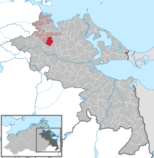
| Location of the municipality of Behrenhoff in the Vorpommern-Greifswald district | ||
  |
||

Behrenhoff is a municipality in the district of Vorpommern-Greifswald . It is administered by the Landhagen office based in Neuenkirchen . Kammin has been part of the community since January 1, 2005.
location
Behrenhoff is about ten kilometers south of Greifswald .
traffic
Landesstraße 35 ( formerly Bundesstraße 96 ) runs west of the municipality . The federal motorway 20 (about nine kilometers) can be reached via the Gützkow junction.
Since 1897 the place had a railway connection of the Greifswald-Jarmener Kleinbahn (GJK) . The line was shut down in 1945 and the track systems and rolling stock dismantled and transported to the Soviet Union as reparations.
Districts
- Behrenhoff
- Busdorf
- Müssow
- Kammin
- New Dargelin
- Stresow
- Stresow settlement
history
Behrenhoff
The place is first mentioned in 1249 as Buztorp . Later the place is also called Budesdorp or Buusdorf and until 1708 in many spelling variants.
The history of the place Behrenhoff is closely connected with the old Pomeranian noble family of those von Behr , who can be proven as landowners since 1387 (sale of a Katenstelle). In the loan letter of 1275 by Duke Barnim and his son Bogislaw no possessions are entered. Butczdorpe was only mentioned in the feudal letter of 1491 . The Swedish-Pomeranian District Administrator Felix Dietrich von Behr auf Bandelin had acquired the entire place in 1759. His youngest son, the Rittmeister Johann Carl Ulrich von Behr (1741-1807), applied to the Swedish-Pomeranian government in Stralsund to rename it Behrenhoff , after he had previously redesigned the entire place into a pure estate business and with completely new buildings had provided. The renaming was approved and on October 26, 1804, the owner donated a Fideikommiss in favor of his grandson Carl Felix Georg von Behr (1804–1838), the son of Chamberlain Felix Bernhard v. B. With this, the house of Behrenhoff , which was later elevated to the baron status, was founded by von Behr. From 1838 Carl Felix Woldemar von Behr was the second majorate from Behrenhoff. In the same year, the palace designed by Schinkel's student Friedrich Hitzig was also completed.


When Count von Behr died in 1933, his nephew inherited the estate, but in will his widow Mechtild received Countess von Behr nee. von Heyden the lifelong right of use for Behrenhoff. It was she who made Behrenhoff Castle available to the Confessing Church and the later murdered Dietrich Bonhoeffer for readings and training of theologians in 1936/1937 . She aroused the displeasure of the National Socialists and was taken into protective custody in 1940 .
The Behrs owned the place until it was expropriated by the land reform in autumn 1945. The stately mansion was burned down when the Red Army marched in in spring 1945. The ruin was demolished for the construction of the new farm houses. The remains of the wall fell on the basement and remained there. They are still buried today, one suspects that archives from Szczecin are still relocated there.
In 1767 the place had 86 inhabitants, in 1865 there were 220. In 1865 Behrenhoff had a church, a school, 12 houses, a factory and 23 farm buildings. The main estate had 800 hectares of agricultural land.
Busdorf
Re-establishment in 1804 as a Vorwerk to the main estate Behrenhoff with the formerly old name of Behrenhoff. Its old place name Busdorf was transferred to the Vorwerk north of the main town .
In 1897, Busdorf received a stop for the Greifswald-Jarmener Kleinbahn (GJK) , shortly before the town from Greifswald was the branch of the Kleinbahn to Klein Zastrow. In 1945 the railway with all its accessories was dismantled as a reparation to the USSR.
Kammin
Kammin was first mentioned in a document in 1249 as Camin . The name means stone and is also archaeologically proven as a Slavic foundation by two corresponding settlement areas northeast of the locality.
From 1579 until the middle of the 18th century the place lay desolate. The Swedish registration records from 1694 also show no settlement. In 1767 Kammin only had five residents again.
In 1865 Kammin had 58 residents in 12 families. There were buildings in the same year: four residential buildings and five farm buildings.
The Feldmark belonged to the Behr's and was managed from Behrenhoff. It was operated as a Vorwerk with a caretaker's house, and was partly an independent Behr'sches estate in the case of inheritance divisions. Kammin was then a municipality with Stresow until a merger with the municipality of Bandelin took place in the 1990s. In 2005, Kammin went to the Behrenhoff community and the Landhagen district to re-establish the offices. As a result, the Kammin thoroughfare was renovated with footpaths with the merger bonuses and the road on the former small railway embankment to Behrenhoff was completely renewed.
Müssow
In the early days there were two Slavic settlements in the area around Müssow, as the archaeological find areas show. The relics found east and west of Müssow are late Slavic (1000–1200); the northern find area is Middle Slavic (800–1000).
Müssow was first mentioned in 1320 as de Mursowe . In 1348 Müssow was then called Morsow , and as early as 1353 it was called Müssow . The Slavic name means something like "to plague" or "torment".
Until 1327 it belonged directly to the Counts of Gützkow , who at that time sold it to the Greifswald citizens of Walen for use. This property then went to the city of Greifswald and in 1407 to the then Greifswald citizen Detlof Behr. The Feldmark then came to the von Behr family , with parts of the place with certain courtyards belonging to the Dominal (Wolgast Office) or to the Greifswald hospital property. In 1742 all of Müssow came into the possession of the administration except for a Dominalhof. In the loan letter of the Behrs from 1491 Müssow was specified as the seat of a branch of the family.
In 1767 Müssow had 62 inhabitants, in 1865 there were 108. In the same year the place had 6 residential buildings, 1 factory and 10 farm buildings. In 1863 the clay deposits in the area were used for the construction and management of a brick factory.
The estate was built over with the later LPG buildings. The half-timbered manor house burned down in 1982 and was removed. The manor park is only recognizable in relics as a wood.
New Dargelin
The name Neu Dargelin was first mentioned in 1932 in the municipality register. Before that, the settlement was called Dargelin Hof II. Neu-Dargelin, as part of Dargelin, was the old property of the city of Greifswald and went back to the Dargelin II leased farm established in the 19th century. From 1912 Neu Dargelin was touched by the GJK small railway with the Busdorf - Klein Zastrow branch.
Only later did the place come to be part of the Behrenhoff community.
Stresow and Stresow settlement


Stresow is a Slavic foundation, as evidenced by the name and the two late Slavic archaeological settlements in the area.
It was first mentioned in documents in 1284 as "Stresow", it is an old Slavic settlement and describes the word Strasha - the guardian or guardian.
As Strescuv the name of the place in the Lehnbrief Behr's was named by the 1491st
In 1694 it was reported that the von Behr family had pawned the property to the von Kirchbach family. Philipp Joachim von Behr auf Dargezin, redeemed the pledged Stresow in 1742. It then fell to the descendants of District Administrator Felix Dietrich von Behr auf Bandelin. Partly it was leased. 1767 Stresow had 55 inhabitants.
Population in 1865: 102; Buildings: five residential buildings and eleven farm buildings. There was a post mill to the north of the village.
In 1926, Graf von Behr-Bandelin sold the Stresow estate to Hermann Ulrich, previously a tenant on Vargatz. It remained in his possession until the land reform in 1945. In 1938 Ulrich had to give up 100 hectares of 426 hectares of land to the settlement company. As a result, five farms were built on the then F 96, each 20 hectares in size. The new district was "Stresow-Siedlung".
In 1945 Gut Stresow was relocated as part of the land reform and new farmer positions of six to eight hectares were created. In 1958, four new farmers joined together to form a Type I LPG called "German-Soviet Friendship", and in 1960 the other farmers joined. In 1975 the LPG was initially merged with that from Behrenhoff in Type III. With the beginning of the large-scale economy at the end of the 1970s, Stresow came to LPG Dargelin.
The place Stresow with settlement had 123 inhabitants in 1984.
After 1990 a new estate was built in Stresow and the manor house restored. There were only a few farm buildings left.
In 2006 the Stresower See was drained and then dredged with funds from the Environment Agency because it was totally silted up. The mud was spread on the fields of the Stresower estate as fertilizer. The lake was then flooded again and boats could be used at the village festival in 2009.
politics
Coat of arms, flag, official seal
The municipality has no officially approved national emblem, neither a coat of arms nor a flag . The official seal is the small state seal with the coat of arms of the region of Western Pomerania . It shows an upright griffin with a raised tail and the inscription "GEMEINDE BEHRENHOFF * LANDKREIS VORPOMMERN-GREIFSWALD".
Attractions
- Behrenhoff church from the 13th century, with bell cage, cemetery, Behr grave
- Row of farm workers' houses in Behrenhoff
- Manor building (stables, stables) in Behrenhoff
- Behrenhoff landscape park by Peter Joseph Lenné , with many rhododendron bushes
- Foundling New Dargelin
Sons and daughters of the place
- Philipp Christian von Normann-Ehrenfels (1756–1817), Württemberg State Minister, born in Stresow
- Carl von Behr (1835–1906), manor owner and politician (MdR)
- Carl von Behr (1865–1933), manor owner and politician (MdH)
- Friedrich Petri (1866–1951), philologist, high school teacher in Stettin, Anklam and Greifswald
- Otto Bauernfeind (1889–1972), theologian
literature
- Heinrich Berghaus : Land book of the Duchy of Pomerania and the Principality of Rügen, Part IV, Volume II, Anklam 1868 p. 36 ff.
- Manfred Niemeyer: East Western Pomerania. Collection of sources and literature on place names. Vol. 2: Mainland. (= Greifswald contributions to toponymy. Vol. 2), Ernst-Moritz-Arndt University of Greifswald, Institute for Slavic Studies, Greifswald 2001, ISBN 3-86006-149-6 . P. 92
Web links
Individual evidence
- ↑ Statistisches Amt MV - population status of the districts, offices and municipalities 2019 (XLS file) (official population figures in the update of the 2011 census) ( help ).
- ^ Area changes in Mecklenburg-Western Pomerania 2005. (PDF; 87 kB) Statistical Office Mecklenburg-Western Pomerania, January 26, 2006, p. 4 , accessed on July 16, 2015 .
- ↑ a b c d e f Manfred Niemeyer: Ostvorpommern . Collection of sources and literature on place names. Vol. 2: Mainland. (= Greifswald contributions to toponymy. Vol. 2), Ernst-Moritz-Arndt-Universität Greifswald, Institute for Slavic Studies, Greifswald 2001, ISBN 3-86006-149-6 , p. 7 ff.
- ^ Report in the church registers
- ^ A b Heinrich Berghaus : Land book of the Duchy of Pomerania and the Principality of Rügen . IV. Part II. Volume: Greifswalder Kreis . Anklam 1868, p. 57 ( Google Books ).
- ^ Heinrich Berghaus : Land book of the Duchy of Pomerania and the Principality of Rügen . IV. Part II. Volume: Greifswalder Kreis . Anklam 1868, p. 36 and 58 ( Google Books ).
- ↑ Main Statute, Section 1, Paragraph 2 (PDF).
Ahlbeck | Old Tellin | Altwarp | Altwigshagen | Anklam | Bandelin | Bargischow | Behrenhoff | Bentzin | Benz | Mountain wood | Blankensee | Blesewitz | Boldekow | Boock | Brietzig | Brünzow | Bugewitz | Buggenhagen | Butzow | Daberkow | Dargelin | Dargen | Dersekow | Ducherow | Eggesin | Fahrwalde | Ferdinandshof | Garz | Glazov | Görmin | Grambin | Grambov | Greifswald | Gribow | Gross Kiesow | Groß Luckow | Great Polzin | Gützkow | Hammer ad Uecker | Hanshagen | Heinrichswalde | Heringsdorf | Hinrichshagen | Hintersee | Iven | Jarmen | Jatznick | Comb teeth | Karlsburg | Karlshagen | Katzow | Kemnitz | Klein Bünzow | Koblentz | Korswandt | Koserow | Krackow | Krien | Kröslin | Kruckow | Krugsdorf | Krummin | Krusenfelde | Lassan | Leopoldshagen | Levenhagen | Liepgarten | Löcknitz | Loddin | Loissin | Loitz | Lubmin | Luebs | Luckow | Luetow | Medow | Meiersberg | Mellenthin | Mesekenhagen | Mölschow | Mönkebude | Murchin | Nadrensee | Neetzow-Liepen | New Boltenhagen | New Kosenow | Neuenkirchen | Neuenkirchen | Low | Papendorf | Pasewalk | Peenemünde | Penkun | Plow | Polzow | Postlow | Pudagla | Ramin | Rankwitz | Rollwitz | Rossin | Rossow | Rothemühl | Rothenklempenow | Rubenov | Rubkov | Sarnow | Sassen-Trantow | Sauzin | Schmatzin | Schönwalde | Spantekow | Stumble on the Peene | Stolpe on Usedom | Strasburg (Uckermark) | Torgelow | Trassenheide | Tutow | Ückeritz | Ueckermünde | Usedom | Square | Vogelsang-Warsin | Völschow | Wackerow | Weitenhagen | Wilhelmsburg | Wolgast | Wrangelsburg | Wusterhusen | Zemitz | Zempin | Zerrenthin | Ziethen | Zinnowitz | Zirchow | Züssow