
Ahlbeck (near Ueckermünde)
| coat of arms | Germany map | |
|---|---|---|

|
Coordinates: 53 ° 40 ′ N , 14 ° 11 ′ E |
|
| Basic data | ||
| State : | Mecklenburg-Western Pomerania | |
| County : | Vorpommern-Greifswald | |
| Office : | At the Szczecin Lagoon | |
| Height : | 10 m above sea level NHN | |
| Area : | 18.66 km 2 | |
| Residents: | 597 (Dec. 31, 2019) | |
| Population density : | 32 inhabitants per km 2 | |
| Postal code : | 17375 | |
| Area code : | 039775 | |
| License plate : | VG, ANK, GW, PW, SBG, UEM, WLG | |
| Community key : | 13 0 75 001 | |
| Office administration address: | Stettiner Strasse 1 17367 Eggesin |
|
| Website : | ||
| Mayor : | Josef Schnellhammer ( CDU ) | |
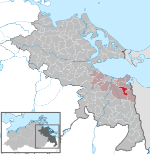
| Location of the municipality of Ahlbeck in the Vorpommern-Greifswald district | ||
 _in_VG.svg) |
||

Ahlbeck is a municipality in the district of Vorpommern-Greifswald in Mecklenburg-Western Pomerania (Germany). It is administered by the Am Stettiner Haff office based in Eggesin .
geography

The municipality of Ahlbeck is located in the eastern part of the Ueckermünder Heide , an extensive forest area near the Polish border. With the districts of Gegensee and Ludwigshof, Ahlbeck encloses the northwestern part of a former lake that was drained by colonists ( Ahlbecker See ). This wetland , called Seegrund, is a nature reserve about six kilometers long and two kilometers wide . The Neuwarper See - a bay in the Szczecin Lagoon (Oderhaff) - is about five kilometers from Ahlbeck (municipality of Luckow, district of Rieth ). A military training area for the Bundeswehr (Karpin - Spechtberg - Drögeheide) is located southwest of Ahlbeck . The nearest town (eight kilometers away) is Eggesin.
Ahlbeck is surrounded by the neighboring communities of Luckow in the north, Hintersee in the east and south-east and Eggesin in the south-west and west.
Districts
- Gegensee - with some thatched half-timbered houses from the Wilhelminian era and a holiday settlement (bungalows and Finnhütten)
- Ludwigshof (district since 1912) - including a riding stables and the Ludwigshofer See
history
The history of the place goes back to the 12th century. However, Ahlbeck did not appear for the first time in a document until 1491 - the existence of a church is documented for the middle of the 15th century.
In the area around Ahlbeck there lived farmers, fishermen and lumberjacks, charcoal burners and tarners. The village belonged to the Duchy of Pomerania from 1493 to 1648 and then came into Swedish ownership. During the Thirty Years' War several farms and the church were destroyed. In the area around Ahlbeck wolves were hunted until the beginning of the 19th century. In 1719 the area was taken over by Prussia. The colonization of the then largely deserted Ueckermünder Heide began with an edict of the Prussian King Friedrich II in 1745. The Vorsee, Ludwigshof and Gegensee farms , which today belong to the community, were created. In the hope of creating fertile meadows, the Ahlbecker See was lowered by drawing drainage ditches to the west (to the Randow ), later to the north (to the Neuwarper See ) and finally drained completely. The desired success did not materialize because the sand and peat soils were not ideal for agricultural use. Today the former lake, the so-called Fenn , is a unique natural landscape.
The 614 inhabitants living in Ahlbeck in 1865 were farmers, traders and fishermen, forest workers, traders and linen weavers. Around 1900, near the district Ludwigshof See Schlick of the former Ahlbeck lake was dredged (the excavator hole is today's Ludwigshofer lake ) in order to produce ammonia from the digested sludge , which was not profitable.
On July 1, 1950, the previously independent community of Gegensee was incorporated.
Since 1993, the town center has been extensively renovated with the help of urban development funding.
politics
Coat of arms, flag, official seal
The municipality has no officially approved national emblem, neither a coat of arms nor a flag . The official seal is the small state seal with the coat of arms of the region of Western Pomerania . It shows an erect griffin with a raised tail and the inscription "GEMEINDE AHLBECK * LANDKREIS VORPOMMERN-GREIFSWALD".
Worth seeing
_2015_NE.jpg)
- The village church of Ahlbeck is a baroque , stately, rectangular half-timbered church from 1759 (other sources from 1754). The tower has an open hood. The furnishings (altar, pulpit, gallery) also date from the 18th century. It is one of the most beautiful examples of a half-timbered church in Northern Germany.
- The grave chapel of the von Voss family in the cemetery dates from the 2nd half of the 19th century.
- The entire, relatively uniform appearance of the village with its mostly eaves half-timbered houses
Gegensee hunting lodge

West of Gegensee, in a wooded area bordered by the towns of Eggesin, Spechtberg , Borken and Gegensee, was the hunting area of the GDR Minister for National Defense , Heinz Hoffmann . After a fire in the early 1970s, a new hunting lodge was built, colloquially known as the Gegensee hunting lodge . In addition, there were vehicle garages, a guard building, a steel lattice tower with radio equipment, other hunting equipment and a helicopter landing pad. In addition to generals of the NVA , hunting guests were also guests from abroad. Because of the resulting security measures, some planned training measures had to be suspended at the nearby shooting range of Garrison Eggesin. When the hunting lodge was no longer sufficient to store the hunting trophies, a trophy house was built at the end of the 1970s.


Hunting vehicles / buckets of the " Wartburg " type specially manufactured in the Eisenach automobile plant in the GDR were available for the minister and his wife. The hunting lodge was manned around the clock and was economically connected to the Hintersee military forestry operation . In terms of communications, the cabin was connected to the communications center of the Ministry of National Defense with direct communications . These connections were operated via the node cable (Kk) 274 Zw 1-10 / 4 of the Deutsche Post of the GDR from Ahlbeck to the hunting lodge. During the hunt, all hunting vehicles were connected to each other and to the hunting lodge via a radio network.
In October and November 1985, an additional hunting bungalow was built for the Minister about five kilometers south of the hunting lodge and north of Rothenklempenow .
The buildings are listed in "TK 25 der DDR" and also in "Geo Basis-DE / MV - DTK 10". The position is 53.61891 and 14.18835. To the southwest of it at a distance of approx. 1000 m there is a rectangular clearing on the top left edge of which a building is also drawn. That could be the helipad described above. From the circular clearing approx. 400 m to the northwest there is another oblique, rectangular clearing with a drawn building and an entrance to the military area. That could be the described car garage. Approx. 3 km to the south you can still see a building at the edge of the forest on Google Maps - hunting bungalow. Except for the last-mentioned building, all buildings have been cleared, the area has been renatured or has itself overgrown.
Transport links
Ahlbeck can be reached from the B 109 via Torgelow and Eggesin. Other highways lead from Ahlbeck to Vogelsang-Warsin on the Stettiner Haff and south to the municipality of Löcknitz on the B 104, around 30 kilometers away . In Eggesin, eight kilometers away, there is also a connection to the railway via the Jatznick – Ueckermünde line.
Web links
Individual evidence
- ↑ Statistisches Amt MV - population status of the districts, offices and municipalities 2019 (XLS file) (official population figures in the update of the 2011 census) ( help ).
- ↑ Main Statute, Section 1, Paragraph 2 (PDF).
- ^ Dehio: Handbook of German Art Monuments.
- ↑ In the map of the telecommunications network, GVS.-Nr. M 787 838 1st edition 1 sheet 117 KB edition 1986 the cable is verified.
- ↑ TK 25 of the GDR, Geo Basis-DE / MV - DTK 10
Ahlbeck | Old Tellin | Altwarp | Altwigshagen | Anklam | Bandelin | Bargischow | Behrenhoff | Bentzin | Benz | Mountain wood | Blankensee | Blesewitz | Boldekow | Boock | Brietzig | Brünzow | Bugewitz | Buggenhagen | Butzow | Daberkow | Dargelin | Dargen | Dersekow | Ducherow | Eggesin | Fahrwalde | Ferdinandshof | Garz | Glazov | Görmin | Grambin | Grambov | Greifswald | Gribow | Gross Kiesow | Groß Luckow | Great Polzin | Gützkow | Hammer ad Uecker | Hanshagen | Heinrichswalde | Heringsdorf | Hinrichshagen | Hintersee | Iven | Jarmen | Jatznick | Comb teeth | Karlsburg | Karlshagen | Katzow | Kemnitz | Klein Bünzow | Koblentz | Korswandt | Koserow | Krackow | Krien | Kröslin | Kruckow | Krugsdorf | Krummin | Krusenfelde | Lassan | Leopoldshagen | Levenhagen | Liepgarten | Löcknitz | Loddin | Loissin | Loitz | Lubmin | Luebs | Luckow | Luetow | Medow | Meiersberg | Mellenthin | Mesekenhagen | Mölschow | Mönkebude | Murchin | Nadrensee | Neetzow-Liepen | New Boltenhagen | New Kosenow | Neuenkirchen | Neuenkirchen | Low | Papendorf | Pasewalk | Peenemünde | Penkun | Plow | Polzow | Postlow | Pudagla | Ramin | Rankwitz | Rollwitz | Rossin | Rossow | Rothemühl | Rothenklempenow | Rubenov | Rubkov | Sarnow | Sassen-Trantow | Sauzin | Schmatzin | Schönwalde | Spantekow | Stumble on the Peene | Stolpe on Usedom | Strasburg (Uckermark) | Torgelow | Trassenheide | Tutow | Ückeritz | Ueckermünde | Usedom | Square | Vogelsang-Warsin | Völschow | Wackerow | Weitenhagen | Wilhelmsburg | Wolgast | Wrangelsburg | Wusterhusen | Zemitz | Zempin | Zerrenthin | Ziethen | Zinnowitz | Zirchow | Züssow