
Dargelin
| coat of arms | Germany map | |
|---|---|---|

|
Coordinates: 54 ° 1 ' N , 13 ° 21' E |
|
| Basic data | ||
| State : | Mecklenburg-Western Pomerania | |
| County : | Vorpommern-Greifswald | |
| Office : | Landhagen | |
| Height : | 24 m above sea level NHN | |
| Area : | 15.72 km 2 | |
| Residents: | 358 (Dec. 31, 2019) | |
| Population density : | 23 inhabitants per km 2 | |
| Postal code : | 17498 | |
| Area code : | 038356 | |
| License plate : | VG, ANK, GW, PW, SBG, UEM, WLG | |
| Community key : | 13 0 75 025 | |
| Community structure: | 5 districts | |
| Office administration address: | Theodor Körner Strasse 36 17498 Neuenkirchen |
|
| Website : | ||
| Mayor : | Fred Feike | |
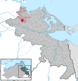
| Location of the community Dargelin in the district of Vorpommern-Greifswald | ||
  |
||

Dargelin is a municipality in the Vorpommern-Greifswald district. The municipality is administered by the Landhagen office with its seat in Neuenkirchen .
Geography and traffic
The 16 km² large community is about ten kilometers south of Greifswald at an altitude of 24 m above sea level. It is mainly surrounded by agricultural land, only in the north it is limited by a forest area. The Schwinge tributary also touches the municipality there. The community is affected by the geotope " Os Sassen-Dersekow-Dargelin ".
The administrative center of Neuenkirchen to the north is about 16 kilometers by road. The municipal area is crossed by the state road 35, the former federal road 96 from north to south. The federal motorway 20 runs west of Dargelin and can be reached via the northern junction Greifswald (16 km) and the southern junction Gützkow (9 km). The next rail connections on the Berlin – Stralsund railway line are in Greifswald and Groß Kiesow .
Districts
|
|
|
history
Dargelin
To the north and northeast of the eponymous district of the municipality are several sites with evidence of settlement from the late Slavic period, as well as an early German tower hill. It was first mentioned in 1248 as Dargolyn and Dargolin. The name comes from Slavic and means something like "dear and dear" (after Niemeyer) or "way" or "gift" (after Berghaus). The von Behr family, who lived in Dargelin, gave the place to the city of Greifswald in 1284 as a gift from the Pomeranian Duke Bogislaw IV , to which it belonged until the 20th century. In 1597 the 800 hectare site consisted of two cottages, a jug and a mill. During the Thirty Years War Dargelin was badly devastated in 1637 by the Swedish general Johan Banér , whereupon Greifswald gave up the self-management and leased the property. Dargelin was mortgaged both from 1686 to 1740 and from 1809 to 1849. As early as 1700, the place had developed into a rural village , in 1788 Greifswald merged the three existing farms into one manor. In 1849 one of the tenants built the manor house. While the manor district had 30 families with a total of 184 inhabitants in 1865, the census of 1910 showed only 165 inhabitants for the manor district Dargelin. Since 1897 the place had a railway connection on the branch line Behrenhoff - Klein Zastrow of the Greifswald-Jarmener Kleinbahn (GJK). The route touched Dargelin, Old Negentin and New Negentin. The places Sestelin and Sophienberg were connected to the route by field railways. The line was shut down in 1945 and the tracks were dismantled as reparations. Around 1927 the city exchanged the Dargelin estate for land owned by the University of Greifswald in Eldena and Koitenhagen . From 1938 to July 31, 1946, Dargelin was part of the Bandelin community . In 1947 the estate was relocated as part of the land reform and given to 21 new farmers . In 1952 they formed an agricultural production cooperative (LPG). A go- kart track was established in the LPG buildings after 1990 . While Dargelin still had 387 inhabitants in 1964, the number changed to 353 in 1990, to 421 in 2003 and to 367 in 2013. With the formation of the Landhagen office in 1992 , Dargelin regained the status of an independent municipality.
Dargelin yard
Dargelin Hof was only given this name in municipal directories from 1971. Before that, around 1920 it was called a courtyard according to the measurement table sheet . It was later a cluster of LPG stables with a few residential buildings. After 1990, many of the town's buildings are only ruins.
Old Negentine
The area around Alt Negentin has been settled since the Neolithic Age, as can be seen from several large stone graves from this era. The Bronze Age , as a settlement area for the Germanic peoples, is evidence of continuous settlement through several barrows (see also megalithic graves near Neu Negentin ). Alt Negentin was first mentioned in 1284 as "Neghentin". The name means something like "heath, forest area" in Slavic. It was not until 1835 that the name changed to Alt Negentin.
Alt Negentin was partly a manor, partly from the 17th century a tertial property . In the 13th century, the Greifswald councilor Heinrich Negentin owned the estate, followed by thelesenitz family in the 15th century. They were also members of the city's magistrate and were related to the university's founder Heinrich Rubenow . In 1476, the literary family sold both goods to Claus Blixen zu Klein Zastrow. During the Thirty Years War the four existing farms were devastated. Later the fiefdom had 1,385 prussia. Tomorrow and the Tertialgut 1.097 Prussia. Tomorrow with high proportions of fertile farmland. In 1852 the male line of the family died out with Gustav Adolf von Blixen. His sister's descendants, married Franz, owned the Alt Negentin estate until the first half of the 20th century. In 1865 there were 121 residents in 16 families in the village, and there were seven residential and nine farm buildings as well as a Dutch windmill and a distillery. In the 1910 census, 100 inhabitants were determined for the Alt Negentin manor district. On March 23, 1912, the branch line to Klein Zastrow (8.93 km), serving only goods traffic, was opened. In the 1920s, the estate ran a warmblood breeding stud. The last owner of the estate until 1945 was the Ringenberg family. After the end of the Second World War , Alt Negentin had 395 inhabitants. The property was expropriated in the course of the land reform and distributed to new settlers. The property was later transferred to the Agricultural Production Cooperative (LPG) "Happy News". Peter Ringenberg bought back the ancestral estate in 1991. In 1997 the former manor house was demolished and a new building was erected, which is used as a kindergarten.
New Negentin
The place was first mentioned in 1624 as "New Negentine". The village and the local economy have been the town and hospital property of St. Spiritus in Greifswald since that time. It consisted of the manor and a few farm workers' houses. As a rule, city or hospital goods were leased and their income then flowed to the owner. In 1848 the estate had 954 acres of fields and 91 acres of meadows. In 1865 Neu Negentin had 62 inhabitants in nine families, there were four residential buildings, one school and nine farm buildings. In 1871 the population had increased to 71, the 1910 census showed 79 inhabitants.
Sestelin
To the west and south-east of the village are two late Slavic settlement areas that have been archaeologically proven and thus prove the founding of the Slavic village. Documents of the time also reported that the place was mainly inhabited by Slavs. The place was first mentioned in 1284 as "Sestelyn". The Slavic place name means "settle down". The noble Blixen family had been named as owners since 1284, and in 1810 the Greifswald businessman Philipp Hermann Weißenborn acquired the Sestelin estate. In 1865 Sestelin had 91 inhabitants in 14 families. Six residential and seven farm buildings were registered. In 1910 the Sestelin manor had 85 inhabitants.
- Sophienberg (historical desert)
Sophienberg was laid out between 1824 and 1825 as a preliminary work for the Alt Negentin estate. It was named after the wife of the owner of Klein Zastrow, Carl Emil Weissenborn. The Vorwerk was about 1.5 kilometers southwest of Sestelin. After 1920 the place fell desolate. and was assigned to the district of Alt Negentin in 1946. Today only a bushy area is visible.
politics
Coat of arms, flag, official seal
The municipality has no officially approved national emblem, neither a coat of arms nor a flag . The official seal is the small state seal with the coat of arms of the region of Western Pomerania . It shows an erect griffin with a raised tail and the inscription "GEMEINDE DARGELIN * LANDKREIS VORPOMMERN-GREIFSWALD".
Attractions
→ See: List of architectural monuments in Dargelin
- Great stone graves near Dargelin (1) and Neu Negentin (4)
- Alt Negentin and Dargelin manor
literature
- Greifswald and its surroundings, Akademie-Verlag Berlin, 1968, page 142
- Manfred Niemeyer: East Western Pomerania. Collection of sources and literature on place names. Vol. 2: Mainland. (= Greifswald contributions to toponymy. Vol. 2), Ernst-Moritz-Arndt University of Greifswald, Institute for Slavic Studies, Greifswald 2001, ISBN 3-86006-149-6 . Pp. 94, 124, 125
- Eckhard Oberdörfer: Ostvorpommern, Edition Temmen, Bremen, 2006, ISBN 3-86108-917-3
Web links
Individual evidence
- ↑ Statistisches Amt MV - population status of the districts, offices and municipalities 2019 (XLS file) (official population figures in the update of the 2011 census) ( help ).
- ↑ a b c d e f Manfred Niemeyer: Ostvorpommern . Collection of sources and literature on place names. Vol. 2: Mainland. (= Greifswald contributions to toponymy. Vol. 2), Ernst-Moritz-Arndt University of Greifswald, Institute for Slavic Studies, Greifswald 2001, ISBN 3-86006-149-6 . P. 24 ff
- ^ A b c Heinrich Berghaus : Land book of the Duchy of Pomerania and the Principality of Rügen . IV. Part II. Volume: Greifswalder Kreis . Anklam 1868, pp. 36, 57 ff ( Google Books ).
- ↑ http://wiki-de.genealogy.net/Gemeinde_Dargelin
- ↑ Main Statute, Section 1, Paragraph 1 (PDF).
Ahlbeck | Old Tellin | Altwarp | Altwigshagen | Anklam | Bandelin | Bargischow | Behrenhoff | Bentzin | Benz | Mountain wood | Blankensee | Blesewitz | Boldekow | Boock | Brietzig | Brünzow | Bugewitz | Buggenhagen | Butzow | Daberkow | Dargelin | Dargen | Dersekow | Ducherow | Eggesin | Fahrwalde | Ferdinandshof | Garz | Glazov | Görmin | Grambin | Grambov | Greifswald | Gribow | Gross Kiesow | Groß Luckow | Great Polzin | Gützkow | Hammer ad Uecker | Hanshagen | Heinrichswalde | Heringsdorf | Hinrichshagen | Hintersee | Iven | Jarmen | Jatznick | Comb teeth | Karlsburg | Karlshagen | Katzow | Kemnitz | Klein Bünzow | Koblentz | Korswandt | Koserow | Krackow | Krien | Kröslin | Kruckow | Krugsdorf | Krummin | Krusenfelde | Lassan | Leopoldshagen | Levenhagen | Liepgarten | Löcknitz | Loddin | Loissin | Loitz | Lubmin | Luebs | Luckow | Luetow | Medow | Meiersberg | Mellenthin | Mesekenhagen | Mölschow | Mönkebude | Murchin | Nadrensee | Neetzow-Liepen | New Boltenhagen | New Kosenow | Neuenkirchen | Neuenkirchen | Low | Papendorf | Pasewalk | Peenemünde | Penkun | Plow | Polzow | Postlow | Pudagla | Ramin | Rankwitz | Rollwitz | Rossin | Rossow | Rothemühl | Rothenklempenow | Rubenov | Rubkov | Sarnow | Sassen-Trantow | Sauzin | Schmatzin | Schönwalde | Spantekow | Stumble on the Peene | Stolpe on Usedom | Strasburg (Uckermark) | Torgelow | Trassenheide | Tutow | Ückeritz | Ueckermünde | Usedom | Square | Vogelsang-Warsin | Völschow | Wackerow | Weitenhagen | Wilhelmsburg | Wolgast | Wrangelsburg | Wusterhusen | Zemitz | Zempin | Zerrenthin | Ziethen | Zinnowitz | Zirchow | Züssow