
Wusterhusen
| coat of arms | Germany map | |
|---|---|---|

|
Coordinates: 54 ° 7 ' N , 13 ° 37' E |
|
| Basic data | ||
| State : | Mecklenburg-Western Pomerania | |
| County : | Vorpommern-Greifswald | |
| Office : | Lubmin | |
| Height : | 35 m above sea level NHN | |
| Area : | 19.08 km 2 | |
| Residents: | 1119 (Dec. 31, 2019) | |
| Population density : | 59 inhabitants per km 2 | |
| Postal code : | 17509 | |
| Area code : | 038354 | |
| License plate : | VG, ANK, GW, PW, SBG, UEM, WLG | |
| Community key : | 13 0 75 146 | |
| Community structure: | 5 districts | |
| Office administration address: | Geschw.-Scholl-Weg 15 17509 Lubmin |
|
| Website : | ||
| Mayor : | Burkhard Köpnick | |
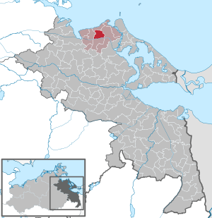
| Location of the municipality of Wusterhusen in the Vorpommern-Greifswald district | ||
  |
||

Wusterhusen is a municipality in the district of Vorpommern-Greifswald in Mecklenburg-Western Pomerania (Germany). She belongs to the Lubmin office .
geography
Wusterhusen is located about 16 km east of Greifswald and two kilometers south of Lubmin on the district road K 22 between Wolgast and Greifswald . The community lies on a ridge between the Greifswalder Bodden in the north and the marshy lowland of the Ziese in the south. The terrain is wavy and has heights from 15.7 to 34.9 meters above sea level . To the north of Wusterhusen lies Lubmin, Rubenow in the east , Neu Boltenhagen in the south and Brünzow in the west.
Community structure
|
|
|
history

Gustebin
To the north-east of Gustebin there was a Bronze Age barrow, but it has since been removed. In 1930 stonecutters discovered urn remains while working on the boundary stone, a bronze sword ( finger-tongue sword ) with a cast handle, a fibula and small parts. The sword was 68 cm long, 4 cm wide, the blade alone is 57 cm long. The handle consists of 8 cast rings, it is 11 cm long. It was a unique find in Pomerania at the time.
Directly to the west on the outskirts of Gustebin is an archaeological settlement from the late Slav period (1000 to 1200).
Gustebin was first mentioned in a document with its current name in 1271. The name has different spellings later. The name interpretation of the Slavic foundation is derived from "guest".
Gustebin is a typical manor village with the dominant manor and a farm worker list. Only relics remain of the estate, such as B. the distillery with the tall chimney. The manor house was demolished after 2015.
After 1945 the village grew into a stately place to live.
Konerow
Konerow was first mentioned in 1271 as Cunirow . It is a Slavic foundation and its name means "place of the horse herdsman". The Slavic foundation is also evidenced by three nearby archaeological settlements.
Konerow is an estate village, but even before 1835 (according to PUM) it had a lime kiln and a brick factory, due to the corresponding deposits. However, these were later discontinued due to unprofitability.
Pritzwald

Pritzwald was mentioned in a document as early as 1271 as Priszwalck . The interpretation of the Slavic word gives many variants, "Fuhrweg durch den Wald" seems the best. There are three late Slavic evidence of settlement close to the site that prove this foundation.
In the cadastral map of 1865, only one post mill is shown for Pritzwald. In 1869 two post mills built by local farmers were drawn on the cadastral map. One of the new windmills no longer existed in 1892/1893. According to the building control role, the demolition of the oldest windmill, which still existed in 1920, was registered in 1943.
The place was a farming village and had the shape of a cluster village with the hint of an Angers.
In 1897 Pritzwald received a connection with a stop on the Kleinbahn Greifswald-Wolgast (KGW) .
Stevelin

The Slavic foundation of the place is evidenced by two neighboring late Slavic archaeological settlements, one directly in the village and the other somewhat to the east.
Stevelin was first mentioned in 1271 as "Steuelin". The Slavic name means something like "dark" or "sorrel".
Stevelin was spatially separated from Wusterhusen until after 1920, today it is fully integrated into Wusterhusen, but is still managed as a separate village location. The formerly large and closed estate is predominantly built over in a modern way, usually during the LPG era, but also later. The estate, which was built after 1990, was rebuilt further east, but old facilities continued to be used.

Wusterhusen
The area of Wusterhusen was settled early in prehistoric times, for example in the Neolithic (5500 to 1800 BC), the Bronze Age (1800 to 600 BC) and the Pre-Roman Iron Age (600 BC to 0). These early settlement periods document the finds of several rock axes, a bronze brooch and an Iron Age burial ground , including a campfire grave as a women's burial with numerous additions. In the gentile tombs, jewelery predominated. a. so-called Pomeranian fibulae. Eggers uncovered an urn grave field with 85 burials in Wusterhusen in 1937. The result was beautiful urns and many metal gifts, including many brooches and needles. The graves were assigned to the Younger Bronze Age and the Pre-Roman Iron Age. In 1938, Dr. Gau there is a sensational house urn with a bronze razor in it.
Today's community embodies one of the oldest Slavic place and landscape names in Pomerania. It was first mentioned on December 3, 1150 as "Wostrose". The emperor Konrad III. confirmed the tithe from six Pomeranian provinces, including Wusterhusen, to the diocese of Havelberg . The name means something like land fenced with palisades, area and suggests a Slavic castle and place of worship.
One of the oldest documentary evidence from 946 with "Wostze" is considered to be false.
Proven settlements with finds of pottery shards and burnt clay plaster testify to a late Slavic settlement of the district Wusterhusen, which extended to the southern border of the Greifswald Bodden . The late Slavic settlements are spread around the place. A large number can also be found outside the district near Kräpelin and Lubmin.
Wusterhusen, later Germanized, was the medieval administrative center of the Slavic country Ostrusna (1193) or Wostrosne (1208) and belonged to the Duchy of Pomerania under Bogislaw IV and Casimir I. During the armed conflict between Denmark and Pomerania at that time in which the The ducal-Pomeranian fleet was smashed at Whitsun 1184 in the Greifswalder Bodden, the Danish bishop and fleet leader Absalon wanted to conquer the land of Wusterhusen at the same time from Rügen . But the wind stood against the northerners in the Greifswalder Bodden and they could not realize their project. Wusterhusen escaped destruction. The existence of a pastor in the village is already recorded from the year 1230. Towards the end of the 13th century, craftsmen built a village church , which was consecrated in 1271 .
Wusterhusen itself did not have a farm, it was located in the directly neighboring Stevelin. This was very large and compact and was also dominant for Wusterhusen. Wusterhusen itself was a village and church village with small farmsteads and craftsmen and farm workers' cottages.
In 1897 Wusterhusen got a connection to the Kleinbahn Greifswald-Wolgast (KGW) with a stop south of the church.
After the war, Wusterhusen developed through the incorporation of Stevelin and the expansion of an LPG (P) established there, the LPG (T) was mainly relocated to Lubmin. Wusterhusen became the place of residence for the employees; in addition to the prefabricated buildings, a number of private homes were also built. The new Anger was built around the newly built school, the cultural center (later the Genesis large disco) and the residential areas. A commercial area was created on Gustebiner Damm, which was expanded and modernized after 1990.
After 1990 the LPG was privatized and the property in the former Stevelin was reactivated. A larger residential area was created in the direction of Lubmin.
In 2000 Wusterhusen celebrated its 850th anniversary. In the run-up to the anniversary year and the 35th Pomeranian meeting in Greifswald in May 1998, a modern rune stone with a corresponding inscription was designed and positioned on the premises of the local company Hallen- und Anlagenbau (HAL) Wusterhusen in order to refer to the historical events over 850 years ago recall. The large stone (dimensions H: 1.25 m, W: 1.23 m, D: 0.85 / 0.65 m, U: 3.75 m) disappeared around 2003. The following inscription after runes of the younger Viking - Futhark was cut into the heavy granite boulder : WOZTROSA (Wusterhusen) - MCMXCVIII (1998) .
- Cruselin or Kräselin (desert)
First mentioned in a document in 1271 as Cruselin . As a Slavic foundation, the name means "beauty, also red color". The place was north of Wusterhusen near Lubmin. The place was a Vorwerk zu Wusterhusen. After 1835 (last drawing in Prussia. Urmeßtischblatt) the place disappears, at that time the place was called Kräselin. The place was dissolved as a municipality in 1836 and turned into a district of Wusterhusen-Stevelin.
- Gnögentin (desert)
Gnögentin was first mentioned in 1271 as Gnuyentin . It is a Slavic foundation and means something like "dung" or "pus". The location southwest of Wusterhusen is not precisely documented, but the archaeological evidence is evidence of the location near the current industrial park. In 1696 the place was named Gnögentin for the last time and afterwards it was soon desolate.
politics
coat of arms
|
|
Blazon : “In green, an octagonal silver steeple rising from the lower edge with a golden weathercock on a spherical knob; accompanied: on the right by a golden butcher's mallet, on the left by a golden ear. "
The coat of arms and the flag were designed by the Weimar heraldist Michael Zapfe . It was approved together with the flag on May 29, 2000 by the Ministry of the Interior and registered under number 208 of the coat of arms of Mecklenburg-Western Pomerania. |
| Reasons for the coat of arms: The coat of arms reflects the octagonal steeple that characterizes the town and served as a landmark for the seafarers. While the wooden hammer should be used to refer to the craft, especially the cooper's trade, the ear of corn symbolizes the agriculture that has dominated all districts for centuries. |
flag

The flag is striped in green, white and green across the longitudinal axis of the flag cloth. The green stripes each take up one fifth, the white stripe three fifths the length of the flag cloth. In the middle of the white stripe is the municipal coat of arms, which takes up two thirds of the height of the flag. The length of the flag is related to the height as 5: 3.
Official seal
The official seal shows the municipal coat of arms with the inscription "GEMEINDE WUSTERHUSEN * LANDKREIS VORPOMMERN-GREIFSWALD".
Attractions
Buildings
- Johanneskirche in Wusterhusen . Originally built as a hall church in the 13th century , it was redesigned in both the 15th and 17th centuries. It has a baroque altar .
- Half-timbered houses from the 18th century with clay infills and half- hipped roofs in Wusterhusen, some of which are listed .
- Commemorative plaque for Bruno Jackley in Wusterhusen, in the course of the Kapp Putsch was killed
- Two-storey warehouse in Gustebin
- Manor house in Konerow

Half-timbered house in Wusterhusen

Old warehouse Gustebin

Konerow Manor


Green areas and local recreation
- The Hohe Berg is a 48 meter high elevation that lies east of the municipality.
- Remnants of the estate parks in Wusterhusen, Gustebin and Konerow
- Ziesetal south on the municipality border
Economy and Infrastructure
Companies
The community is characterized by the farms. In Wusterhusen there is an industrial park to the southwest. In addition, in most places there are smaller businesses and some tourist offers due to the proximity to the Greifswalder Bodden.
education
- Daycare center Wusterhusen
- Primary school "Lütt Matten"
traffic
The L 262 runs north and the K 22 runs through the municipality, otherwise all districts are connected by municipal roads.
From 1897 to 1945 the community was crossed by the Kleinbahn-Gesellschaft Greifswald-Wolgast (KGW) coming from Lubmin via Wusterhusen and Pritzwald to Wolgast. It had stops near Wusterhusen and Pritzwald, and in Wusterhusen the typical corrugated iron shed of the small railways for the storage of goods and work materials stood until the 2010s. In the 21st century, the route is mainly used as a cycle path.
Personalities

- Henning Christoph Gerdes (1665–1723), Professor of Law in Greifswald
- Karl Lappe (1773–1843), Pomeranian poet
literature
- Greifswald and its surroundings (= values of the German homeland . Volume 14). 1st edition. Akademie Verlag, Berlin 1968.
- Lutz Mohr : The "rune stone" from Kräpelin-Wusterhusen in the wider area of the university and Hanseatic city of Greifswald / Western Pomerania . In: Stone Cross Research (SKF). Edited by Rainer H. Schmeissner. Studies on German and international land monument research, Volume No. 10 (series of monographs), Regensburg 1999, pp. 36–38
- Manfred Niemeyer: East Western Pomerania. Collection of sources and literature on place names. Vol. 2: Mainland. (= Greifswald contributions to toponymy. Vol. 2), Ernst-Moritz-Arndt University of Greifswald, Institute for Slavic Studies, Greifswald 2001, ISBN 3-86006-149-6 . Pages 73
Web links
Individual evidence
- ↑ Statistisches Amt MV - population status of the districts, offices and municipalities 2019 (XLS file) (official population figures in the update of the 2011 census) ( help ).
- ^ Wilhelm Petzsch , communications from the collection of prehistoric antiquities at the University of Greifswald , Volume VI., Verlag Bamberg - Greifswald, 1933, p. 26 ff.
- ↑ Corpus 43/49
- ↑ a b c d e f g h Manfred Niemeyer: Ostvorpommern . Collection of sources and literature on place names. Vol. 2: Mainland. (= Greifswald contributions to toponymy. Vol. 2), Ernst-Moritz-Arndt University of Greifswald, Institute for Slavic Studies, Greifswald 2001, ISBN 3-86006-149-6 . P. 22
- ^ Susanne Möckel: The Petri Church in Lubmin 1957-2007, stories and memories. , P. 40
- ↑ Hans-Heinz Schütt: On shield and flag production office TINUS, Schwerin 2011, ISBN 978-3-9814380-0-0 , p. 377/378.
- ↑ a b main statute § 1 (PDF).
Ahlbeck | Old Tellin | Altwarp | Altwigshagen | Anklam | Bandelin | Bargischow | Behrenhoff | Bentzin | Benz | Mountain wood | Blankensee | Blesewitz | Boldekow | Boock | Brietzig | Brünzow | Bugewitz | Buggenhagen | Butzow | Daberkow | Dargelin | Dargen | Dersekow | Ducherow | Eggesin | Fahrwalde | Ferdinandshof | Garz | Glazov | Görmin | Grambin | Grambov | Greifswald | Gribow | Gross Kiesow | Groß Luckow | Great Polzin | Gützkow | Hammer ad Uecker | Hanshagen | Heinrichswalde | Heringsdorf | Hinrichshagen | Hintersee | Iven | Jarmen | Jatznick | Comb teeth | Karlsburg | Karlshagen | Katzow | Kemnitz | Klein Bünzow | Koblentz | Korswandt | Koserow | Krackow | Krien | Kröslin | Kruckow | Krugsdorf | Krummin | Krusenfelde | Lassan | Leopoldshagen | Levenhagen | Liepgarten | Löcknitz | Loddin | Loissin | Loitz | Lubmin | Luebs | Luckow | Luetow | Medow | Meiersberg | Mellenthin | Mesekenhagen | Mölschow | Mönkebude | Murchin | Nadrensee | Neetzow-Liepen | New Boltenhagen | New Kosenow | Neuenkirchen | Neuenkirchen | Low | Papendorf | Pasewalk | Peenemünde | Penkun | Plow | Polzow | Postlow | Pudagla | Ramin | Rankwitz | Rollwitz | Rossin | Rossow | Rothemühl | Rothenklempenow | Rubenov | Rubkov | Sarnow | Sassen-Trantow | Sauzin | Schmatzin | Schönwalde | Spantekow | Stumble on the Peene | Stolpe on Usedom | Strasburg (Uckermark) | Torgelow | Trassenheide | Tutow | Ückeritz | Ueckermünde | Usedom | Square | Vogelsang-Warsin | Völschow | Wackerow | Weitenhagen | Wilhelmsburg | Wolgast | Wrangelsburg | Wusterhusen | Zemitz | Zempin | Zerrenthin | Ziethen | Zinnowitz | Zirchow | Züssow