
Dargen
| coat of arms | Germany map | |
|---|---|---|

|
Coordinates: 53 ° 53 ' N , 14 ° 4' E |
|
| Basic data | ||
| State : | Mecklenburg-Western Pomerania | |
| County : | Vorpommern-Greifswald | |
| Office : | Usedom-South | |
| Height : | 1 m above sea level NHN | |
| Area : | 28.24 km 2 | |
| Residents: | 581 (Dec. 31, 2019) | |
| Population density : | 21 inhabitants per km 2 | |
| Postcodes : | 17419, 17429 (Katschow) |
|
| Area code : | 038376 | |
| License plate : | VG, ANK, GW, PW, SBG, UEM, WLG | |
| Community key : | 13 0 75 026 | |
| Community structure: | 7 districts | |
| Office administration address: | Markt 1 17406 Usedom |
|
| Website : | ||
| Mayor : | Detlef Wenzel | |
| Location of the community Dargen in the Vorpommern-Greifswald district | ||
  |
||

Dargen is a municipality near Usedom on the island of the same name, right on the banks of the Szczecin Lagoon . The municipality is administered by the Usedom-Süd office based in the city of Usedom. Until 2005, the community belonged to the Ahlbeck-Stettiner Haff district .
geography
Dargen is located on the north bank of the Szczecin Lagoon in the middle of the Usedom Island Nature Park . About eleven kilometers west of the municipality is the town of Usedom and about ten kilometers north of the seaside resort of Ahlbeck .
Community structure
|
|
|
|
history
The community has belonged to the state of Mecklenburg-Western Pomerania since 1990. Since 1994 it has belonged to the district of Ostvorpommern , which was added to the district of Vorpommern-Greifswald in 2011 .
Bossin
The first documentary mention of Bossin took place in 1256 as "Bvssino" (PUB II No. 631). In the document, Duke Barnim I testifies to the exchange of the Grobe monastery from the village of Bossin in the Land of Usedom with Gut Crakow in the Land of Gützkow. An older document from 1239 (PUB I No. 367) later turned out to be false. An earlier mention of the place comes from the year 1111 as "Bussyno" and "Bussyn" in the registers or annals of the monastery of Grobe / Pudagla. The year 1111 is so far not plausible, the register of the monastery was only created during the term of office of Abbot Heinrich IV. With this and two further reviews based on Niemeyer's note, the year is probably correct, but the meaning remains unclear, as no text translations of the passage in question are known to date. The name is traced back to a person's name.
Bossin is a small clustered village on the lagoon and functionally a farming village. Around 1900 there was a post mill, which disappeared after 1920. The village still has the same shape and size today.
On July 1, 1950 Bossin was incorporated.
Dargen
The area around Dargen was settled early on, as evidenced by many prehistoric and prehistoric sites.
The first documentary mention was made as "Dargen" in 1617. The Slavic name is interpreted as "lying in the valley" or as "market".
An earlier mention of the place comes from the year 1111 as "Darghen" in the registers or annals of the monastery of Grobe / Pudagla. The year 1111 is so far not plausible, the register of the monastery was only created during the term of office of Abbot Heinrich IV. With this and two further reviews based on Niemeyer's note, the year is probably correct, but the meaning remains unclear, as no text translations of the passage in question are known to date.
Together with the neighboring Stolpe, the Feldmark von Dargen belonged to the estate of the Lords of Winterfeld as early as the 14th century .
Since 1876 Dargen was touched by the Ducherow – Swinoujscie railway . A train station was built here, some of which is still preserved today with the signal tower and other buildings.
The Buddelberg Dargen estate was economically important and became an LPG property after the war and the land reform phase.
After the Peace of Westphalia in 1648 Dargen belonged to Swedish Pomerania and became Prussian in 1720 after the Peace of Stockholm . After the administrative reform in 1815, Dargen came to the Prussian province of Pomerania and belonged to the district of Usedom-Wollin from 1818 to 1945 . From 1945 to 1952 the part of the district that remained in Germany after the Second World War formed the district of Usedom, which in 1952 became part of Wolgast in the Rostock district.

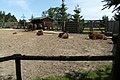
During the GDR era, a well-known two-wheeler museum was built on the station area and was expanded after 1990. Several tourist facilities were created, which benefit from the scenic location on the nearby lagoon, as well as from the Pratenow bison enclosure and Stolpe Castle.
Goerke
Görke was first mentioned in a document in 1239 as "Gureke". The Slavic name is interpreted as "small mountain".
In terms of structure, Görke was a street green village and in terms of function it was a farming village. It had a settlement yard to the northeast (dismantling) and a village school in the direction of Kachlin. Later the place developed more to a street village on the B 110 with a restaurant. The Ducherow – Swinoujscie line ran parallel to the B 110 and can be seen very clearly here with the embankment. Apart from agriculture and a few gravel pits, the place had no economic importance.
On July 1, 1950, Görke was incorporated.
Kachlin
Kachlin was first mentioned in 1238 as Gaghelyn. The spelling changes from “G” at 1300 to “C” and then at 1700 to “K”. The original name is interpreted as a West Slavic name for "goose" or "duck".
A short distance from the village is an early German tower hill (from 1230). It is plowed over, but has been archaeologically proven by the nature of the soil and ceramic and brick finds.
Kachlin is a manor village with the Dominalgut as the core and the agricultural workers' list along the street. The estate was owned by the Pudagla Monastery, previously Grobe, and was assigned to the ducal property through secularization after 1534 and thus became a dominal.
The estate is still easily recognizable today, despite partial building over after the war. The farm buildings are a combination of field and brick. The village is close to the B 110. Today the village has partly dedicated itself to tourism.
Katschow
Katschow was first mentioned in a document in 1238 as "Catzegow". The current spelling was not used until 1699. The Slavic name is interpreted as “duck place” because of the wild ducks on the nearby Kachlin Lake and the Thurbruch.
Katschow is a small street green village with small farms. It only had a post mill. It was only after 1960 that a larger LPG complex developed, which was partly abandoned after 1990, but partly also re-used and modernized.
On July 1, 1950, Katschow was incorporated.
Neverow
Neverow was first mentioned in a document in 1270 as "Nieuerowe". In it (PUB II No. 910) the cathedral chapter of Cammin exchanges some land and taxes with the Grobe monastery, including from Neverow. Earlier documents from 1238 (PUB I No. 357) and 1239 (PUB I No. 367) in which Neverow appeared for the Grobe monastery are later considered to be fake - the monasteries were not squeamish in forging because they had monks who knew how to write could do that and ownership has always been important. The Slavic name is interpreted as "distrust" and "faithlessness".
The village was not far from the backwater and was a street village in shape.
Neverow consisted of 3 farms in 1835 and 5 farms in 1880, the easternmost of the latter had a post mill. The courtyards were three or four-sided courtyards, i.e. closed objects, because the fourth side of the three-sided courtyards was closed by a wall and gate.
In 1920 the structure was unchanged, only the windmill had disappeared. After 1945 only two courtyards and a small holiday complex (bungalows) were added by the water.
On July 1, 1950, Neverow was incorporated.
Praetenow
Pretenow was not called Pretmow until 1535. The spelling changed often until the current spelling was used for the first time in 1818. The origin of the name is not interpreted. The deserted Poretse was assumed to be the forerunner of this place.
From 1835 (according to PUM) to 1920 (according to MTB ) Prietenow remained a farming village, a scattered settlement with around 8 to 10 farms. Only with the construction of the Ducherow-Swinoujscie railway line did the place have a station keeper's house, but no stopping point. The Praetenower had to use the Dargen train station. There was also a post mill at the level crossing, which disappeared by 1920. After 1945 a new small residential area belonging to Pratenow was built on the road to Dargen and later an agricultural complex further north.
In 2004, after long preparations and official approvals, the first bison from the Miedzyzdroje breeding station on Wollin was settled in the enclosure built 1.1 km north of Praetenow. This developed into a tourist attraction, as the bison have also developed splendidly since it was founded.
On July 1, 1950 Pratenow was incorporated.
Housing areas and desertification
Buddelberg (living space)
Buddelberg was mentioned with this name in the directory of places in 1906. As a field name, the name probably comes from the nearby mountain. It is a residential space a little separated from the place Dargen, south of this. The living space still exists today, but is integrated after Dargen. In 1835 the place was registered as a Vorwerk in the Prussian original measurement table, from 1880 it was listed as an estate. A Dutch windmill was recorded around 1900, but it probably disappeared after 1920. The structure of the property has been preserved to this day, it seems to have been modernized. The living space has increased, a restaurant and a holiday farm were created. From the eponymous mountain you have a good view of the lagoon.
Eschengrund (living space)
Eschengrund was also mentioned by the name in 1906 in the register of places. The location was not described and is not shown on the maps with the name, so it can only be assumed that it is the mining close to the lagoon. It is located southeast of Dargen and has a small port. There are some leisure buildings there.
Garlitz (living space)
Garlitz was first recorded in the topographic map in 1992. It is interpreted as the mouth of a river. This living space consists of a homestead that still exists today. Garlitz is exactly south of Dargen am Haff.
Lutebog (desert)
Lutebog is said to have been named for the first time in 1239 as "Lutebuch", then in 1247 as "Lutebugh". Both documents (PUB I 1868 No. 365 and 453) are now considered to be false, they were forged in favor of the Pudagla Monastery. The first correct documented mention was made in 1265 as "Luthebug" (PUB 1881 No. 770). The Slavic name is interpreted as "grim god". The place is said to have been on Lake Kachlin near the village of Kachlin. The last mention was made in 1779, then the place is said to have been destroyed in a fire.
Poretse (desert)
Poretse was first mentioned in a document in 1254 as "Poretse". The Slavic name is interpreted as "river area". In this document, the exchange of the Grobe monastery with the knight Tammo from the village of Schlatkow (Gützkow province) for some villages on Usedom, including Poretse, by the dukes Barnim I and Wartislaw III. approved. The place was only mentioned until 1267 and was then probably desolate. It was assumed that the place was not far from Praetenow, some authors, like Zietlow in 1859, made it the forerunner of Praetenow.
politics
Coat of arms, flag, official seal
The municipality has no officially approved national emblem, neither a coat of arms nor a flag . The official seal is the small state seal with the coat of arms of the region of Western Pomerania . It shows an erect griffin with a raised tail and the inscription "GEMEINDE DARGEN * LANDKREIS VORPOMMERN-GREIFSWALD".
Economy and Infrastructure
Transport links
From 1876 until the line was dismantled in 1945, Dargen had its own train station on the Ducherow – Heringsdorf – Wolgaster ferry line . During the Second World War , the port on the Haff coast served as a transhipment point for ammunition.
The area of the municipality is crossed by the federal road 110 , on which the district of Görke is located. The community has a port on the lagoon.
Attractions
→ See: List of architectural monuments in Dargen
- Technology and two-wheeled museum in Dargen - train station on the former Ducherow – Swinoujscie line
- Wisent enclosure near Pretenow
- Kachlin wind pumping station in Thurbruch
- Kachlin Tower Hill
- DDR Museum
- Dargen stone oven
- Dargen harbor on the Szczecin Lagoon

Wind power pumping station in the Thurbruch near Kachlin
Wisentgehege Praetenow


Web links
- Municipality of Dargen on the website of the Usedom Süd office
Individual evidence
- ↑ Statistisches Amt MV - population status of the districts, offices and municipalities 2019 (XLS file) (official population figures in the update of the 2011 census) ( help ).
- ↑ a b c d e f g h i j k l Manfred Niemeyer: Ostvorpommern I . Collection of sources and literature on place names. Vol. 1: Usedom. (= Greifswald contributions to toponymy. Vol. 1), Ernst-Moritz-Arndt University of Greifswald, Institute for Slavic Studies, Greifswald 2001, ISBN 3-86006-149-6 . P. 8
- ↑ Main Statute, Section 1, Paragraph 3 (PDF).
- ↑ https://www.museumdargen.m-vp.de/
Ahlbeck | Old Tellin | Altwarp | Altwigshagen | Anklam | Bandelin | Bargischow | Behrenhoff | Bentzin | Benz | Mountain wood | Blankensee | Blesewitz | Boldekow | Boock | Brietzig | Brünzow | Bugewitz | Buggenhagen | Butzow | Daberkow | Dargelin | Dargen | Dersekow | Ducherow | Eggesin | Fahrwalde | Ferdinandshof | Garz | Glazov | Görmin | Grambin | Grambov | Greifswald | Gribow | Gross Kiesow | Groß Luckow | Great Polzin | Gützkow | Hammer ad Uecker | Hanshagen | Heinrichswalde | Heringsdorf | Hinrichshagen | Hintersee | Iven | Jarmen | Jatznick | Comb teeth | Karlsburg | Karlshagen | Katzow | Kemnitz | Klein Bünzow | Koblentz | Korswandt | Koserow | Krackow | Krien | Kröslin | Kruckow | Krugsdorf | Krummin | Krusenfelde | Lassan | Leopoldshagen | Levenhagen | Liepgarten | Löcknitz | Loddin | Loissin | Loitz | Lubmin | Luebs | Luckow | Luetow | Medow | Meiersberg | Mellenthin | Mesekenhagen | Mölschow | Mönkebude | Murchin | Nadrensee | Neetzow-Liepen | New Boltenhagen | New Kosenow | Neuenkirchen | Neuenkirchen | Low | Papendorf | Pasewalk | Peenemünde | Penkun | Plow | Polzow | Postlow | Pudagla | Ramin | Rankwitz | Rollwitz | Rossin | Rossow | Rothemühl | Rothenklempenow | Rubenov | Rubkov | Sarnow | Sassen-Trantow | Sauzin | Schmatzin | Schönwalde | Spantekow | Stumble on the Peene | Stolpe on Usedom | Strasburg (Uckermark) | Torgelow | Trassenheide | Tutow | Ückeritz | Ueckermünde | Usedom | Square | Vogelsang-Warsin | Völschow | Wackerow | Weitenhagen | Wilhelmsburg | Wolgast | Wrangelsburg | Wusterhusen | Zemitz | Zempin | Zerrenthin | Ziethen | Zinnowitz | Zirchow | Züssow