
Hanshagen
| coat of arms | Germany map | |
|---|---|---|

|
Coordinates: 54 ° 3 ' N , 13 ° 32' E |
|
| Basic data | ||
| State : | Mecklenburg-Western Pomerania | |
| County : | Vorpommern-Greifswald | |
| Office : | Lubmin | |
| Height : | 20 m above sea level NHN | |
| Area : | 9.64 km 2 | |
| Residents: | 897 (Dec. 31, 2019) | |
| Population density : | 93 inhabitants per km 2 | |
| Postal code : | 17509 | |
| Area code : | 038352 | |
| License plate : | VG, ANK, GW, PW, SBG, UEM, WLG | |
| Community key : | 13 0 75 046 | |
| Office administration address: | Geschwister-Scholl-Weg 15 17509 Lubmin |
|
| Website : | ||
| Mayor : | Joachim Pukowski | |
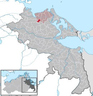
| Location of the municipality of Hanshagen in the Vorpommern-Greifswald district | ||
  |
||

Hanshagen is a municipality in the Vorpommern-Greifswald district in Mecklenburg-Western Pomerania . She belongs to the Lubmin office .
geography
The municipality of Hanshagen is located about ten kilometers southeast of Greifswald and about 25 kilometers northwest of Anklam on the federal highway 109 . Surrounding communities are Weitenhagen , Groß Kiesow , Wrangelsburg , Neu Boltenhagen and Kemnitz .
The Hanshäger Bach named after her flows through the community .
history
The first documentary mention of Hanshagen was by Wartislaw III. as Johanneshaghen in 1248. It was probably Count Johann I. von Gützkow who gave the place its name. At that time two hooves belonged to the Eldena monastery , the rest of the part to the count. They gradually pledged the farms in Hanshagen to Greifswald citizens z. B. to the Lübeck family. They sold their property in 1492 to the Krummin Monastery on Usedom . The monastery leased the village and mill to the Dreyer family. With the secularization of the monastery in 1534, Hanshagen became dominal . In 1524 the community received permission to build a water mill. In 1634 Duke Bogislaw XIV gave the village to the University of Greifswald .
In 1767 Hanshagen still had 126 inhabitants, this number rose to 856 in 1865. The village had a church, two schools, 51 residential buildings, six factory buildings (to the mill) and 125 farm buildings.
From 1648 to 1815 it belonged to Swedish Pomerania , then to the Prussian province of Pomerania . In 1855 the Büdner could each lease an acre of arable land from the university in Greifswald .
For a long time, Hanshagen consisted of three sub-areas, which were never registered as districts. These were the church village Hanshagen, the separately lying Gut Hanshagen on the Fernstrasse and the place Fliederberg. The estate owned u. a. the families von Moltke, von Oertzen , von Plessen and Joachim Christian von Müller, Warnke and until 1945 von Storch .
The expansion of Fliederberg originated in 1800 through the settlement of state forest workers, craftsmen, etc., so 14 Büdner were resident there. The place Fliederberg was drawn as a straight, elongated row of houses in the Prussian original measuring table sheet of 1835. Fliederberg is also marked as an independent place in the maps from 1880 and 1920. This part of Hanshagen was and is known for its medieval Hanshagen water mill , which, after extensive restoration, includes a hotel, a restaurant, a farm shop and the aforementioned mill with a mill stream and reservoir. In the 21st century, the former town of Fliederberg and the church village grew together to form the municipality of Hanshagen. The name only exists as a street name.
From 1897 to 1945 the small railway Greifswald – Wolgast (KGW) touched the place.
During the Second World War women and men from Poland and the Soviet Union had to do forced labor in the village. There was also a prisoner-of-war camp near the village. A small resistance group, consisting of Johann Pilarski and his brother and Ernst Boberg, secretly supplied the forced laborers and prisoners with news about the course of the front. As the 2nd Belorussian Front approached the place, Pilarski and his friends put white flags on the church tower and the light poles, preventing the forcible capture of the place.
Since 1952 the place belonged to the Rostock district and since 1990 to the state of Mecklenburg-Western Pomerania. In 1953 an agricultural production cooperative was founded , which all farmers had joined in 1960. Nonetheless, the production of agricultural goods declined and practically came to a standstill in 1972. Between 1971 and 1980 the community built a total of three blocks of flats, which are managed by a non-profit housing association in the 21st century. In 1973 the community gradually received a central drinking water supply. In 1993 a central sewage treatment plant went into operation.
In Karbower forest east of Hanshagen there was a service of the NVA . Until the mid-1980s, the radio electronic combat battalion (moved to Böhlendorf in 1985) and a storage area of the supply and equipment warehouse VAL 18 (ship rockets) were stationed here. On December 1, 1986, the rocket torpedo base 18 was established in this building. Workshop buildings for the maintenance of missiles and torpedoes were built and some were completed by 1990. At the end of 1990 the office was closed and the property was used by VEBEG for a few years .
politics
coat of arms
|
|
Blazon : “Divided by gold over blue, above three torn green deciduous trees in bars; below a sixteen-bladed golden mill wheel. "
The coat of arms and the flag were designed by Ingrid and Michael Cherubim from Hanshagen. It was approved together with the flag on November 29, 1999 by the Ministry of the Interior and registered under the number 201 of the coat of arms of the state of Mecklenburg-Western Pomerania. |
| Justification of the coat of arms: In the coat of arms the deciduous trees symbolize the forest surrounding the place as a source of recreation and a place of recreation. The mill wheel stands for the historic water mill, which is now a tourist attraction. |
flag

The flag is evenly striped lengthways with blue and yellow. In the middle of the flag, two-thirds of the height of the blue and yellow stripes, is the municipal coat of arms. The length of the flag is related to the height as 5: 3.
Official seal


.JPG)

The official seal shows the municipal coat of arms with the inscription "GEMEINDE HANSHAGEN * LANDKREIS VORPOMMERN-GREIFSWALD".
Partner communities
Hanshagen's partner communities are the Holstein communities of Borsfleth and Bahrenfleth .
Attractions
- Hanshagen church with Gothic parts from the 13th and 14th centuries and a neo-Gothic tower from the 19th century.
- Wassermühle Hanshagen has existed since 1524. Between 1634 and 1855 it was a paper mill at the University of Greifswald , then a grinding mill until 1952. Since 2010 a local investor has been renovating the listed complex and expanding it into a gastronomic business with a technical museum (grain mill).
- In front of the former school, which bore his name in GDR times, there has been a memorial since 1972 for the KPD chairman Ernst Thälmann , who was murdered in the Buchenwald concentration camp in 1944 . In the 21st century, the buildings are used by local councils, the volunteer fire brigade, a grocery store and a youth club. In the former school yard there is a playground and an area for festive events.
- In 2002 the folk high school in Lubmin put up some wooden sculptures in the roundabout . They show Don Quixote , a female torso and a bird. In 2004 a siren, a fisherwoman and a bladderwrack were added.
- In the cemetery there are several old grave slabs from the 19th century, for example by Carl Johann and Michael Gudke, who died in 1818. A cast iron cross commemorates the pastor, superintendent and founder of an educational institution in Hanshagen, Theodor Ziemssen (1777–1843). Another gravestone commemorates Gustav Adolf Plath (1799–1837), who owned the estate in neighboring Karbow .
literature
- Heinrich Berghaus : Land book of the Duchy of Pomerania and the Principality of Rügen , IV. Part Volume II, Anklam 1868, pp. 370–373, Google books .
- Eckhard Oberdörfer: Ostvorpommern , Edition Temmen, Bremen, 2006, ISBN 3-86108-917-3
Web links
- Official website of the municipality of Hanshagen , accessed on August 17, 2015.
Individual evidence
- ↑ Statistisches Amt MV - population status of the districts, offices and municipalities 2019 (XLS file) (official population figures in the update of the 2011 census) ( help ).
- ^ A b Manfred Niemeyer: Ostvorpommern . Collection of sources and literature on place names. Vol. 2: Mainland. (= Greifswald contributions to toponymy. Vol. 2), Ernst-Moritz-Arndt University of Greifswald, Institute for Slavic Studies, Greifswald 2001, ISBN 3-86006-149-6 . P. 40 ff
- ^ Alfred Harendt: It happened before Greifswald , in: Die Stunden Null, Berlin 1966, p. 93
- ↑ Hans-Heinz Schütt: On shield and flag production office TINUS, Schwerin 2011, ISBN 978-3-9814380-0-0 , p. 360/361.
- ↑ a b main statute § 1 (PDF).
Ahlbeck | Old Tellin | Altwarp | Altwigshagen | Anklam | Bandelin | Bargischow | Behrenhoff | Bentzin | Benz | Mountain wood | Blankensee | Blesewitz | Boldekow | Boock | Brietzig | Brünzow | Bugewitz | Buggenhagen | Butzow | Daberkow | Dargelin | Dargen | Dersekow | Ducherow | Eggesin | Fahrwalde | Ferdinandshof | Garz | Glazov | Görmin | Grambin | Grambov | Greifswald | Gribow | Gross Kiesow | Groß Luckow | Great Polzin | Gützkow | Hammer ad Uecker | Hanshagen | Heinrichswalde | Heringsdorf | Hinrichshagen | Hintersee | Iven | Jarmen | Jatznick | Comb teeth | Karlsburg | Karlshagen | Katzow | Kemnitz | Klein Bünzow | Koblentz | Korswandt | Koserow | Krackow | Krien | Kröslin | Kruckow | Krugsdorf | Krummin | Krusenfelde | Lassan | Leopoldshagen | Levenhagen | Liepgarten | Löcknitz | Loddin | Loissin | Loitz | Lubmin | Luebs | Luckow | Luetow | Medow | Meiersberg | Mellenthin | Mesekenhagen | Mölschow | Mönkebude | Murchin | Nadrensee | Neetzow-Liepen | New Boltenhagen | New Kosenow | Neuenkirchen | Neuenkirchen | Low | Papendorf | Pasewalk | Peenemünde | Penkun | Plow | Polzow | Postlow | Pudagla | Ramin | Rankwitz | Rollwitz | Rossin | Rossow | Rothemühl | Rothenklempenow | Rubenov | Rubkov | Sarnow | Sassen-Trantow | Sauzin | Schmatzin | Schönwalde | Spantekow | Stumble on the Peene | Stolpe on Usedom | Strasburg (Uckermark) | Torgelow | Trassenheide | Tutow | Ückeritz | Ueckermünde | Usedom | Square | Vogelsang-Warsin | Völschow | Wackerow | Weitenhagen | Wilhelmsburg | Wolgast | Wrangelsburg | Wusterhusen | Zemitz | Zempin | Zerrenthin | Ziethen | Zinnowitz | Zirchow | Züssow