
Great Polzin
| coat of arms | Germany map | |
|---|---|---|

|
Coordinates: 53 ° 54 ' N , 13 ° 36' E |
|
| Basic data | ||
| State : | Mecklenburg-Western Pomerania | |
| County : | Vorpommern-Greifswald | |
| Office : | Züssow | |
| Height : | 19 m above sea level NHN | |
| Area : | 29.38 km 2 | |
| Residents: | 400 (Dec. 31, 2019) | |
| Population density : | 14 inhabitants per km 2 | |
| Postal code : | 17390 | |
| Area code : | 039724 | |
| License plate : | VG, ANK, GW, PW, SBG, UEM, WLG | |
| Community key : | 13 0 75 043 | |
| Community structure: | 7 districts | |
| Office administration address: | Dorfstrasse 6 17495 Züssow |
|
| Website : | ||
| Mayor : | Sebastian Hornburg | |
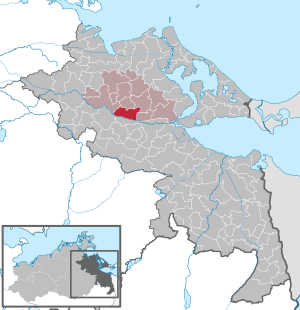
| Location of the community of Groß Polzin in the Vorpommern-Greifswald district | ||
  |
||

Groß Polzin is a municipality in the district of Vorpommern-Greifswald . It has been administered by the Züssow Office , based in Züssow , since January 1, 2005 . Until December 31, 2004 she was part of the Ziethen office . It has 445 inhabitants (as of December 31, 2015).
geography
Geographical location
Groß Polzin is 10 kilometers northwest of Anklam and 14 km east of Gützkow . Federal highway 109 runs east of the municipality . The federal motorway 20 can be reached via the Gützkow junction (17 km). The Peene runs in the south of the municipality . A seasonal passenger ferry runs over this from Stolpmühl to Stolpe .
Community structure
|
|
|
Neighboring communities
Neighboring communities are: Schmatzin in the N, Klein Bünzow in the NE, Ziethen in the O, Stolpe on the Peene in the S, Neetzow-Liepen in the SW and Gützkow , Stadt in the W.
history


Consages
Konsages was first mentioned in a document as Cossozuwe in 1168. As a Slavic foundation, it means "place of the mower". In the 13th century the place was Cosauits and in the 14th it was called Konsawe .
The place was owned by the Counts of Gützkow until they died out. It was probably then in the possession of the dukes, there is no documentary proof of ownership. It was not until 1784 that Jochen Christoph Manthey was named as the owner. The brothers Gustav Johann and Magnus Hermann von Wolffradt bought the estate, but sold it shortly afterwards in 1798 to their uncle's son-in-law, who was Baron Friedrich Carl Erst von Falkenstein. In 1805 it was sold again to the von Below brothers. But Bleichert Wilhelm von Wolffradt then brought the property back into his family.
The manor house is a half-timbered building with a spacious central section. The white plastered middle section contrasts with the other parts of the building, which are made of red bricks in half-timbered style. The manor house is located on the historic Heerstraße that led from Anklam to Greifswald. Originally, Konsages was a jug pub. It was later expanded into a manor.
In 1868 Konsages had 75 inhabitants in 12 families, including 1 tenant with 8 relatives, 4 servants and 5 maids, 9 male and 8 female day laborers, 2 residents were alms recipients. The buildings consisted of: 3 residential and 11 farm buildings.
After 1945 14 families lived in the village. From 1954 to 1958 there was a post office in the manor house. From 1968 to 1990 there was a consumer outlet here.
On December 31, 2014, Konsages had 50 residents with a main residence and 6 with a secondary residence.
On December 31, 2015, Konsages had 52 residents with a main residence and 6 with a secondary residence.
Stolpmühl
The water mill was already built by the monks from Stolpe from the other bank of the Peene, they also operated the ferry from the north to Stolpe. This remained the case in the 19th century.
In 1782 Stolpmühl was called "Stolpe Mühle".
In 1675 parts of the Great Elector's armed forces crossed the Peene to conquer Swedish Pomerania. The place or the mill was also shown in the Swedish registers in 1694, and in the Swedish war maps in 1759 and 1761. There were extensive fortifications of the Swedes at the transition to the Peenehochufer, because the Peene had been the border between Swedish-Western Pomerania and Prussia since 1720 and was at times contested. Along with Gützkow and Anklam, Stolpe - Stolpmühl was an important Peene crossing from south to north.
Stolpermühle was the name of the mill estate in 1865, the water mill of which was only operated as a sideline because there was rarely a sufficient water level in the reservoir. The current owner was Ernst Hermann von Wolffradt auf Schlatkow. At that time the place had 40 inhabitants in 7 families, including 1 owner with 2 relatives, 1 housekeeper, 4 servants, 1 maid, 2 male and 2 female day laborers, 2 craftsmen and 4 servants. There were 4 residential and 5 farm buildings, as well as 1 water mill.
Today there are only a few foundation walls of the mill, the fortifications have been razed, remains are hardly recognizable. The location now belongs to Quilow, there are still 2 houses whose residents belong to Quilow.

Pachev

To the south-east of the village there are several Bronze Age barrows that suggest an older settlement. To the north of Pätschow there are archaeological records of 2 settlements from the Slav period.
Pätschow was first mentioned in a document in 1228 as "Petsecowe". The obviously Slavic name is not interpreted.
In the 15th century the Horn and the Owstin owned the manor. A short time later, the entire estate was owned by the von Horn family. Bernhard Horn auf Schlatkow took tenants from Pätschow in 1514. In 1570, however, Petzkow was pledged by the von Horn brothers to Rolof von Owstin on Quilow. Fritz von Horn and his son continued to live on a smaller part on Pätschow. Christoph and Joachim von Owstin were enfeoffed again in 1602 by Duke Bogislaw X. after their ancestors Hans and Claus had already been enfeoffed in 1485, but only with a portion. In 1723 Berend Christoph von Owstin had to pledge the property to Michel Kruse because of a loan. In 1787 Owstin could not redeem the estate and so it became the proper property of Johann Philipp Kruse with an additional payment of 14,000 thalers. The estate remained in the possession of the Kruses until 1850, when it became the property of the government council of Westrell zu Stralsund. In 1862 the property went to Hans Dietrich von Zanthier from the Putnitz house.
In 1865 Pätschow had 186 inhabitants in 25 families, including 1 owner with 7 relatives, 1 administrator, 12 servants and 5 maids, 20 male and 20 female day laborers, 1 craftsman, 3 male and 3 female servants. Building stock: 15 residential and 14 farm buildings, as well as 2 factory buildings, including 1 windmill.
Before 1945 the Hecker family owned the property, which they lost in the land reform after the war, but bought it back after 1990. The manor buildings are only partially preserved.
On December 31, 2014, Pätschow had 73 residents with a main residence and 4 with a secondary residence.
On December 31, 2015, Pätschow had 74 residents with a main residence and 5 with a secondary residence.
Quilow

The first documentary mention was made in 1172 as "villa Quilowe", when Duke Bogislaw I transferred income from the village to the Stolpe monastery. The Slavic name is interpreted as "lamentation". In 1194, Siegfried I, Bishop of Cammin, transferred the bishop's tenth from Quilow and other places to the monastery.
Quilow and Stolpmühl had 92 residents with main residence and 7 with secondary residence on December 31, 2014.
With Stolpmühl on December 31, 2015, Quilow had 89 residents with a main residence and 7 with a secondary residence.
Vitense
A single find of a Neolithic trough mill (5500 to 1800 BC) was recovered between Vitense and Quilow, next to it there is a Bronze Age barrow (1800 to 600 BC). To the east of Vitense is an archaeologically proven late Slavic settlement (1000 to 1200). This shows that the area was populated early and continuously.
Vitense was first mentioned as Vitenze in 1186, but also in the same year with its current name. The name is also interpreted as "Viking place". Perhaps this has to do with the proximity to the Viking settlement near Menzlin on the Peene. In the course of time other spellings have also been transmitted, the place was even Germanized as Wittensee for a long time .
The estate was south and the residential village north of the Gützkow - Ziethen road, today's L 263. That is actually a novelty, because both are about 600 m apart. This is probably due to the geological conditions of the earlier existing village, because the estate was built later, the village is surrounded by silts, depressions and swampy meadows that hindered the construction of the larger estate.
The farm was ducal property from the beginning and was given away to the church of Kammin, which sold it to Hans von Owstin on Quilow in 1531. It was then a manor, but only pertinence to Quilow. Therefore later ownership changed, as with Quilow - see there.
In 1865 Vitense had 108 inhabitants in 14 families, including 1 administrator, 1 housekeeper, 6 servants and 1 maidservant, 21 male and 20 female day laborers, the village had 1 almsgiver. Building stock: 6 residential and 8 farm buildings, as well as 2 factory buildings.
At the moment nothing can be seen of the estate. After the land reform in 1945, the estate and its surroundings were built over, while the residential village, on the other hand, became smaller and smaller due to the old structure.
On December 31, 2014, Vitense had 32 residents with a main residence and 4 with a secondary residence.
As of December 31, 2015, Vitense had 36 residents with a main residence and 4 with a secondary residence.
Great Polzin

Groß Polzin was first mentioned in a document in 1172 as "Poluziz". The name means Slavic "piece of wood". Groß Polzin was an estate without knightly privileges.
Groß Polzin was originally an anger and estate village, which means that the dominant estate is located on the Anger, as is the elongated farm workers' list. Only after the war did the village shape change into a street village.
According to MTB, the estate had already reached an attractive size after 1835 and especially around 1880 . It had a park surrounded by a stone wall, which, according to the map, was designed to be quite sophisticated.
In 1868 the village had 120 inhabitants in 28 families, including 1 owner with 5 family members, 1 manager, 9 servants, 5 maids, 13 male and 18 female day laborers, and 1 craftsman. There were 5 alms recipients in the village. The following buildings were available: 10 residential and 20 farm buildings. At the time, A. Westphal-Rewoldt was the owner of the property. Otherwise nothing is currently known.
During the GDR era, Groß Polzin had a real boom. The LPG had managed the estate and a large nursery with greenhouses was built. Vocational training with a dormitory was set up for the LPG and the nursery. A block of flats was built for the employees. The village developed along the main road Gützkow - Ziethen with settlement houses after the land reform, as well as private homes for the later LPG employees.
For the village and the LPG, a cultural center with a large event hall and a restaurant on the main street was built in the 1960s and used for a variety of purposes.
The LPG later built other farm buildings as a larger complex, especially in the direction of Quilow. Today it has been modernized and continues to be used as a storage complex with an extensive solar system.
After 1990, as everywhere, there were many problems. The nursery, the vocational training, the culture house and LPG were "wound up". The nursery and the cultural center were gradually devastated.
The property is still relatively good and almost completely preserved, even if it is mostly vacant and beginning to deteriorate. Up until a few years ago, the manor house was the seat of the municipal administration.
In 2009 the OPAL gas pipeline was laid to the west of the village and in 2011 a sealing and compression station was put into operation on site. The nursery has been reactivated privately since 2015.
Groß Polzin had 132 residents with main residence and 10 with secondary residence on December 31, 2014.
Groß Polzin had 131 residents with main residence and 9 with secondary residence on December 31, 2015.
Klein Polzin


An early settlement is documented by the three important large stone graves from the Neolithic (5500 to 1800 BCE) in and around the Schnell farm in Klein Polzin.
Klein Polzin as a manor consisted of only two developed farms and belonged to Hermann Wilhelm Carl Gustav von Wolffradt auf Lüssow since 1842, the tenant was C. Prützmann. Before that, Duke Philipp Julius lent Oswald Suawe (Schwabe) zu Schmatzin the 2 farms at Polzin in 1614, after the Suawe died out it belonged to Capitain Bengt Börsen (Swede?), From whom Berend Wolffradt bought the estate in Lüssow in 1654.
Klein Polzin was first mentioned as such in 1851. Name and meaning see Groß Polzin.
In 1865 Klein Polzin had 35 inhabitants in 5 families, including 1 tenant with 5 family members, 8 servants, 4 maids, 4 male and 4 female day laborers. There were 3 residential and 4 farm buildings.
On December 31, 2014, Klein Polzin had 24 residents with a main residence and 2 with a secondary residence.
On December 31, 2015, Klein Polzin had 29 residents with a main residence and 3 with a secondary residence.
- Cabowe (desert)
The place was first mentioned as Chabowe in 1182, then until 1304 with different spellings, until it disappeared from the records with the name Cabowe . Cabowe cannot be precisely localized, it is said to have been near the northern Peenehochufers between Lüssow and Stolpmühl. Archaeological evidence has not yet been found either, only to the southeast of Pätschow is a burial mound known to indicate the proximity of a settlement. The Slavic name is interpreted as a bush place .
- Mudlimow (desert)
Mudlimow was first mentioned as such in 1214. It was between Pätschow and Quilow. It was last mentioned in 1304 and has been desolate since then, the exact location could not be determined. There are several Bronze Age barrows in the Peeneberge area, but no other archaeological evidence of settlement.
- Wamperin (desert)
Wamperin was first mentioned as such in a document in 1214. It cannot be located exactly, is said to have been in the Quilow - Polzin field. It is still mentioned by Berghaus in 1868. There is no archaeological evidence for this either.
religion

30% of the inhabitants of the community are Protestant, only 1% Catholic. The only church building in the community is the Quilow village church , which is part of the Ziethen parish in the Demmin provost of the Evangelical Lutheran Church in Northern Germany . The few Catholics are assigned to the parish of St. Otto Usedom-Anklam-Greifswald of the Archdiocese of Berlin , whose nearest church is St. Salvator (Anklam) .
politics
Coat of arms, flag, official seal
The municipality has no officially approved national emblem, neither a coat of arms nor a flag . The official seal is the small state seal with the coat of arms of the region of Western Pomerania . It shows an upright griffin with a raised tail and the inscription "GEMEINDE GROß POLZIN * LANDKREIS VORPOMMERN-GREIFSWALD".
Attractions
- Manor house, now Groß Polzin municipal office
- Passenger ferry across the Peene near Stolpmühl to Stolpe
- Church, churchyard and belfry Quilow
- Quilow moated castle
- 3 large stone graves in and around the Schnell farm in Klein Polzin
- "Trabbi" barn in Quilow
- Village pond facilities and seasonal info shop in the former Quilow fire station
- Tower Hill Konsages
literature
- Manfred Niemeyer: East Western Pomerania. Collection of sources and literature on place names. Vol. 2: Mainland. (= Greifswald contributions to toponymy. Vol. 2), Ernst-Moritz-Arndt University of Greifswald, Institute for Slavic Studies, Greifswald 2001, ISBN 3-86006-149-6 . Pages 69, 91, 104, 137
- Heinrich Berghaus : Land book of the Duchy of Pomerania and the Principality of Rügen . Part 4, Vol. 2, Dietze, Anklam 1868, p. 1070 f. ( Digitized version ).
Web links
Individual evidence
- ↑ Statistisches Amt MV - population status of the districts, offices and municipalities 2019 (XLS file) (official population figures in the update of the 2011 census) ( help ).
- ↑ a b c d e f g Amt Züssow, residents of the Züssow district, as of December 31, 2015
- ↑ a b c d e f g h i j Manfred Niemeyer: Ostvorpommern . Collection of sources and literature on place names. Vol. 2: Mainland. (= Greifswald contributions to toponymy. Vol. 2), Ernst-Moritz-Arndt University of Greifswald, Institute for Slavic Studies, Greifswald 2001, ISBN 3-86006-149-6 . P. 20 ff
- ↑ a b c d e f Amt Züssow, residents of the Züssow district, as of December 31, 2014
- ↑ 2011 census
- ↑ Main Statute, Section 1, Paragraph 2 (PDF).
Ahlbeck | Old Tellin | Altwarp | Altwigshagen | Anklam | Bandelin | Bargischow | Behrenhoff | Bentzin | Benz | Mountain wood | Blankensee | Blesewitz | Boldekow | Boock | Brietzig | Brünzow | Bugewitz | Buggenhagen | Butzow | Daberkow | Dargelin | Dargen | Dersekow | Ducherow | Eggesin | Fahrwalde | Ferdinandshof | Garz | Glazov | Görmin | Grambin | Grambov | Greifswald | Gribow | Gross Kiesow | Groß Luckow | Great Polzin | Gützkow | Hammer ad Uecker | Hanshagen | Heinrichswalde | Heringsdorf | Hinrichshagen | Hintersee | Iven | Jarmen | Jatznick | Comb teeth | Karlsburg | Karlshagen | Katzow | Kemnitz | Klein Bünzow | Koblentz | Korswandt | Koserow | Krackow | Krien | Kröslin | Kruckow | Krugsdorf | Krummin | Krusenfelde | Lassan | Leopoldshagen | Levenhagen | Liepgarten | Löcknitz | Loddin | Loissin | Loitz | Lubmin | Luebs | Luckow | Luetow | Medow | Meiersberg | Mellenthin | Mesekenhagen | Mölschow | Mönkebude | Murchin | Nadrensee | Neetzow-Liepen | New Boltenhagen | New Kosenow | Neuenkirchen | Neuenkirchen | Low | Papendorf | Pasewalk | Peenemünde | Penkun | Plow | Polzow | Postlow | Pudagla | Ramin | Rankwitz | Rollwitz | Rossin | Rossow | Rothemühl | Rothenklempenow | Rubenov | Rubkov | Sarnow | Sassen-Trantow | Sauzin | Schmatzin | Schönwalde | Spantekow | Stumble on the Peene | Stolpe on Usedom | Strasburg (Uckermark) | Torgelow | Trassenheide | Tutow | Ückeritz | Ueckermünde | Usedom | Square | Vogelsang-Warsin | Völschow | Wackerow | Weitenhagen | Wilhelmsburg | Wolgast | Wrangelsburg | Wusterhusen | Zemitz | Zempin | Zerrenthin | Ziethen | Zinnowitz | Zirchow | Züssow