
Krackow
| coat of arms | Germany map | |
|---|---|---|

|
Coordinates: 53 ° 20 ' N , 14 ° 16' E |
|
| Basic data | ||
| State : | Mecklenburg-Western Pomerania | |
| County : | Vorpommern-Greifswald | |
| Office : | Löcknitz-Penkun | |
| Height : | 34 m above sea level NHN | |
| Area : | 44.18 km 2 | |
| Residents: | 620 (Dec. 31, 2019) | |
| Population density : | 14 inhabitants per km 2 | |
| Postcodes : | 17329, 17322 (Lebehn) , 17328 (Battinsthal, Schuckmannshöhe) |
|
| Area code : | 039746 | |
| License plate : | VG, ANK, GW, PW, SBG, UEM, WLG | |
| Community key : | 13 0 75 067 | |
| Office administration address: | Chausseestraße 30 17321 Löcknitz |
|
| Website : | ||
| Mayor : | Gerd Sauder | |
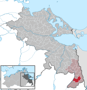
| Location of the municipality of Krackow in the Vorpommern-Greifswald district | ||
  |
||

Krackow [ ˈkraːko ] is a municipality in the district of Vorpommern-Greifswald in the extreme south-east of Mecklenburg-Vorpommern (Germany). The community belongs to the office Löcknitz-Penkun with seat in the community Löcknitz .
geography


Krackow is located in the southeastern tip of Mecklenburg-Western Pomerania between the Randow (state border with Brandenburg and 4 km municipality border) and the 10-15 km distant Oder in the east. Krackow is located 25 km southeast of the city of Pasewalk and 20 km southwest of the city center of Stettin (Szczecin, Poland ). In the west, the municipality is part of the Randowbruch . The larger part, however, lies on the hilly ground moraine ridge . There are several small lakes here, especially in the east of the municipality; the largest in terms of area is Lebehnsche See in the northeast. Near the district of Schuckmannshöhe there is a bathing lake called Düstere See . The water level of the Seegraben, which drains a lake south of the community towards Randow, is 14 m above that of the Randow in Krackow. The heights of the hilltops are about 40 m above sea level.
Krackow is surrounded by the neighboring communities Glasow in the north, Grambow in the northeast, Nadrensee in the east, Penkun in the south and Brüssow in the west.
Community structure
- Districts
- Incorporations
- Battinsthal with Schuckmannshöhe and Hohenholz were incorporated into a district on October 15, 1950.
- Lebehn and Kyritz were incorporated into a district on June 13, 2004.
history
Krackow : The name is of Slavic origin and could mean place of crows ( Kracac = croak) or derived from krk = neck and refer to the geographical location in a brook valley between lakes and the wide Randow valley. According to archaeological findings, the Slavic foundation of the town took place around AD 600. The first documented mention of the place was in 1271 when Otto von Ramin gave the Franciscans in Stettin an elevation from his property in Krackow.
Battinsthal was laid out as a Vorwerk in the 17th century , and there is a burial chapel in the manor park.
Schuckmannshöhe was laid out in 1824 by Chamberlain Carl Friedrich von Schuckmann as a Vorwerk von Battinsthal.
Hohenholz is over 700 years old and used to be a manor . The local stone church with a half-timbered tower was renovated. The manor house, a two-storey plastered brick building, was built in the Baroque style in 1840 for the von Eickstedt family , who owned the property from 1280 to 1945.
Lebehn was first mentioned in 1490. Together with the place Kyritz (first mentioned in 1523) Lebehn lies in a lake area.
Population development
|
politics
mayor
- from 2006 to July 2016 Alfred Hopfinger (resigned)
- July to November 2016 Hans-Peter Bobrowski (officiating)
- since November 2016 Gerd Sauder
Coat of arms, flag, official seal
The municipality has no officially approved national emblem, neither a coat of arms nor a flag . The official seal is the small state seal with the coat of arms of the region of Western Pomerania . It shows an upright griffin with a raised tail and the inscription "GEMEINDE KRACKOW * LANDKREIS VORPOMMERN-GREIFSWALD".
Sights, culture and education


Buildings
→ See also the list of monuments in Krackow
- Krackow
- Historic kitchen garden
- Field stone church from the 13th century
- Manor house: two-storey, 13-axis plastered building with a medium risalit
- Manor house: One-storey, 8-axis plastered building with a crooked hip roof and central projectile as well as the large barn storage facility; Estate u. a. of the von Krakevitz (13th century) and Moltke (14th century) families
- Classic car museum with carriages, sleighs and two- and four-wheeled vintage cars from the 1920s to 1970s
- Battinsthal: manor house and manor park with cemetery and burial chapel
- Hohenholz:
- Single-aisle hall church made of granite stone from the second half of the 13th century with a half-timbered tower
- Manor house (castle) Hohenholz: A two-storey baroque , plastered brick building with a mansard roof and central projection ; Erected in 1840 for the von Eickstedt family
- Lebehn manor: two-storey plastered building from 1910 with park
Regular events
- Every year, the classic car club organizes an excursion and invites you to a meeting.
education
The Kinderland daycare center is located in Krackow .
Personalities
- Ulrich Scherping (1889–1958), master hunter
- Emil von Hacke (1814–1887), Prussian lieutenant general, deputy commander of the 38th Infantry Brigade
- Otto von Ramin († February 18, 1610 in Stettin ) was Chancellor in the Duchy of Pomerania-Stettin
Transport links
Krackow is on federal highway 113 , 3.5 kilometers north of the Penkun motorway junction on federal motorway 11 ( Berlin - Stettin ). The border crossings to Poland are only a few kilometers away ( Mescherin , Rosow, Pomellen , Linken ). The municipality is connected to tourism by the Oder-Neisse cycle path .
Web links
Individual evidence
- ↑ Statistisches Amt MV - population status of the districts, offices and municipalities 2019 (XLS file) (official population figures in the update of the 2011 census) ( help ).
- ↑ Main statute of the municipality of Krackow . February 27, 2014, § 8, p. 4 ( amt-loecknitz-penkun.de [PDF; 3.2 MB ; accessed on September 8, 2017]). amt-loecknitz-penkun.de ( Memento of the original from September 8, 2017 in the Internet Archive ) Info: The archive link was inserted automatically and has not yet been checked. Please check the original and archive link according to the instructions and then remove this notice.
- ↑ genealogy.net: Randow district
- ^ StBA: Changes in the municipalities in Germany, see 2004
- ↑ Municipal directory Germany 1900. Randow district.
- ^ A b c Michael Rademacher: German administrative history from the unification of the empire in 1871 to the reunification in 1990. Landkreis Greifenhagen. (Online material for the dissertation, Osnabrück 2006).
- ↑ a b c d e f Population on December 31. according to communities and districts. (No longer available online.) In: SIS-Online - Statistisches Informationssystem. Statistical Office MV, archived from the original on December 26, 2017 ; Retrieved December 25, 2017 . Info: The archive link was inserted automatically and has not yet been checked. Please check the original and archive link according to the instructions and then remove this notice.
- ↑ Main Statute, Section 1, Paragraph 2 (PDF).
- ↑ Origin and beginning. Part II. Retrieved December 7, 2019 .
Ahlbeck | Old Tellin | Altwarp | Altwigshagen | Anklam | Bandelin | Bargischow | Behrenhoff | Bentzin | Benz | Mountain wood | Blankensee | Blesewitz | Boldekow | Boock | Brietzig | Brünzow | Bugewitz | Buggenhagen | Butzow | Daberkow | Dargelin | Dargen | Dersekow | Ducherow | Eggesin | Fahrwalde | Ferdinandshof | Garz | Glazov | Görmin | Grambin | Grambov | Greifswald | Gribow | Gross Kiesow | Groß Luckow | Great Polzin | Gützkow | Hammer ad Uecker | Hanshagen | Heinrichswalde | Heringsdorf | Hinrichshagen | Hintersee | Iven | Jarmen | Jatznick | Comb teeth | Karlsburg | Karlshagen | Katzow | Kemnitz | Klein Bünzow | Koblentz | Korswandt | Koserow | Krackow | Krien | Kröslin | Kruckow | Krugsdorf | Krummin | Krusenfelde | Lassan | Leopoldshagen | Levenhagen | Liepgarten | Löcknitz | Loddin | Loissin | Loitz | Lubmin | Luebs | Luckow | Luetow | Medow | Meiersberg | Mellenthin | Mesekenhagen | Mölschow | Mönkebude | Murchin | Nadrensee | Neetzow-Liepen | New Boltenhagen | New Kosenow | Neuenkirchen | Neuenkirchen | Low | Papendorf | Pasewalk | Peenemünde | Penkun | Plow | Polzow | Postlow | Pudagla | Ramin | Rankwitz | Rollwitz | Rossin | Rossow | Rothemühl | Rothenklempenow | Rubenov | Rubkov | Sarnow | Sassen-Trantow | Sauzin | Schmatzin | Schönwalde | Spantekow | Stumble on the Peene | Stolpe on Usedom | Strasburg (Uckermark) | Torgelow | Trassenheide | Tutow | Ückeritz | Ueckermünde | Usedom | Square | Vogelsang-Warsin | Völschow | Wackerow | Weitenhagen | Wilhelmsburg | Wolgast | Wrangelsburg | Wusterhusen | Zemitz | Zempin | Zerrenthin | Ziethen | Zinnowitz | Zirchow | Züssow