
Bruessow
| coat of arms | Germany map | |
|---|---|---|

|
Coordinates: 53 ° 24 ' N , 14 ° 8' E |
|
| Basic data | ||
| State : | Brandenburg | |
| County : | Uckermark | |
| Office : | Bruessow (Uckermark) | |
| Height : | 55 m above sea level NHN | |
| Area : | 101.83 km 2 | |
| Residents: | 1800 (Dec. 31, 2019) | |
| Population density : | 18 inhabitants per km 2 | |
| Postal code : | 17326 | |
| Area code : | 039742 | |
| License plate : | UM, ANG, PZ, SDT, TP | |
| Community key : | 12 0 73 085 | |
| LOCODE : | DE UWS | |
City administration address : |
Prenzlauer Strasse 8 17326 Brüssow |
|
| Website : | ||
| Mayor : | Michael Rakow ( SPD ) | |
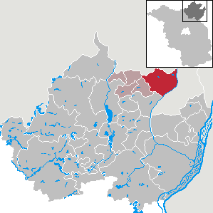
| Location of the city of Brüssow in the Uckermark district | ||
  |
||

Brüssow [ ˈbrʏso ] is a country town in the northeast of the Uckermark district in Brandenburg and the administrative seat of the office of Brüssow (Uckermark) . It lies between the cities of Prenzlau and Pasewalk and the Polish metropolis of Szczecin .
geography
Brüssow, the northernmost city of Brandenburg, lies in a ground moraine area that extends between the parallel Ucker and Randow valleys . The extensive hilly landscape is characterized by many small lakes and ponds ( Sölle ), which form the northeastern part of the Uuckmarket lakes . The east of the municipal area drops about 30 meters to the Randowbruch; Here there is also a larger contiguous forest area in the otherwise largely agricultural area. In the north and east, the Mecklenburg- Western Pomerania district of Vorpommern-Greifswald borders the Brüssow district.
City structure
According to its main statute, the municipality consists of the districts
- Bagemühl
- Bruessow
- Grünberg
- Woddow
- Wollschow
Inhabited parts of the community without district status are Battin, Butterholz, Frauenhagen, Grimme, Hammelstall, Klausthal, Menkin , Moor, Petersruh, Stramehl and Trampe.
There are also the Battin-Expansion, Heimstedt and Wassermühle residential areas .

history
The area around Brüssow was settled quite late. The megalithic structures of Brüssow-Hammelstall can be found around the city . In the necropolis of Wollschow there were 14 Urdolmen and 28 stone boxes , five of which have been preserved.
The originally Slavic settlement became a German castle location at the end of the 12th century.
The city name probably comes from Old Polish and should be derived from brus equal to grindstone .
The town charter was first mentioned in a document in 1259. The certificate was drawn up by the knight Heinrich von Stegelitz. This was not least due to the fact that Brüssow was on the Magdeburg - Berlin - Stettin road . The town's rights were withdrawn from the town between 1550 and 1809.
On October 22, 1935 , Adolf Hitler gave Field Marshal August von Mackensen the Prussian domain of Brüssow, which at that time had an area of over 1,231 hectares and was later declared an hereditary farm.
Albrecht Schönherr , Dietrich Bonhoeffer's pupil and later bishop of the East Region of the Evangelical Church in Berlin-Brandenburg, was brought to Brüssow by Mackensen and had his first pastor here from 1937 to 1946.
Administrative history
Brüssow, Bagemühl, Grünberg, Woddow and Wollschow belonged to the Prenzlau district in the Prussian province of Brandenburg since 1817 and to the Pasewalk district in the GDR district of Neubrandenburg from 1952 .
The previously independent municipality of Menkin was incorporated into Wollschow on July 1, 1950. On January 1, 1973, the community of Grimme was incorporated into Brüssow, the communities of Battin and Trampe to Grünberg.
After a referendum, Brüssow has been part of the state of Brandenburg again since August 1st, 1992. Since 1993 the places have been in the Brandenburg district of Uckermark.
On December 31, 2001, the places Bagemühl, Grünberg, Woddow and Wollschow were incorporated into Brüssow.
Population development
|
|
|
|
|
Territory of the respective year, number of inhabitants: as of December 31 (from 1991), from 2011 based on the 2011 census
religion
In 1847, the Rothen Haus was founded in Brüssow, based on the model of the Rauhen Haus in Hamburg, the first diaconal institution in the Uckermark. Since 1973, Brüssow has belonged to the Pomeranian Evangelical Church and from 2012 to the Pomeranian parish of the Evangelical Lutheran Church in Northern Germany . The Protestant parish Brüssow and Fahrenwalde is a transnational parish with eleven churches in Brüssow, Bagemühl, Battin, Grimme, Grünberg, Menkin, Trampe, Woddow, Wollschow, Bröllin, Fahrenwalde and Friedrichshof.
politics
City Council
The city council of Brüssow consists of 12 city councilors and the honorary mayor. The local election on May 26, 2019 resulted in the following distribution of seats:
| Party / group of voters | Seats |
|---|---|
| SPD | 4th |
| CDU | 4th |
| Farmer's rural area | 2 |
| Active Brüssow city and country | 1 |
| Single applicant Norman Glowe | 1 |
mayor
- 1998–2003: Klaus Wellmann (CDU)
- 2003-2008 Gisela Müllenhagen: (SPD)
- since 2008: Michael Rakow (SPD)
Rakow was elected in the mayoral election on May 26, 2019 with 55.8% of the valid votes for a further term of five years.
coat of arms
The coat of arms was approved on June 27, 1997.
Blazon : “In red on green ground a silver castle with three pointed towers crossed with gold; a red ladder in the archway. "
Explanation: “This coat of arms is probably from the 15th century and, in addition to the city symbolism, contains the scaling ladder as a symbol of the former lords of Ramin (formerly Pomerania ). A later seal shows a ram (block of wood with crossbar). ”
Contrary to the old blazon, the new coat of arms shows four climbing sticks.
Twin town
A town partnership has existed with the North Rhine-Westphalian town of Salzkotten since August 16, 1993.
Sights and culture
- City fortification with city wall, remains of Wiek houses and gatekeeper house
- Church of St. Sophia in Brüssow
- Village churches in the districts of Bagemühl, Battin, Grimme, Grünberg, Menkin, Trampe, Woddow and Wollschow
- Kulturhaus der Stadt with the Kulturhaus-Kino Brüssow as one of the Brandenburg branches and representative of the Mecklenburg-Western Pomerania Regional Association for Film Communication .

traffic
The state roads L 26 Prenzlau - Löcknitz and L 251 Pasewalk - Schmölln cross in Brüssow . The Prenzlau-Ost motorway junction on the A 20 ( Uckermark - Lübeck junction) is approx. 12 km, the Schmölln junction on the A 11 (Berlin - Stettin ) about 17 km from Brüssow.
The next train station is in Löcknitz on the Pasewalk – Stettin railway line after the Prenzlau – Löcknitz railway line has been closed.
Personalities
sons and daughters of the town
- Friedrich Ehrenreich von Ramin (1709–1782), Prussian Lieutenant General and Inspector General of the Infantry
- Moritz Pistor (1835–1924), physician
- Karl Kollhoff (1846–1901), Real Secret War Council, Department Head in the Prussian War Ministry
- Rudolf Hartmann (1856–?), Politician ( DNVP )
- Arnold Hartmann (1861-1919), architect
- Joachim von Winterfeldt-Menkin (1865–1945), lawyer and politician, born in Grünberg
- Johanna Beckmann (1868–1941), silhouette artist
- Georg Edmund Dann (1898–1979), pharmacy historian
Personalities associated with Brüssow
- Carl Heinrich Poppenburg (1811–1869), theologian, superintendent in Brüssow
- August von Mackensen (1849–1945), Prussian Field Marshal General, received the domain Brüssow as a donation from Adolf Hitler
- Albrecht Schönherr (1911–2009), Protestant theologian and Biachof, pastor in Brüssow
- Dieter Frielinghaus (* 1928), Protestant Reformed pastor, lives in Brüssow
- Volkmar Haase (1930–2012), sculptor, lived in Brüssow
literature
- Lieselott Enders : Historical local dictionary for Brandenburg. Part VIII: Uckermark. Weimar 1986, ISBN 3-7400-0042-2 .
Web links
- Office Brüssow (Uckermark)
- Information on the city's history
- Kulturhaus Kino Brüssow: cinema, gallery and neighborhood meeting place
Individual evidence
- ↑ Population in the State of Brandenburg according to municipalities, offices and municipalities not subject to official registration on December 31, 2019 (XLSX file; 223 KB) (updated official population figures) ( help on this ).
- ^ Service portal of the state administration Brandenburg. City of Brüssow
- ↑ StBA: Changes in the municipalities in Germany, see 2001
- ↑ Historical municipality register of the state of Brandenburg 1875 to 2005. District Uckermark . Pp. 14-17
- ↑ Population in the state of Brandenburg from 1991 to 2017 according to independent cities, districts and municipalities , Table 7
- ^ Office for Statistics Berlin-Brandenburg (Ed.): Statistical report AI 7, A II 3, A III 3. Population development and population status in the state of Brandenburg (respective editions of the month of December)
- ↑ 170 years of Diakonie and Stephanus Foundation in Brüssow , accessed on June 10, 2017
- ^ Brüssow parish
- ^ Result of the local election on May 26, 2019
- ↑ Results of the local elections in 1998 (mayoral elections) for the district of Uckermark ( Memento of the original from April 15, 2018 in the Internet Archive ) Info: The archive link was inserted automatically and has not yet been checked. Please check the original and archive link according to the instructions and then remove this notice.
- ↑ Local elections October 26, 2003. Mayoral elections , p. 34
- ↑ Local elections in the state of Brandenburg on September 28, 2008. Mayoral elections , p. 12
- ↑ Brandenburg Local Election Act, Section 73 (1)
- ^ Result of the mayoral election on May 26, 2019
- ↑ Coat of arms information on the service portal of the state administration of Brandenburg
- ^ Karlheinz Blaschke, Gerhard Kehrer, Heinz Machatscheck: Lexicon cities and coats of arms of the German Democratic Republic. Verlag Enzyklopädie, Leipzig 1979, DNB 800116615 .
- ^ Coat of arms of the city of Brüssow . Ministry of the Interior and for Local Affairs of the State of Brandenburg. Accessed January 30, 2019.
- ↑ Kulturhaus Kino Brüssow
Angermünde | Berkholz-Meyenburg | Boitzenburger Land | Brüssow | Carmzow-Wallmow | Casekow | Flieth-Stegelitz | Gartz (Oder) | Gerswalde | Göritz | Gramzow | Grünow | Hohenselchow-Groß Pinnow | Lychen | Mark Landin | Mescherin | Milmersdorf | Mittenwalde | Northwestuckermark | Oberuckersee | Passow | Pinnow | Prenzlau | Randow Valley | Schenkenberg | Schöneberg | Schönfeld | Schwedt / Oder | Tantow | Temmen-Ringenwalde | Templin | Uckerfelde | Upland | Zichow