
Tantow
| coat of arms | Germany map | |
|---|---|---|

|
Coordinates: 53 ° 16 ' N , 14 ° 20' E |
|
| Basic data | ||
| State : | Brandenburg | |
| County : | Uckermark | |
| Office : | Gartz (Or) | |
| Height : | 18 m above sea level NHN | |
| Area : | 35.47 km 2 | |
| Residents: | 825 (Dec. 31, 2019) | |
| Population density : | 23 inhabitants per km 2 | |
| Postal code : | 16307 | |
| Area code : | 033333 | |
| License plate : | UM, ANG, PZ, SDT, TP | |
| Community key : | 12 0 73 565 | |
| LOCODE : | DE TAN | |
| Office administration address: | Kleine Klosterstrasse 153 16307 Gartz (Oder) |
|
| Website : | ||
| Mayor : | Silke Natter | |
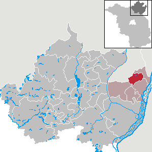
| Location of the municipality of Tantow in the Uckermark district | ||
  |
||

Tantow is a municipality in the Uckermark district in the far northeast of Brandenburg (Germany). It belongs to the Gartz (Oder) office based in the city of the same name .
geography
Tantow lies in the elongated valley of the Landgraben , which runs parallel between the glacial valleys of the Oder and Randow . The Salveybach drains the ditch from Tantow in a south-easterly direction to Westoder near Gartz (Oder) . The agriculturally intensively used area in the municipality is characterized by low terminal moraine lines along the ditch (up to 50 m above sea level ). Small lakes and ponds except in the valleys, of the approximately 35 hectares is Schloßsee with the under nature conservation appreciably standing island in the district Damitzow. The next larger cities are Schwedt / Oder and Prenzlau , 30 km and 35 km away, respectively. In the west, the municipality is bounded by the Vorpommern district of Vorpommern-Greifswald .
Community structure
Districts:
|
|
Inhabited parts of the community:
|
|
|
|
Residential places:
|
|
history
- Tantow


The oldest mention of Tantow is from 1255. At that time, gave the Bishop of Pomerania, Hermann von Gleichen , the Szczecin Zisterzienserinnenkloster the tithe of the village.
In 1373 the village was assigned to the Stephanskirche in Gartzer . On the map of Daniel Friedrich Sotzmann the place is shown as a Uckermark enclave of Pomerania east of the Salway river (today Landgraben). The border is still included in the table sheet from 1880. Tantow, located in the border area between Pomerania and Brandenburg , became part of Brandenburg in 1479 and was a Brandenburg exclave in Pomerania until 1815 .
The estate had been owned by the von Eickstedt family from the Rothenklempenow family since the Middle Ages . Only brief changes of ownership interrupted the Eickstedts' ownership, which lasted until 1945. The simple neo-Gothic manor house from 1856 was the seat of the manager or tenant; it burned down in 1945.
On August 15, 1843, the place with the station Tantow on the Berlin-Szczecin Railway received a rail connection. On January 31, 1943, a serious railway accident occurred here when the express train for front vacationers , SF 62, crashed into two locomotives after dispatcher and shunting errors. 38 people died and 16 were injured.
The neo-Gothic brick chapel was built in 1858. One of the original five watermills on Salveybach was operated in the former estate park in Tantow. Of this chain of mills, some of which are 800 years old, only Salveymühle III has been preserved (museum in the neighboring town of Geesow , now part of the town of Gartz ). After the political change, a nature and leisure path was created in Tantow (1992). The Damitzow Church was expanded in 1994, the Tantow Church was re-consecrated in 2000 after the restoration .
Administrative history
In 1817 Tantow and Schönfeld became part of the Prussian province of Pomerania and there were assigned to the Randow district . When the Randow district was dissolved in 1939, the places came to the Greifenhagen district .
The Randow district was re-established after 1945 and assigned to the state of Mecklenburg . After the GDR district reform of 1950, Tantow and Schönfeld belonged to the Angermünde district in the state of Brandenburg (from 1952 in the Frankfurt (Oder) district ). Since 1993 they have been in the Brandenburg district of Uckermark.
In 1925 Radekow (now part of Mescherin ) was incorporated in Tantow, but in 1945 it was outsourced again.
On December 31, 2002 Schönfeld was incorporated.
Population development
|
|
|
|
|
Territory of the respective year, number of inhabitants: as of December 31 (from 1991), from 2011 based on the 2011 census
According to the results of the census, the community had a proportion of foreigners of 9.6% in 2011. Most of them were Polish citizens .
politics
Community representation
The community council of Tantow consists of ten community representatives and the honorary mayor. The local election on May 26, 2019 resulted in the following distribution of seats:
| Party / group of voters | Seats |
|---|---|
| Tantow voter group | 5 |
| Voting group Freiwillige Feuerwehr Schönfeld | 2 |
| CDU | 1 |
| All for Tantow | 1 |
| Community of voters Tantow, district of Schönfeld | 1 |
mayor
- 2003–2014: Axel Becker
- 2014–2019: Andreas Meincke (citizen for Tantow)
- since 2019: Silke Natter (Tantow voter group)
Natter was elected in the mayoral election on May 26, 2019 with 61.1% of the valid votes for a term of five years.
Parish partnership
The partner municipality in Poland is Gmina Bielice in the Pyrzyce district in the West Pomeranian Voivodeship .
Attractions
→ See: List of architectural monuments in Tantow
- Chapel Tantow, 1857-1859, designed by Friedrich August Stüler built
- Tantow water tower
- Tantow train station
- Granary Tantow
Economy and Infrastructure
Schönfeld wind farm
The wind farm Schoenfeld in Tantow-Schonfeld consists of twelve wind turbines of the type Enercon E-82 with 138 meters hub height. The nominal output of the generators is 2 MW each. As these systems have a rotor diameter of 82 meters, they have a total height of 179 meters. The Schönfeld wind park is thus the wind park in Brandenburg with the tallest wind turbines with closed towers. The Spremberg wind farm has taller towers, but they are made of open steel framework construction.
traffic

Tantow is on the federal highway 113 between Penkun and the Mescherin - Gryfino border crossing to Poland. The nearest motorway junction eight kilometers away is Penkun on the A 11 (Berlin – Szczecin).
Tantow station on the Berlin – Szczecin ( Stettin ) railway line is the last German station before the border with Poland . It is served by the regional express line RE 66 Berlin-Lichtenberg - Szczecin Główny and the regional train line RB 66 Angermünde - Szczecin Główny . Until the timetable change in December 2010, the morning Intercity on the Stettin – Schiphol route stopped in Tantow.
Between 1913 and 1945 a branch line branched off to Gartz, seven kilometers away .
literature
- Heinrich Berghaus : Land book of the Duchy of Pomerania . Volume 2, Anklam 1865, pp. 1719–1723 ( digitized version )
- Lieselott Enders : Historical local dictionary for Brandenburg. Part 8: Uckermark. Böhlau, Weimar 1986, ISBN 3-7400-0042-2 ( publications of the State Archives Potsdam 21).
- Johannes Hinz : Pomerania. Signpost through an unforgettable country. Flechsig-Buchvertrieb, Würzburg 2002, ISBN 3-88189-439-X , p. 379.
Web links
- Website of the municipality of Tantow
- Tantow in the middle of the 19th century (Duncker Collection) (PDF; 267 kB)
Individual evidence
- ↑ Population in the State of Brandenburg according to municipalities, offices and municipalities not subject to official registration on December 31, 2019 (XLSX file; 223 KB) (updated official population figures) ( help on this ).
- ^ Service portal of the state administration Brandenburg. Tantow parish
- ^ Hubertus Neuschäffer: Western Pomerania's castles and mansions . Husum Druck- und Verlagsgesellschaft 1993, p. 192, ISBN 3-88042-636-8
- ^ Hans Joachim Ritzau: Railway disasters in Germany. Splinters of German history . Vol. 1: Landsberg-Pürgen 1979, p. 137.
- ↑ Historical municipality register of the state of Brandenburg 1875 to 2005. District Uckermark . P. 41
- ↑ StBA: Changes in the municipalities in Germany, see 2002
- ↑ Historical municipality register of the state of Brandenburg 1875 to 2005. District Uckermark . Pp. 26-29
- ↑ Population in the state of Brandenburg from 1991 to 2017 according to independent cities, districts and municipalities , Table 7
- ^ Office for Statistics Berlin-Brandenburg (Ed.): Statistical report AI 7, A II 3, A III 3. Population development and population status in the state of Brandenburg (respective editions of the month of December)
- ↑ Census 2011 ( Memento of the original from April 13, 2014 in the Internet Archive ) Info: The archive link was inserted automatically and has not yet been checked. Please check the original and archive link according to the instructions and then remove this notice.
- ^ Result of the local election on May 26, 2019
- ↑ Local elections October 26, 2003. Mayoral elections , p. 34
- ^ Result of the mayoral election on May 25, 2014
- ↑ Brandenburg Local Election Act, Section 73 (1)
- ^ Result of the mayoral election on May 26, 2019
- ↑ http://tantower.wordpress.com/nachbarland-polen/partnergemeinde-bielice/
- ↑ On the difficulties of a regional train line ( Memento of April 8, 2012 in the Internet Archive )
Angermünde | Berkholz-Meyenburg | Boitzenburger Land | Brüssow | Carmzow-Wallmow | Casekow | Flieth-Stegelitz | Gartz (Oder) | Gerswalde | Göritz | Gramzow | Grünow | Hohenselchow-Groß Pinnow | Lychen | Mark Landin | Mescherin | Milmersdorf | Mittenwalde | Northwestuckermark | Oberuckersee | Passow | Pinnow | Prenzlau | Randow Valley | Schenkenberg | Schöneberg | Schönfeld | Schwedt / Oder | Tantow | Temmen-Ringenwalde | Templin | Uckerfelde | Upland | Zichow