Greifswalder Bodden
The Bay of Greifswald is a bay of the southern Baltic Sea and with an area of 514 square kilometers is the largest lagoon of the Western Pomeranian Bodden landscape on the south coast of the western Baltic Sea. It is significantly larger than the largest inland lake in which Germany has a share, Lake Constance ( Obersee : 473 km²).
geography
The water surface is surrounded by the island of Rügen in the north and the West Pomeranian mainland in the west and south. In the east, the Boddenrandschwelle, only 1.5 to 2.5 m below sea level , separates the Bodden from the open Baltic Sea with the small islands of Ruden and Greifswalder Oie . To the southeast is the island of Usedom .
In the west of the Greifswald Bodden, the Strelasund forms another connection to the Baltic Sea. The north of the Bodden is also called Rügischer Bodden . The coastline of the Greifswald Bodden is strongly structured. The Zudar , Struck and parts of the Mönchgut peninsula extend far into the water. These in turn divide the lagoon into bays, some of which are deeply cut (in the north the Having with the Selliner See and the Hagensche Wiek , in the west the Schoritzer Wiek and in the south the Danish Wiek ). In addition to the islands in the east of the Bodden, there are the islands of Vilm , Koos , Riems and the former island of Stubber .
The average water depth is 5.6 m (max. 13.5 m). The water of the Greifswald Bodden consists of fresh water from the river Ryck , the slightly salty water of the Peene River and the salty water of the Baltic Sea and is known as brackish water . The Greifswalder Bodden is structured by various shoals, some of which are named after ships that came into contact with them, such as Doretta- or Ellidagrund. Others are named after captains, such as B. the Schuhmachergrund north of the Struck peninsula. There is a driving and mooring ban for large stretches of coast, in the nature reserves and around the epidemic protection area around the island of Riems all year round. Other bank sections and bays are only navigable from May to September.
Former drilling platforms
In the south of the Greifswalder Bodden at the transition to the Danish Wiek there are two abandoned drilling platforms . In the 1970s, test bores were carried out on the originally three plants by VEB Erdöl-Erdgas Grimmen , but no rich oil deposits were found.
Water sports area during the GDR era
In the GDR times, the Bodden, in contrast to the rest of the Baltic Sea, was an accessible water sports area, as the exits to the Baltic Sea could be effectively monitored to prevent escapes from the GDR .
Others
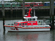
In Lauterbach on Rügen there has been a DGzRS station with a sea rescue boat since 1991 . The first of these boats, the Südperd , was exhibited at Cape Arkona . From 1992 to 2017 the Putbus was stationed in Lauterbach , which was replaced by the Casper Otten .
The InterCity 2216/2217 of the Deutsche Bahn from Offenburg to Greifswald is named after the Greifswalder Bodden in the 2018 timetable period .
The Greifswalder Bodden is considered to be the herring nursery in the western Baltic Sea. However, larval production has been declining there since 2004. This may be due to the phenology that has changed due to climate change . Proof of this hypothesis is still pending. However, fishermen are not seeing any negative changes in the herring population in the western Baltic Sea. It is possible that since 2004 the herrings have increasingly moved to other, previously unknown spawning grounds.
Individual evidence
- ↑ DGzRS, Lauterbach station , accessed on November 23, 2019
- ^ Marcus Grahnert: Directory of train names 2018. Long-distance traffic database, accessed on May 23, 2018
- ↑ Stefanie Lambernd: Baltic Sea: How climate change affects the herring. In: ndr.de . April 13, 2019, accessed July 15, 2019 .
Web links
Coordinates: 54 ° 13 ′ 22 ″ N , 13 ° 32 ′ 48 ″ E


