Struck (peninsula)
Coordinates: 54 ° 10 ' N , 13 ° 42' E
The Struck is a German (half) island on / in the Baltic Sea and belongs to the state of Mecklenburg-Western Pomerania .
location
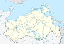
The Struck is located about 6 kilometers northeast of the seaside resort of Lubmin at the exit of the Peene River and 2.5 kilometers west of the northwestern tip of the island of Usedom opposite the village of Peenemünde . The Spandowerhagener Wiek is located south of the island . Greifswald is 22 kilometers southwest and Wolgast 13 kilometers south.
Surname
The name “Struck” is derived from the Low German word for “shrub”, as trees and bushes that were visible from afar grew on the raised wall areas in the flat country. The original name of the island is "Freesendorfer Struck". Freesendorf was a small town on the banks of the Bodden, which was given up for the construction of the north nuclear power plant . Today the pipes of the Nord Stream gas pipeline come to light at this point . The district belongs to the municipality of Lubmin .
nature
Whether the struck is an island or just a peninsula is not precisely defined, as the area is directly connected to the mainland, but at the same time through the Freesendorfer See and its connections (narrower watercourses) with the Greifswalder bays Bodden and Spandowerhagener Wiek is separated from this.
A bridge connects the Struck with the mainland. The Struck has a maximum length of 1800 meters in a north-easterly direction and a width of up to 1600 meters and an area of a good 2.5 km². The terrain is flat and reaches a height of only about 1.5 meters above sea level, in a few small places a little higher. It is criss-crossed by numerous smaller ponds (reddening) and watercourses (tidal creeks) and consists mainly of moist to wet salt grassland (lower parts, coastal flood moor on alluvial sand) and smaller bush areas, some of which are the size of a forest (old beach ridges and dunes).
Use and conservation
During the GDR times, the Struck was a restricted area due to its proximity to the Lubmin nuclear power plant and was generally not allowed to be entered. In the meantime, excursions to the animal and plant species located here, some of which are quite rare, are possible in the brackish water area under certain conditions. Because there are no paths on the Struck and there is a ban on “entering the nature reserve outside of the marked paths” (Protected Area Ordinance), permission must be obtained from the Lower Nature Conservation Authority in any case. The area used for agriculture only in the area of the salt grassland (necessary for its conservation) forms with the island of Ruden and the west coast of the island of Usedom the " nature reserve Peenemünder Haken, Struck and Ruden ".


