Ziese
| Ziese | ||
|
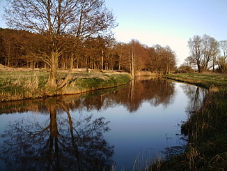
The Ziese near the Ziesaberg near Wolgast |
||
| Data | ||
| Water code | DE : 9658 (east), 965721 (vertex), 965729 (west) | |
| location | Mecklenburg-Western Pomerania | |
| Drain over | (Peenestrom) → Baltic Sea | |
| River basin district | Warnow / Peene | |
| muzzle | west: near Greifswald in the Danish Wiek 54 ° 5 ′ 17 ″ N , 13 ° 30 ′ 3 ″ E east: near Wolgast in the Peenestrom Coordinates: 54 ° 1 ′ 55 ″ N , 13 ° 44 ′ 41 ″ E 54 ° 1 55 ' N , 13 ° 44' 41 " E |
|
| Mouth height |
0 m above sea level NHN
|
|
| Right tributaries | Mill moat | |
The Ziese is a twenty kilometer long stream in the Vorpommern-Greifswald district in Mecklenburg-Western Pomerania , Germany .
course
The Ziese is fed from lateral inflows and drains the wide to three kilometers Ziesetal (also Ziese break ), a front of the Weichseleiszeit Resulting Urstromtal out to both ends. It flows west into the Danish Wiek and east into the Peene River , which connects the Stettiner Haff and the Baltic Sea. Its confluence with the Danish Wiek lies west of Kemnitz on the border with the district town of Greifswald . The Ziese flows into the Peene River southwest of Wolgast near Hohendorf in the so-called Hohendorfer Bay.
Former peat canal
The apex area (a little under 4.9 m above sea level ) of the Ziese near Rappenhagen, part of the municipality of Kemnitz, was artificially created as a peat canal in the 18th century. The water level and direction of flow are dependent on water locks . Nevertheless, it is often referred to as a bifurcation . However, since no current divides here, but rather the predominantly standing water of a trench flows off in two directions, the term pseudobifurcation is actually correct.
Inflows and outflows
The western part of the Ziese was once the lower reaches of the Hanshäger Bach . Its source streams arise at Groß Kiesow and unite at Hanshagen .
The largest tributary flowing into the apex of the Ziese is now hydrographically assigned to the eastern Ziese. It rises at 20 m above sea level. NN on the northern edge of the Karbower Forest two kilometers south-southwest of Neu Boltenhagen . The largest tributary of the eastern Ziese is called "Mühlgraben" or more precisely Lodmannshäger Mühlgraben , its upper course Prägelbach . Its sources are near Lühmannsdorf and Wrangelsburg .
At 0.5 m³ / s, the entry of the Ziese is the third largest water entry into the Peene River after the water entries from the Peene and Oder.
landscape
Since the Ziesetal, sometimes also referred to as "Ziesebruch", is a damp, formerly boggy lowland, there is hardly a settlement directly on the water. The meadows along the Ziese are mainly used agriculturally as pastures.

